ICEYE has announced that the company’s recently developed Spotlight imaging mode, which enables 1 meter radar imaging from the company’s satellite constellation, is now commercially available to customers around the world.
ICEYE Spotlight imaging is purpose-built to achieve a high resolution that supports a variety of use cases for both commercial and government customers.

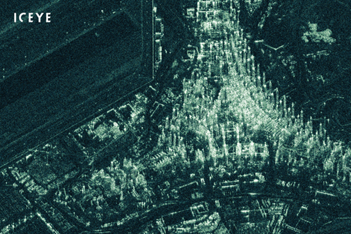
ICEYE Spotlight radar satellite image of the Kuwait International Airport’s new terminal under construction. Image is courtesy of the company.
The successful deployment of Spotlight imaging for commercial customers is a major milestone for ICEYE, as well as a technological achievement. There are few comparable services available worldwide, and ICEYE is currently the only organization in the world to provide this capability as a commercial service from such small SAR microsatellites. High resolution radar imagery is especially useful for distinguishing between small objects, and in helping data users classify larger objects with more certainty. One meter Spotlight radar imagery is particularly useful in detailed volume monitoring of stockpiles, vehicle count monitoring, property damage estimation, and oil transshipment monitoring.

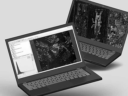
Example Spotlight SAR Data, featuring two locations in Singapore,are available for download on the ICEYE website in SLC and GRDformats. Image is courtesy of the company.
ICEYE was the first organization in the world to develop technology that can achieve under 1 meter resolution imagery from SAR satellites under 100 kg. in mass. The latest two ICEYE SAR Satellites were launched in July of 2019. The company continues to grow its commercially available SAR satellite constellation with additional satellite launches at an increasing pace.
Pekka Laurila, CSO and Co-Founder of ICEYE, said the commodities sector is an early example where the availability of high-resolution SAR imaging can have dramatic impacts. It is now possible to track specific locations, often, with high reliability, and at an incredible level of detail. The potential benefits for our early users are immense, as the competitive edge our data provides is still very fresh in the market.
Rafal Modrzewski, CEO and Co-Founder of ICEYE, commented that the company and its partners are in a unique position in the world with this new commercial availability of high-resolution radar satellite data.
