• Skip to main content
  • Skip to primary sidebar
  • Home
  • News
  • Featured
  • More News ⌄
    • SatNews
    • SatMagazine
    • MilSatMagazine
  • Events ⌄
    • MilSat Symposium
    • SmallSat Symposium
    • Satellite Innovation
  • Contacts
  • SUBSCRIPTION

SmallSat News

You are here: Home / 2023 / Archives for November 2023

Archives for November 2023

Intellian + Iridium enhance safety at sea

November 30, 2023 by editorial

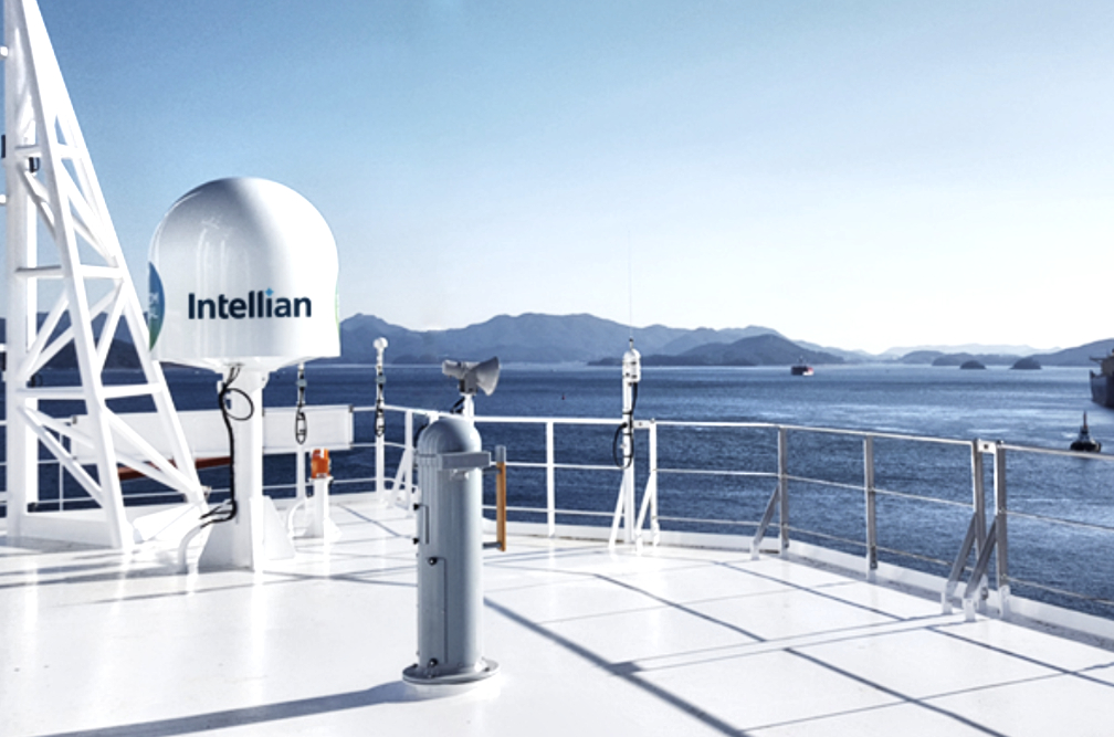
Intellian Technologies, Inc. and Iridium Communications Inc.have developed a new Global Maritime Distress and Safety System (GMDSS) safety display terminal.

The Iridium® network’s LEO location provides highly reliable, weather-resilient L-band connectivity everywhere on the planet, making it essential when other satellite and cellular networks don’t work.

Using Iridium’s network, the Intellian GMDSS safety terminal will significantly enhance the safety of millions of seafarers with the terminal featuring several purpose-built and some unique capabilities that include Maritime Safety Information, Safety Voice, and a one-touch Distress Alert function.

The Intellian GMDSS terminals will also support SSAS and LRIT, as well as the full range of Iridium Certus® standard services including voice and broadband data. Iridium GMDSS distress alerts are automatically routed to a Rescue Coordination Centre (RCC) based on the location of the vessel. Alternatively, a user may pre-select an RCC of their choice. Nearby vessels can also be alerted and called directly, enabling them to potentially offer faster assistance to those in distress.

Planned for Q4 2024, the GMDSS safety terminal will use the Iridium network which is supported by a unique constellation of 66, cross-linked, L-band satellites in LEO. This network provides reliable coverage around the globe, including the entire Arctic and Antarctic areas, which only Iridium GMDSS serves. Users will have access to reliable and secure safety services even in the most extreme weather conditions while at sea.

Additional features for the GMDSS solution include Distress Alert Relay, Shore-to-Ship Distress Calling, Medical Assistance/Advice, and reporting of dangers or debris.

“Traversing vast distances across our oceans, seafarers encounter numerous challenges. Anything from ship failures to medical emergencies to adverse weather conditions. The new Iridium GMDSS satellite safety terminals we’re developing are lifelines between ship and shore. We’re delighted to be expanding our Iridium portfolio and collaborating once again on fantastic new solutions. Iridium brings reliable and truly global GMDSS services to the market for the first time ever, making critical safety services available anywhere on the globe. It’s an exciting journey ahead, as we develop this GMDSS solution together and bring it to market next year.” — Eric Sung, CEO, Intellian Technologies Inc.

“This announcement of Intellian’s GMDSS safety terminal development is another fantastic chapter in our GMDSS journey and our ongoing efforts to improve maritime safety. Iridium’s GMDSS service brings many new capabilities to the maritime industry. The combination of Iridium Certus, the fastest L-Band broadband service, with Iridium GMDSS and security services establishes a new standard in maritime communications technology. The new Intellian terminal delivering Iridium GMDSS services will ensure that even more seafarers will have peace of mind and that no matter their location, they’ll remain safe and connected.” — Wouter Deknopper, Vice-President and General Manager Maritime Business at Iridium

Filed Under: News

Loft Orbital: The rise of the virtual mission

November 30, 2023 by editorial

For decades, satellites have been a valuable resource for understanding events on Earth in slow motion, from assessing damage from extreme weather, to forecasting crop outputs, to predicting economic activity from the number of ships docked in a port. At Loft, the company believes that satellites can do far more.

Satellites should be able to provide answers and insights – not just raw data – in real time. Realizing this future requires us to shorten the time it takes to derive value from satellite data. Specifically, it means having the ability to parse, process, and analyze raw data onboard the satellite, at the moment of collection. This requires that we think of satellites as more than just data collection platforms. They also need to be edge compute nodes, where software applications (apps) can run as easily as they do in a data center.

Over the past two years, Loft has quietly built the product stack that enables any developer to deploy software apps to Loft satellites, or what the firm calls virtual missions. The company has now announced YAM-6, the first, virtual mission-enabled satellite. Launching on SpaceX‘s upcoming Transporter-10 mission, YAM-6 will abstract away the hardware by providing access to Loft-owned sensors and compute nodes that support AI. This is a revolutionary shift in the space industry: a satellite no longer has to be owned.

A virtual mission is the deployment of a customer-developed software app onto Loft’s space infrastructure to leverage onboard resources, such as imagers and compute. YAM-6’s payloads include a hyperspectral imager, an RGB imager, a software-defined radio (SDR), and real-time connectivity via an inter-satellite link (ISL). They’re paired with a powerful robust set of CPU and GPU compute options and are AI-ready, with GPU acceleration for heavier AI workloads, such as image processing or change detection.

Loft Orbital payload hub.

While many space companies are constrained to the traditional process of designing, building, integrating, testing, launching, and operating a satellite, Loft manages this challenging, capital-intensive process so the customer can directly access the data they need. Just as a developer can deploy their software to a cloud server, we’re providing the tools for customers to do the same with our satellites.

Virtual missions represent Loft’s goal to make space simple — by providing a SDK (Software Development Kit) and environment for testing, the company creates a CI/CD (Continuous Integration/Continuous Deployment) pipeline for space. This is all supported by our culture of SatDevOps. Here’s how virtual missions operate…

  1. Loft provides the customer with the SDK, which includes a clearly defined framework, documentation, and APIs.
  2. Our customer develops their software app, according to their business objectives.
  3. The software app is deployed in the development environment to test and identify bugs to mitigate risk, before deployment into a satellite).
  4. The software app is then deployed to the firm’s infrastructure in space using Cockpit, our mission-agnostic, operations software. By abstracting away hardware interactions, Loft can provide rapid access and a simple interface for any application.

Partner Microsoft, provides the cloud development environment and on-orbit application framework that makes this possible on YAM-6. Any developer using Microsoft’s Azure Orbital space edge can easily deploy software apps to a Loft satellite with the Loft-specific satellite APIs that give access to our onboard sensors and compute platforms.

Virtual missions provide the opportunity to radically shorten time to orbit. Customers can deploy their own software apps to Loft’s infrastructure to analyze data as it is being collected, enabling all kinds of use cases like tip-and-cue, response and sensor fusion. Software apps that require compute power, such as AI and Machine Learning (ML), enable the company to use the unique vantage point of space in a variety of important ways.

YAM-6 will deploy a number of virtual missions from customers, directly after launch. One of the most exciting parts of this industry shift is that the company doesn’t exactly know what customers will come up with. This is just the beginning of an ecosystem of developers and applications that run on Loft’s space infrastructure.

Article authored by Bethany Pulcini-Baldwin, Missions Product Lead, Loft Orbital

Filed Under: News

Italy’s 1st private smallsat IoT constellation is born

November 29, 2023 by editorial

Apogeo Space is creating Italy’s first private satellite constellation to provide a telecommunication service for Internet of Things (IoT) devices and has released the firm’s first batch of nine smallsats. 

Launched into orbit on November 11 by SpaceX’s Falcon 9 launcher and recently released by the Orbital Transfer Vehicle (OTV) of D-Orbit, the first nine pico-satellites will be able to provide global coverage.  The launch of subsequent pico-satellites will increasingly shorten the revisit time by increasing the frequency of service, as well as introducing new features such as two-way (or better bi-directional) communication. 

The launching of the first nine satellites happened with D-Orbit vector, an orbital logistics and transportation company headquartered in Fino Mornasco (CO), an all-Italian tandem proving the excellence of the tricolor space sector and supply chain, a significant step for an advanced and low-cost satellite telecommunication service. 

Apogeo Space’s next launch is scheduled for March of 2024 with Momentus and, thereafter, a launch is planned every three to four months, each one always composed of nine satellites measuring 10x10x3 cm, for the realization of Italy’s first private telecommunications constellation for IoT, which will be completed by 2027, when there will be 96 active pico-satellites on-orbit.  

The realization of the first important piece of the project, developed in this case by a completely Italian supply chain, will strengthen even more the role of Italy in the space economy and specifically in telecommunication and pico-satellite constellations, areas in which Apogeo Space wants to be the first Italian company able to compete in the international arena of telecommunications for IoT. 

Apogeo Space’s project has a solid foundation. In April 2021, in fact, the company had announced the successful launch of FEES 1 (Flexible Experimental Embedded Satellite), having the same compact dimensions as the newly released pico-satellites and a precursor of technological development.  

This was followed by the release of a second FEES2 satellite in January of 2022, the smallest satellite ever released from the International Space Station. 

Apogeo Space aims to establish its LEO smallsat constellation to offer global telecommunications coverage and a full range of advanced services. These services include data collection for a variety of applications, from agri-tech to integrated logistics, from forest and glacier monitoring to oil & gas, from large watersheds to networks and infrastructure. 

The German research institute Statista estimates a worldwide deployment of about 30 billion connected IOT devices by 2030 (with an average annual steady growth of 2 billion between now and then). 

“We are proud and excited about the release of our first batch of satellites, a project that started from far away. It took years of design and experimentation that, thanks to the main support of Primo Space fund, were able to find industrial concreteness. We look to the future with enthusiasm, aiming to make an important contribution in the world of telecommunications for IoT.”  — Eng. Guido Parissenti, CEO and Co-Founder, Apogeo Space

Filed Under: News

Lockheed Martin tech demo to showcase faster on-orbit sensor calibration

November 29, 2023 by editorial

Lockheed Martin’s latest technology demonstration (Tantrum) is designed to showcase a unique, highly producible Electronically Steerable Antenna (ESA) on orbit.

Lockheed Martin (NYSE: LMT) will soon launch a unique, wideband, Electronically Steerable Antenna (ESA) payload demonstrator to show the company’s investment in advanced technology to perform missions faster, once on-orbit.

Based on an innovative, proprietary design, Lockheed Martin expects to calibrate this new ESA sensor in a fraction of the time it takes to operationalize traditional on-orbit sensors, which historically can take months to be powered on, fully calibrated and ready to perform their mission.

The payload demonstrator, which will launch aboard Firefly Aerospace’s Alpha rocket, extends Lockheed Martin’s significant investment in scalable wideband ESA technology development to showcasing an actual on-orbit capability. This technology is critical to future remote sensing architectures.

The ESA payload is built on a novel, scalable design, using highly reliable commercial parts for quick, mass-producibility. For this demonstration, it was integrated on a Terran Orbital Nebula smallsat bus.

The payload, nicknamed Tantrum, was developed in Lockheed Martin Space’s Ignite organization, a new team established to target three main missions: exploratory research and development, accelerating the pace of technology development and, lastly, introducing new product innovations. 

The payload demonstrator is expected to launch in December on a Firefly Aerospace Alpha rocket as part of the agreement with Lockheed Martin that Firefly announced in June. Most recently in September, Firefly’s Alpha successfully launched the U.S. Space Force’s VICTUS NOX responsive space mission following a 24-hours’ notice. 

Lockheed Martin also is producing several other self-funded technology demonstrator spacecraft, including Pony Express 2, which will further demonstrate mesh networking among satellites, and the Tactical Satellite, which will demonstrate on-orbit processing, intelligence, surveillance and reconnaissance capabilities, all part of an ongoing investment plan to showcase technology maturity and new capabilities.

Earlier this year, the company successfully launched and tested its In-space Upgrade Satellite System (LM LINUSS™) demonstrator, which proved how smallsats can help upgrade and sustain space architectures with new capabilities.

Lockheed Martin’s In-Space Upgrade Satellite System showcased several new capabilities that include close proximity maneuvers and on-orbit servicing techniques.

“Our customers’ mission needs and operational tempo have increased dramatically. We designed this technology to showcase how a highly producible ESA antenna could be built, launched, and quickly calibrated and fielded on orbit, in support of 21st Century Security.” — Maria Demaree, vice president and general manager of National Security Space, Lockheed Martin Space

“Within the Ignite construct, the payload was developed from early architecture to flight-ready product in 24 months on an accelerated schedule piloting many streamlined agile processes. For this demonstration, Lockheed Martin has invested its own resources and is embracing more calculated risks from initial development through on-orbit operations to bring new technologies to the forefront of space faster and to keep our customers ahead of ready.” — Sonia Phares, vice president of Ignite,Lockheed Martin Space

Filed Under: News

COLAF + GomSpace extend collaborative endeavors

November 29, 2023 by editorial

The Colombian Aerospace Force (COLAF) and GomSpace have formally renewed their collaboration in support of the Colombian space program — at a value of $261,000, the first phase of enhancing Colombian space capabilities has now been initiated. 

The expectation is that the agreement will support establishing a local Assembly, Integration, and Verification (AIV) setup. The AIV will allow the COLAF to design and develop, locally, its satellites, pushing forward its space objectives in line with Colombian interests.

The partnership with COLAF dates back to June 2014, and has so far delivered crucial successes evidenced in two active satellites, FACSAT-1 and FACSAT-2. The FACSAT-1, launched in November of 2018, has contributed significantly to institutional and state objectives by capturing more than 3,000 images.

Recently, the FACSAT-2 mission, also known as Chiribiquete, was successfully launched and is currently operational. Knowledge transfer is central to the FACSAT program by enabling COLAF to participate in all satellite development stages, from design to operation. Equally important is the fact that the COLAF built the Space Operations Center in Cali, Colombia, a ground station that facilitates control and management of its satellites.

Filed Under: News

Space Development Agency completes space to ground transmission from Link 16 Tactical Data Network

November 28, 2023 by editorial

The Space Development Agency (SDA) has successfully demonstrated the first-ever Link 16 network entry through space to ground connection from LEO to a series of receivers using terrestrial radios during three demonstrations held November 21-27, 2023.

Operators working with SDA conducted both passive and active network entry, obtained fine synchronization, and transmitted multiple tactical messages from satellites using L-band radios aboard Tranche 0 (T0) Transport Layer satellites to a ground test site located within the territory of a Five Eyes partner nation.

This success represents a major milestone for T0 of the Proliferated Warfighter Space Architecture (PWSA) and demonstration of a significant new capability for the warfighter. This accomplishment also reflects a leap ahead in the Department of Defense-wide Joint All Domain Command and Control (JADC2) effort, connecting available sensors to available warfighting platforms globally.

The PWSA Transport Layer is the backbone of JADC2 in space and will enable delivery of tactical messages, including beyond-line-of-sight scenarios, using Link 16 radios aboard space vehicles.

Link 16 is a tactical datalink communication system used by the United States, NATO, and coalition forces to transmit and exchange real-time situational awareness data among all network participants. For the initial Link 16 demonstration, SDA used three T0 Transport Layer satellites provided by York Space Systems, Denver, from both of the 2023 T0 launches. The 46th Test Squadron, 96th Test Wing, headquartered at Eglin Air Force Base, Florida, served as the lead developmental test organization for ground operations.

The demonstration leveraged prior fixed-site risk reduction testing at the 46th Test Squadron Datalinks Test Lab and with York Space Systems. The tests began within 10 hours of receiving approval from an allied nation after the National Telecommunications and Information Administration issued a waiver, in accordance with the International Telecommunication Union process, to transmit from space to ground.

The waiver also includes permission to conduct future tests over international waters. Due to current Federal Aviation Administration restrictions that prevent broadcasting Link 16 from space into the U.S. National Airspace System, SDA coordinated with the NTIA to obtain a waiver to transmit to a Five Eyes nation and over international water to meet established PWSA mission criteria.

While the U.S. military and allied partners have used Link 16 aboard aircraft for years, a fully operational PWSA will require the ability to establish bi-directional communication from space to ground. Testing Link 16 from space, first with an international partner and then over international water, represents a compromise position and SDA’s requirement remains to test over U.S. air space to demonstrate the feasibility of the PWSA and its ability to deliver fire control information to the warfighter over existing tactical data networks.

Tranche 0, the warfighter immersion tranche, demonstrates the feasibility of a proliferated architecture in cost, schedule, and scalability toward necessary performance for beyond-line-ofsight targeting and advanced missile detection and tracking.

SDA launched the first 10 satellites in April of 2023 and the next 13 in September of 2023. A third launch carrying the final T0 space vehicles is scheduled for the near future. Once completed, the Tranche 0 constellation will consist of 28 satellites – 19 Transport and eight Tracking satellites, plus one ground-based testbed satellite – forming a resilient constellation in LEO.

SDA plans to field the first operational generation of the PWSA, Tranche 1, beginning in late 2024. Tranche 1 will include 126 Transport Layer satellites, 35 Tracking satellites, and 12 tactical demonstration satellites (called T1DES). Tranche 1 will be operated by SDA’s groundbreaking space operations centers based heavily on commercial space operations models.

“I can’t underscore enough the significance of this technical achievement as we demonstrate the feasibility of the Proliferated Warfighter Space Architecture and its ability to deliver space-based capabilities to the warfighter over existing tactical data links. This is not only the first time Link 16 has been broadcast from space, but the beginning of turning the world’s finest warfighting force into a truly connected beyond line-of-sight joint force.” — Derek Tournear, Director, SDA

Filed Under: News

SkyFi is expanding horizons with aerial, SAR + global satellite imagery

November 28, 2023 by editorial

SkyFi continues to evolve and expand their EO capabilities — the company is introducing Urban Sky’s stratospheric balloon imagery and that represents a significant enhancement to SkyFI’s data offerings and also has the distinction of being the firm’s first, integrated, aerial imaging provider.

This new technology offers an impressive 10 cm resolution, offering finer details and smaller scene sizes for our archive.

● Enhanced Resolution: Observe the world with clarity never before seen on SkyFi with 10 cm resolution imagery
● Smaller Scene Sizes: Tailored to your specific needs, our archive now includes smaller minimum scene sizes for Urban Sky data. Order aerial imagery with areas as compact as 1 km² for your most detail-focused projects.

Deepening our SAR Data Partnership with Umbra
SkyFi continues to offer the highest resolution, commercially available, Synthetic Aperture Radar (SAR) data thanks to partner Umbra. Umbra’s full commercial data archive is now accessible on SkyFi, a first for the industry. This offering provides SkyFi customers with a unique opportunity to explore past landscapes and changes over time from a radar’s point of view.

SkyFi’s Open Data initiative now includes more than 20 diverse, global locations and lots of volcanoes, providing free SAR data in varied resolutions. This initiative gives access to more than $1 million of free data Umbra has given away this year and is now available on SkyFi’s web and mobile apps.

GEOSAT is the latest expansion of SkyFI’s high resolution, daytime imagery offerings with 75 cm archive data. This partnership adds to SkyFi’s global provider footprint with the firm’s first commercial Western European data.

● Bolstering a Robust Archive: With data rich and visually appealing 75 cm optical imagery, GEOSAT gives customers more options for historical analysis and ongoing change monitoring.
● Global Reach: GEOSAT’s archive opens up additional existing imagery options across the globe, including some of our customers’ most requested regions in Asia and the Middle East.

SkyFi is also integrating IMPRO’s capabilities, adding a new, very high-resolution satellite to the company’s network and enhancing optical and stereo data offerings across the planet.

● Advanced Resolution: IMPRO’s integration gives SkyFi another trusted partner at the 50 cm Very High resolution tier, one of our most popular offerings.
● Tri-Stereo Capability: Experience a new dimension in satellite imagery with our new tri-stereo option, offering enhanced depth perception for data-intensive analysis.
● Global Coverage with Regional Focus: IMPRO’s global reach comes with specialized access, particularly offering Very High resolution coverage over China and East Asia, meeting growing demands in one of the world’s most dynamic regions.

Filed Under: News

EnduroSat’s new satellite Space Centre enables satellite modules delivery within two weeks

November 27, 2023 by editorial

EnduroSat is able to now ship the company’s standard satellite modules to customers within two weeks of receiving an order, the fastest turnaround in EnduroSat’s history — this milestone follows the recent opening of EnduroSat’s new Space Centre in Bulgaria as well as a significant investment in production and AIT capabilities that will enable the company to meet the highest industry standards for quality and reliability.

This two-week delivery capability milestone was made possible by EnduroSat’s $10 million Series A funding that occurred earlier this year.

EnduroSat’s new 3,200 m2 Space Facility with 700 m2 of Space Labs includes several state-of-the-art labs, as well as an ISO-7-certified Satellite Assembly Lab, an RF Testing Laboratory, a Hardware Testing Laboratory, and a Mechanical Integration Facility. With offices in Bulgaria, Italy, Luxembourg, France, Germany, and the United States, EnduroSat has established a global presence, enabling its team to serve clients globally.

The President of Bulgaria visits EnduroSat’s Space HQ

The company’s team can now assemble, test, integrate, and deliver 10+ satellites per month. This enhanced production capacity has allowed EnduroSat to meet the growing demands of the space industry, making it a trusted partner for complex space missions.

The company recently launched the DeskSat, its most advanced flatsat. It provides an unprecedented opportunity to scale fast mission testing and space operations. Unlike alternative products in the traditional industry, the DeskSat comes fully integrated with unique software tools for development and operations: SpaceDev and SpaceOps.

EnduroSat’s DeskSat.

EnduroSat has more than 2,500 avionics on-orbit and more than 50 satellites successfully delivered to clients across the globe. The company successfully launched its latest satellites on the Transporter 9 mission. EnduroSat confirmed that they have acquired signals from all satellites and will be starting the operational phase.

EnduroSat supports multiple cutting-edge missions: PADRE solar exploration mission of NASA and the University of California-Berkeley, TOLIMAN, an astronomy mission observing the Alpha Centauri system organized by Breakthrough Initiatives and the University of Sydney, FLAMINGO, Europe’s first commercial constellation for in-situ space situational awareness (SSA) developed by Vyoma.

EnduroSat actively invests in nurturing the next generation of space scientists through its unique Space Challenges Program. The extensive practice-oriented curriculum is led by top-tier industry experts and has been organized and funded by EnduroSat for many years.

Filed Under: News

Satellogic wins NOAA license

November 26, 2023 by editorial

Satellogic ($SATL) has been granted a new, remote sensing license by NOAA.

Satellogic has been building and operating EO satellites equipped with optical and multispectral sensors since the company was founded in Buenos Aires, Argentina, in 2010. The company went public via SPAC in January 2022 in a merger that provided $262 million in gross proceeds.

During the company’s H1 2023 financial results call, executives announced that Satellogic would realign its business in the U.S. to capture more government and commercial contracts. That shift included two key changes:

  1. Redomiciling the company from the British Virgin Islands to Delaware by the first half of 2024
  2. Securing a remote sensing license from NOAA for its Aleph-1 constellation

The first goal is still in progress — the second can be checked off the list.

Earning a NOAA remote sensing license means that Satellogic is now subject to the agency’s oversight and also means that the company is able to open up ground stations in the U.S. to downlink from its Aleph-1 constellation, and that U.S. personnel can now take the lead on satellite operations.

The license allows Satellogic to pursue more opportunities for contracts and partnerships with US military and civil agencies, a key area of growth for the company’s remote sensing data.

“U.S. defense, intelligence, and civilian agencies have recognized a significant and growing need to collaborate with commercial partners like Satellogic that can provide rapid, accurate, and trusted geospatial data for a range of global applications.” — Matt Tirman, President, Satellogic

Filed Under: News

Skyrora + Spirit to enhance future UK launch capability

November 26, 2023 by editorial

Skyrora and Spirit AeroSystems have announced a collaboration on orbital launch capability — the companies celebrated the announcement in Belfast, home to Spirit’s largest UK manufacturing facility.

From left to right: Volodymyr Levykin, CEO & Founder of Skyrora; Nick Laird, Managing Director of European Space & Defence at Spirit AeroSystems; David Morris, MP and National Space Champion; and Matt Archer, Director of Launch at the UK Space Agency.

UK-based, launch-vehicle manufacturer Skyrora is developing an agile, end-to-end, launch service to provide access to space for smallsats across the globe.. Having conducted a test launch of the suborbital Skylark L vehicle in October of 2022, as part of the company’s incremental learning approach to launch, Skyrora is well on track to become the first UK company to vertically launch satellites from the UK, expecting to conduct as many as 16 launches per year once operating at scale.

The UK Government has made orbital launch a key priority, with the National Space Strategy outlining plans to secure an increased portion of a global space economy expected to be worth £490 billion by 2030. 

Spirit’s presence in UK space is growing. Its broad offering of highly adaptive manufacturing and testing solutions in metallics and composites, at both its Scotland and Northern Ireland facilities, brings significant industrial capacity to Skyrora’s launch proposition. Leveraging Spirit’s aerostructures expertise, the companies will explore opportunities to transition Skyrora’s orbital launch vehicles from development to full-scale production.

Collaborative goals also include the research of space technologies, particularly in additive manufacturing. Skyrora will provide Spirit with access to Skyprint 2, the largest in-house hybrid 3D printer of its kind in Europe. Located in Skyrora’s manufacturing facility just outside Glasgow, Scotland, research enabled by Skyprint 2 has the potential to unlock a localized supply chain to reduce costs and lead times for Spirit, bolster industrial cooperation, and promote growth within the UK space sector.

Filed Under: News

  • Go to page 1
  • Go to page 2
  • Go to page 3
  • Interim pages omitted …
  • Go to page 5
  • Go to Next Page »

Primary Sidebar

WEEKLY NEWSLETTER

Archives

  • July 2025
  • June 2025
  • May 2025
  • April 2025
  • March 2025
  • February 2025
  • January 2025
  • December 2024
  • November 2024
  • October 2024
  • September 2024
  • August 2024
  • July 2024
  • June 2024
  • May 2024
  • April 2024
  • March 2024
  • February 2024
  • January 2024
  • December 2023
  • November 2023
  • October 2023
  • September 2023
  • August 2023
  • July 2023
  • June 2023
  • May 2023
  • April 2023
  • March 2023
  • February 2023
  • January 2023
  • December 2022
  • November 2022
  • October 2022
  • September 2022
  • August 2022
  • July 2022
  • June 2022
  • May 2022
  • April 2022
  • March 2022
  • February 2022
  • January 2022
  • December 2021
  • November 2021
  • October 2021
  • September 2021
  • August 2021
  • July 2021
  • June 2021
  • May 2021
  • April 2021
  • March 2021
  • February 2021
  • January 2021
  • December 2020
  • November 2020
  • October 2020
  • September 2020
  • August 2020
  • July 2020
  • June 2020
  • May 2020
  • April 2020
  • March 2020
  • February 2020
  • January 2020
  • December 2019
  • November 2019
  • October 2019

© 2019–2025 SatNews

x
Sign Up Now!

Enjoy a free weekly newsletter with recent headlines from the global SmallSat industry.

Invalid email address
We promise not to spam you. You can unsubscribe at any time.
Thanks for subscribing! You will now receive weekly SmallSat News updates.
We love our advertisers.
And you will too!

Please disable Ad Blocker to continue... We promise to keep it unobtrusive.
We promise not to spam you. You can unsubscribe at any time.
Invalid email address
Thanks for subscribing! Please check your email for further instructions.