• Skip to main content
  • Skip to primary sidebar
  • Home
  • News
  • Featured
  • More News ⌄
    • SatNews
    • SatMagazine
    • MilSatMagazine
  • Events ⌄
    • MilSat Symposium
    • SmallSat Symposium
    • Satellite Innovation
  • Contacts
  • SUBSCRIPTION

SmallSat News

You are here: Home / 2023 / Archives for May 2023

Archives for May 2023

BAE Systems to develop autonomous space-based surveillance technology for DARPA

May 31, 2023 by editorial

The Defense Advanced Research Projects Agency (DARPA) has awarded BAE Systems’ FAST Labs™ research and development organization a $7 million contract for the Oversight autonomous, space-based, target custody program.

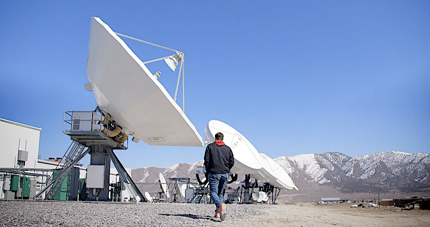
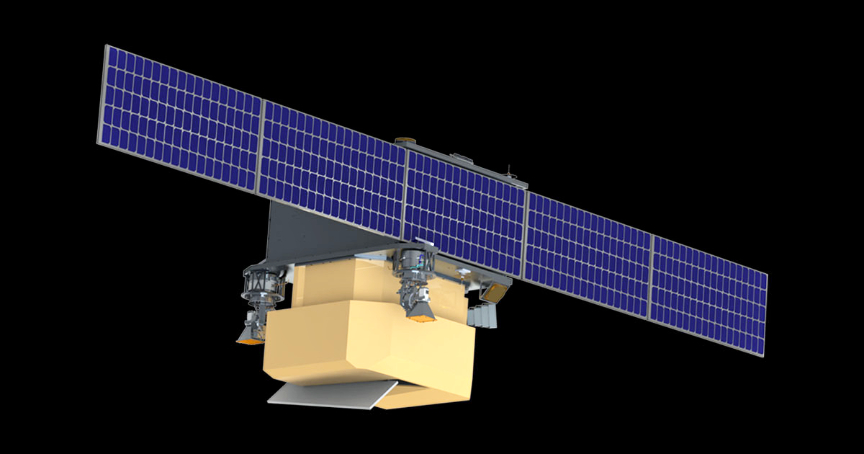
Traditional space intelligence, surveillance, and reconnaissance (ISR) collection can be siloed, labor intensive and unable to dynamically re-evaluate quickly enough to take advantage of new space systems. To address this, DARPA, the U.S. Space Force and the Space Development Agency are developing satellite constellations to improve the tactical relevance of U.S. space systems.

Proliferated LEO satellite constellations are significantly expanding on-orbit, ISR capabilities. The DARPA Oversight program will focus on creating an autonomous system that maintains constant “custody” of a large number of assets across new, diversified constellations. Under the terms of the program, the technology will be deployed to both tactical-edge satellites and ground stations.

Work on the program, which is part of BAE Systems’ autonomous technologies portfolio, includes collaboration with subcontractors OmniTeq and AIMdyn, Inc.

“Rapidly advancing near-peer adversary capabilities are driving a need for additional long-range tracking at increased scale and timeliness. To meet this requirement, our team includes technical expertise in autonomy, space processing, ISR systems, tactical-edge software development, system integration and architectures, and mission focus.”
— Dr. John Grimes, director of Small Satellites at BAE Systems’ FAST Labs

About DARPA’s Oversight program…

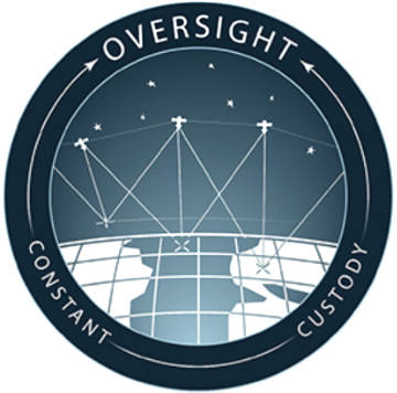
DARPA aims to help military planners keep track of up to 1,000 targets of interest through management of available space domain resources. The goal of the Oversight program is to enable constant custody to maintain tracking of targets of interest for tactical missions.

“Oversight seeks to support both peacetime and wartime simultaneous monitoring of high value entities in contested environments, where resources and targets of interest are highly dynamic. Through this program, DARPA aims to extend the applicability of U.S. space assets and make the space domain more tactically relevant for warfighters. We are working with the military service branches on early transitions during Phase 1. We want to get initial products out as fast as possible and that will help cultivate the development needs in Oversight Phase 2, during which we plan to have applications running on hardware resources. Meeting Oversight’s goals will enable military personnel to track important targets of interest at a large scale with fewer operators than is possible today.”
— Lael Rudd, program manager for Oversight in DARPA’s Tactical Technology Office

U.S. Space Force has been involved since the origin of the program and the Oversight team is in discussions with the Space Development Agency about potential integration into the Proliferated Warfighter Space Architecture. The U.S. Department of Defense’s Joint All-Domain Command and Control (JADC2) might one day utilize Oversight’s space-based object tracking capability, providing enhanced situational awareness to assist in faster decision making and expediting government efforts to use the space domain during missions.

JADC2 is a warfighting necessity to keep pace with the volume and complexity of data in modern warfare and to defeat adversaries decisively. JADC2 enables the Joint Force to “sense,” “make sense,” and “act” on information across the battle-space quickly using automation, artificial intelligence (AI), predictive analytics, and machine learning to deliver informed solutions via a resilient and robust network environment.
— Department of Defense

The program will leverage a large body of research about efficiently optimizing resources and apply it to use of future and current satellite assets. Oversight plans to also enable collaboration between satellite and ground-based resources. Newly developed algorithms will attempt to detect changing behaviors and dynamically re-task appropriate satellite sensors to track objects at scale.

Phase 1 of the program will define tracking requirements, resource management needs, and interface between technologies in development. In parallel, DARPA will assess current government-owned applications and services that could be leveraged. This phase will span 15 months, with a possible option of three months in continued development if needed.

Filed Under: News

Momentus to deliver Lunasonde tech demo payload to orbit

May 29, 2023 by editorial

Momentus Inc. (NASDAQ: MNTS) has signed a contract with Lunasonde to deliver their Picacho CubeSat to orbit.

Lunasonde is a sub-surface imaging company with the goal of making underground resources – such as water and minerals – easier to locate. The Picacho CubeSat is a tech demo of Lunasonde’s sensors and will measure the power spectral density of low-frequency radio signals in the ionosphere that will help inform designs for the company’s future satellites. Picacho will fly on the Vigoride-7 spacecraft targeted to launch on the SpaceX Transporter-9 mission in October 2023.

Momentus currently has three Vigoride Orbital Service Vehicles in orbit. The Company has flights scheduled through the end of 2024.

“With more affordable and reliable access to space comes more impactful and dynamic uses of the space environment. We thank Lunasonde for their trust and the Momentus team is dedicated to making the orbital delivery of their payload a seamless part of their mission.”
— Chris Kinman, Chief Commercial Officer, Momentus

“We are excited to partner with Momentus on this mission. The responsive and versatile nature of the Vigoride platform has been a fantastic opportunity for our Picacho technology demonstrator, which will pave the way for Lunasonde’s groundbreaking insights into the Earth’s subsurface environment.”
— Jeremiah Pate, Founder and Chief Executive Officer, Lunasonde

Filed Under: News

Space Systems Command (SSC) awards million$$ launch service order to Northrop Grumman

May 26, 2023 by editorial

The U.S. Space Force’s (USSF) Small Launch and Targets Division’s Office at Kirtland Air Force Base, Albuquerque, New Mexico, part of the Space Systems Command (SSC) Assured Access to Space organization, awarded a $45.5 million task order to Northrop Grumman Systems Corporation on May 24 via an Orbital Services Program (OSP)-4 Indefinite Delivery / Indefinite Quantity (IDIQ) contract.

The contract will provide orbital launch services for the SSC Space Sensing Directorate’s latest spacecraft innovation, the Electro-Optical Infrared (EO/IR) Weather System (EWS) prototype, known as EWS Operational Demonstration-1, for a U.S. Space Force mission designated as USSF-261S-A.

Artistic rendition of the USSF’s EWS Operational Demonstration-1 satellite, courtesy of General Atomics-EWS

The EWS prototype will prove out new EO/IR sensor technology to provide operational quality data to the DoD weather community and inform development of a more cost-effective and proliferated operational architecture. Northrop Grumman Systems Corporation will accomplish one launch of its Minotaur IV rocket to deliver the prototype satellite to LEO. The launch of EWS Operational Demonstration-1 on USSF-261S-A is planned for May of 2025.

The OSP-4 contract allows for the rapid, competitive acquisition of launch services to meet mission requirements enabling launch within 12-24 months from task order award. OSP-4 also allows for periodic on-ramps to ensure emerging, innovative launch providers can compete for future missions.

“The Space Force is committed to increasing speed in space acquisitions, and launch is an important part of the solution. We are excited to support future weather capabilities with this launch, using our flexible contracting approach to acquire the launch service in just five months. We are relentless about improving and streamlining the way we do business to use the best industry has to offer.”
— Lt. Col. Justin Beltz, SSC’s chief of the Small Launch and Targets Division

Space Systems Command is the U.S. Space Force’s field command responsible for acquiring and delivering resilient war fighting capabilities to protect our nation’s strategic advantage in and from space. SSC manages an $11 billion space acquisition budget for the DoD and works in partnership with joint forces, industry, government agencies, and academic and allied organizations to accelerate innovation and outpace emerging threats. Our actions today are making the world a better space for tomorrow.

Filed Under: Featured, News

Update: Rocket Lab’s TROPICS constellation launch for NASA to monitor storms is delayed

May 26, 2023 by editorial

Rocket Lab is preparing to launch the second half of NASA’s TROPICS satellite constellation as early as May 22, just two weeks after successfully completing the first launch

UPDATE: Rocket Lab USA, Inc. (Nasdaq: RKLB), a launch and space systems company, is preparing for the second of two dedicated Electron launches to deploy a constellation of storm monitoring satellites for NASA. This mission, named Coming To A Storm Near You, is now rescheduled for lift-off no earlier than Thursday, 8:10 PST on May 25, and Friday, May 26, 2023 NZST from Launch Complex 1 on New Zealand’s Mahia Peninsula.

The ‘Rocket Like a Hurricane’ launch was the first of two dedicated Electron launches to deploy a constellation of hurricane monitoring satellites for NASA

Launch Window Opens:
NZST | 16:00, May 25
UTC | 04:00, May 25
EDT | 00:00, May 25
PDT| 21:00, May 24

Coming To A Storm Near You marks Rocket Lab’s second of two TROPICS launches for NASA, following the first launch on May 8th NZST. Like the previous launch, Coming To A Storm Near You will send a pair of shoebox-sized satellites to low Earth orbit to collect tropical storm data more frequently than other weather satellites. The TROPICS constellation (Time-Resolved Observations of Precipitation structure and storm Intensity with a Constellation of Smallsats) will help increase understanding of deadly storms and improve tropical cyclone forecasts, complementing other NASA and partner satellites. The TROPICS CubeSats require launch to a specific orbit at an altitude of 550 kilometers and inclination of about 30 degrees and all four satellites need to be deployed into their operational orbit within a 60-day period ahead of the 2023 North American storm season which begins in June.

“The TROPICS constellation has the potential to save lives and improve our knowledge of deadly storms, so we’re immensely proud to be part of making it possible,” said Rocket Lab founder and CEO, Peter Beck. “With one pair of TROPICS satellites now safely in orbit, we’re pleased to be back on the pad just two weeks later ready for the next launch. Regular and reliable dedicated small sat launch is what we developed Electron and our launch sites for, so it’s a great feeling to be delivering on that for NASA.”

Coming To A Storm Near You will be Rocket Lab’s fifth Electron mission for 2023 and the Company’s 37th launch overall since Rocket Lab’s first Electron launch in 2017. The TROPICS launches follow on from previous successful Electron missions for NASA, including the ELaNa-19 mission and CAPSTONE mission to the Moon.

The live launch webcast will be available at www.rocketlabusa.com/live-stream from around T-20 minutes on launch day.

Filed Under: News

ICEYE intros 1st-in-market satellite radar dwell capability

May 25, 2023 by editorial

ICEYE has introduced a new imaging mode known as Dwell — with Dwell, ICEYE synthetic aperture radar (SAR) satellites remain focused on a specific point on the ground for an extended collection time.

This unique, long-duration, imaging mode allows ICEYE satellites to capture significantly more information about the imaging target, creating a powerful new capability for imagery users. For example, Dwell can be used to determine the heading and speed of moving vehicles, and under some circumstances, Dwell can even enable the discovery of human-made objects that would otherwise remain hidden under tree canopy. The Dwell product is unique in commercial remote sensing and will transform how customers with demanding mission requirements exploit SAR imagery.

The Dwell image product is created from a 25 second collection of the imaging target, in contrast to the 10 second duration of a traditional, high-resolution, ICEYE Spot image. This longer-duration collection provides new information about activity on the ground while also improving the image fidelity over a traditional SAR image. The result is a powerful, new, imaging capability that will expand the use of SAR for critical applications. Importantly, when combined with ICEYE’s day/night all-weather imaging capability and tactical responsiveness, Dwell provides an imagery capability that is superior to electro-optical collections.

The Dwell product is a bundle with three components:

  • High-fidelity SAR image. A common feature in high-resolution SAR images is speckle, which is the result of the specific SAR collection geometry and gives SAR imagery a noise-like appearance. The extended collection time for a Dwell image enables a significantly larger synthetic aperture angle and produces pixels with an along-track resolution of 5 cm. Standard processing combines pixels together, a process called ‘multi-looking’, which significantly reduces the speckle artifacts. The result is a high-fidelity image with superior interpretability.
  • Color subaperture image. A Dwell collection is particularly efficient at distinguishing human-made features, such as vehicles and buildings, from natural backgrounds such as tree canopy and vegetation. The color subaperture image preferentially distinguishes human-made features, allowing analysts to quickly find objects and features of interest among natural backgrounds.
  • Video. The video is built from the multiple sub-images that comprise a Dwell collection. The video product enables determination of vehicle heading and speed during the 25-second collection, and provides additional context about activities and patterns of behavior.

Dwell expands the powerful portfolio of high-tempo, day/night, all-weather imaging capabilities enabled by the ICEYE constellation. Today ICEYE offers a wide-area collection mode called Scan for large area search; an intermediate, higher-resolution mode called Strip for higher-resolution mapping and search, and highest-resolution Spot and Spot Extended Area for high-confidence monitoring and mapping applications. With the introduction of Dwell, users can now unlock new insights about their areas of interest, doing so with capabilities unique to the commercial SAR market.

“Dwell mode is ideal for customers who need to extract more information from our radar imagery, including movement and direction. In the long term, the research community, scientists, the SAR community, and most importantly, our customers with demanding missions will benefit from this latest ICEYE innovation. This product is another element in using remote sensing to better understand and characterize what is happening and changing on the ground in all lighting and weather conditions.”
— John Cartwright, Head of Data Product at ICEYE

Filed Under: News

TRL11, Inc. closes pre-seed funding to bring nexgen video technology to the space economy

May 25, 2023 by editorial

TRL11, Inc., has closed a pre-seed funding round of more than $3 million, which enables expansion of their team, leasing of a facility and the launch of two, prototype, video payloads to LEO — TRL11 aims to make full motion video (FMV) solutions commonplace in all space applications.

Space Domain Awareness starts with better self situational awareness. TRL11 space aware video solutions can be used to confirm mission success, help mitigate risk, and troubleshoot surprises. The same video platform used for monitoring satellite deployment, can also be used to assist on-orbit docking, refueling, and other service applications.

According to Nicol Verheem, company Founder and CEO, typical video solutions in space are far behind those used in the media and entertainment (M&E) industry, which has invested billions of dollars in advancing sensors, edge processing, transmission, and the AI/ML (Artificial Intelligence / Machine Language) of FMV over the past few decades. The M&E industry supports a much higher volume of video products in circulation, and typically has quick refresh cycles which fuel rapid and ongoing innovation. This helps hone and mature video products over time, which explains why M&E is ahead of the Aerospace industry.

Under his lead, TRL11 will be bringing some of the best video solutions and expertise from M&E into the nascent space market, targeting on-orbit applications such as mission confirmation, space domain awareness, and proximity operations like docking or debris removal.

As the common phrase “space is hard” suggests, the operating environment is uniquely harsh, but many technologies and techniques used in media map well to space, and with the right modifications and the correct support, can perform well in space.

“I’ve always been a science fiction space nerd, but I never thought it could be a career path. However the recent explosive growth in the number of launches to Low Earth Orbit creates some real challenges and thus exciting new opportunities, some of which can best — or sometimes only — be solved with full motion video solutions on-orbit. The bandwidth is obviously not there yet to support every one of the many applications of video that are possible in space, but it’ll come. We’ve been through similar transitions in other industries before, more than once. Time and time again, video finds a way to add new value to just about every industry on Earth. Space will be no different. That’s why I love video and why it will always continue to shine as a key enabling technology.”
— Nicol Verheem, TRL11 Founder and CEO, serial entrepreneur and Technical Oscar™ and Emmy™ award winner

About the company…
TRL11, Inc. designs and manufactures state-of-the-art full motion video solutions and the supporting subsystems for aerospace applications. Headquartered in Irvine, California, the company was started in 2022 and launched the first prototypes to orbit in less than a year. The name TRL11 is meant to imply taking the first step toward the next chapter of space exploration. e Vu CFO), will join Anthony Baker on the Board, representing the company.

Filed Under: News

Satellite Vu closes Series A2 round + raises further million$$

May 25, 2023 by editorial

Satellite Vu has announced that the company’s Series A2 of £12.7 million brings the firm’s total investment to £30.5 million in VC funding to accelerate the mission to provide sustainable solutions to global issues.

The A2 round was led by Molten Ventures, with participation from Seraphim Space Investment Trust PLC, A/O Proptech, Lockheed Martin, Ridgeline Ventures, Earth Sciences Foundation, and Stellar Ventures – all existing investors.

Satellite Vu’s space-enabled climate technology provides a valuable insight into economic activity, energy efficiency and carbon footprint for a range of industries including: Built Environment; Defense and Intelligence and Industrial Activity Monitoring. This data will enable industries, organizations and governments to take critical action toward Net Zero goals. Satellite Vu has already secured customer commitments through its Early Access Option Program (EAP) valued at more than £128 million ($160 million).

This Series A2 was an ‘up round’ for Satellite Vu, highlighting the confidence investors have in the company’s cutting-edge thermal satellite technology and their ready-to-buy revenue stream, which gives them an edge in the climate mission market.

The company’s upcoming satellite launch via SpaceX, slated for early June, is highly anticipated. Their first thermal monitoring satellite – aka ‘The World’s Thermometer’ – built in partnership with Surrey Satellite Technology Ltd. (SSTL), is ready for deployment and is expected to deliver valuable data to support Satellite Vu’s mission.

This funding will enable Satellite Vu to enter commercial operation, converting EAP customers to revenue bookings from Q4 2023, post launch, to bring unique new datasets to market, and to build out an organizational structure ready to scale post completion of a Series B round. Satellite Vu expects to go to market for a Series B raise post first launch, to complete the constellation of eight satellites to enable high frequency thermal monitoring at scale.

“This funding round puts us in a strong position to hit our commercialization goals over the next 12 months and build the foundations to enable rapid scale-up post-Series B. We are proud to have such meaningful support from our existing investors – it shows that we are on the right track, both to building an economically sustainable business and tackling the climate crisis.”
— Camilla Taylor, CFO, Satellite Vu

“We’re leading SatelliteVu’s funding round as it prepares for its June launch. Their unique technology tackles key climate issues, and we’re impressed with their commercial progress. Their $160m in early commitments is a stellar model of pre-launch sales for deep-tech companies, which other climate-tech firms could emulate.”
— George Chalmers, Head of Climate-tech at Molten Ventures

“In these extraordinary times of immense technological progress, Satellite Vu stands out as a trailblazing commercial enterprise at the forefront of harnessing space and data to revolutionise our approach to major climate change issues. With a remarkable commitment of over 160 million dollars in their EAP and the imminent launch of their first satellite, I extend my heartfelt congratulations to Anthony and the entire team on their exceptional achievements. Together, they prove that the sky is not the limit.”
— Patrick McCall, Venture Partner, Seraphim Space

“By providing data from the unique vantage point of space, Satellite Vu’s technology can support action to protect our planet and bring us closer to Net Zero. The commercial demand for these services is demonstrated by the customer commitments secured to date, and this impressive new funding round is a brilliant example of how support from UK Space Agency programmes is catalysing investment into the sector. I wish the team at Satellite Vu all the best for their upcoming satellite launch next month.”
— Dr. Paul Bate, Chief Executive of the UK Space Agency

Filed Under: News

First Astranis satellite successfully deployed to GEO, beams first signals down to Alaska

May 25, 2023 by editorial

Falcon Heavy launch. Credit: SpaceX

A few weeks ago, we launched our first Astranis satellite to GEO onboard a SpaceX Falcon Heavy rocket. The satellite is Arcturus, which is set to provide high-speed bandwidth to Alaska for our customer Pacific Dataport. I am extremely happy to report that our satellite has completed the orbital maneuvers necessary to arrive in its orbital slot in Geostationary Orbit (GEO), and has now completed a key end-to-end test connecting a gateway in Utah with multiple user terminals in Alaska for the very first time, with the payload performing above spec. The test was 100% successful.

Astranis has designed a new kind of satellite — and it works.

This test demonstrated the core functionality of Arcturus, with the payload fully powered on and including a test of Astranis’s proprietary software-defined radio — and it worked perfectly, on the first try. The test also demonstrated that the satellite could maintain tight positioning in its orbital slot, with high pointing accuracy, under total control of our Mission Operations team. That’s thanks to the successful operation of a variety of complex systems — avionics, power electronics, flight software, guidance navigation & control, onboard rocket thrusters, and more.

Falcon Heavy launch. Credit: SpaceX

This means that we have a new way to connect the most remote and underserved parts of the planet. Our MicroGEO satellites will help get millions of people connected to the internet through our commercial customers, and importantly they are a new tool in the toolbox for the U.S. Department of Defense as it increases the resiliency of its fleet of satellites on orbit.

Achieving this milestone took years of work from some of the most talented hardware and software engineers in the world. I founded Astranis in 2015 with my co-founder and CTO, Ryan McLinko, and in the early years we wondered whether building a small comms satellite for geostationary orbit was even possible. We have now proved that it is.

Solar arrays deploying on orbit. Credit: SpaceX

It’s hard to overstate how many things had to go right for this demonstration to be a success:

  • Executing the world’s first MicroGEO satellite development program — from initial R&D and design to assembly, test, launch, and on-orbit operations
  • Completing a stable and thermally-regulated coast to geostationary orbit mounted to the second stage of the Falcon Heavy rocket, which required us to design a novel battery and thermal system bolted to the spare ESPA slot on our launch
  • Successfully separating the spacecraft from the Falcon Heavy upper stage, quickly followed by deploying our solar arrays, boom, and subreflector — all mechanisms designed in house at Astranis
  • Rapidly achieving a power-positive and thermally-balanced state in a near-GEO orbit
  • Closing our TTC link, and acquiring telemetry and tracking data from the satellite — a milestone that we completed just 94 seconds after separation from the launch vehicle
  • Gaining three-axis control of the vehicle, using a suite of sensors (gyros, sun sensors, star trackers) and actuators (reaction wheels, monopropellant thrusters)
  • Demonstrating our ability to complete over-the-air (over-the-space!) updates to our flight software on orbit
  • Commissioning our ground infrastructure, collecting telemetry from multiple ground stations all around the world, and commanding the satellite using our mission operations center in San Francisco
  • Commissioning the satellite’s major systems — including nine separate Astranis-designed electronics assemblies, all of which are working as intended and without issue
  • Completing an orbit raise maneuver — altitude raise, circularization, phasing relocation, and more — to traverse the GEO arc and settle precisely in our designated orbital slot above Alaska
  • Powering on and doing initial checkout of our payload, including the Astranis-designed Software-Defined Radio, and all high-power amplifiers
  • Demonstrating end-to-end communications in a key payload test
  • Operating a cohesive team, on 24/7 shifts, flying the satellite and handling any issues that have come up with cool confidence
Gateway Earth station in Eagle Mountain, Utah

Achieving this kind success required the coordinated effort of hundreds of engineers. It is no small feat.

Importantly, working with our customer Pacific Dataport this satellite represents a major step forward for the people of Alaska. At full capacity, it will more than triple the amount of satellite bandwidth available in the state, bringing prices down and helping connect the 39% of the state that still lacks affordable access to reliable broadband internet.

The Astranis team celebrating the launch 🙂

It’s also a major step forward for Astranis. We are launching four more MicroGEO satellites later this year for customers around the world, and many more from there. Our orders over the next 24 months alone represent over $1 billion of satellite services, all based on our now-flight-proven design. But we’re just getting started. Stay tuned for more exciting news in the days and weeks to come.

Written by John Gedmark , “Cofounder & CEO of Astranis. Your friendly neighborhood rocket scientist.”

Filed Under: Featured, News

Rocket Lab prepares NASA for storms with the second TROPICS constellation monitoring launch on Wednesday

May 25, 2023 by editorial

Rocket Lab is preparing to launch the second half of NASA’s TROPICS satellite constellation as early as May 22, just two weeks after successfully completing the first launch

Rocket Lab USA, Inc. (Nasdaq: RKLB), a launch and space systems company, is preparing for the second of two dedicated Electron launches to deploy a constellation of storm monitoring satellites for NASA. This mission, named Coming To A Storm Near You, is scheduled for lift-off no earlier than 16:00 NZST on May 25th from Launch Complex 1 on New Zealand’s Mahia Peninsula.

The ‘Rocket Like a Hurricane’ launch was the first of two dedicated Electron launches to deploy a constellation of hurricane monitoring satellites for NASA

Launch Window Opens:
NZST | 16:00, May 25
UTC | 04:00, May 25
EDT | 00:00, May 25
PDT| 21:00, May 24

Coming To A Storm Near You marks Rocket Lab’s second of two TROPICS launches for NASA, following the first launch on May 8th NZST. Like the previous launch, Coming To A Storm Near You will send a pair of shoebox-sized satellites to low Earth orbit to collect tropical storm data more frequently than other weather satellites. The TROPICS constellation (Time-Resolved Observations of Precipitation structure and storm Intensity with a Constellation of Smallsats) will help increase understanding of deadly storms and improve tropical cyclone forecasts, complementing other NASA and partner satellites. The TROPICS CubeSats require launch to a specific orbit at an altitude of 550 kilometers and inclination of about 30 degrees and all four satellites need to be deployed into their operational orbit within a 60-day period ahead of the 2023 North American storm season which begins in June.

“The TROPICS constellation has the potential to save lives and improve our knowledge of deadly storms, so we’re immensely proud to be part of making it possible,” said Rocket Lab founder and CEO, Peter Beck. “With one pair of TROPICS satellites now safely in orbit, we’re pleased to be back on the pad just two weeks later ready for the next launch. Regular and reliable dedicated small sat launch is what we developed Electron and our launch sites for, so it’s a great feeling to be delivering on that for NASA.”

Coming To A Storm Near You will be Rocket Lab’s fifth Electron mission for 2023 and the Company’s 37th launch overall since Rocket Lab’s first Electron launch in 2017. The TROPICS launches follow on from previous successful Electron missions for NASA, including the ELaNa-19 mission and CAPSTONE mission to the Moon.

The live launch webcast will be available at www.rocketlabusa.com/live-stream from around T-20 minutes on launch day.

Filed Under: News

New NASA mission to study ice clouds + Earth’s dynamic atmosphere

May 23, 2023 by editorial

NASA has initiated a new mission to help humanity better understand Earth’s dynamic atmosphere – specifically, ice clouds that form at high altitudes throughout tropical and sub-tropical regions. The PolSIR instrument (Polarized Submillimeter Ice-cloud Radiometer) study such ice clouds to determine how and why they change throughout the day. This will provide crucial information about how to accurately simulate these high-altitude clouds in global climate models.

The investigation consists of two identical CubeSats — each smallsat is just a little over a foot tall — flying in orbits separated by three to nine hours. Over time, these two instruments will observe the clouds’ daily cycle of ice content.

The award is for for lifecycle costs no more than $37 million, which does not include launch costs. The radiometer is an Earth Venture instrument — lower-cost instruments with a targeted research goal, which typically catch a ride along with another mission or commercial satellite in order to minimize launch costs.

The Earth Venture class also focuses on providing frequent flight opportunities, so innovative science investigations can be flown relatively quickly, generally within five years or less. Missions like this provide key targeted research opportunities, which help us improve our understanding of what’s driving change in the entire Earth system.

The mission is led by Ralf Bennartz, principal investigator at Vanderbilt University in Nashville, Tennessee, and by Dong Wu, deputy principal investigator at NASA’s Goddard Space Flight Center in Greenbelt, Maryland.

NASA Goddard will provide the project management team that builds the two instruments, while science operations will be conducted by the Space Science and Engineering Center at the University of Wisconsin – Madison. The two spacecraft will be built by Blue Canyon Technologies in Lafayette, Colorado.

“Studying ice clouds is crucial for improving climate forecasts – and this will be the first time we can study ice clouds in this level of detail. Every NASA mission is carefully chosen to better understand our home planet.”
— Nicola Fox, associate administrator for the Science Mission Directorate at NASA Headquarters in Washington

“Understanding how these ice clouds respond to a changing climate – and then, in turn, contribute to further changes – remains one of the great challenges to predicting what the atmosphere will do in the future. The radiometers, which measure the radiant energy emitted by clouds, will significantly improve our understanding of how ice clouds change and respond throughout the day.”
— Karen St. Germain, who leads NASA’s Earth Sciences Division

Filed Under: Featured, News

  • Go to page 1
  • Go to page 2
  • Go to page 3
  • Interim pages omitted …
  • Go to page 6
  • Go to Next Page »

Primary Sidebar

WEEKLY NEWSLETTER

Archives

  • June 2025
  • May 2025
  • April 2025
  • March 2025
  • February 2025
  • January 2025
  • December 2024
  • November 2024
  • October 2024
  • September 2024
  • August 2024
  • July 2024
  • June 2024
  • May 2024
  • April 2024
  • March 2024
  • February 2024
  • January 2024
  • December 2023
  • November 2023
  • October 2023
  • September 2023
  • August 2023
  • July 2023
  • June 2023
  • May 2023
  • April 2023
  • March 2023
  • February 2023
  • January 2023
  • December 2022
  • November 2022
  • October 2022
  • September 2022
  • August 2022
  • July 2022
  • June 2022
  • May 2022
  • April 2022
  • March 2022
  • February 2022
  • January 2022
  • December 2021
  • November 2021
  • October 2021
  • September 2021
  • August 2021
  • July 2021
  • June 2021
  • May 2021
  • April 2021
  • March 2021
  • February 2021
  • January 2021
  • December 2020
  • November 2020
  • October 2020
  • September 2020
  • August 2020
  • July 2020
  • June 2020
  • May 2020
  • April 2020
  • March 2020
  • February 2020
  • January 2020
  • December 2019
  • November 2019
  • October 2019

© 2019–2025 SatNews

x
Sign Up Now!

Enjoy a free weekly newsletter with recent headlines from the global SmallSat industry.

Invalid email address
We promise not to spam you. You can unsubscribe at any time.
Thanks for subscribing! You will now receive weekly SmallSat News updates.
We love our advertisers.
And you will too!

Please disable Ad Blocker to continue... We promise to keep it unobtrusive.
We promise not to spam you. You can unsubscribe at any time.
Invalid email address
Thanks for subscribing! Please check your email for further instructions.