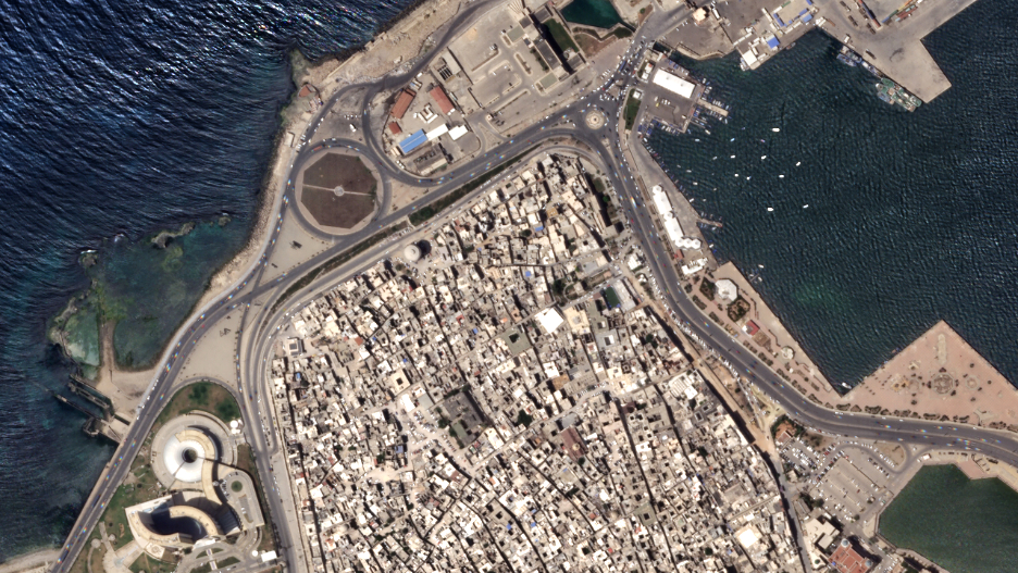
The Old City of Tripoli, Libya imaged at 50 centimeters per pixel from an altitude of 456 kilometers. © 2020, Planet Labs Inc.
All Rights Reserved.
Over the past year, Planet has seen increased demand for its SkySat imagery to fulfill customers’ needs for timely, accurate and frequent information across the decision cycle — the COVID-19 pandemic has intensified this trend, as traditional surveying and inspection methods are not currently possible.
To meet the present moment, and demonstrate the company’s commitment to rapidly deliver more value to customers every year, Planet has unveiled three new releases as part of their overall tasking offerings. Combined, these releases enhance the core imagery for analysis as well as reduce friction to acquire that data.
Higher Resolution
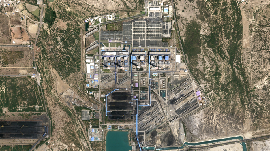
50 cm imagery: In just six months, we successfully lowered our SkySat constellation to enhance the spatial resolution of our SkySat imagery from 80 to 50 cm for our ortho product. This improvement enables customers to get a more precise view of changing conditions on the ground and adds more granular context to decision-making. This is particularly important for commercial and government mapping use cases, where seeing smaller features like road surface markings are key.

50 cm SkySat imagery of the Mundra Power Plant in Gujarat, India, on April 4, 2020. © 2020, Planet Labs Inc.
All Rights Reserved.
Tasking Dashboard
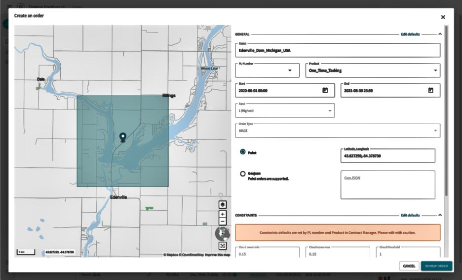
Planet’s imaging pipeline and delivery infrastructure have been built in the cloud and the Tasking Dashboard and API are the latest results of that foundation. The Tasking Dashboard is a new user interface that allows customers to request SkySat collections, while our new API provides efficient, automated access. Instead of spending precious time going back and forth with a human rep, with the Tasking Dashboard and API, customers can autonomously submit, modify and cancel SkySat imagery requests. This enables visibility into the end-to-end experience, from order to fulfillment, so expectations can be managed with analysts and teams.

Screenshot of Planet’s Tasking Dashboard © 2020, Planet Labs Inc.
All Rights Reserved.
Rapid Revisit, with up to 12x revisit capabilities
Planet guarantees sub-daily revisit and the upcoming launch of six new SkySats will allow the company to image certain locations up to 12 times per day, at a global average of 7 times per day. This unprecedented capability will provide more rapid response to global events and enable imaging at times of the day previously unseen by satellites.
At Planet’s SkySat offerings support the company’s growing customer base, from federal and civil governments, to commercial forestry to energy and more. These product advances are key components of Planet’s overall mission to democratize access to satellite imagery, providing critical intelligence to customers and organizations when they need it most.

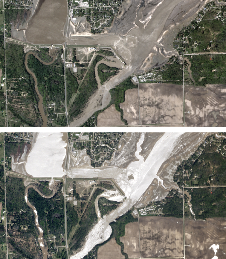
The first SkySat image (taken in the morning) and second SkySat image (taken in the afternoon) were collected on May 20, 2020, and show the remains of the Edenville Dam, breached after heavy rainfall over Michigan. The silvery appearance of the water in the morning is due to sunglint, which is the reflection of light directly into the satellite’s telescope. © 2020, Planet Labs Inc.
All Rights Reserved.
Story by Martin Van Ryswyk, the Senior Vice President of Product at Planet
