• Skip to main content
  • Skip to primary sidebar
  • Home
  • News
  • Featured
  • More News ⌄
    • SatNews
    • SatMagazine
    • MilSatMagazine
  • Events ⌄
    • MilSat Symposium
    • SmallSat Symposium
    • Satellite Innovation
  • Contacts
  • SUBSCRIPTION

SmallSat News

You are here: Home / 2022 / Archives for January 2022

Archives for January 2022

Joining Forces To Launch The 1st Kenyan Smallsat Are EnduroSat + SayariLabs

January 31, 2022 by editorial

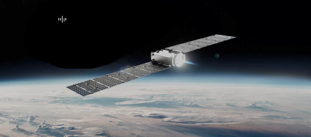
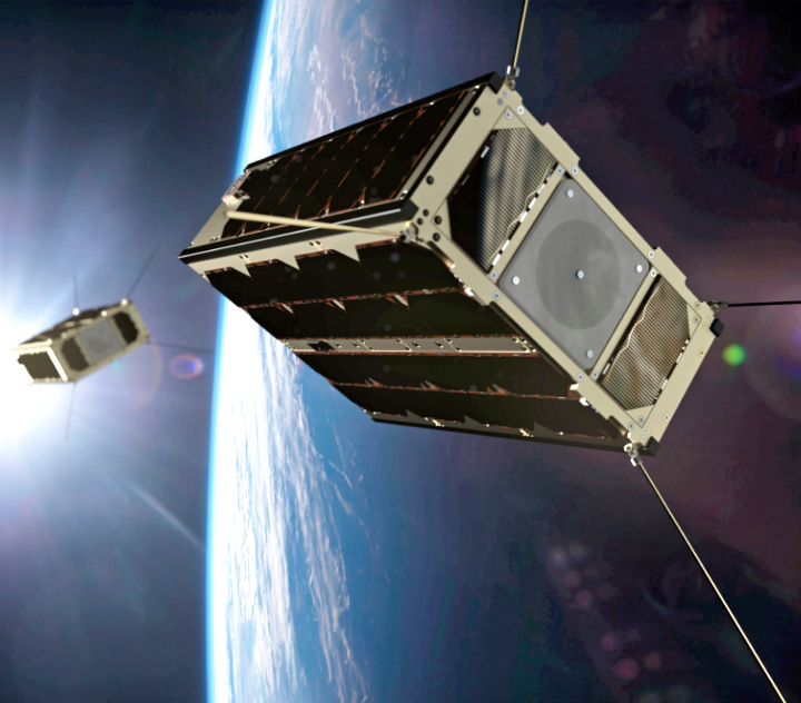
SayariLabs, first Kenyan space company, provider of satellite services and space-based solutions to governments, industries, and academic institutions in Africa and beyond, and EnduroSat, a provider of software-defined smallsats and space services for business and academia, have signed a commercial agreement to launch TAIFA-1 (“one nation” from Swahili), the first Kenyan, 3U, software-defined smallsat.

TAIFA-1 will get to orbit on SpaceX`s Falcon 9 — the launch is scheduled for Q4, 2022.

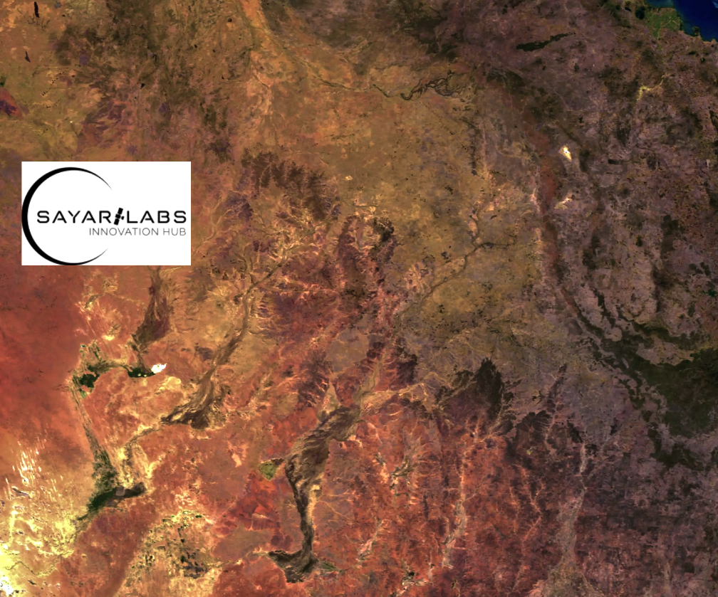
In the past decade, East Africa has been hit with heavy droughts and wildfires, causing water crisis, and damages of local agriculture and food supplies. TAIFA-1 will be loaded with a hyperspectral, Earth Observation (EO) camera that will capture environmental, wildlife, agricultural and land use mapping, all in the battle to halt the calamities in the region.

EnduroSat and SayariLabs also signed an MOU, which is another milestone for this partnership and the upcoming, joint space projects of the two companies. EnduroSat organized a two-week educational training program, dedicated to space systems and engineering and covering all aspects of mission analysis, design, and space craft assembly for the engineering team of SayariLabs.

“Over the past decades, space and satellite industries have been reserved for the wealthy and mighty. SayariLabs is on a mission of democratizing these industries for all interested players in the African region and in making Kenya a space giant in the next generation. With the advancement of technology this fantasy is quickly becoming a reality. Our partnership with EnduroSat, a leading company in this industry, is a major game-changer and it strengthens our hope and belief of being a major space and satellite solution provider in Kenya, the African region and other parts of the world,” said Aaron Nzau, the Founder and CEO SayariLabs

“I am really proud to have the opportunity to support SayariLabs in their efforts to bring space closer to thousands of people in Kenya. Working alongside their team has been an amazing experience for us and I cannot wait to see the innovations and the positive impact that they plan to have, realized in practice. EnduroSat has been for long time a true believer in open, responsible and accessible space and this is yet another step in this direction,” said Raycho Raychev, Founder and CEO of EnduroSat

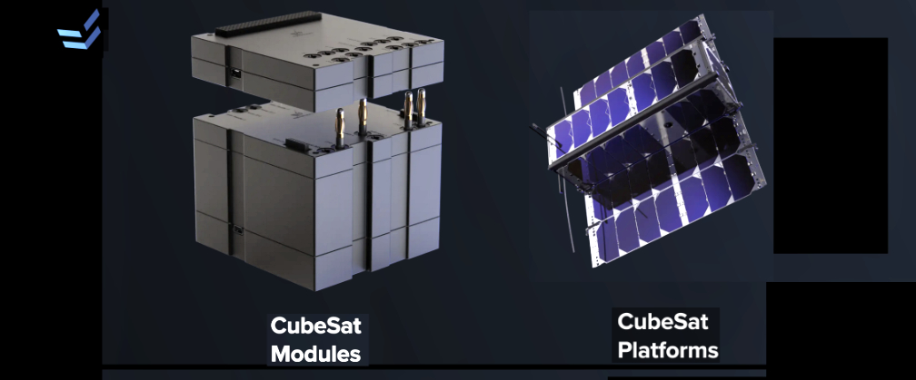
EnduroSat provides software-defined smallsats and space services for business, exploration, and science teams. Its focus is on the development of next generation space commercial services and exploration programs. With an annual growth of 250%+, it is one of the fastest growing space companies in Europe. Proud member of the International Astronautical Federation (IAF), EnduroSat’s team exceeds 100+ talented developers, engineers, and scientists, currently serving more than 120+ clients worldwide. Customers for the Shared Satellite Service include 1) commercial space companies focused on IoT, remote sensing, meteorology, and Earth observation, and 2) research organizations: space agencies, universities, and institutes.

SayariLabs is the first Kenyan space startup company established in 2020 to provide satellite services and space-based solutions to governments, industries, and academic institutions in Kenya, as well as in the African region and other parts of the world. the company’s focus is on being the commercial market leader for satellite manufacture and space exploration activities in Africa and beyond. We are honored to be the first Kenyan satellite manufacturing startup company to be supported by the Kenya Space Agency, and partnering with EnduroSat from Bulgaria, in achieving our first satellite mission – TAIFA – 1. With our team of eight dedicated and talented Kenyan engineers, SayariLabs intends to grow and serve customers in several technology areas including the IoT industry, remote sensing, meteorology, earth observation and build more partnerships with research organizations, academic institutions, and MDA’s (Ministries, Departments and Agencies) within governments.

Filed Under: News

Carnegie Mellon University’s Tartan-Artibeus-1 Smallsat Resident In LEO

January 31, 2022 by editorial

The sensor-equipped, 5 cm. cube smalsat will sense its environment and perform orbital edge computing to process sensor data in a way that is robust to intermittent operation.

The Tartan-Artibeus-1 satellite, developed at Carnegie Mellon University, was aboard SpaceX‘s successful Falcon 9 launch of Transporter-3 to orbit on January 13 and was deployed to LEO as part of the Alba Unicorn constellation.

Professor Brandon Lucia (far right) with his lab students.

The mission’s goal was to demonstrate the viability of PocketQube-scale nanosatellites that operate reliably without batteries, eliminating the cost and complexity of battery-based power systems in smallsats. The sensor-equipped, 5 cm. cube (1/8 the size of a cubesat) can sense its environment and perform orbital edge computing to process sensor data in a way that is robust to intermittent operation.

Alba Orbital in partnership with the European Space Agency (ESA), has developed a flight proven 3p PocketQube platform called Unicorn-2. The goal of the platform is to get 3U cubesat performance on a PocketQube.

During the mission, the satellite collected telemetry data about its operation (power state, stored energy, GPS location) and collected and processed sensor data about its environment using applications such as machine learning and inference. The results were sent back to Earth using a low-power radio.

Falcon 9’s first stage booster previously launched Crew Demo-2, ANASIS-II, CRS-21, Transporter-1, and five Starlink missions. Transporter-3 is SpaceX’s third dedicated rideshare mission, and on board this launch were 105 spacecraft (including cubesats, microsats, PocketQubes, and orbital transfer vehicles (OTV)).

“Our lab developed the Tartan-Artibeus-1 Satellite, which is what we believe to be the world’s first battery-less PocketQube nanosatellite,” said Brandon Lucia, an associate professor of electrical and computer engineering. “This project was led by Ph.D. students Brad Denby and Emily Ruppel from my lab and in collaboration with Alba Orbital, our launch services provider.”

“A unique aspect of this mission was that while on orbit, the satellite ran Cote, a physics-based orbital dynamics model and orbital edge computing simulator that we developed, giving the satellite better situational awareness without the need to communicate to earth,” said Lucia. “This battery-less satellite is the first of its kind and we are very excited for the new scientific results enabled by this unique deployment to Earth’s orbit.”

Story by Krista Burns

Filed Under: News

NASA Selects 12 Companies To Provide Launch Services For VADR Missions

January 27, 2022 by editorial

NASA has selected 12 companies to provide launch services for the agency’s Venture-Class Acquisition of Dedicated and Rideshare (VADR) missions, providing new opportunities for science and technology payloads and fostering a growing U.S. commercial launch market.

The award selections are:

  • ABL Space Systems of El Segundo, California
  • Astra Space Inc. of Alameda, California
  • Blue Origin Florida LLC of Merritt Island, Florida
  • L2 Solutions LLC of Houston
  • Northrop Grumman Systems Corporation of Chandler, Arizona
  • Phantom Space Corporation of Tucson, Arizona
  • Relativity Space Inc. of Long Beach, California
  • Rocket Lab USA Inc. of Long Beach, California
  • Spaceflight Inc. of Seattle
  • Space Exploration Technologies Corp. (SpaceX) of Hawthorne, California
  • United Launch Services LLC of Centennial, Colorado
  • Virgin Orbit LLC of Long Beach, California

The fixed-price indefinite-delivery/indefinite-quantity contracts have a five-year ordering period with a maximum total value of $300 million across all contracts. The acquisition also includes a special on-ramp provision to enable additional providers and incumbents to submit proposals introducing launch services for new capabilities not available or identified at the time of the initial contract award.

The VADR contract will provide a broad range of Federal Aviation Administration-licensed commercial launch services capable of delivering payloads ranging from cubesats to Class D missions to a variety of orbits. These smallsats and Class D payloads tolerate relatively high risk and serve as an ideal platform for technical and architecture innovation, contributing to NASA’s science research and technology development.

The VADR acquisition builds on previous procurement efforts such as the Venture Class Launch Services (VCLS) and VCLS Demo 2 contracts that are fostering development of new, small launch vehicles for NASA payloads.

Firm-fixed-price task orders will be issued to provide the launch services under these contracts for NASA and NASA-sponsored missions. Launches under the VADR contract will align with commercial practices, using less NASA oversight to achieve lower launch costs.

NASA’s Launch Services Program at the agency’s Kennedy Space Center in Florida will manage the VADR contracts. The agency works with private industry, mission, and international partners to launch science payloads ranging from small satellites with colleges and universities to NASA’s highest priority missions.

“We are incredibly excited to announce the awardees for VADR from a broad range of established and emerging launch providers and launch service aggregators and brokers,” said Bradley Smith, director of launch services at NASA Headquarters in Washington. “This speaks to our expertise in understanding the launch market as we crafted VADR to maximize our efforts in enabling a growing U.S launch industry. With this new tool in our toolbox, these tremendously flexible contracts will meet a wide variety of NASA science and technology needs, further enhancing the agency’s Launch Services Program’s reputation as Earth’s bridge to space.”

Filed Under: Featured, News

Xplore Contracts With OrbAstro To Acquire Smallsat Buses For A Variety Of Missions

January 26, 2022 by editorial

Xplore Inc. has signed a contract with Orbital Astronautics Ltd. (OrbAstro) to use OrbAstro’s satellite buses for a variety of innovative missions, starting with OrbAstro’s ORB-6 platform — Xplore will fly Earth and astronomical observation imagers, with a first launch scheduled for late 2022.

Orbital Astronautics ORB-b platform.

Xplore selected OrbAstro’s bus as it meets the company’s more complex requirement to fly multiple instruments on a single mission. One way that Xplore maximizes the value of its missions is by collecting a variety of data for its commercial, astronomical and climate research customers.

OrbAstro is highly vertical, having built satellite platforms and all subsystems from the ground up to the requirements of comprehensive satellite and constellation operations. This has allowed the company to compress costs and lead-times substantially, while providing as a baseline, a compelling offering for satellite and constellation operators. Their ORB-class platforms are state-of-the-art, with Ultrascale+ and LPDDR4 based onboard computing, electric propulsion, full ADCS with dual star-trackers, S-band transceiver, and optical communications as standard.

“We are excited to have our first flight underway, and it is wonderful to work with OrbAstro — a collaborative and high-quality supplier helping reduce time and cost in our mission development,” said Lisa Rich, Xplore’s Founder and Chief Operating Officer. “OrbAstro’s turnkey solution enables Xplore to run missions that prove out operations, data acquisition capabilities and customer integration functions. We embrace suppliers and partners capable of moving at the speed of business, as they accelerate our ability to rapidly deliver high-value data to our customers. We know that great innovation is afoot, and we love meeting new suppliers who surprise us with amazing capabilities that give us an edge.”

“Xplore is a highly innovative company that likes to move fast, which is what OrbAstro is all about. They are exactly the sort of company we love supporting,” said Dr. Ash Dove-Jay, CEO of OrbAstro. “Through working very closely with the Xplore team, we were able to quickly create an affordable solution for highly demanding mission parameters.”

As a collaborative company, Xplore is actively seeking incremental offerings and unique capabilities from the innovative suppliers with lower cost, high-quality solutions that are proliferating in today’s global space ecosystem.

Xplore offers Space as a Service®, providing data as a service, sensors as a service and satellites as a service to collect data from space that provides commercial, intelligence and climate solutions for its customers. The company is accelerating hardware development of the Xcraft, Xplore’s high-capability satellite data collection platform at its state-of-the-art 22,000 sq. ft. satellite manufacturing facility in Redmond, Washington. Xplore has multiple flight programs in progress and is currently recruiting space professionals. Openings at their Redmond headquarters include operations and engineering roles. Applicants may visit Xplore’s career page for details. Visit: www.xplore.com/careers.html About OrbAstro OrbAstro

Orbital Astronautics Ltd. is a United Kingdom and New Zealand based space technology company focused on supporting companies looking to directly use satellites for their businesses. Orbital Astronautics is currently maturing a satellite batch production facility targeting constellation markets and is building its own satellite constellation to provide low-latency access and autonomous operations services for customers satellites.

Filed Under: News

mu Space CEO + Founder To Speak @ The SmallSat Symposium

January 26, 2022 by editorial

Artistic rendition of mu Space’s mu-B200 smallsat on-orbit.

mu Space Corp has been invited to speak at the SmallSat Symposium in Silicon Valley — mu Space will be representing the space industry in Southeast Asia at this internationally renowned event.

Joining the event will allow mu Space to announce the company’s latest updates that include the recently priced mu-B200 satellite at $4 million.

CEO and CTO, James Yenbamroong, will be speaking on the topic of “Smallsat Manufacturing in Mature and Burgeoning Organizations,” a topic mu Space is experienced to speak on, due to the firm’s expertise in being a manufacturing company.

This event takes place from February 8 to 10 at the Computer History Museum in Silicon Valley. Mr. Yenbaroong will be speaking on February 9th at 11:00 am on the topic mentioned above. The session will revolve around the manufacturing side of the space industry and will focus on the production of satellites.

The invited speakers will be sharing their expertise from their own businesses and experiences regarding smallsat manufacturing. Being a hub for tech companies, those attending the event represent leading aerospace companies throughout the world, including mu Space Corp. This, therefore, gives companies a chance to network with one another and build relationships for the future. mu Space anticipates meeting with partners and clients that will also be attending the event and building new relationships with organizations that attend the event.

Filed Under: News

Strategic Alliance Between Synspective + AMH Philippines For SatSAR Support

January 25, 2022 by editorial

AMH Philippines, Inc. and Synspective have signed a Memorandum of Understanding (MoU) to use SAR technology as part of an integrated and comprehensive approach to mitigate geohazards for infrastructure in the Philippines.

The partnership includes the Land Displacement Monitoring (LDM) service, fully developed and automated by Synspective, and is empowered with AMH’s years of local experience in various projects in transportation infrastructure, energy, property, and mining sectors.

AMH Philippines, Inc., is actively involved in various hazard mitigation and risk reduction projects in the Philippines. The Philippine archipelago, located in the Ring of Fire region and along a typhoon belt in the Pacific, is susceptible to various natural hazards such as earthquakes and rainfall-induced landslides, liquefaction, subsidence, storm surges and flooding.

Synspective is both a SAR satellite manufacturer/operator and a geospatial SaaS provider in Japan. LDM is one such service. Empowered by data science and machine learning, LDM aims to provide insightful analysis through ground deformation patterns on its dashboard. Synspective will promote LDM and its data to address various geohazards in the country and expand its global presence.

These two parties will attempt to mutually leverage the strengths in their respective fields and deliver comprehensive end-to-end geohazard consultation to support local communities that are prone to frequent natural disasters.

AMH President, Jose Carlo Eric Santos, said, “This collaboration with Synspective is very much aligned with AMH’s policy of providing our clients with the best and most responsive engineering solutions. It is our hope that the utilization of SAR technology will contribute to our efforts of helping our clients, and the whole country, build safer and more resilient infrastructure and communities.”

Founder and CEO of Synspective, Dr. Motoyuki Arai, said, “It is a great honor to collaborate with AMH Philippines, Inc. to kick off our new exciting year. This partnership makes sense not only for Synspective’s plan for global expansion of operation but also from the context of leveraging AMH’s proven track record of reputable capability through thousands of local engineering consultations. We anticipate the essence of LDM will be of great value in building safer communities across the Philippines.”

AMH Philippines Inc. (AMH) is an employee-owned, academe-linked, Filipino engineering consulting company based at the University of the Philippines in Diliman, Quezon City. AMH currently has 33 shareholders, 16 of which have involvement as Professors or Senior Lecturers with the UP Institute of Civil Engineering, the UP National Engineering Center and the National Institute of Geological Sciences. The synergy of advanced academic training and professional industry experience has enabled AMH to undertake more than a thousand projects in the past 20 years. Among them are of various scales across a wide range of civil engineering disciplines, including comprehensive site evaluation studies, traditional services such as building systems, civil works/land development design and construction management, and specialized services such as modeling and assessment work for coastal environments and slopes.

Filed Under: News

RUAG Space + Stream Analyze Connect Together To Enable AI On Satellites

January 25, 2022 by editorial

Swarms of hundreds or thousands of smallsats are increasingly used for bringing data and internet services to Earth. To position, communicate and dispose such large amounts of satellites, Artificial Intelligence (AI) is getting increasingly important. To enable a large-scale use of AI on-orbit, RUAG Space and Stream Analyze are teaming up.

They have agreed to combine RUAG Space’s latest single board computer for satellites called “Lynx,” with Stream Analyze’ analytics platform “sa.engine,” to provide solutions for space customers’ future AI applications in space. A “smart” satellite will be able to automatically send messages to Earth of its own performance and status, such as: “Hello, it seems like I am going to use 20% more energy than usual next week. Is that ok?” instead of just raw data.

With large new constellations of satellites (satellite swarms) forming a large mesh of interconnected nodes in a constantly moving dynamic global network, it is a huge challenge to orchestrate the communication traffic in an optimal way. Analyzing the network behavior, such as traffic patterns or other characteristics in a software defined satellite dynamic communication network, allows for optimizing data routes through the network and hence the performance of the complete communication system. Stream Analyze’ sa.engine allows this network optimization to be performed in real-time onboard the satellite.

Through Stream Analyze’ analytics platform sa.engine the operator of the satellite will be able to interact directly with the satellite’s sensors and query any kind of questions. The sa.engine itself requires only a few megabytes and is hardware and software independent, so it can be integrated into the complete standard portfolio of RUAG Space’s on-board computers and into almost any other satellite computer. As sa.engine is scalable, it will be able to support any fleet of satellites and to interact with and learn from other satellites.

“This cooperation makes satellites ready for intensified use in future of Artificial Intelligence,” said Anders Linder, Senior Vice President Satellites at RUAG Space. Moving the intelligence from servers on ground into edge processing on the satellite in space has several advantages, Anders Linder added, “It is possible to optimize response times and utilization of the data downlink resource which is often a bottleneck. Especially as sensors are getting more powerful and producing more and more data in the satellites which would currently need to be sent to Earth for processing.”

“For us at Stream Analyze to add value and new capabilities to others through edge analytics is what we are all about. An example of such a new capability will be for others to analyze the data provided by the satellite sensors on the fly, as it is produced and without latency, allowing for faster response times and decisions,” said Nils Sahlberg, Vice President and Head of Strategy and Business Development at Stream Analyze. “Decision support can be downlinked to ground much quicker than with a complete data set. It is also possible to make the decisions autonomously directly on the satellite. Data can be analyzed on board the satellite to make decisions in real-time by combining different sensor inputs. Monitoring data related to the satellite itself will also enable a more optimized satellite operation, performance and lifetime.”

The development of analytics algorithms is both time consuming and has limited capability to be changed after launch. “With the sa.engine at hand, one doesn’t need to finalize the algorithms and the satellite capabilities before launch. You can literally develop and deploy as you go – changing the model development process and the satellite operations fundamentally – generating a better, more adaptable, and cheaper operation,” said Jan Nilsson, CEO at Stream Analyze.

Stream Analyze provides a groundbreaking software engine that enables an interactive deployment of analytics and local smartness on any device. It becomes a tool in the hands of people in the whole organization, allowing them to change the way they do business, forever. Based on over 30 years of research, the company was founded in 2015 in Uppsala, and was recognized as one of Sweden’s leading tech start-ups in 2021.

RUAG Space is a leading supplier to the space industry in Europe and has a growing presence in the United States. Around 1,300 employees across six countries (Switzerland, Sweden, Austria, Germany, USA and Finland) develop and manufacture products for satellites and launch vehicles—for both the institutional and commercial space market. RUAG Space is part of RUAG International. The Lynx computers are being designed and built at RUAG Space’s site in Gothenburg, Sweden.

Filed Under: News

Partnership Between Spire Global + Dragonfly Aerospace Will Support The Australian Office of National Intelligence

January 25, 2022 by editorial

Spire Global, Inc. (NYSE: SPIR) is now engaged in a partnership with Dragonfly Aerospace to support the Australian Government’s Office of National Intelligence (ONI) with a second satellite as a part of its ongoing National Intelligence Community Satellite (NICSAT) program.

The follow-up program, NICSAT2, will witness Spire designing, building, and launching the company’s Low Earth Multi-Use Receiver (LEMUR), a 6U smallsat platform, with the capability of on-board computing and processing of machine learning and artificial intelligence across multi-modal data. Dragonfly Aerospace will provide a high-performance Gecko camera using its proprietary space-proven electronics and ruggedized optics for an easy-to-integrate imaging solution for the satellite.

The Australian National Intelligence Community (NIC) launched the NICSAT program to experiment with commercial satellite technologies, including the on-board application of advanced machine learning capabilities on smallsats, such as those manufactured by Spire. In keeping with its predecessor, NICSAT2 will be managed by ONI and focused on the application and use of miniaturized satellite systems, especially in regard to machine learning. Both programs are unclassified science and technology programs, focused on innovative engineering and research that aim to utilize commercial satellites to improve data collection and analysis.

With the large influx of data sent to Earth, corporations, governments, and other organizations increasingly need advanced systems and processes to efficiently understand the data received. Artificial Intelligence (AI)-assisted processing within satellites allows operators to unburden ground stations and other infrastructure and focus resources on analyzing mission-critical information in space. ONI recognizes the potential application of semi-supervised or unsupervised learning methods for in orbit autonomous machine learning to, amongst other things, enable autonomous sensor operations, speed analytics and data processing, reduce downlink requirements, and better enable human analysts.

Spire previously worked on the NICSAT program’s first satellite, Djara, last year. The mission focus of Djara is to conduct experiments with systems that enable the on-orbit collection and analysis of data including commercially available sensors and technologies such as Field Programmable Gate Arrays (FPGAs) and Machine Learning (ML) systems on a chip. The satellite went from concept to launch in just six months and to full operation in just nine months. Djara collects and processes data on orbit and then leverages Spire’s cloud infrastructure to downlink, further process, and analyze data.

NICSAT2 was successfully launched aboard the SpaceX Transporter-3 mission on January 13th, 2022.

“The success of Djara and the NICSAT program show the significant value of small satellites for rapid deployment of leading-edge innovations and on-orbit data analysis,” said Theresa Condor, Chief Operating Officer at Spire Global. “With our continued work on NICSAT2, Spire and Dragonfly Aerospace reaffirm the importance of public-private partnerships for dual-use space technologies.”

“Dragonfly Aerospace’s Gecko camera will elevate the satellite’s imaging capabilities and improve the image quality sent back to the ONI,” said Bryan Dean, CEO of Dragonfly Aerospace. “Spire’s proven success with NICSAT made them an ideal partner to continue to support the Australian government and we look forward to working together.”

Spire (NYSE: SPIR) is a global provider of space-based data, analytics, and space services, offering access to unique datasets and powerful insights about Earth from the ultimate vantage point so that organizations can make decisions with confidence, accuracy, and speed. Spire uses one of the world’s largest multi-purpose satellite constellations to source hard to acquire, valuable data and enriches it with predictive solutions. Spire then provides this data as a subscription to organizations around the world so they can improve business operations, decrease their environmental footprint, deploy resources for growth and competitive advantage, and mitigate risk. Spire gives commercial and government organizations the competitive advantage they seek to innovate and solve some of the world’s toughest problems with insights from space. Spire has offices in San Francisco, Boulder, Washington DC, Ontario, Glasgow, Luxembourg, and Singapore.

Dragonfly Aerospace designs and builds compact high-performance imaging payloads and microsatellites which enable large imaging constellations that provide persistent views of the Earth in a wide range of spectrums giving unprecedented business intelligence and improving the lives of people around the world. Dragonfly Aerospace satellites and payloads are based on a 25-year heritage of components and design approach dating back to the first South African smallsat, SUNSAT, launched in 1999. Members of our team have worked on every microsatellite space mission since South Africa entered the space race more than 40 years ago.

Filed Under: News

Orbital Micro Systems Selected For Elite U.S. Defense Exportability Features Program

January 25, 2022 by editorial

Orbital Micro Systems’ (OMS) Global Earth Monitoring System (GEMS), WeatherRecord, WeatherLock, and International Center for Earth Data (ICED) capabilities, have been competitively selected across the entire Department of Defense (DoD) after nomination by the U.S. Space Force (USSF) to the Office of the Secretary of Defense’s Defense Exportability Features (DEF) program.

The DEF program is designed to develop and incorporate technology protection features into designated systems during their research and development phases with the goals of enhancing coalition interoperability, decreasing costs to the DoD and partner nations, and improving the international competitiveness of U.S. defense systems.

Through this initiative, OMS will perform market research for the DoD regarding the potential to export its technology portfolio to countries who have signed defense cooperation treaties or agreements with the United States, including the Combined Maritime Forces, Organization of American States, North Atlantic Treaty Organization (NATO), Five Eyes, Five Power Defense Arrangement, ANZUS treaty, Compact of Free Association, U.S.-Israel Strategic Partnership, Japanese Security Alliance, South Korea Mutual Defense Agreement, India Major Defense Partner, and Rio treaty. In addition, OMS will outline a plan to incorporate the necessary program protection and security features to enable future export of its capabilities.

In its nomination for the DEF program, the USSF noted that the OMS technology portfolio has a high degree of potential for export to international government customers who lack in-country Meteorological Satellite (MetSat) and Meteorological Data (MetData) capabilities.

“OMS is truly humbled to be selected for the highly competitive DEF program and is working quickly to engage with 20 U.S. government stakeholder organizations to coordinate this complex effort, including the Space Force, U.S. Air Force, U.S. Navy, and National Oceanic and Atmospheric Administration (NOAA),” said Michael Hurowitz, OMS chief executive officer. “Our unique passive microwave satellites (GEMS), data platform (ICED), WeatherRecord nowcasting, and WeatherLock forecasting systems enable continuous monitoring of and rapid access to environmental data to inform mission critical decisions. Our suite of technologies can cost-effectively deliver MetSat and MetData capabilities to countries without their own space-based weather observation infrastructure.”

Orbital Micro Systems (OMS) specializes in the development and delivery of remote sensing technologies for space, air, sea, and land applications. With broad expertise in applied science, weather science and Earth observation, instrumentation development, data science, space operations, and program delivery, OMS is positioned to deliver innovation to many markets, including insurance, transportation, government, and agriculture.

Filed Under: News

AFRL Assigns Million$$ Contract To HawkEye 360 For Space-Based ISR

January 24, 2022 by editorial

HawkEye 360 Inc. has been awarded a three year, $15.5 million Experimental Purpose Agreement (EPA) contract with the Air Force Research Laboratory’s (AFRL) Space Vehicles Directorate. Through the agreement, HawkEye 360 will provide radio frequency analytics research, development, and experiments to help the government demonstrate, test and evaluate its hybrid space ISR architecture.

HawkEye 360 has previously supported numerous AFRL exercises, but had never done so through a direct contract vehicle. As part of the new agreement, HawkEye 360 will support a variety of operational use cases by providing embedded personnel support, data collection, tools for data ingestion, analytics and more.

The agreement scope includes participating military exercises, such as the Rim of the Pacific exercises, to introduce new capabilities to the warfighter and identify ways to improve and integrate into operational workflows. The EPA contract vehicle is available for use by all Combatant Commands as they look to test and demonstrate innovative commercial RF data and analytics to include Direct Downlink to government ground stations.

"This agreement is a tremendous opportunity for HawkEye 360 to showcase the whole spectrum of capability we offer the government as it develops its space architectures," said CEO, John Serafini. "We deliver value not only through the efficient tasking, collection and delivery of our RF data, which has never before been commercially available, but also through embedded operational support and enhanced analytics capabilities, deriving applicable insights for diverse end users. Ultimately, we hope to shape a pathway for further integration of valuable commercial capabilities into the government's space architecture."
“We appreciate the opportunity to partner with one of the most prestigious military research organizations in the world,” said Alex Fox, Executive Vice President for Global Growth. “Our team is excited to be part of an AFRL program focused on developing and transitioning space capabilities for more effective and affordable warfighter missions. We share AFRL’s vision for a hybrid government and commercial ISR architecture to address growing global threats and to provide the warfighter with high-impact insights needed to support their mission.” 
“The Department of Defense constantly seeks to identify, evaluate and recommend commercial intelligence, surveillance, and reconnaissance capabilities for integration into United States Air Force and United States Space Force workflows,” said AFRL Technical Program Manager, Charlene Jacka. “We are pleased to have the opportunity to explore at greater scale and depth, using real-world scenarios, how a leading radio frequency data and analytics provider such as HawkEye 360 can supplement and strengthen our hybrid satellite ISR architecture, and to develop new tactics, techniques and procedures to enable further utility assessments.” 

HawkEye 360 operates a growing constellation of satellites which detects, characterizes and precisely geolocates radio frequency signals from a broad range of emitters used for communication, navigation and security. By processing and analyzing this RF data, the company delivers high-impact actionable insights across a broad range of sectors, including environmental protection and national security.

Filed Under: News

  • Go to page 1
  • Go to page 2
  • Go to page 3
  • Interim pages omitted …
  • Go to page 7
  • Go to Next Page »

Primary Sidebar

WEEKLY NEWSLETTER

Archives

  • June 2025
  • May 2025
  • April 2025
  • March 2025
  • February 2025
  • January 2025
  • December 2024
  • November 2024
  • October 2024
  • September 2024
  • August 2024
  • July 2024
  • June 2024
  • May 2024
  • April 2024
  • March 2024
  • February 2024
  • January 2024
  • December 2023
  • November 2023
  • October 2023
  • September 2023
  • August 2023
  • July 2023
  • June 2023
  • May 2023
  • April 2023
  • March 2023
  • February 2023
  • January 2023
  • December 2022
  • November 2022
  • October 2022
  • September 2022
  • August 2022
  • July 2022
  • June 2022
  • May 2022
  • April 2022
  • March 2022
  • February 2022
  • January 2022
  • December 2021
  • November 2021
  • October 2021
  • September 2021
  • August 2021
  • July 2021
  • June 2021
  • May 2021
  • April 2021
  • March 2021
  • February 2021
  • January 2021
  • December 2020
  • November 2020
  • October 2020
  • September 2020
  • August 2020
  • July 2020
  • June 2020
  • May 2020
  • April 2020
  • March 2020
  • February 2020
  • January 2020
  • December 2019
  • November 2019
  • October 2019

© 2019–2025 SatNews

x
Sign Up Now!

Enjoy a free weekly newsletter with recent headlines from the global SmallSat industry.

Invalid email address
We promise not to spam you. You can unsubscribe at any time.
Thanks for subscribing! You will now receive weekly SmallSat News updates.
We love our advertisers.
And you will too!

Please disable Ad Blocker to continue... We promise to keep it unobtrusive.
We promise not to spam you. You can unsubscribe at any time.
Invalid email address
Thanks for subscribing! Please check your email for further instructions.