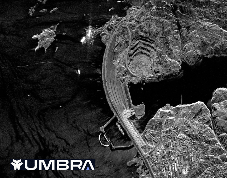
Umbra has successfully produced a 16 cm. resolution Synthetic Aperture Radar (SAR) image — the highest-resolution commercial satellite image ever released. The company also announced that the company is now able to provide customers with the highest-quality data the firm’s satellites are capable of capturing — in all formats and resolutions, including complex data better than 25 cm., for the first time.
Umbra’s ability to expand its industry-leading, high-resolution data product offerings for commercial customers is a direct result of NOAA removing the temporary licensing conditions under which Umbra previously operated.
Umbra offers single-looked, spotlight mode at an unrivaled 25 and 35 cm. resolution, as well as 50 cm., 1 meter resolutions, and multi-looked spotlight modes, which features longer dwell times to reduce speckle and aid visual interpretation. All of Umbra’s spotlight products can be delivered with GEC, SICD, SIDD, and CPHD formats. Umbra data is also provided with a Creative Commons license, which means users can do anything they want with it, as long as they credit Umbra as the source.
Umbra also regularly captures and publicly shares high-resolution SAR data from diverse locations around the world via its Open Data Program (ODP). Recently, Umbra crossed more than $1 million of free SAR data released into the ODP.
Umbra has released more open data than all other SAR providers combined. The ODP is updated several times a week and offers users the opportunity to analyze the time-series data to detect changes at each location. Following the NOAA licensing update, Umbra added 25 cm. imagery with the newly unlocked phase history data into the Open Data Program.
Umbra provides easy access to the highest quality commercial satellite data available, which is an indispensable tool for the growing number of organizations monitoring the Earth to make data-driven decisions that address global issues. Umbra’s constellation is able to identify and monitor surface-level changes globally, and can be used for a variety of efforts, including remote wildlife habitat protection, pollution and plastic waste tracking, oil spill detection, military intelligence gathering, live flooding estimation during storms, and more.
“The removal of the temporary license conditions by NOAA is impactful news for both Umbra and our customers. This means that we are finally able to offer customers the highest resolution images that our satellites are capable of capturing, setting the stage for even further expansion of products to customers.” — Gabe Dominocielo, Umbra’s co-founder and president.
Umbra is a technology company that offers intelligence data as a service to commercial and government customers. Our cutting-edge products help customers solve complex business and security challenges. Umbra is a U.S.-owned and operated company headquartered in Santa Barbara, California, and has a presence in Austin, Texas, and Washington, D.C.