• Skip to main content
  • Skip to primary sidebar
  • Home
  • News
  • Featured
  • More News ⌄
    • SatNews
    • SatMagazine
    • MilSatMagazine
  • Events ⌄
    • MilSat Symposium
    • SmallSat Symposium
    • Satellite Innovation
  • Contacts
  • SUBSCRIPTION

SmallSat News

You are here: Home / Archives for News

News

Xona Space Systems has launched their Pulsar-0 PNT satellite

July 1, 2025 by editorial

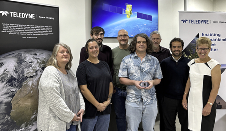
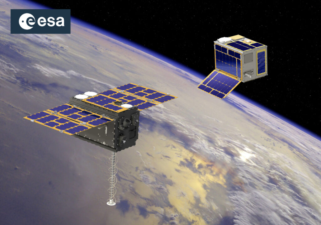
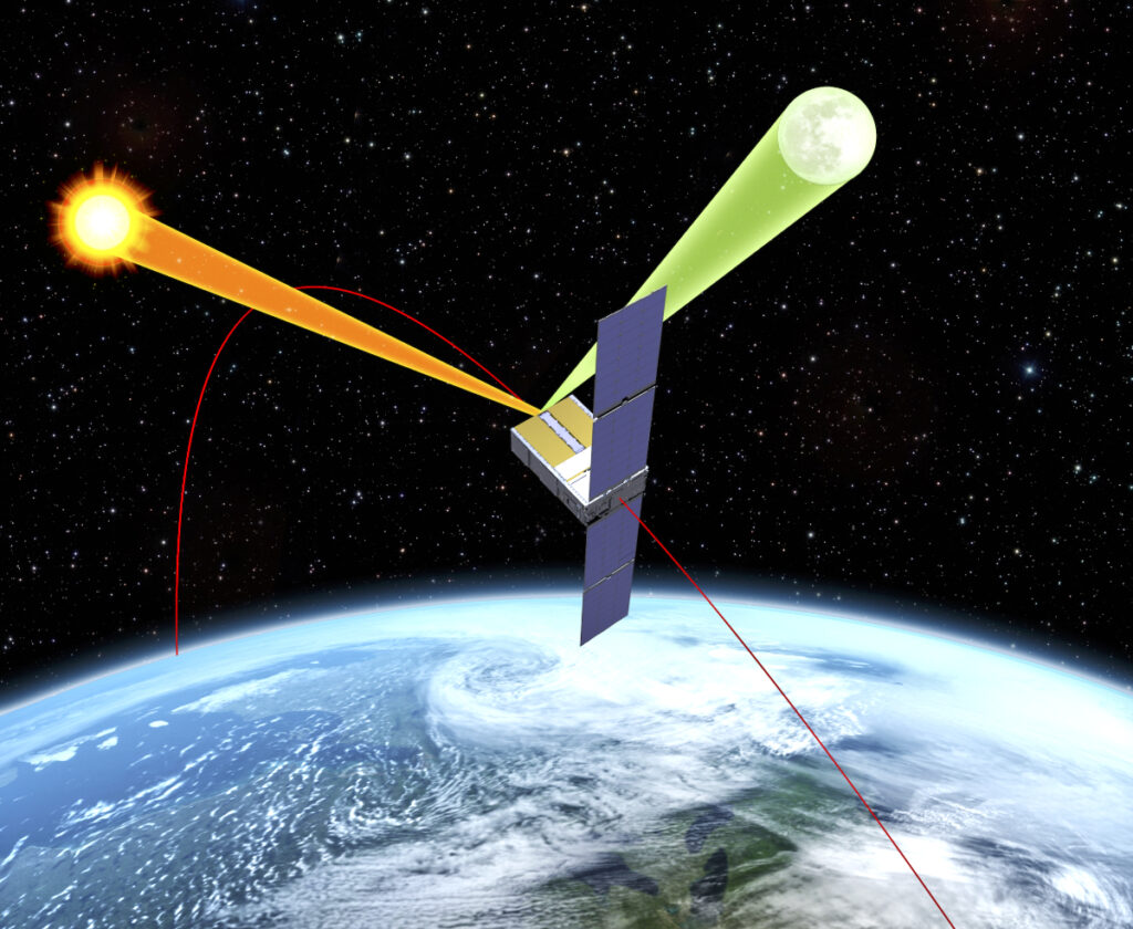
Xona Space Systems has launched Pulsar-0, the first production-class satellite in the company’s LEO constellation that will bring accuracy and affordable resiliency to industries across defense, construction, agriculture, mining, critical infrastructure, logistics, and automotive environs. The company believes introducing this technology will unlock an entirely new category of innovation by providing a new way to localize hardware in this physical world.

Photo of the Pulsar-0 satellite, courtesy of the company

Critical infrastructure, civil aviation, and financial systems rely on positioning, navigation, and timing (PNT) services from aging government satellites to function. But they are vulnerable and easy to manipulate. The need for resiliency in this infrastructure is urgent, and Pulsar will be a key part in closing this gap. We’ve heard from leaders across private and public sectors alike that there is no time to waste.

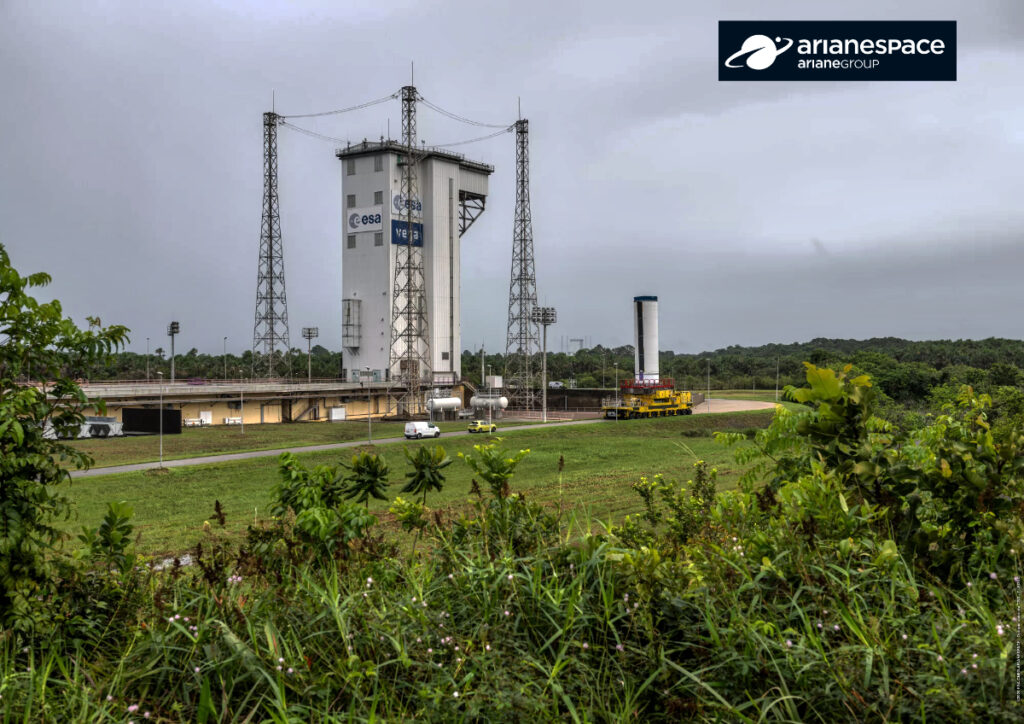
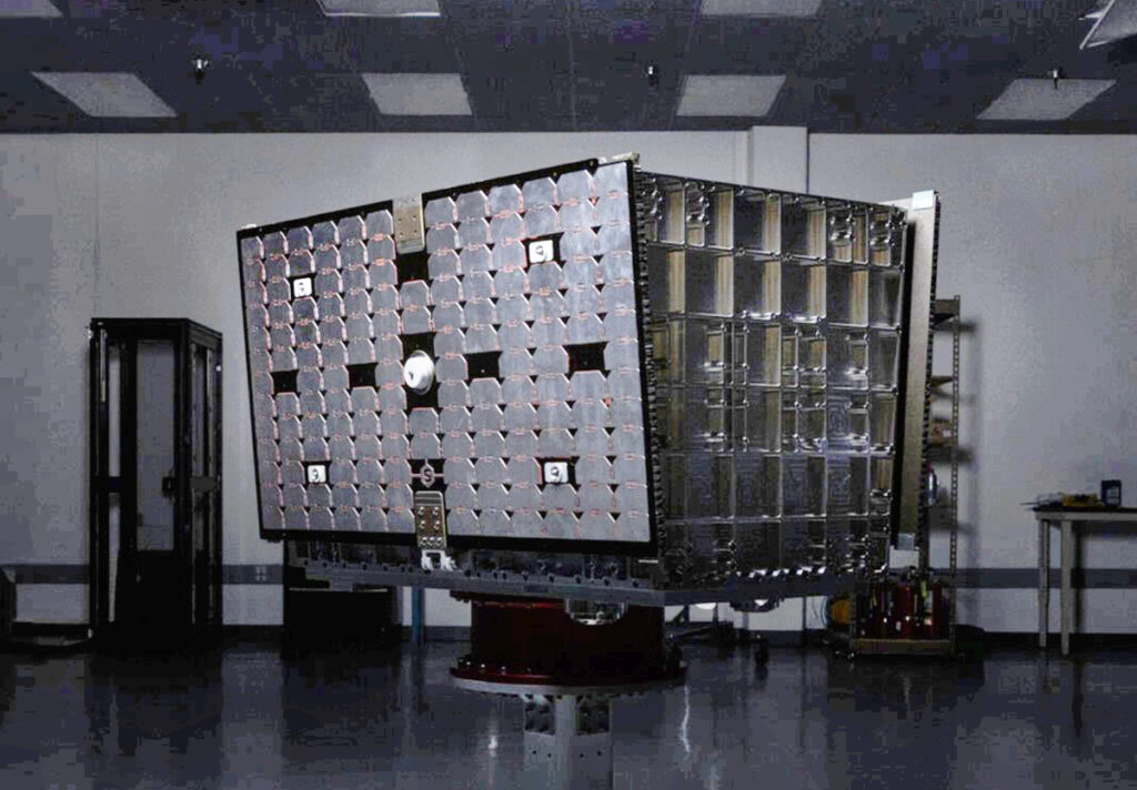
Pulsar-0 entered orbit aboard the SpaceX Transporter-14 mission and will begin broadcasting signals to Earth after the smallsat completes spacecraft commissioning. The primary mission is to validate Xona’s technology and unlock live sky testing with the firm’s early customers, charting the path for more frequent launches as the constellation gows and starts commercial operations.

Building hardware is difficult. Building hardware for space is even harder. Along the way, difficult decisions had to be made to preserve momentum in the face of supply chain volatility. One of those decisions was to proceed with launching Pulsar-0 without a propulsion system onboard, a tradeoff that reduces the mission capability and lifetime from our initial plans but has enabled the company to remain on track for launch and to initiate testing quickly. In a world where resilient PNT is needed now more than ever, launching sooner means real-world implementation can start sooner.

Over the coming months, Pulsar-0 will demonstrate:

  • Precise location: Making progress towards delivering on our partnership with Trimble, Pulsar-0 will broadcast real-time precision location with accuracy greater than 10cm. By broadcasting GNSS corrections from low Earth orbit, Pulsar can provide improved positioning before our full constellation is operational while users benefit from stronger signals that reach more places.
  • Range authentication: Legacy GPS signals are open and unencrypted, opening the door for malicious actors to generate counterfeit signals that are perceived as real. Pulsar will show a new way to verify the authenticity of our signal in action, providing protection against spoofing attacks.
  • Jamming resistance: Today, contested environments are frequently jammed, blocking legacy GPS signals which disrupts civilian life and military operations. With a received signal strength 100 times stronger than that of legacy GPS, Pulsar will outperform in denied domains where jammers and other interference might be present.
  • Signal penetration: Environments occluded from open sky have long been a challenge for legacy GPS to reach. We expect to show Pulsar excelling in these environments, bringing reliable connection to traditionally denied spaces inside reinforced buildings, urban canyons, and more.

Pulsar-0 is a milestone for Xona Space Systems and the company will now be focusing on building the capacity to launch more satellites faster and to grow the constellation to achieve persistent and redundant coverage everywhere on Earth.

Filed Under: Featured, News

Maxar awarded contract by NGA to deliver AI-powered object detection services

July 1, 2025 by editorial

Maxar Intelligence has been awarded Delivery Order 01 under the Luno A program by the National Geospatial-Intelligence Agency (NGA).

This award is focused on delivering commercial analytic services, specifically, automated AI/ML-generated object detections over many specified locations at once. Maxar is primarily identifying various classes of aircraft, ships, ground vehicles and railcars, helping NGA determine object counts at specified locations, classification of objects, identify trends and anomalies, and perform spatial and temporal geospatial intelligence analysis. The mission represents a strong example of operationalizing commercial technologies for persistent site monitoring at global scale.

Maxar has partnered on this award with satellite Earth Observation data provider Satellogic, Inc. (NASDAQ: SATL), integrating the capacity and revisit of both constellations to deliver a combination of persistent monitoring and high-resolution imaging for the most demanding multi-sensor applications; Enabled Intelligence to aid with model validation and verification; and Striveworks for the AIOps platform.

Delivery Order 01 requires excellent performance against extremely tight delivery timelines, including the ability to collect multiple images across constellations within specified windows and delivering model outputs within hours of image acquisition. Automation is the key to success for all phases that include collection, computer vision model inference, and delivery of timely results.

This award reflects the power of combining commercial innovation to support national security mission needs,” said Susanne Hake, SVP and General Manager of Maxar’s U.S. Government business. “By working together with other industry leaders, we’re enabling a powerful combination of diverse sensor data and advanced analytics to help make smarter, faster decisions.”

Filed Under: Featured, News

Teledyne Space Imaging CIS120 sensors launch on Japanese GOSAT-GW climate change observation mission

June 30, 2025 by editorial

Teledyne Technologies Incorporated (NYSE:TDY) has two CIS120 sensors that were designed and manufactured by Teledyne Space Imaging that are playing a major role in the third in a series of Japanese climate change and Earth Observation (EO) satellite missions.

The Global Observing SATellite for Greenhouse gases and Water cycle (GOSAT-GW) was launched on June 29th at 1:33am (JST) from the Tanegashima Space Center in Japan. This mission is a collaborative project between Japan’s Ministry of the Environment (MOE), the National Institute for Environmental Studies (NIES), and the Japan Aerospace Exploration Agency (JAXA).

The GOSAT-GW mission carries the two CIS120 sensors from Teledyne Space Imaging as part of its Total Anthropogenic and Natural emissions mapping SpectrOmeter-3 (TANSO-3). TANSO-3 has been designed to provide high-precision, wide-area monitoring of greenhouse gases in space to gauge their effects on climate change. TANSO-3 will specifically observe gases such as carbon dioxide, methane and nitrogen dioxide, while other parts of the satellite will gather data around the physical qualities of water, such as sea surface temperatures.

This will be the first satellite in the GOSAT series to include the CIS120 sensor. Imaging data gathered from this 2025 launch will be shared with other agencies and organisations for the betterment of human knowledge around climate change and greenhouse gases.

Teledyne Space Imaging was selected to supply the sensors due to the company’s reputation for excellence as well as the flexible nature of the CIS120 sensors and their high signal to noise ratio. The sensors had to be modified with a new package to connect to the instrument’s specific cooling mechanism and the rest of the satellite. They have been fully radiation tested, and life tested in extreme temperatures in order to be space qualified for up to 14 years.

Teledyne Space Imaging initially won the bid to supply the third GOSAT mission with CIS120 sensors in 2019 and the team worked hard to deliver the final products in 2023. Two years later, the work has led to other customers requesting Teledyne Space Imaging’s sensors for similar projects in the Earth observation sector.

Members of the Teledyne Space Imaging team that produced the CIS120 detector. From left to right: Julie Holowczyk​, Alice Gooday, Ashley Armstrong, Paul Marven, Ross Mackie, Frank Puczkowski, Rafael Gil Ot​ero and Jackie Shacklock

Ross Mackie, Principal Project Lead Engineer at Teledyne Space Imaging, said, “We get very excited when we work on Earth observation missions such as GOSAT-GW, as we get to play an active part in monitoring carbon emissions and developing countermeasures. In addition, we can help countries and organisations understand the science behind more extreme weather events and reduce their own environmental impact on the planet. Having our sensors onboard the GOSAT-GW satellite mission is a very special moment for us and the team is extremely proud of what we have achieved since winning the bid in 2019.”

Filed Under: News

Arianespace to launch CO3D + MicroCarb satellites via Vega C

June 30, 2025 by editorial

On July 25, 2025, Arianespace will place into orbit Airbus Defence and Space’s CO3D satellites, as well as the CNES’s MicroCarb satellite, with a Vega C rocket.

The CO3D mission is a constellation (Constellation Optique en 3D) composed of four small satellites which are set to map the globe in 3D from LEO, serving public and private sector needs.

The MicroCarb mission is designed to map sources and sinks of carbon dioxide (CO2) – the most important greenhouse gas – on a global scale.

This data will answer both the military need for precise and up-to-date cartography as well as civil applications such as hydrology, geology, civil security, urban planning and land and resource management.

The CNES’ MicroCarb mission is designed to map sources and sinks of carbon dioxide (CO₂), the most important greenhouse gas, on a global scale. The satellite’s dispersive spectrometer instrument will measure atmospheric concentration of CO₂ globally with a high degree of precision.

MicroCarb’s platform is based out of the lastest CNES Myriade model. Its instrument was built by Airbus Defence and Space, and the integration was realized by Thales Alenia Space UK through a dedicated partnership implemented with the UK Space Agency.

The VV27 launch at a glance:

  • 354th launch by Arianespace, 5th Vega C launch
  • 10% of the satellites launched by Arianespace are Earth observation satellites
  • 147th-150th spacecraft built by Airbus Defence and Space launched by Arianespace (CO3D, 4 satellites)
  • 108th spacecraft built by Thales Alenia Space launched by Arianespace (MicroCarb platform)

Filed Under: News

Rocket Lab to launch Electron mission for ESA’s next-generation navigation system

June 27, 2025 by editorial

Rocket Lab’s Electron rocket

Rocket Lab Corporation (Nasdaq: RKLB) has been selected to launch a dedicated Electron mission for the European Space Agency (“ESA”) for the first time, to deploy the first pair of satellites for a future navigation constellation for Europe, LEO-PNT.

Artistic rendition of ESA’s Pathfinder A smallsats for the LEO-PNT mission

Rocket Lab will launch two “Pathfinder A” spacecraft for ESA, provided by European satellite prime contractors Thales Alenia Space and GMV, from Rocket Lab Launch Complex 1 no earlier than December of 2025.

The spacecraft will be deployed to a 510 km LEO as part of a mission to test a new approach of providing location, direction, and timing services from satellites in low orbit—otherwise called LEO-PNT (Low Earth Orbit Positioning, Navigation, and Timing). ESA’s LEO-PNT demonstration mission will assess how a LEO fleet of satellites can work in combination with the Galileo and EGNOS constellations in higher orbits that provide Europe’s own global navigation system.

This latest launch contract underscores Electron’s international reputation as an industry-leading launcher, and reinforces Rocket Lab’s commitment to supporting the growing demand for space access by European constellation operators. Earlier this year Electron completed the deployment of an entire constellation of IoT satellites for French satellite operator Kinéis, before launching a global wildfire detection mission for Germany-based customer OroraTech. Missions for other European satellite operators on Electron date back to 2021.

Rocket Lab founder and CEO, Sir Peter Beck, said, “Launching a European mission on Electron that is integral to the future of Europe’s satellite navigation system is both an honor and a testament to our industry-leading launch service. An important constellation like LEO-PNT needs a strong foundation to grow from, and with Electron’s track record of precise orbital deployment, we’re excited to help secure the future of LEO-PNT for Europe with our launch of these first two satellites in the constellation.”

Filed Under: News

SSC + Firefly planning orbital launch from Esrange following TSA signing between Sweden + U.S.

June 27, 2025 by editorial

Firefly’s Alpha Rocket

Swedish Space Corporation (SSC) and Firefly Aerospace are moving closer to a historic first satellite launch from Esrange Space Center in Kiruna, Sweden, following a Technology Safeguards Agreement (TSA) that was signed between Sweden and the United States on June 20.

The bilateral agreement, signed at the Embassy of Sweden in Washington D.C., provides the legal and technical framework for U.S. commercial launches from Swedish spaceports while ensuring proper handling of sensitive technology. This agreement—only the sixth TSA signed by the United States with another country—allows SSC and Firefly Aerospace to continue building a comprehensive satellite launch service at Esrange Space Center and meet the increasing demand for orbital launch capabilities from mainland Europe.

Infrastructure development at SSC’s Esrange Space Center is progressing for Launch Complex 3C where Firefly’s Alpha rocket will launch. The tracking and control systems, security and depot facilities, and the Launch Control Center have already been stood up.

I could not be more excited that the U.S. and Sweden have now finalized the TSA,” said Ulrika Unell, President, Orbital Launch & Rocket Test division, at SSC. “This agreement enables us to move forward into the next important phase of the infrastructure establishment at the spaceport of our Esrange Space Center – allowing for this comprehensive launch service to soon enter the market.”

Finalization of the TSA gets us one step closer to launching our Alpha rocket from Sweden and filling a void for the European satellite market,” said Adam Oakes, Vice President of Launch at Firefly Aerospace. “In collaboration with SSC, we’re building on the existing infrastructure at Esrange to move quickly and meet the responsive space needs of our NATO partners and commercial customers. This TSA agreement removes the regulatory barriers and provides customers with additional assurance that the U.S. and Sweden are committed to an orbital launch capability from Esrange.”

Adding this capability in mainland Europe will strengthen Sweden’s and Europe’s capabilities and competitiveness in the space arena, as well as our relations with the U.S. and NATO,” said Charlotta Sund, CEO at SSC.

Filed Under: News

RTX provides Blue Canyon satellite to shape future space missions

June 27, 2025 by editorial

Blue Canyon Technologies, RTX’s (NYSE: RTX) launched a CubeSat in support of ARCSTONE, a NASA mission to measure lunar spectral reflectance, or the way sunlight is reflected back from the Moon’s surface at different wavelengths of light—the ARCSTONE mission will use the data it collects to help calibrate space-based imagers for earth observation.

Sunlight, reflected from Earth, carries a vast amount of information into space about the planet’s surface, atmosphere and its composition. ARCSTONE will use a spectrometer to precisely measure reflected sunlight from the entire lunar disk. This cannot be done as effectively from Earth’s surface due to interference from the atmosphere.

The ARCSTONE observatory is shown in LEO with the spectrometer viewing the Sun and Moon. The spacecraft rotates in order to view the Moon or the Sun.

In addition to building the spacecraft, Blue Canyon Technologies will also provide mission operations support, making approximately three contacts with the satellite per day.

The ARCSTONE spacecraft is Blue Canyon’s 66th CubeSat to launch into orbit, bringing the company’s total number of CubeSat and microsatellite spacecraft launched to 84 units. The satellite was designed using the company’s guidance, navigation and control systems to enable high pointing accuracy and agility for targeting.

Pointing accuracy describes the process of orienting a spacecraft which is especially important in data collection missions. The spacecraft was assembled at Blue Canyon’s CubeSat factory in Boulder, Colorado, and mission operations will be conducted from the company’s Mission Operations Center in Lafayette.

One of the most challenging tasks in remote sensing from space is achieving required instrument calibration accuracy on-orbit,” said Dr. Constantine Lukashin, physical research scientist at NASA’s Langley Research Center and principal investigator for the ARCSTONE mission. “The Moon is an excellent and available source for calibration with the potential for high accuracy. ARCSTONE will enable multiple spaceborne assets to improve quality of measurements and data products for generations to come.”

Blue Canyon’s advanced spacecraft technology will support ARCSTONE in its efforts to enable high-accuracy lunar calibration standard for past, present, and future sensors in low-Earth and geostationary orbits,” said Chris Winslett, general manager of Blue Canyon Technologies.

Filed Under: News

New HawkEye 360 satellite cluster supports mission success for government and allied partners in complex environments

June 27, 2025 by editorial

HawkEye 360 Inc. has made successful contact with its Cluster 12 satellites following their launch from New Zealand aboard a Rocket Lab Electron rocket— Cluster 12 was launched on June 26 (ET) / June 27 (NZT) and includes three formation-flying satellites designed to detect, characterize, and geolocate radio frequency (RF) signals.

The mission also included Kestrel-0A, an experimental satellite designed to evaluate emerging capabilities and inform future technological advancements.

As the first HawkEye 360 cluster to operate in a dawn/dusk sun-synchronous orbit (SSO), Cluster 12 fills a critical coverage gap in polar orbit revisit and expands the company’s ability to deliver timely RF insights in strategically significant regions. The cluster continues the proven design of Clusters 9 through 11 and includes a demonstration of a Ka-band downlink to evaluate higher throughput for potential future use.

Cluster 12 further reinforces HawkEye 360’s commitment to advancing space-based RF capabilities in support of global security and situational awareness. The company continues to deliver multidimensional signals intelligence that equips allied governments and intelligence organizations with critical knowledge for informed, timely decision-making.

Successful contact with Cluster 12 is the result of meticulous engineering, rigorous testing, and seamless coordination with our launch and mission partners,” said Lorin Metzger, Senior Vice President of Engineering at HawkEye 360. “We’re proud of the team’s work in ensuring a smooth deployment and look forward to bringing this new cluster fully online in the coming weeks.”

Cluster 12 strengthens our mission to deliver timely, defense-relevant RF insights that empower our government and allied partners operating in complex, dynamic environments,” said Patrick Zeitouni, Chief Strategy Officer at HawkEye 360. “By extending coverage through a new orbital plane, this launch reflects our continued leadership in innovation and strategic growth, ensuring our customers have the trusted knowledge they need to achieve mission success.”

Filed Under: News

AST SpaceMobile + Fairwinds Technologies demo world’s 1st tactical NTN connectivity over standard mobile devices

June 27, 2025 by editorial

AST SpaceMobile, Inc. (NASDAQ: ASTS) has successfully demo’d the world’s first Non-Terrestrial Network (NTN) tactical satellite communications delivering high-throughput data, voice, and video using unmodified mobile devices in collaboration with Fairwinds Technologies (a privately held company).

The field test showcased key defense-related use cases, including real-time connectivity to the Tactical Assault Kit (TAK) over a VPN, multimedia streaming via TAK, and secure multi-party video calls, all executed on standard, unmodified smartphones.

This milestone demonstration was conducted near AST SpaceMobile’s gateway facility on Oahu, Hawaii, with active participation from U.S. Indo-Pacific Command (USINDOPACOM), including representation from the U.S. Navy, Marine Corps, Army, U.S. Space Command, and the Office of the Under Secretary of Defense for Research and Engineering (OUSD R&E) FutureG team.

AST SpaceMobile collaborated with Fairwinds Technologies on this demonstration. Fairwinds is a trusted partner providing program integration and military tactical network support as AST SpaceMobile explores direct-to-device satellite communications for U.S. government and defense applications.

This effort follows the recent award by the Defense Innovation Unit (DIU) to the Fairwinds/AST SpaceMobile team under the Hybrid Space Architecture 2 initiative within DIU’s Space Portfolio. The project is jointly supported by DIU’s Cyber & Telecom Portfolio and aims to evaluate the viability of space-based direct-to-device communications for resilient, secure tactical networks in denied or austere environments.

This was the first in a series of planned prototype demonstrations to evaluate space-based mobile broadband for defense applications, with additional testing, including over open ocean environments, planned in the coming months as the team continues to push the boundaries of multi-domain, space-based tactical communications.

This demonstration represents a significant leap forward in advancing resilient, secure communications capabilities for the U.S. defense community,” said Chris Ivory, Chief Commercial and Government Business Officer at AST SpaceMobile. “We are proud to help enable a new layer of mobile connectivity—directly from space to standard smartphones, with no need for specialized equipment, in support of national security objectives.”

This is just the beginning,” said Timothy Hillner, Chief Technology Officer and Co-Founder of Fairwinds Technologies. “We’re honored to collaborate with AST SpaceMobile and the Defense Innovation Unit to deliver next-generation communications at the tactical edge – precisely where and when they’re needed most. Together, we’re enabling the future of command and control.”

Filed Under: News

Startical launches the firm’s 2nd demo satellite — IOD-2

June 26, 2025 by editorial

IOD-2, Startical’s second demonstrator satellite and part of the EU-funded ECHOES project, will continue validating real-time VHF voice and data communications between aircraft pilots and air traffic controllers from space

Startical, the company created by ENAIRE and Indra, has successfully launched its second satellite, IOD-2, from Vandenberg Space Force Base in California.

The launch of IOD-2 follows the successful deployment of IOD-1 in March of 2025, that already made history by enabling the first-ever VHF voice communications between aircraft pilots and air traffic controllers via satellite, fully compliant with international aviation standards. These milestones accelerate the development of Startical’s future constellation of more than 200 Low Earth Orbit (LEO) satellites, designed to provide real-time VHF voice and data communications and aircraft surveillance, particularly in regions currently without coverage, such as oceans and remote areas.

With IOD-2, Startical intensifies its testing phase to demonstrate robust, real-time aeronautical communications and surveillance services from space. Additionally, it reflects Spain’s commitment and capabilities to innovate in the aerospace sector.

The mission is led by Startical ,while the engineering behind the mission systems and the satellite payload have been developed by Indra, with the support of ENAIRE.

Today, aircraft flying over oceans or remote regions must maintain wide separation due to the lack of real-time communication. Startical’s satellites will change that, enabling continuous monitoring and direct voice contact with pilots anywhere on Earth, allowing faster responses to storms, emergencies, or rerouting needs. It also paves the way for more direct and fuel-efficient routes, contributing to a greener aviation industry.

Like its predecessor, IOD-2 is part of ECHOES, a project co-founded by the European Union under the Connecting Europe Facility (CEF), managed by the European Climate, Infrastructure, and Environment Executive Agency (CINEA) and supported by the SESAR Joint Undertaking.

The project aims to demonstrate how satellite technology can enhance ATM services and reduce environmental impact. Both satellites will continue undergoing test over the South Atlantic, covering airspace managed by the Canary Islands, Azores, Dakar, Cape Verde, and Brazil. Beyond technological demonstration, these real-world tests will help define future international standards for satellite-based air traffic communications.1

The success of IOD‑1 proved that space-based VHF works. With IOD‑2, we advance Spain’s leadership in aerospace technology and reaffirm our mission to be the first company that will provide VHF voice and data global coverage for ATM,” said Juan Enrique González Laguna, General Manager of Startical.

Filed Under: News

  • « Go to Previous Page
  • Go to page 1
  • Interim pages omitted …
  • Go to page 9
  • Go to page 10
  • Go to page 11
  • Go to page 12
  • Go to page 13
  • Interim pages omitted …
  • Go to page 322
  • Go to Next Page »

Primary Sidebar

WEEKLY NEWSLETTER

Archives

  • September 2025
  • August 2025
  • July 2025
  • June 2025
  • May 2025
  • April 2025
  • March 2025
  • February 2025
  • January 2025
  • December 2024
  • November 2024
  • October 2024
  • September 2024
  • August 2024
  • July 2024
  • June 2024
  • May 2024
  • April 2024
  • March 2024
  • February 2024
  • January 2024
  • December 2023
  • November 2023
  • October 2023
  • September 2023
  • August 2023
  • July 2023
  • June 2023
  • May 2023
  • April 2023
  • March 2023
  • February 2023
  • January 2023
  • December 2022
  • November 2022
  • October 2022
  • September 2022
  • August 2022
  • July 2022
  • June 2022
  • May 2022
  • April 2022
  • March 2022
  • February 2022
  • January 2022
  • December 2021
  • November 2021
  • October 2021
  • September 2021
  • August 2021
  • July 2021
  • June 2021
  • May 2021
  • April 2021
  • March 2021
  • February 2021
  • January 2021
  • December 2020
  • November 2020
  • October 2020
  • September 2020
  • August 2020
  • July 2020
  • June 2020
  • May 2020
  • April 2020
  • March 2020
  • February 2020
  • January 2020
  • December 2019
  • November 2019
  • October 2019

© 2019–2025 SatNews

x
Sign Up Now!

Enjoy a free weekly newsletter with recent headlines from the global SmallSat industry.

Invalid email address
We promise not to spam you. You can unsubscribe at any time.
Thanks for subscribing! You will now receive weekly SmallSat News updates.
We love our advertisers.
And you will too!

Please disable Ad Blocker to continue... We promise to keep it unobtrusive.
We promise not to spam you. You can unsubscribe at any time.
Invalid email address
Thanks for subscribing! Please check your email for further instructions.