• Skip to main content
  • Skip to primary sidebar
  • Home
  • News
  • Featured
  • More News ⌄
    • SatNews
    • SatMagazine
    • MilSatMagazine
  • Events ⌄
    • MilSat Symposium
    • SmallSat Symposium
    • Satellite Innovation
  • Contacts
  • SUBSCRIPTION

SmallSat News

You are here: Home / Archives for News

News

Sidus Space receives an additional contract award for NASA ASTRA

September 13, 2024 by editorial

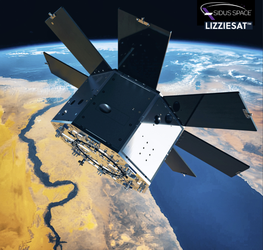
Sidus Space (NASDAQ: SIDU) has been awarded a follow on contract from NASA Stennis for additional ASTRA (Autonomous Satellite Technology for Resilient Applications) support aboard LizzieSatTM-1.

A key component of the additional objectives is collecting onboard data for critical systems. This capability enables ASTRA’s Primary Operations Control Center (POCC) to manage the Electrical Power System (EPS) through Sidus’ Mission Control Center (MCC). As a result, the satellite’s battery voltage can be continuously monitored and optimized, ensuring that the payload operates normally even in less-than-ideal solar conditions. The ability to dynamically manage power by activating or deactivating specific equipment based on battery charge levels and mission needs represents a crucial advancement in operational flexibility and efficiency.

Carol Craig, CEO of Sidus Space, said, “With the successful completion of ASTRA’s primary mission objective in early July, we now look forward to the opportunity to provide further support for this historical NASA Stennis mission.  We anticipate the execution of the additional requirements to be mutually beneficial by optimizing satellite performance and ensuring operational continuity under varied and even adverse conditions. This contract with NASA exemplifies our dedication to advancing space technology through innovation and rigorous execution.”

About Sidus Space
Sidus Space (NASDAQ: SIDU) is a multi-faceted Space Infrastructure-as-a-Service satellite company focused on mission-critical hardware manufacturing; multi-disciplinary engineering services; satellite design, production, launch planning, mission operations; and in-orbit support. The Company is in Cape Canaveral, Florida, where it operates from a 35,000-square-foot manufacturing, assembly, integration, and testing facility focused on vertically integrated Space-as-a-Service solutions including end-to-end satellite support. Sidus Space has a mission of Bringing Space Down to Earth™ and a vision of enabling space flight heritage status for new technologies while delivering data and predictive analytics to domestic and global customers.  More than just a “Satellite-as-a-Service” provider, Sidus Space products and services are offered through its several business units: Space-as-a-Service, Space-Based Data Solutions, AI/ML Products and Services, Mission Planning and Management Operations, 3D Printing and Products and Services, Satellite Manufacturing and Payload Integration. and Space and Defense Hardware Manufacturing. Sidus Space is ISO 9001:2015, AS9100 Rev. D certified, and ITAR registered.

Filed Under: News

ICEYE US selected by NASA for radar satellite imagery to support Earth science + research

September 13, 2024 by editorial

ICEYE US has been selected by NASA to provide synthetic aperture radar (SAR) data for its Commercial Smallsat Data Acquisition (CSDA) Program through a five year fixed-price, indefinite-delivery/ indefinite-quantity (IDIQ), multiple-award contract.

Since 2020, NASA’s CSDA program has been identifying, evaluating, and acquiring data from commercial sources, including ICEYE satellites, to support the scientific research, analysis, and application objectives of NASA’s Earth Science Division.

Since 2020, NASA’s CSDA program has been identifying, evaluating, and acquiring data from commercial sources, including ICEYE satellites, to support the scientific research, analysis, and application objectives of NASA’s Earth Science Division.

NASA has long proven the value of adding commercial remote sensing data to its existing capabilities as a critical tool for capturing changes across the Earth’s surface. With the increasing impact of climate change, these tools are more critical than ever.

Unlike traditional Earth observation satellites, SAR satellites can collect data in daylight, at night, through cloud cover, and under other challenging atmospheric conditions.  Importantly for science, radar sensors provide millimeter accuracy in their measurement of features on Earth’s surface, allowing detailed investigation for scientific study.  Unique to ICEYE’s constellation capabilities is the ability to produce both wide area datasets, such as glacial regions or deserts, or targeted areas, like forests or coastlines, with a high revisit rate that optimizes scientific value and supports breakthrough scientific research applications.

“NASA’s Earth Science objectives are invaluable for exploring and protecting our planet.  We remain grateful for the opportunity to continue supporting NASA’s mission with our data,” said Eric Jensen, CEO of ICEYE US. “NASA researchers, collaborating scientists and academic partners will enjoy expanded access to a reliable, accurate radar data stream from the world’s largest commercial SAR constellation.  We look forward to enabling the scientific discoveries that lie ahead.”

About ICEYE
ICEYE delivers unparalleled persistent monitoring capabilities to detect and respond to changes in any location on Earth, faster and more accurately than ever before. Owning the world’s largest synthetic aperture radar (SAR) satellite constellation, ICEYE provides objective, near real-time insights, ensuring that customers have unmatched access to actionable data, day or night, even in challenging environmental conditions. As a trusted partner to governments and commercial industries, ICEYE delivers intelligence in sectors such as insurance, natural catastrophe response and recovery, security, maritime monitoring, and finance, enabling decision-making that contributes to community resilience and sustainable development. ICEYE operates internationally with offices in Finland, Poland, Spain, the UK, and the US. We have more than 700 employees, inspired by the shared vision of improving life on Earth by becoming the global source of truth in Earth Observation (EO).

Filed Under: News

Celestia + Uzma move toward ground segment technologies partnership 

September 12, 2024 by editorial

Celestia has signed an Expression of Interest (EOI) with Uzma for a mutual collaboration between the two commercial partners on the development of advanced space satellite solutions for the South East Asia region.

Screenshot

The signing follows the successful first Space Trade Mission to Malaysia organized by Scottish Development International in partnership with organizations that included the Malaysian Space Agency (MYSA), the Malaysian Industry-Government Group for High Technology (Malaysian Investment Development Authority), and the Malaysian Investment Development Authority (MIDA) earlier this year as well as closer dialogue between Scottish and Malaysian space industry players, leading to the identification of several key development projects for the Malaysian space industry.

These include new satellite communications and ground segment infrastructure for MicroGEO satellites with investment in leading-edge technologies. Celestia brings extensive experience in developing and deploying innovative solutions, such as its Ka-band, multi-beam, phased array SATCOM gateway, a new generation of gateway ground terminal with no moving parts for increased reliability and less downtime, minimal footprint requirements and the ability to be connected to multiple multi-orbit satellites providing full 2.5 GHz instantaneous bandwidth in Ka-band.

The partnership between Celestia and Uzma represents a significant step forwards for both companies as they seek to bring cutting-edge satellite communications technology to the South East Asia market.

“We are delighted that Uzma, one of Malaysia’s leading space businesses is interested in partnering with our company and harnessing our capabilities, experience and solutions,” said Dr. Malachy Devlin, CEO of Celestia UK. “We are leaders in advanced SATCOM technologies such as phased array antennas which will be an important part of the infrastructure in which Malaysia is investing, and we bring extensive expertise in the ground segment to support their ambitions.  We have already demonstrated our solutions with other commercial partners, and we look forward to becoming Uzma’s trusted partner in this exciting venture.”

“We are pleased to announce our partnership with Celestia UK, with the help of Scottish Development International, marked by the signing of an Expression of Interest (EOI),” said Dato’ Kamarul Redzuan Mohamed, CEO of Uzma. “Scotland has established itself as a hub of space innovation, with the necessary infrastructure, policies and capabilities to drive the growth of the space industry. We look forward to collaborating and contributing to this dynamic ecosystem.”

“We’ve been working hard to support Scotland’s drive to become a leading space nation, so it’s great to see companies like Celestia choosing Scotland as a location for its R&D activities,” said Jan Robertson, Director of Global Trade at Scottish Development International. “Scotland’s space industry has the potential to be worth more than £4 billion to the country’s economy by 2030 and we’ve thrown our weight behind that goal by identifying space as a priority under our new missions-based approach. Building partnerships and fostering international collaboration is of critical importance to the space sector’s growth. This EOI is an exciting milestone in Scotland’s space journey, bringing together key players from Scotland and Malaysia to develop and deepen relationships with our Malaysian partners and cement a genuine desire to get deals over the line. It’s particularly fitting that it’s all coming together at Scotland’s first ever Space-Comm. We look forward to continuing to work with Celestia as it grows and scales.“

Filed Under: News

1st images from the Arctic Weather Satellite are received

September 12, 2024 by editorial

The European Space Agency’s Arctic Weather Satellite late last month delivered the first images captured by its scientific weather payload supplied by AAC Clyde Space — these first images revealed atmospheric temperature and humidity, aiming to improve short-term weather forecasts in the Arctic and around the world. 

Launched on August 16th, the Arctic Weather Satellite is commissioned by OHB Sweden. The satellite’s payload, a cross-track scanning microwave radiometer manufactured by AAC Omnisys, was turned on for the first time in space during a week dedicated to functional testing.

Artistic rendition of the Arctic Weather Satellite on-orbit, courtesy of OHB Sweden.

ESA’s Arctic Weather Satellite mission, for which OHB is mission prime, is designed to show how a potential polar-orbiting constellation of satellites could provide data for very short-term weather forecasts and nowcasts in the Arctic, and around the world. With its cross-track scanning microwave radiometer, the Arctic Weather Satellite mission is to provide measurements of atmospheric humidity and temperature.

The mission is a prototype mission that is intended to be followed by a full constellation of satellites to provide more frequent measurement, something that cannot be achieved by larger GEO satellites currently in use.

Filed Under: News

PlanetiQ awarded million$ NOAA Contract

September 11, 2024 by editorial

PlanetiQ received a Delivery Order (DO-4) contract valued at more than $6.5 million to supply NOAA with their proprietary radio occultation (RO) data for a period of one year starting on September 18, 2024.

Under the Radio Occultation Data Buy II (RODB-2) Indefinite Delivery/Indefinite Quantity (IDIQ) contract, PlanetiQ will provide 2,200 GNSS-RO profiles per day to support NOAA’s Commercial Weather Data Program. NOAA, the U.S.Air Force, U.S. Navy and other weather prediction centers around the world will use PlanetiQ’s data to ingest into their numerical weather prediction models to improve their weather forecasts.

On August 16, 2024, PlanetiQ successfully launched the 5th generation of its GNOMES satellites (GNOMES-5), which began producing the world’s highest quality radio occultation data within 24 hours of launch from Vandenberg AFB. GNOMES-5 is equipped with the world’s best weather sensor, a PlanetiQ-proprietary technology sensor called Pyxis.

Pyxis enables PlanetiQ to supply the highest quality GNSS-RO data for enhanced weather forecasting and atmospheric research to both government and commercial customers, including airlines, insurance, energy, agriculture and financial services. In addition to having the same world class Pyxis sensor as on GNOMES-4, GNOMES-5 carries the world’s most accurate high gain, GNSS dual linear polarization antenna for radio occultation and related applications, which profiles heavy precipitation and snowfall, and measures surface reflections to determine ocean surface winds, soil moisture, sea ice, rivers and lakes, flooding, and freeze-thaw transitions.

Pyxis receives signals from all four world-wide GNSS constellations (GPS, GLONASS, Galileo, and Beidou), and is powerful enough to provide more than double the amount of data available from the next-best GNSS-RO sensors currently on orbit.

“In addition to our deep understanding of RO technology, PlanetiQ provides highly valuable data to the government, military and commercial sectors to benefit people and businesses around the world, including our armed forces,” said PlanetiQ CEO Ira Scharf. “PlanetiQ has built the only system capable of profiling the thermodynamic state of the atmosphere with very high vertical resolution, precision and accuracy routinely down to the surface under any and all weather conditions, over any type of surface, across the globe.”

About PlanetIQ
The mission of PlanetiQ is to bring innovation to the global atmospheric observing system at low cost, via high performance GNSS and related observations to fill the urgent need for highly accurate data to improve weather and climate forecasts to save lives and provide a more environmentally secure future for our planet. Founded in 2015 and privately owned, PlanetiQ is building, launching, and operating a commercial constellation of the highest quality GNSS-RO weather satellites, with an eventual full constellation of 20 Low Earth Orbit (LEO) satellites.

Filed Under: News

Sunstorm CubeSat developed by Kuva Space + Isaware completes mission

September 10, 2024 by editorial

Kuva Space has announced the successful completion of the Sunstorm CubeSat’s mission — after three years of operation, the Sunstorm satellite re-entered Earth’s atmosphere on September 4, 2024, at 10:30 EEST, marking the end of its mission that started under the European Space Agency’s (ESA) General Support Technology Programme (GSTP).

Launched in 2021, the Sunstorm satellite was a joint project of Kuva Space and Isaware, designed to monitor solar X-ray flares with its cutting-edge X-ray Flux Monitor (XFM-CS). The mission’s primary goal was to collect high-resolution data to advance our understanding of solar eruptions and space weather phenomena.

Kuva Space was the satellite platform provider, integrator, and operator in this ESA mission, while Isaware led the development and manufacturing of the X-Ray Flux Monitor for CubeSat (XFM-CS) instrument for the mission and performed the processing of acquired X-ray data for further use in science and services.

Observing solar X-rays is crucial for predicting space weather, but this can only be done from space. As our reliance on networks, electronic systems, and satellites grows, Sunstorm has improved our ability to predict space weather phenomena with unparalleled precision, making it the first of its kind with potential for commercial use.

Throughout its operation, Sunstorm exceeded expectations, delivering the most extensive and highest quality set of X-ray spectral data on solar flares available to date.

The mission was initially planned for two years but was extended by Kuva Space and Isaware due to the satellite’s continued excellent performance. This extension allowed for additional data collection, further enriching the already significant dataset. Sunstorm has provided unprecedented insights into solar activity, which will continue to benefit the scientific community for years to come.

In addition to its primary mission, the success of XFM-CS on Sunstorm has paved the way for future missions. A version of the XFM is currently being developed under ESA’s Space Safety Programme for the National Oceanic and Atmospheric Administration’s (NOAA) Space Weather NEXT program. This mission, scheduled for launch in 2029, will place the XFM instrument aboard an unnamed solar observatory at the Lagrange Point 1 (L1) of the Sun-Earth system. This instrument will be based on the technology successfully proven with XFM-CS but includes two detectors of different sensitivities, which will further improve its performance, particularly during extremely low or high levels of solar activity.

For Kuva Space, the mission set the precedent in how CubeSats are transitioning from high-risk proof-of-concept missions to fully operational high-availability monitoring campaigns with usable scientific data. The mission reaffirms the company’s capability in launching and operating CubeSats that deliver scientific-grade data.

Kuva Space successfully launched its Hyperfield-1 satellite in August 2024, marking the initial stage of Kuva Space’s large hyperspectral constellation, which aims to provide daily observation by 2027 and gapless subdaily global monitoring with 100 satellites by 2030. Its second hyperspectral satellite, Hyperfield-1B, will be deployed in Q1 2025 as part of the ESA InCubed program.

“We are extremely proud of the Sunstorm mission’s success,” said Janne Kuhno, co-founder and principal space engineer at Kuva Space. “The data collected by Sunstorm over the past three years has been invaluable for space weather research and scientific studies of solar eruptions. This mission has set a new benchmark for solar X-ray observations.”

“Sunstorm’s performance and the quality of the data collected have been outstanding,” said Juhani Huovelin, Principal Investigator of the XFM-CS. “This mission has not only achieved its objectives but has also laid the groundwork for future advancements in space weather monitoring. We look forward to seeing the continued impact of the Sunstorm mission in the years to come.”

Filed Under: News

Spire Global awarded million$ NOAA contract for satellite weather data

September 9, 2024 by editorial

Spire Global, Inc. (NYSE: SPIR) hs been awarded a $3,832,500 contract from NOAA to provide radio occultation (RO) data for a one-year period from September 18, 2024 to September 18, 2025. 

The Company’s near-real-time RO data consists of vertical profiles of atmospheric measurements, including pressure, humidity and temperature, that can reach all points of the globe. The data will be used for NOAA’s operational weather forecasts, space weather models and climate research, among other applications.

The award is part of an Indefinite Delivery Indefinite Quantity (IDIQ) contract with a $59 million ceiling for NOAA’s Commercial Weather Data Program’s Radio Occultation Data Buy II

“From the ultimate vantage point of space, our satellites are able to provide unique data sets to improve weather prediction, contribute to climate research, and ultimately, protect lives and prevent the loss of property,” said Mike Eilts, general manager of Weather & Climate at Spire Global. “Our continued work with NOAA speaks to the power of government partnership with the commercial satellite industry to improve weather forecasting.” 

About Spire Global, Inc.  
Spire (NYSE: SPIR) is a global provider of space-based data, analytics and space services, offering unique datasets and powerful insights about Earth so that organizations can make decisions with confidence in a rapidly changing world. Spire builds, owns, and operates a fully deployed satellite constellation that observes the Earth in real time using radio frequency technology. The data acquired by Spire’s satellites provides global weather intelligence, ship and plane movements, and spoofing and jamming detection to better predict how their patterns impact economies, global security, business operations and the environment. Spire also offers Space as a Service solutions that empower customers to leverage its established infrastructure to put their business in space. Spire has nine offices across the U.S., Canada, UK, Luxembourg, Germany and Singapore.

Additional Spire Global posts at SatNews…

Filed Under: News

Telesat selects Calian for element management system for Lightspeed Network

September 9, 2024 by editorial

Telesat (NASDAQ and TSX: TSAT) has selected Calian Group Ltd. (TSX:CGY) to design, develop, deliver and deploy the Element Management System (EMS) within the Telesat Lightspeed LEO satellite network, as well as provide lifecycle maintenance and support for the system.

The EMS will be instrumental in connecting and maintaining operations for various components within the Telesat Lightspeed network, identifying and addressing issues to ensure optimal performance. With the EMS, Telesat will be able to manage the configuration and capabilities of Telesat Lightspeed Landing Stations, User Terminals, and the satellite onboard processors as needed. In addition, Telesat will leverage the EMS to collect and share Telesat Lightspeed system data with the company’s Operations Support Systems and Network Operations Centers to gain full visibility into the state of the entire constellation.

The Telesat Lightspeed constellation is a network of advanced LEO satellites and integrated terrestrial infrastructure that will offer high-speed, low-latency broadband connectivity to remote locations across Canada and worldwide. The Telesat Lightspeed network will support multi-Gbps data rates for government, aeronautical, maritime and enterprise customers, including industries such as oil and gas that operate in locations without access to fiber. Telesat Lightspeed will also help to bridge the digital divide, by expanding the reach of telecom networks in unserved and underserved areas.

Calian’s EMS technology will play a crucial role in the network operations for Telesat Lightspeed, the largest space program in Canada’s history. In addition to helping to bridge the digital divide, the Telesat Lightspeed network is creating and sustaining thousands of high-quality Canadian jobs and puts Canada at the forefront of the burgeoning New Space Economy. 

“We are excited to support the Telesat Lightspeed LEO network with essential software and services for this cutting-edge satellite constellation,” said Valérie Travain-Milone, President, Advanced Technologies, Calian. “By enabling high-speed connectivity in remote and underserved areas, Telesat Lightspeed will empower industries and communities across Canada and beyond. We’re proud to contribute to this transformative project, ensuring reliable, affordable internet access on land, at sea and in the air.”

“The EMS is a critical component of the orchestration of system segments in this advanced, enterprise-class network,” said Aneesh Dalvi, Vice President for Telesat Lightspeed Systems Development. “We conducted a thorough search to find an innovative partner that could meet our requirements and Calian demonstrated the technological knowledge and expertise to deliver this capability; selecting them is a significant milestone as we push toward the launch of the Telesat Lightspeed network.”

About Telesat
Backed by a legacy of engineering excellence, reliability and industry-leading customer service, Telesat (NASDAQ and TSX: TSAT) is one of the largest and most innovative global satellite operators. Telesat works collaboratively with its customers to deliver critical connectivity solutions that tackle the world’s most complex communications challenges, providing powerful advantages that improve their operations and drive profitable growth. Continuously innovating to meet the connectivity demands of the future, Telesat Lightspeed, the company’s state-of-the-art Low Earth Orbit (LEO) satellite network, has been optimized to meet the rigorous requirements of telecom, government, maritime and aeronautical customers. Telesat Lightspeed will redefine global satellite connectivity with ubiquitous, affordable, high-capacity links with feiber-like speeds.

About Calian
We keep the world moving forward. Calian® helps people communicate, innovate, learn and lead safe and healthy lives. Every day, our employees live our values of customer commitment, integrity, innovation, respect and teamwork to engineer reliable solutions that solve complex challenges. That’s Confidence. Engineered. A stable and growing 40-year company, we are headquartered in Ottawa with offices and projects spanning North American, European and international markets.

Filed Under: News

Infostellar providing GSaaS support for Panasonic’s CURTIS Satellite using partner ground stations

September 5, 2024 by editorial

Infostellar Inc., a Ground Segment as a Service (GSaaS) provider, is going to support Panasonic Group’s CURTIS satellite by providing multiple ground stations through the company’s StellarStation platform. 

Infostellar provided a ground station in Gifu, Japan, owned by Kawasaki Heavy Industries (KHI); a ground station in Azerbaijan owned by Azercosmos; and ground stations in South Africa and Bahrain owned by another partner ground station facility, for the CURTIS satellite mission. Using StellarStation the ground station setup for these four different ground stations was completed in just a few months, enabling CURTIS a rapid technology demonstration.

CURTIS was launched from the International Space Station (ISS) in April of 2024, and this technical demo satellite consists mainly of the following three mission payloads:

(1)Demonstrate the operation of the satellite itself, designed as an easy-to-assemble satellite

(2)Conduct technical demonstrations of Panasonic Group products in space. Panasonic will demonstrate components using components and modules that are already in use on the ground, and verify the possibility of converting them for space usage.

(3)Demonstrate circuit formation technology using a thermal management unit composed of technology that downsizes the basic bus section of the satellite and expands the volume of the mission section, as well as graphite material technology with excellent heat dissipation properties. This is done by using high-density circuit design and mounting technologies developed in mobile terminals and product groups that require compactness and light weight.

It is common for such technology demonstrations to use a single ground station. This is because setting up a ground station is a complex and time-consuming task, and it is not efficient to use multiple ground stations operated by different owners for a technology demonstration. However, StellarStation provides a network of third-party ground stations around the world and enables the setup of multiple ground stations in a short period of time. In addition, the use of multiple ground stations increases opportunities for communication with satellites in the S-band, which is common for satellite operations, and allows for large observational data to be downloaded over multiple separate contacts, leading to a quick and effective implementation of the technical demonstration.

In addition to providing ground stations through StellarStation, Infostellar also supported Panasonic in their ITU international frequency coordination and the acquisition of radio licenses for the satellite and overseas ground stations. The Kinki Bureau of the Ministry of Internal Affairs and Communications (MIC) issued the radio station license on July 22, 2024, and Infostellar was able to provide comprehensive support as a GSaaS (Ground Segment as a Service) provider.

Infostellar will continue to support CURTIS operations by providing a network of ground stations through StellarStation.

Naomi Kurahara, CEO of Infostellar, said, “Infostellar is very pleased to support Panasonic Group’s satellite “CURTIS” by providing multiple ground stations through StellarStation and supporting the acquisition of radio station licenses. Our mission is “We connect Earth and Space to empower the future.” And we aim to be the most effective enabler of space business by providing the best access to satellite, as our vision. We hope to contribute to the success of satellite operators’ missions by providing a comprehensive range of services related to the ground segment. Through the access of technical data obtained from the Panasonic Group’s demonstration, we hope that this will lead to the future development of the space industry.

About Infostellar
Infostellar is a satellite ‘Ground Segment as a Service’ (GSaaS) provider. Infostellar provides flexible and scalable ground station services enabled by our cloud platform, StellarStation, which virtualizes ground station networks. Infostellar also provides support for the ground segment operations necessary for satellite operations, such as radio license acquisition and frequency coordination operations. By lowering the barriers to entry in the ground segment, Infostellar empowers new space businesses to build better missions and improve the quality of their service. Founded in 2016, Infostellar is headquartered in Tokyo, Japan and has offices in the UK and the U.S.

About StellarStation
StellarStation is Infostellar’s unique cloud-based platform that provides Satellite Operators with easy access to an expansive and ever-growing network of ground stations around the world. Whether your satellite mission is a global, space-based communications network of high performing satellites; a constellation of Earth Observation satellites or a single, cubesat-based experiment, StellarStation provides services that scale to meet a variety of service needs. Access your satellite data from anywhere in the world. Your data appears where you need it, when you need it and in the most cost-effective manner. Communicate with your orbiting satellites for command and control frequently and efficiently.

Filed Under: News

WISeKey Subsidiary WISeSAT.Space Announces Strategic Alliance with Global Radio Systems

September 4, 2024 by editorial

WISeKey International Holding Ltd. (SIX: WIHN, NASDAQ: WKEY), a global leader in cybersecurity, digital identity and IoT, has announced that, via the firm’s subsidiary WISeSAT.Space, the company has entered into a strategic alliance with Global Radio Systems for the development of innovative solutions and integration of advanced technologies to enhance cyber-secure radio communications connectivity in critical environments, such as emergencies, security and defense.

Headquartered in Spain, and with operations in more than 15 countries, Global Radio Systems offers secured, professional radio communication services, including local and international talk/connection, remote support, emergency alerts, location and real time status, etc. to a wide range of clients.

The collaboration between Global Radio Systems and WISeSAT will focus on creating innovative solutions that combine the advanced technologies of WISeKey and Global Radio Systems. This synergy will allow the offering of cutting-edge services and products that improve safety and efficiency in key sectors. The benefits of this alliance will extend to essential services, including the armed forces, police forces, firefighters, and other organizations that operate in extreme conditions and require reliable and secure communications.

The agreement provides for the use of the WISeSAT low-orbit satellite constellation to ensure robust and continuous connectivity, even in the most challenging environments. These technologies will allow greater flexibility and reach in emergency, security and defense operations, providing essential support for real-time decision making.

“This alliance represents a significant step in our commitment to leading innovation in secure radio communications,” said Pedro Roldán, CEO of Global Radio Systems. “By joining our strengths with WISeSAT, we are prepared to offer unique solutions that meet the most demanding needs of our clients in critical sectors.”

Carlos Moreno, VP Corporate Alliances & Partnerships of WISeSAT.Space, said, “We are excited to work alongside Global Radio Systems to develop technologies that not only revolutionize the market, but also provide critical service to those who depend on secure communications in their daily operations.”

About WISeSAT.Space
WISeSat AG is pioneering a transformative approach to IoT connectivity and climate change monitoring through its innovative satellite constellation. By providing cost-effective, secure, and global IoT connectivity, WISeSat is enabling a wide range of applications that support environmental monitoring, disaster management, and sustainable practices. The integration of satellite data with advanced climate models holds great promise for enhancing our understanding of climate change and developing effective strategies to combat its impacts. As the world continues to grapple with the challenges of climate change, initiatives like WISeSat’s IoT satellite constellation are essential for creating a more resilient and sustainable future.

About WISeKey
WISeKey International Holding Ltd (“WISeKey”, SIX: WIHN; Nasdaq: WKEY) is a global leader in cybersecurity, digital identity, and IoT solutions platform. It operates as a Swiss-based holding company through several operational subsidiaries, each dedicated to specific aspects of its technology portfolio. The subsidiaries include (i) SEALSQ Corp (Nasdaq: LAES), which focuses on semiconductors, PKI, and post-quantum technology products, (ii) WISeKey SA which specializes in RoT and PKI solutions for secure authentication and identification in IoT, Blockchain, and AI, (iii) WISeSat AG which focuses on space technology for secure satellite communication, specifically for IoT applications, (iv) WISe.ART Corp which focuses on trusted blockchain NFTs and operates the WISe.ART marketplace for secure NFT transactions, and (v) SEALCOIN AG which focuses on decentralized physical internet with DePIN technology and house the development of the SEALCOIN platform.

Filed Under: News

  • « Go to Previous Page
  • Go to page 1
  • Interim pages omitted …
  • Go to page 55
  • Go to page 56
  • Go to page 57
  • Go to page 58
  • Go to page 59
  • Interim pages omitted …
  • Go to page 338
  • Go to Next Page »

Primary Sidebar

WEEKLY NEWSLETTER

Archives

  • February 2026
  • January 2026
  • December 2025
  • November 2025
  • October 2025
  • September 2025
  • August 2025
  • July 2025
  • June 2025
  • May 2025
  • April 2025
  • March 2025
  • February 2025
  • January 2025
  • December 2024
  • November 2024
  • October 2024
  • September 2024
  • August 2024
  • July 2024
  • June 2024
  • May 2024
  • April 2024
  • March 2024
  • February 2024
  • January 2024
  • December 2023
  • November 2023
  • October 2023
  • September 2023
  • August 2023
  • July 2023
  • June 2023
  • May 2023
  • April 2023
  • March 2023
  • February 2023
  • January 2023
  • December 2022
  • November 2022
  • October 2022
  • September 2022
  • August 2022
  • July 2022
  • June 2022
  • May 2022
  • April 2022
  • March 2022
  • February 2022
  • January 2022
  • December 2021
  • November 2021
  • October 2021
  • September 2021
  • August 2021
  • July 2021
  • June 2021
  • May 2021
  • April 2021
  • March 2021
  • February 2021
  • January 2021
  • December 2020
  • November 2020
  • October 2020
  • September 2020
  • August 2020
  • July 2020
  • June 2020
  • May 2020
  • April 2020
  • March 2020
  • February 2020
  • January 2020
  • December 2019
  • November 2019
  • October 2019

© 2019–2026 SatNews

Insert/edit link

Enter the destination URL

Or link to existing content

    No search term specified. Showing recent items. Search or use up and down arrow keys to select an item.
      x
      Sign Up Now!

      Enjoy a free weekly newsletter with recent headlines from the global SmallSat industry.

      Invalid email address
      We promise not to spam you. You can unsubscribe at any time.
      Thanks for subscribing! You will now receive weekly SmallSat News updates.
      We love our advertisers.
      And you will too!

      Please disable Ad Blocker to continue... We promise to keep it unobtrusive.
      We promise not to spam you. You can unsubscribe at any time.
      Invalid email address
      Thanks for subscribing! Please check your email for further instructions.