• Skip to main content
  • Skip to primary sidebar
  • Home
  • News
  • Featured
  • More News ⌄
    • SatNews
    • SatMagazine
    • MilSatMagazine
  • Events ⌄
    • MilSat Symposium
    • SmallSat Symposium
    • Satellite Innovation
  • Contacts
  • SUBSCRIPTION

SmallSat News

You are here: Home / 2025 / Archives for October 2025

Archives for October 2025

stc group + AST SpaceMobile announce 10-year commercial agreement + long-term revenue commitment for space-based cellular broadband connectivity

October 30, 2025 by editorial

Collaboration for rollout in Saudi Arabia and select markets in the Middle East and Africa

AST SpaceMobile, Inc. (NASDAQ: ASTS) and stc group have signed a 10- year commercial agreement to enable direct-to-device satellite mobile connectivity across Saudi Arabia and key regional markets.

As part of this agreement, stc has committed to a prepayment of $175 million for future services and made a significant long-term commercial revenue commitment.

AST SpaceMobile will integrate its space-based cellular broadband connectivity with stc’s terrestrial infrastructure to expand mobile coverage across Saudi Arabia, as well as select countries in the Middle East and Africa. The partnership aims to eliminate connectivity gaps by delivering 5G and 4G LTE services directly to standard mobile phones without the need of any specialized software or device support or updates, for consumers, enterprises, and government sectors, ensuring seamless voice and broadband access

Under this agreement, the first in the region for AST SpaceMobile, the company will build three ground gateways in Saudi Arabia and establish a Network Operations Center (NOC) in Riyadh to support the network’s operations and service quality. These key infrastructure developments will be instrumental in providing seamless connectivity across the region.

The partnership will extend broadband cellular coverage to remote and underserved areas, empowering millions of people with reliable, high-speed connectivity. By complementing stc’s existing mobile networks, AST SpaceMobile’s technology will help drive economic development, education, and digital inclusion across the region.

With this agreement, stc group will become the first operator in the region to adopt direct-to-device satellite broadband connectivity, advancing its strategy to expand digital access, invest in next-generation infrastructure, and shape the future of mobile connectivity across the Kingdom and beyond. By leveraging AST SpaceMobile’s technology, stc group aims to extend its network far beyond the limits of traditional terrestrial infrastructure, delivering enhanced mobile access to customers and reinforcing its position as a leading digital enabler in the region.

Commercial services are anticipated to launch during the fourth Q of 2026, contingent upon securing full regulatory authorization, licensing, and compliance from the Communications, Space and Technology Commission (CST) of Saudi Arabia and other relevant regulatory bodies across the 15-country operating footprint.

stc group regional leadership and commitment to innovation, combined with our pioneering space-based network, will create a paradigm shift in how people connect,” said Abel Avellan, Founder, Chairman, and CEO of AST SpaceMobile “We are pleased to partner with stc as the first regional operator to collaborate with us on this groundbreaking initiative. This partnership is another major leap forward to deliver on the promise of truly universal mobile broadband coverage, bridging the digital divide and empowering millions with reliable and easy-to-use connectivity.”

Olayan Alwetaid, CEO of stc group, said, “By expanding coverage by using the latest innovations in telecommunications technology, stc and AST SpaceMobile are bridging connectivity gaps and ensuring no one is left out of the digital future. It’s a step forward in our ambition to lead in digital infrastructure and deliver world-class connectivity access to everyone, no matter where they are located.”

Filed Under: News

Pramatra Space + Infostellar sign strategic MoU for QKD ground station services

October 30, 2025 by editorial

Pramatra Space and Infostellar Inc. have signed a Memorandum of Understanding (MoU) to partner to establish and conduct joint development for networks to link Quantum Key Distribution (QKD) ground stations that offer secure space communications.

The agreement marks a significant milestone in building the foundation for a global quantum communication network, leveraging both organizations’ complementary strengths. Under the scope of the MoU, Infostellar will provide access to its global ground station network, spanning optical and RF systems, to support Pramatra’s upcoming satellite missions. This includes Launch and Early Orbit Phase (LEOP) operations and the integration of third-party ground segments.

In parallel, both companies will engage in collaborative R&D to design and validate a QKD-enhanced ground station framework that supports secure satellite-to-ground data links. The partnership is expected to open future commercial pathways for quantum-grade encryption services, data relays, and hybrid space-terrestrial communication systems addressing various applications.

The collaboration underlines a shared commitment to advancing quantum resilience in data exchange infrastructure. Both companies aim to explore opportunities in joint demonstrations, technology validation missions, and commercial deployment strategies in alignment with emerging space and cybersecurity regulations.

This MoU reinforces the strategic alignment between India’s expanding quantum-space ecosystem and Japan’s leadership in ground networking technologies—creating a platform for innovation, knowledge exchange, and deployment of secure space-driven connectivity across continents.

Richa Hukumchand, Founder and Director of Pramatra Space, said, “We see this partnership as a pivotal step in strengthening global collaboration between India and Japan in the domain of secure space communications. Infostellar brings exceptional expertise in scalable and interoperable ground infrastructure, which perfectly complements Pramatra’s quantum communication roadmap.”

Naomi Kurahara, CEO of Infostellar Inc., said, “We’re excited to partner with Pramatra Space to advance quantum-secure satellite communications. This MoU combines Infostellar’s proven ground network infrastructure with Pramatra’s cutting-edge quantum capabilities, positioning both companies to lead in the next era of space-based secure connectivity.”

Filed Under: News

WISeKey affiliate WISeSat.Space teams with INNOSPACE for post-quantum satellite launches

October 29, 2025 by editorial

WISeKey International Holding’s subsidiaries WISeSat.Space and SEALSQ Corp. have signed a Memorandum of Understanding (MoU) to establish a strategic partnership with INNOSPACE Co., Ltd., a South Korean satellite launch service company.

This collaboration marks a significant milestone in advancing secure and efficient satellite deployment, leveraging South Korea’s rapidly growing space ecosystem.

WISeSat aims to diversify the launch locations of its next-generation satellites to expedite the establishment of its infrastructure. Through this partnership, WISeSat will deploy its latest generation of secure satellites using INNOSPACE’s HANBIT-SERIES launch vehicles, ensuring reliable, cost-effective, and innovative access to space. Collaborating with INNOSPACE reinforces WISeSat’s commitment to providing quantum-resistant, secure IoT connectivity solutions on a global scale.

INNOSPACE, recognized for its groundbreaking achievements in private space launches, offers flexible and affordable launch solutions tailored to the unique needs of satellite operators such as WISeSat. This collaboration will facilitate efficient satellite deployment, supporting critical sectors such as cybersecurity, IoT, environmental monitoring, and secure communications.

This announcement comes at a time when the European market for satellite connectivity is experiencing rapid expansion, with growing demand for European alternatives in the sector. The partnership between WISeSat and INNOSPACE underscores the importance of international collaboration in fostering secure and sustainable space technology.

This is beginning of a long-term collaboration between WISeSat and INNOSPACE. The companies will continue to explore further opportunities for cooperation in space-based cybersecurity, AI-driven satellite applications, and beyond.

Partnering with INNOSPACE marks a significant advancement in expanding WISeSat’s capabilities in secure satellite communications,” said Carlos Moreira, Founder and CEO of WISeKey. “South Korea has emerged as a key player in the global space industry, and INNOSPACE’s cutting-edge technology aligns seamlessly with our vision of delivering highly secure and resilient connectivity solutions.”

Partnering with WISeSat represents an opportunity to combine INNOSPACE’s agile launch capabilities with WISeSat’s cutting-edge satellite technologies,” said Soojong Kim, Founder and CEO of INNOSPACE. “Together, we look forward to enabling new possibilities in secure and reliable access to space.”

Filed Under: News

AAC Clyde Space has started the integration of their VIREON™ EO constellation

October 29, 2025 by editorial

AAC Clyde Space has begun integration of the first satellite in its VIREON™ 
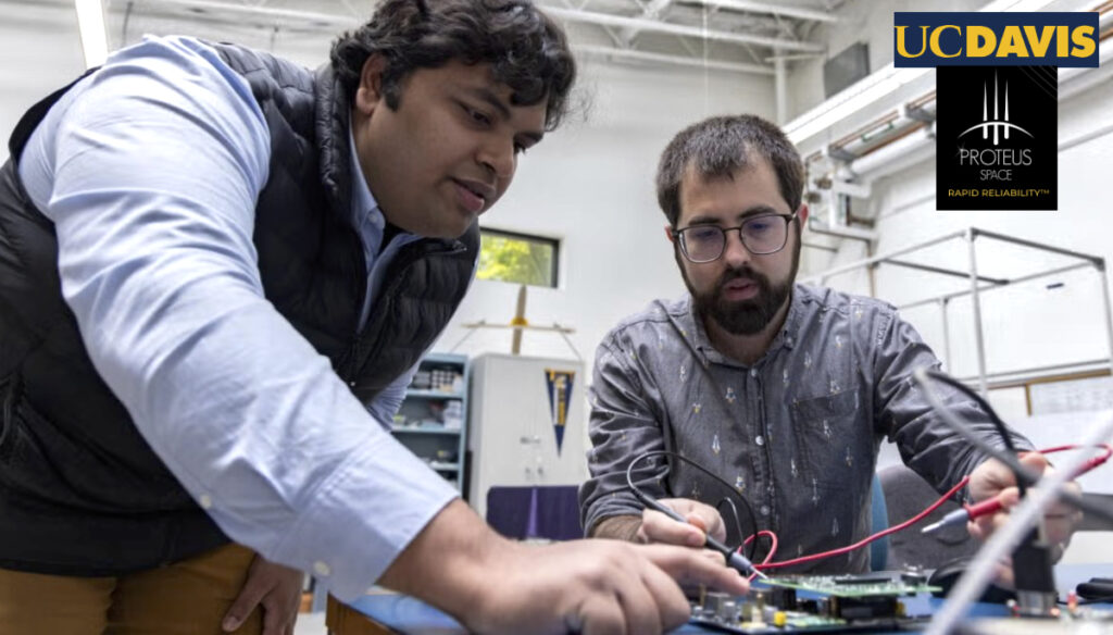
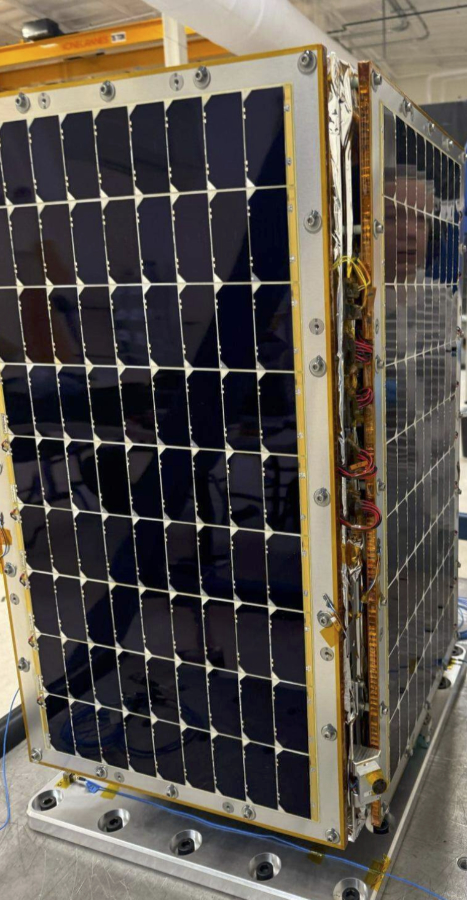
constellation. This phase involves assembling the spacecraft and verifying that the onboard systems work together as designed. The constellation is designed to deliver actionable, high-quality data to multiple customers worldwide.

VIREON™ is built to provide frequent, reliable data on land and vegetation. Its insights support agriculture and forestry, helping users improve productivity and sustainability while addressing growing environmental and climate pressures.

Combining advanced imaging capabilities with analysis-ready data, VIREON delivers both the detail and the insight users need, offering exceptional value for money across commercial and institutional applications.

The constellation advances AAC Clyde Space’s expansion in Data and Services, providing recurring revenue through the delivery of decision-ready data to multiple customers worldwide.

VIREON connects every part of our business, showing the strength of our full value chain,” said Luis Gomes, CEO of AAC Clyde Space. “We build our own satellites, use our own components, and deliver unique data that helps customers turn information into insight and make better decisions.”

Filed Under: News

Hubble Network raises $70 million Series B to scale global Bluetooth®-to-Satellite connectivity + presenting at Silicon Valley Space Week

October 29, 2025 by editorial

Hubble Network recently announced a major step forward as the firm raised $70 million in Series B funding, bringing the company’s total funding to $100 million since its founding in 2021.

This raise fuels their growth and also validates the enormous opportunity to reshape global IoT connectivity.

Space is hard and the industry has long been known for capital intensity, slow cycles, and technical hurdles. Hubble has taken a different path. By leveraging existing Bluetooth chips and building a developer-first platform, we dramatically lower costs, simplify integration, and speed up adoption.

With seven satellites on-orbit, the company has proven that satellite connectivity doesn’t have to be complicated or expensive. This approach is making space practical and scalable for the billions of IoT devices that need it. With this new funding, the company is focused on…

  • Expanding the satellite constellation toward global coverage
  • Scaling the developer ecosystem to make integration as easy as plugging in an SDK.
  • Powering enterprise deployments across logistics, infrastructure, defense, and consumer IoT.

Hubble Network’s long-term vision is bold and clear: to build a global satellite network that enables affordable, low-power, ubiquitous connectivity for billions of devices unlocking a new era of IoT at planetary scale.

Alex Hare, the Chief Executive Officer of the company and also the co-founder of Life360, will be a featured panelist at Silicon Valley Space Week that is now in session through October 30th. Mr. Haro will be taking part in the discussion titled: The Sensing Stack: How Are Multimodal Inputs Transforming GEOINT?

The panel discussion occurs on Wednesday, October 29th, from 9:00 to 9:45 a.m. PST at the Computer History Museum in Silicon Valley, California.

Filed Under: News

Sidus Space finalizes commercial pathfinder mission agreement with Lonestar for LizzieSat®-5

October 28, 2025 by editorial

Sidus Space (NASDAQ: SIDU) has executed a Commercial Pathfinder Mission Agreement with Lonestar Data Holdings, Inc. (“Lonestar”) for the design and integration of Lonestar’s high-capacity Digital Data Storage Payload, featuring edge processing capabilities, onto LizzieSat®-5, a LEO satellite within Sidus’ LizzieSat® micro-constellation.

Under the terms of the agreement, Sidus will design, develop, and integrate one Lonestar payload onto LizzieSat®-5, along with arranging deployment and payload commissioning in coordination with Lonestar. The mission serves as the roll out of Lonestar’s commercial offering for in-space data storage and edge processing technologies, designed to establish sovereign, secure, and scalable orbital data infrastructure where data from Earth can be uplinked, stored long-term, processed, and downlinked as needed from onboard a spacecraft.

In accordance with the agreement, the mission aims to validate long-term, sovereign data retention and near real-time analytics capabilities from space. Sidus will maintain operational control of the satellite through Launch and Early Orbit Phase (LEOP) and commissioning at an orbital altitude of approximately 500-550 km.

The LizzieSat®-5 mission builds upon the growing collaboration between Sidus and Lonestar, following the companies’ earlier preliminary $120 million agreement for future lunar data storage spacecraft, underscoring Sidus’ expanding role as a trusted mission enabler across both LEO and cislunar domains.

This mission exemplifies how modular satellite design and integrated partnerships can rapidly advance commercial space innovation,” said Carol Craig, Founder and CEO of Sidus Space. “By hosting Lonestar’s Data Storage Payload on LizzieSat®-5, we’re not only enabling new applications for edge computing in orbit but also strengthening the foundation for secure, scalable data networks across LEO.”

After our successful test flights earlier this year, this mission with Sidus represents the perfect next step for our commercial service.” said Chris Stott, CEO of Lonestar Data Holdings.

Filed Under: Featured, News

UC Davis + Proteus Space to launch 1st dynamic digital twin into space

October 28, 2025 by editorial

UC Davis graduate students Ayush Patnaik (left) and Adam Zufall (right) working on a payload that will travel into space this fall. The payload is a digital twin that will use AI software to measure the activity and predict the future state of the battery. Developed at the UC Davis Center for Space Exploration Research, it is a step towards fully autonomous spacecraft. The project is in collaboration with a company, Proteus Space. (Mario Rodriguez/UC Davis)
Photo of the smallsat is courtesy of The Sacramento Bee

The Center for Space Exploration Research at the University of California, Davis, has partnered with Proteus Space to launch a U.S. government-sponsored satellite into space with a custom, AI-enabled payload in a brand-new, first-ever, rapid design-to-deployment small satellite.

The team will launch the satellite and payload in October of 2025 from Vandenberg, California. From the time the project was fully approved, the design and launch will occur within 13 months.

The UC Davis-designed payload was developed by Professor of Mechanical and Aerospace Engineering Stephen Robinson’s Human/Robotics/Vehicle Integration and Performance Laboratory, or HRVIP Lab.

Dr. Robinson

This is a dynamic digital twin that models the current condition and predicts the future condition of the spacecraft’s power system. The novel aspect of this payload is that the system-state model is running in real time onboard the spacecraft, instead of in ground-based mission control.

The satellite, which includes multiple commercial and research payloads, will monitor its own health in space using sensors that assess voltage and measurements of the batteries it is running on. The digital twin software will continually analyze the health and charge capacity of the battery. Using artificial intelligence, the digital twin will be aware of its own state and learn to predict its future state.

Xinfan Lin

In addition to the team at Proteus, Zufall and Robinson are working with Associate Professor of Mechanical and Aerospace Engineering Xinfan Lin, whose research specializes in intelligent battery management systems. The team also includes mechanical and aerospace engineering Ph.D. students Jackson Fogelquist and Ayush Patnaik, and Ansha Prashanth, a master’s student in computer science.

The satellite will settle into LEO and operate for up to 12 months. After three years, the satellite will naturally fall back to Earth, burning up in the atmosphere.

The spacecraft itself can let us know how it’s doing, which is all done by humans now,” said Adam Zufall, a graduate student in the HRVIP Lab who is overseeing the UC Davis side of the project.

It should get smarter as it goes,” said Robinson, “and be able to predict how it’s going to perform in the near future. Current satellites do not have this capability.”

Story by by Jessica Heath, UC David

Filed Under: News

Mil/Gov win to optimize Gogo multi-orbit 5G ATG, LEO, and GEO connectivity networks

October 27, 2025 by editorial

SD Government (SDG), the division of Gogo (NASDAQ: GOGO) that provides SATCOM to global governments, has received a five-year, federal contract to deliver multi-band, multi-orbit, airborne global satellite communications to a U.S. government agency.

The new agreement, initially valued at $3 million, is a follow-on from Small Business Innovation Research (SBIR) Phase III activity originally undertaken by SDG prior to the merger with Gogo.

Awarded as a sole-source contract, the agreement will see the agency consolidate all aero communications across its fleet to this single contract over the next five years. With the consolidation of multiple contracts into a single contract, procurement time and complexity are dramatically reduced. In addition, the agreement allows users to focus resources on the mission rather than managing diverse contracts and vendors.

This is the first SDG government contract to optimize the company’s integrated multi-orbit, multi-band, multi-network capabilities. The deal also includes provision for the government to add new technology and services as they become available over the life of the contract.

The agency’s missions demand consistent, reliable high-bandwidth satellite connections in every theater of operations globally, as well as the highest encryption levels for secure communication and data transfer. SDG’s deep experience in the government and defense markets, combined with its ability to deliver 24/7/365 expert customer support, will ensure the customer retains consistent critical mission connectivity.

As the contract’s full scope is realized, it will employ Gogo’s air-to-ground networks, low-Earth orbit (LEO), medium-Earth orbit (MEO), high-Earth orbit (HEO) and geostationary orbit (GEO) constellations for Ku- and Ka-band connectivity as required.

The customer agency will benefit from our extensive expertise, support, and cybersecurity expertise, along with our agnostic ability to provide the best-performing connections and terminals across multiple orbits on its diverse fleet of aircraft,” said Hayden Olson, Head of SDG. “We are providing a simple, seamless solution for the agency to procure resilient airborne communications. The streamlined access to all types of connectivity will enable seamless procurement and support, which is extremely valuable to a busy government agency.”

Filed Under: News

Open Cosmos celebrates completion of landmark MANTIS mission

October 27, 2025 by editorial

Open Cosmos recently celebrated the successful completion of the company’s MANTIS mission, a two-year program that delivered Earth Observation (EO) data and set a new benchmark for sustainable space operations.

Launched on November 11, 2023, aboard SpaceX’s Transporter-9 mission, MANTIS was the first ESA InCubed satellite, backed by the UK Space Agency, and carried Satlantis’s iSIM90 high-resolution camera and a reconfigurable AI processor from Ubotica.

Over its two-year mission, MANTIS proved how a small, agile satellite could deliver outsized impact. It completed more than 10,000 orbits, capturing high-resolution daily imagery across half a million square kilometers. Its advanced optics and AI allow to transform raw imagery into actionable intelligence in near real time, faster and more efficiently than traditional missions, enabling energy, mining and environmental sectors to make faster, more informed decisions.

The mission also advanced the use of AI in orbit and validated new technologies, processes, and operational models together with IngeniArs and Ubotica that are now embedded into the wider OpenConstellation, the global Earth Observation constellation managed by Open Cosmos and used by governments, businesses, and organisations to tackle global challenges like climate change, resource management and environmental protection using space data.

MANTIS managed to acquire and download imagery within just 10 days of launch, which was presented at the UK Space Expo in 2023.

MANTIS also demonstrated how innovation can go hand-in-hand with responsibility. Designed from the start with sustainability in mind, the satellite is planned to be permanently shut down at an altitude of 300 km and will safely de-integrate during atmospheric re-entry, leaving no debris behind. This means MANTIS not only contributed to better environmental monitoring on Earth, but also left space itself cleaner for future missions.

Rafel Jordà Siquier, founder and CEO of Open Cosmos, said, “MANTIS was a landmark mission for Open Cosmos. It proved our ability to deliver end-to-end Earth Observation with state-of-the-art AI and optical technology, and it delivered critical data for sectors tackling climate, energy and land management challenges. Its safe and sustainable end-of-life shows how responsible satellite design can protect the space environment. MANTIS leaves a powerful legacy – both in the data it produced and the standards it set for future missions.”

Harshbir Sangha, Director of Missions and Capabilities at the UK Space Agency, said, “The MANTIS mission shows how strategic investment can turn advanced ideas into operational systems that deliver real benefits. Our support through ESA’s InCubed programme has strengthened the UK’s role in a competitive global market, opened new commercial opportunities, and addressed pressing challenges such as environmental monitoring. With Open Cosmos demonstrating outstanding technical expertise and leadership throughout the mission, MANTIS has built capability across the UK space sector and set the stage for future missions that will keep the UK leading in innovation in this rapidly expanding domain.”

Filed Under: News

SatSense contracted by Network Rail to monitor Britain’s rail network using satellite radar

October 26, 2025 by editorial

SatSense Ltd., a leading InSAR (Interferometric Synthetic Aperture Radar) technology specialist based in Leeds, UK, has secured a landmark, multi-million-pound, multi-year contract with Network Rail to deliver network-wide ground deformation monitoring, flood mapping and change detection services using satellite radar technology.

Representative image of how SatSense’s InSAR data will be integrated into Network Rail’s internal GIS software to monitor ground movement trends along the rail corridor   

The innovative approach paves the way for redefining geotechnical asset management and setting a new standard for sustainable infrastructure monitoring.

Paddington Station, London

Under the agreement, SatSense will deliver processed InSAR data and derived services that integrate into Network Rail’s earthwork asset management systems, using data from satellites such as the Sentinel-1, NISAR and TerraSAR-X constellations. The approach aims to enable a transition to reduce reliance on repeat on-site examinations which can be costly, subjective and untimely.

Operational Applications 
The implementation will deliver several key operational advantages over traditional monitoring methods:

  • Cost Savings: Providing a cost-effective alternative to scheduled site visits across the entire network Enhanced Safety: Reduces risk to personnel by minimizing time spent on the track and on slopes, through continuous remote monitoring capabilities 
  • Improved Efficiency: Enables faster data collection eliminating time constraints of ground-based surveys, optimizing on-site time and unlocking capacity for critical geotechnical assessments 
  • High Data Accuracy and Consistency: Millimeter-level precision enabling repeatable measurements over time for trend analysis while reducing human error and subjectivity 
  • Continuous and Proactive Monitoring: Near real-time analysis after each satellite overpass, enabling predictive maintenance and improved data-driven decision making rather than reactive responses 
  • The implementation will build upon, rather than replace, Network Rail’s decades of manual examination expertise, using existing asset knowledge to validate and interpret Earth Observation data for enhanced asset management decisions. 

Network Rail’s decision to use a suite of remote sensing technologies to enhance and optimize existing asset management systems reflects the organization’s commitment to operational excellence.

This first network-wide implementation is expected to influence adoption of integrated InSAR solutions across the global rail industry, with other major operators evaluating similar approaches.

The contract demonstrates the commercial viability of integrated satellite-based infrastructure monitoring and establishes new benchmarks for railway asset management. The implementation positions the UK at the forefront of railway innovation, with Network Rail leading the adoption of advanced monitoring technologies in major rail operations. 

We are delighted with this appointment – it is a testament to the vision of decision-makers in Network Rail, and the quality of work delivered by the Network Rail and SatSense teams on this theme over the years,” said Dr. Matthew Bray, CEO of SatSense Ltd. “We’re excited to work towards realising the benefits that remote sensing offers in rail, enhancing safety and reliability at scale.” 

About SatSense Ltd.
SatSense Ltd, founded in 2017 and headquartered in Leeds, is a leading InSAR (Interferometric Synthetic Aperture Radar) service provider specializing in ground and structural movement monitoring for critical infrastructure. Built on decades of academic heritage, the company delivers near real-time satellite-based monitoring solutions across civil engineering, utilities, natural hazards, and energy sectors. While UK-based, SatSense operates globally across Australia, New Zealand, Europe, Southeast Asia, and the Americas. 

Filed Under: News

  • Go to page 1
  • Go to page 2
  • Go to page 3
  • Interim pages omitted …
  • Go to page 5
  • Go to Next Page »

Primary Sidebar

WEEKLY NEWSLETTER

Archives

  • November 2025
  • October 2025
  • September 2025
  • August 2025
  • July 2025
  • June 2025
  • May 2025
  • April 2025
  • March 2025
  • February 2025
  • January 2025
  • December 2024
  • November 2024
  • October 2024
  • September 2024
  • August 2024
  • July 2024
  • June 2024
  • May 2024
  • April 2024
  • March 2024
  • February 2024
  • January 2024
  • December 2023
  • November 2023
  • October 2023
  • September 2023
  • August 2023
  • July 2023
  • June 2023
  • May 2023
  • April 2023
  • March 2023
  • February 2023
  • January 2023
  • December 2022
  • November 2022
  • October 2022
  • September 2022
  • August 2022
  • July 2022
  • June 2022
  • May 2022
  • April 2022
  • March 2022
  • February 2022
  • January 2022
  • December 2021
  • November 2021
  • October 2021
  • September 2021
  • August 2021
  • July 2021
  • June 2021
  • May 2021
  • April 2021
  • March 2021
  • February 2021
  • January 2021
  • December 2020
  • November 2020
  • October 2020
  • September 2020
  • August 2020
  • July 2020
  • June 2020
  • May 2020
  • April 2020
  • March 2020
  • February 2020
  • January 2020
  • December 2019
  • November 2019
  • October 2019

© 2019–2025 SatNews

Insert/edit link

Enter the destination URL

Or link to existing content

    No search term specified. Showing recent items. Search or use up and down arrow keys to select an item.
      x
      Sign Up Now!

      Enjoy a free weekly newsletter with recent headlines from the global SmallSat industry.

      Invalid email address
      We promise not to spam you. You can unsubscribe at any time.
      Thanks for subscribing! You will now receive weekly SmallSat News updates.
      We love our advertisers.
      And you will too!

      Please disable Ad Blocker to continue... We promise to keep it unobtrusive.
      We promise not to spam you. You can unsubscribe at any time.
      Invalid email address
      Thanks for subscribing! Please check your email for further instructions.