• Skip to main content
  • Skip to primary sidebar
  • Home
  • News
  • Featured
  • More News ⌄
    • SatNews
    • SatMagazine
    • MilSatMagazine
  • Events ⌄
    • MilSat Symposium
    • SmallSat Symposium
    • Satellite Innovation
  • Contacts
  • SUBSCRIPTION

SmallSat News

You are here: Home / 2022 / Archives for May 2022

Archives for May 2022

OneWeb’s 1st West African Satellite Network Portal Completed By TinSky

May 25, 2022 by editorial

TinSky Connect has successfully completed the installation of 15 OneWeb antennas and customer provided equipment at a Satellite Network Portal (SNP) or gateway facility in Accra, Ghana.


OneWeb is a global communications network powered through space, enabling connectivity for governments, businesses, and communities. Tinsky Connect was selected as OneWeb’s technical engineering partner for its first west African SNP. The gateway is located in Tema on the outskirts of Accra, Ghana, on a site of six hectares. The site is owned and run by ComSys, who will continue to host the gateway on behalf of OneWeb.

OneWeb’s first SNP gateway in Africa, located in Hartebeesthoek, South Africa is also nearing completion, with others in Senegal and Mauritius currently under development.

Alan Geldenhuys, Executive Director of TinSky Connect Group, said, “The site is now commissioning and will be ready for service later in 2022. Tinsky understood the complexity of the multiple satellite ‘hand offs’ each gateway has to achieve per second and deployed a highly experienced team of field engineers that provided advanced system engineering and technical services addressing OneWeb’s mission critical SNP gateway needs, at low risk and within budget. The teamwork between OneWeb and TinSky resulted in the project successfully completed and all SNP gateways handed over within the schedule.”

TinSky Connect is a leading provider of converged communication solutions to Africa’s satellite, wireless and land/airborne mobility markets. With 21 years’ experience, the company has played a major role in developing several leading first-to-market satellite solutions and managed service offerings, including managed service platforms, radio telescopes and land/air mobility solutions.


Filed Under: News

NanoAvionics Alpha Smallsat Demo To Be Powered By Gama Solar Sails

May 24, 2022 by editorial

NanoAvionics has been contracted by Gama for a demonstration of Gama’s solar sails propulsion system in LEO.

Under the mission agreement, NanoAvionics will provide its 6U smallsat bus, payload integration services, a satellite testing campaign, launch services and satellite operations. The launch of the “Alpha” smallsat is scheduled for the second half of this year.

Gama’s range of solar sails are aimed at commercial companies and research organisations looking for a cost-effective and less complex setup and propulsion system to explore deep space through smallsats. Using nano- or microsatellites propelled through space by solar sails would allow them to travel greater distances without requiring large amount of stored fuel. They can also be launched with smaller and less expensive rockets, making shuttle trips between planets less expensive and more practical than conventional chemical rockets.

Missions for smallsats with solar sail technology could include getting data about Neptune’s atmosphere or Uranus’ magnetosphere, performing low-cost asteroid reconnaissance missions, carrying cargo to the Moon or Mars, sending rovers to Titan or Venus, and helping to remove space debris.

This mission contract with Gama is the second solar sail mission for NanoAvionics, following an earlier contract to build a satellite bus for NASA’s ACS3 solar sail propulsion demonstration.

Louis de Gouyon Matignon, CEO of Gama Space, said, “Our solar sails will greatly advance the possibilities of deep space access for companies and research organisations across the globe. Drawing on their experience with integrating solar sail technology in small satellites and their modular buses, NanoAvionics is the ideal partner for this mission. With sunlight being free and unlimited, solar sail-propelled spacecraft could travel greater distances without requiring large amounts of stored fuel.”

Vytenis J. Buzas, co-founder and CEO of NanoAvionics, said, “While the payloads are similar in nature, NASA’s ACS3 and Gama’s Alpha are two very different satellites, with different customization requirements. Being able to integrate solar sails, a new promising spacecraft propulsion method, into our nano- and microsatellites opens an entire new market for us, way beyond the mission limits of low Earth orbit. Over the years, NanoAvionics engineering team has faced and solved many technical challenges while matching our customers’ mission requirements and integrating different payloads, instruments and novel propulsion systems to our satellite busses. It allowed our engineers to greatly develop and advance NanoAvionics’ technology. Of course, the modularity of NanoAvionics versatile buses and components are a major advantage for a successful integration. Based on these prior experiences, we are able to transfer a lot of know-how not only to the Gama’s Alpha satellite but to every future satellite mission.”

Filed Under: News

Terran Orbital Delivers The PTD-3 Satellite To Cape Canaveral SFS For Integration Into The SpaceX Transporter-5 Mission

May 24, 2022 by editorial

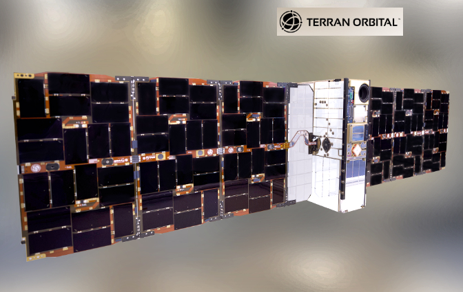
Terran Orbital Corporation (NYSE: LLAP) has delivered the Pathfinder Technology Demonstrator 3 (PTD-3) satellite to the Cape Canaveral Space Force Station in Florida for integration ahead of SpaceX’s Transporter-5 mission.

PTD-3 is a 6-unit (6U) cubesat built and integrated by Terran Orbital to host and support launch and on-orbit operations of the TeraByte InfraRed Delivery (TBIRD) payload funded by NASA’s Space Communications and Navigation (SCaN) program and developed by MIT Lincoln Laboratory (MITLL). The TBIRD mission is the second mission in the PTD series funded by the Small Spacecraft Technology program in NASA’s Space Technology Mission Directorate.

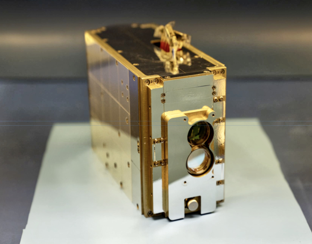
The TeraByte InfraRed Delivery, or TBIRD, is a payload on the PTD-3 mission. It is a 3U payload, approximately the size of a tissue box. Photo is courtesy of the Massachusetts Institute of Technology’s Lincoln Laboratory.

The mission will demonstrate a space-to-ground data transfer capability at orders of magnitude faster than previously demonstrated technologies. This technology could open doors to large volume data communications and data accessibility for advanced space exploration — delivering multiple terabytes of data per day to a single ground station.

Each PTD mission consists of a 6U cubesat weighing approximately 12 kilograms and measuring 36 cm × 23 cm × 10 cm. Each PTD spacecraft will also be equipped with deployable solar arrays that can provide a peak power of 120 watts while on-orbit.

“Terran Orbital is thrilled to deliver pioneering satellite solutions that are changing the space landscape,” said Terran Orbital Co-Founder, Chairman, and Chief Executive Officer, Marc Bell. “PTD-3 will not only disrupt the way our Earth receives data, but also fine-tune future mission capabilities. We look forward to fostering our relationships with NASA, MITLL, and SpaceX as we continue to deliver groundbreaking technologies.”

Terran Orbital is a leading manufacturer of ssmallsats primarily serving the United States aerospace and defense industry. Terran Orbital provides end-to-end satellite solutions by combining satellite design, production, launch planning, mission operations, and in-orbit support to meet the needs of the most demanding military, civil, and commercial customers. Learn more at www.terranorbital.com.

Filed Under: News

Rivada Space Networks Works Toward The Launch Of Their LEO Constellation

May 24, 2022 by editorial

Rivada Space Networks GmbH continues to work toward their launch of a constellation of 600 LEO communications satellites for enterprise data communications.

Rivada Space Networks was established by U.S.-based Rivada Networks, with wireless technology entrepreneur Declan Ganley forming the company to deliver a unique solution for secure, global, end-to-end enterprise and government connectivity that will respond directly to specific customer needs that are not being met by today’s technology.

The company will offer access to secure satellite networks with pole-to-pole reach, offering end-to-end latencies similar or better than terrestrial fiber. The Rivada network will operate like an optical backbone in space, using lasers to interconnect satellites to deliver an ultra-secure and highly reliable global data network for business operations in the telecom, enterprise, maritime, energy and government services markets. The constellation’s unique architecture, high speed and low latency, combined with Rivada’s dynamic pricing and open access technology, will also make it possible to bring internet access to remote and underserved areas where no backhaul is currently available.

Rivada Space Networks will leverage the terrestrial wireless technologies of parent company Rivada Networks Inc. to optimize network utilization and facilitate the buying and selling of broadband capacity. The company’s patented technologies including Dynamic Spectrum Arbitrage and Open Access platform will enable efficient use of spectrum and provide customers with ultimate flexibility.

Based in Germany, Rivada Space Networks is rapidly moving forward with procurement of an LEO network of 600 Ka-band communications satellites. The company is currently undertaking an RFI with major satellite manufacturers to finalize the system design and manufacturing plan, paving the way for the production and deployment of the entire constellation.

Rivada Space Networks Founder Declan Ganley said, “Our goal is to leverage the unique strengths of low-latency satellite communication to provide an enterprise-grade on demand experience anywhere in the world from any platform. Rivada Space Networks will not only provide a competitive advantage, it will help to expand these markets by enabling new opportunities through previously unavailable levels of performance combined with global reach. When wireless technologies converge with satellite over a single, highly secure network – you are going to get the best of both worlds.”

Rivada Space Networks GmbH is a disruptive new company set to establish and operate the first truly global low latency point-to-point connectivity network of LEO satellites. By connecting its satellites with lasers, Rivada Space Networks will provide resellers and B2B customers with the ability to securely connect any two points on the globe with low latency and high bandwidth. The constellation of 600 low-earth-orbit communications satellites will represent a fundamental change in the availability of secure, global, end-to-end enterprise-grade connectivity for Telecom, Enterprise, Maritime, Energy and Government Services markets. Founded by Declan Ganley, Rivada Networks, Inc. is active across North and South America as well as Europe. Rivada holds a multitude of patents relating to spectrum sharing, digital spectrum arbitrage, prioritized messaging, open access services and other wireless communications technologies. For more information:

Filed Under: News

Enhanced Australian Operations Announced By Satellogic To Serve The APAC Region

May 23, 2022 by editorial

Satellogic Inc. (NASDAQ: SATL) is enhancing the company’s operations in the Australian market to strengthen regional customer relationships and provide local support for a growing APAC space economy — the regional presence will be overseen by Ken Fritschel, Vice President, International Sales, Satellogic.

Currently, Satellogic operates 22 high resolution satellites and expects to grow its constellation to 34 satellites by Q1 2023. By 2025, the Company expects to have more than 200 satellites on-orbit to provide daily remaps of the entire surface of the Earth and up to 40 revisits of points of interest per day.

Satellogic recently announced a Multiple Launch Agreement (“MLA”) with SpaceX, reserving launch capacity for the firm’s next 68 satellites. This new MLA, which follows the current MLA covering 2022 launches, confirms that SpaceX continues to be Satellogic’s preferred vendor for rideshare missions, meeting the capacity demands of the Company’s constellation roadmap and providing shorter periods between satellite development and deployment. Satellogic’s rapid and consistent launch cadence enables the company to continually test new technology, refresh and augment its constellation and differentiate from competition.

The announcement is made in tandem with Satellogic’s participation at a key Australian event: Locate 2022, taking place May 24-26 in Canberra. Thomas VanMatre, VP of Global Business Development at Satellogic, will be delivering a presentation on “Multi-Sensor Constellations” at 3:45 p.m., AEST, on Tuesday, May 24th.

Satellogic is also planning to attend Asia Satellite Business Week in Singapore, June 1-3. Brian Lantier, EVP of Global Revenue at Satellogic, will participate on the “Revolutionizing Earth Observation: From Data to AI and Analytics” panel at 3:30 p.m., SGT, on Thursday, June 2nd.

“Our growing presence in Australia, overseen by one of our key executives, will provide a direct connection to the APAC region so we can more easily work with our commercial customers and close public sector allies across Oceania and Asia,” said Emiliano Kargieman, CEO and Co-Founder of Satellogic. “Australia is committed to keeping supply chains open and believes in the democratization of space, which is the core of our mission. We look forward to continuing to collaborate with organizations in the country and across the region as we further expand access to Earth Observation data worldwide, in order to help solve the biggest global challenges that we are facing.”

“We are focused on developing our partnerships with the public sector throughout APAC, in particular Australia, with its strong security alliances across the Indo-Pacific region,” said Matt Tirman, EVP and GM, Global Public Sector, at Satellogic. “Thi’s announcement is an important step forward in this area and we expect that our operations will accelerate the new space industry across APAC and further support our key Oceanic, European, and North American partners.”

Filed Under: News

AAC Clyde Space’s Follow-On Order For Europe’s New Weather Satellites, MetOp-SG

May 23, 2022 by editorial

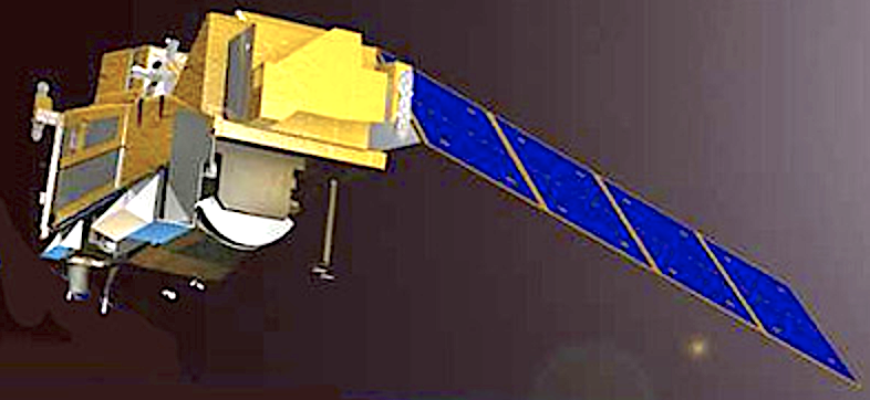
METOP-SG-A [Airbus DS]

The MWIs will provide cloud and precipitation products and all-weather surface imagery to support numerical weather predictions at regional and global scales.

Omnisys, AAC Clyde Space’s new subsidiary, secured an EUR 0.47 M (approx. SEK 4.9 M) order to deliver strategic spare parts to Airbus Defence and Space for Europe’s next generation of meteorological satellites, the MetOp-SG. 

The order follows a contract in 2015 between AAC Omnisys and Airbus Defence and Space in Toulouse, France, where AAC Omisys delivered three sets of flight components, one qualification model and one spare model. From a space segment perspective, MetOp-SG is two series of satellites (Satellite-A and Satellite-B) with three satellites.  The three MetOp-SG satellites-B will be launched seven years apart, beginning in 2024. The spare components that Omnisys will deliver are related to 118 GHz receivers as part of a MicroWave Imaging radiometer (MWI) being built by Airbus Defence and Space in Toulouse and flying on all three satellites-B. The MWIs will provide cloud and precipitation products and all-weather surface imagery to support numerical weather predictions at regional and global scales.

The components are spare parts for the satellites planned to launch in 2024, 2031 and 2038. AAC Omnisys will keep the spare parts on its premises for five years, regularly testing them to ensure that they are operational. Critical front-end components have been developed together with prof. Stake’s research group at the Terahertz and Millimeter Wave Laboratory and produced in the Nanofabrication Laboratory at the Chalmers University of Technology in Gothenburg, Sweden.

“AAC Omnisys continues to build on its strong position in technology for weather satellite missions of all sizes. As part of the MetOp program, Omnisys contributes to ensure top quality meteorological data from this European flagship mission,” says AAC Clyde Space’s CEO Luis Gomes.

Filed Under: Featured, News

Wyld + DEWA Partner To Launch New IoT Satellite Network + Services For The Utilities Sector

May 21, 2022 by editorial

The Dubai Electricity and Water Authority (DEWA) has launched its first satellite — DEWA-SAT1 — and Wyld Networks has partnered with DEWA R&D Centre and Infra X, the telecoms arm of Digital DEWA, to develop IoT terminals to support the new satellite IoT network — Wyld is responsible for delivering the satellite IoT terminals for the network.

With the launch of its DEWA-SAT 1 smallsat earlier this year, DEWA will become the world’s first utility company to use nanosatellites to improve maintenance and planning of electricity and water networks. Wyld has delivered the first test satellite terminals ahead of the launch of the service.

DEWA’s Space-D space program will be using satellites and ground station infrastructure to monitor electricity and water networks. For example, it will use thermal imaging to detect thermal fingerprints in high voltage transmission lines, substations, buildings and solar power stations.

“We are thrilled to part of the DEWA space program. It is an ambitious and far-reaching project to use satellites to provide connectivity anywhere in the world to enhance the operations of water and electricity networks. This is a truly innovative initiative to revolutionise the global utilities sector,” said Alastair Williamson, CEO of Wyld Networks.

Wyld Networks develops and sells innovative wireless technology solutions that enable affordable connectivity anywhere in the world, addressing the problems caused by the lack of global mobile network coverage. The solutions are mainly targeted delivering wireless connectivity for the Internet of Things (IoT) and people.

Filed Under: News

Kongsberg Defence & Aerospace Enlists NanoAvionics For Three Surveillance Satellites

May 20, 2022 by editorial

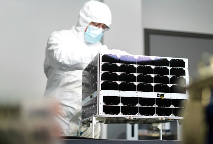
NanoAvionics’s MP42 bus

In combination with advanced data analysis, the surveillance capacity will contribute to defense operations and Norway’s important role in surveillance of the High North.

Norway’s Kongsberg Defence & Aerospace (Kongsberg) has placed an order for three microsatellites with Lithuanian mission integrator NanoAvionics for a space-based maritime surveillance mission covering the North Sea area. All three satellites will be based on NanoAvionics’s largest satellite bus, the MP42 microsatellite bus. 

AIS – Marine traffic monitoring supplementing radar and other coastal infrastructure

The surveillance payload will consist of instrumentation developed by KONGSBERG to include ‘”Automatic Identification System” (AIS) reporting and a navigation radar detector, developed by the Norwegian Defence Research Establishment (FFI), that analyses vessels’ radar use. Combining these provides an overview of ship traffic in the area, to include detection of vessels not reporting correct AIS data. 

It is the second time that FFI and NanoAvionics are working together. Previously, FFI was part of a consortium on a Norwegian-Dutch military use of space (MilSpace) mission where NanoAvionics built two nanosatellites.

“Supplying the initial satellites for the first Norwegian maritime constellation for Kongsberg, together with its more than 200 years of company history, makes this project very special to the entire team at NanoAvionics,” said Vytenis J. Buzas, co-founder and CEO of NanoAvionics. “The agreement with Kongsbergis a perfect example of our technological capabilities and proof that adding microsatellites to our portfolio was the right move. While nanosatellites are still in a high demand, it’s the microsatellites that offer new opportunities and room for more advanced missions and applications. The mission also demonstrates the continued strength of European space companies and agencies working together.

“Staying at the top of the satellite industry requires very quick deployment of innovations, especially for surveillance applications. Smallsats, like our MP42, play an enabling role in quickly deploying those monitoring assets while contributing to the security in sea waters.” 

In combination with advanced data analysis, the surveillance capacity will contribute to defense operations and Norway’s important role in surveillance of the High North. In addition, it is possible to rapidly identify vessels engaged in environmental crime, illegal fishing, smuggling and other illegal activities. Supporting search and rescue for vessels in distress are also capabilities of the constellation.

The surveillance capacity of the satellites will be enhanced by encryption software, developed by Norwegian company Eidsvoll Electronics AS, which provides secure communication for the satellites. All three satellites will be operated by KSAT (Kongsberg Satellite Services) the world’s leading provider of ground station services.  

The three satellites will form the basis for Norway’s first satellite constellation. The plan is to expand the fleet with more satellites to increase the coverage areas and revisit times, and equip them with different types of sensors for other types of data to enhance the situational awareness capabilities.

Eirik Lie, President of Kongsberg Defense & Aerospace, said, “With this, we take a successful model from the defense industry into the space industry. Close collaboration between users, researchers and industry has created world-leading products. We are now making a similar investment with the goal of creating a Norwegian satellite adventure that will lift the Norwegian space industry. We are enthusiastic about the strong NanoAvionics capabilities to support this initiative.”

While all ships traveling in the North Sea must have active AIS to identify themselves, allowing KONGSBERG to capture their signals and map normal traffic, some vessels turn off their AIS to stay hidden. Ships wishing to remain hidden by switching off the identification equipment will still be exposed by capturing the navigation radar of the ships. Turning them off carries a high risk of colliding with other ships and obstacles in the water such as icebergs, especially at night. The advanced antenna to pick up the radar signals has been developed by FFI.

NanoAvionics’s MP42 bus is one of the first commercially available modular microsatellite buses in the industry, which had its flight-heritage mission in April 2022.  Having adopted the principles of NanoAvionics’s successful nanosat bus product line, the modular MP42 extends that experience with the same cost-efficient production approach, requiring minimal reconfiguration. The MP42 buses are highly versatile with performance capabilities optimized for remote sensing, high data throughput, complex communications missions, emergency communications, and research missions.

Filed Under: Featured, News

SpaceX Falcon 9 Launch Vehicle Drives 53 Additional Starlink Satellites To Orbit

May 18, 2022 by editorial

On Wednesday, May 18, at 6:59 a.m. ET, SpaceX launched 53 Starlink satellites to compliment their continually growing smallsat constellation from Launch Complex 39A (LC-39A) at Kennedy Space Center in Florida.

This was the fifth flight for the Falcon 9 first stage booster supporting this mission, which previously launched Arabsat-6A, STP-2, COSMO-SkyMed Second Generation FM2, and now two Starlink missions.

Artistic rendition of SpaceX Starlink satellites on-orbit. Image is courtesy of SpaceX.

Filed Under: News

SI Imaging Services + GHGSat Operating Together @ The World Gas Congress In South Korea

May 18, 2022 by editorial

Artistic rendition of SI Imaging Services’ KOMPSAT satellites on-orbit.

SI Imaging Services (SIIS) will operate a joint booth with GHGSat at the World Gas Congress 2022 (WGC) held at EXCO in Daegu, South Korea, from the 23rd of May for five days.

The World Gas Conference is the world’s largest, international, gas conference that has continued its 90-year history and tradition and will be held in Daegu for the first time in Korea. Governments, NGOs, industry officials, environmental experts, and technical experts from each country exchange their knowledge, technology, and information on gas and discuss the development and energy agenda of the global gas industry. Above all, carbon neutrality is expected to be the biggest issue due to the severe climate crisis.

SIIS has supplied VHR satellite imagery of KOMPSAT series 2, 3, 3A, and 5 worldwide. As the need for ESG management (Environmental, Social and Corporate Governance) has emerged rapidly in recent years, it entered into an official partnership with GHGSat in June of last year, and it started to supply remote, methane, monitoring services using satellites to Korea and East Asia.

GHGSat’s satellites provide 100 times higher spatial resolution than existing greenhouse gas observation satellites and is differentiated for its technology in pinpointing the exact source of methane emissions at the facility level in the Oil and Gas sector.

An official from SIIS said, “This year, we have decided to run a joint booth with GHGSat at the World Gas Conference to inform the industry of the high-resolution methane monitoring satellites. We will establish a foothold to help companies and institutions realize their ESG management goals. It will become more and more important for organizations and companies worldwide to actively respond to environmental issues, and carbon neutrality is the most important task. Gaining the upper hand in carbon diplomacy is expected to bring appropriate development and a sustainable future to our entire industry. ”

SIIS provides satellite imagery of Korean Multi-Purpose Satellite (KOMPSAT) 2, 3, 3A, and 5. SIIS contributes to the remote sensing and earth observation industries with very-high-resolution optical images and SAR images through about 160 resellers worldwide. Satellite imagery is used in remote sensing fields such as mapping, agriculture, and disaster observation. www.si-imaging.com  GHGSat: GHGSAT is a leader in high-resolution greenhouse gas monitoring from space, providing actionable emission data to businesses, governments, and regulators worldwide. With proprietary remote-sensing capabilities and patented technology, GHGSat can monitor individual facilities, offering greater data accuracy, and facilitating timely strategic decision-making insights.

Filed Under: News

  • « Go to Previous Page
  • Go to page 1
  • Go to page 2
  • Go to page 3
  • Go to page 4
  • Go to page 5
  • Interim pages omitted …
  • Go to page 7
  • Go to Next Page »

Primary Sidebar

WEEKLY NEWSLETTER

Archives

  • March 2023
  • February 2023
  • January 2023
  • December 2022
  • November 2022
  • October 2022
  • September 2022
  • August 2022
  • July 2022
  • June 2022
  • May 2022
  • April 2022
  • March 2022
  • February 2022
  • January 2022
  • December 2021
  • November 2021
  • October 2021
  • September 2021
  • August 2021
  • July 2021
  • June 2021
  • May 2021
  • April 2021
  • March 2021
  • February 2021
  • January 2021
  • December 2020
  • November 2020
  • October 2020
  • September 2020
  • August 2020
  • July 2020
  • June 2020
  • May 2020
  • April 2020
  • March 2020
  • February 2020
  • January 2020
  • December 2019
  • November 2019
  • October 2019

© 2019–2023 SatNews

x
Sign Up Now!

Enjoy a free weekly newsletter with recent headlines from the global SmallSat industry.

Invalid email address
We promise not to spam you. You can unsubscribe at any time.
Thanks for subscribing! You will now receive weekly SmallSat News updates.
We love our advertisers.
And you will too!

Please disable Ad Blocker to continue... We promise to keep it unobtrusive.
We promise not to spam you. You can unsubscribe at any time.
Invalid email address
Thanks for subscribing! Please check your email for further instructions.