
• Skip to main content
  • Skip to primary sidebar
  • Home
  • News
  • Featured
  • More News ⌄
    • SatNews
    • SatMagazine
    • MilSatMagazine
  • Events ⌄
    • MilSat Symposium
    • SmallSat Symposium
    • Satellite Innovation
  • Contacts
  • SUBSCRIPTION

SmallSat News

You are here: Home / Archives for 2024

Archives for 2024

Hydrosat gains million$ contract from the U.S.A.F. to enhance thermal imagery for National Defense

October 17, 2024 by editorial

Artistic rendition of a Hydrosat VanZyl satellite on-orbit, courtesy of the company.

Hydrosat has been selected by the U.S. Air Force for a $1.9 million contract to provide Hydrosat’s thermal satellite data to address the most pressing challenges in the Department of the Air Force (DAF) — under this contract, Hydrosat will provide innovative cloud and weather prediction capabilities based on its thermal satellite data that will strengthen the national defense of the United States of America.
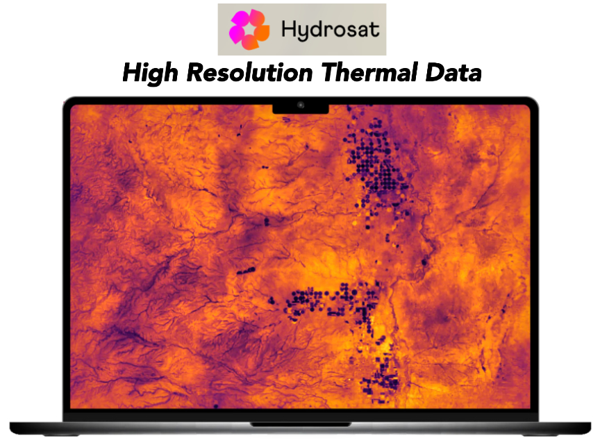
This significant achievement underscores the potential of Hydrosat’s industry-leading thermal data and its crucial role in enhancing cloud and weather prediction models for the Department of Defense. By integrating its cloud top temperature data into current models, Hydrosat will improve weather modeling capabilities, providing unparalleled decision-making superiority and full-spectrum awareness for the Air Force and Space Force. This capability will enhance operations planning critical to the execution of the National Defense Strategy.

The new contract is Hydrosat’s 5th contract with the United States Air Force, and its largest US Air Force Contract to date. Hydrosat also holds a contract to supply satellite data to the National Reconnaissance Office announced in December of 2023.

The contract is part of the AFWERX Tactical Finance program, known as TACFI. The Air Force Research Laboratory (AFRL) and AFWERX have partnered to streamline the Small Business Innovation Research (SBIR) and Small Business Technology Transfer (STTR) process by accelerating the small business experience through faster proposal to award timelines, changing the pool of potential applicants by expanding opportunities to small business and eliminating bureaucratic overhead by continually implementing process improvement changes in contract execution. The DAF began offering the Open Topic SBIR/STTR program in 2018 which expanded the range of innovations the DAF funded.

“Hydrosat is honored to deepen our long-standing partnership with the US Air Force through this contract and excited to deliver the U.S. Air Force thermal satellite data from our VanZyl satellites for the first time,” said Pieter Fossel, CEO and cofounder of Hydrosat. “This award is significant not only because it is to provide thermal data from our satellites but also because it is Hydrosat’s first contract for weather and marks the opening of a new market for the company.”

About Hydrosat
Hydrosat is the climate tech company leveraging thermal imagery to measure water stress in agriculture and help mitigate the effects of climate change. Hydrosat currently monitors millions of acres across customers such as NOAA, NRO, SupPlant, and Nutradrip, who trust the company’s high-resolution, timely satellite thermal imagery to deliver advanced analytics that convey precise crop yield forecasts and improved irrigation tools to financial and agribusiness customers around the globe.

Filed Under: News

ESA orders 6 more radar-based satellites from Thales Alenia Space for IRIDE constellation

October 16, 2024 by editorial

IRIDE image ©Thales Alenia Space.

Thales Alenia Space, a joint venture between Thales (67%) and Leonardo (33%), has signed a 107 million euros contract with the European Space Agency (ESA) for the supply of 6 additional radar-based satellites dedicated to the Italian Earth observation constellation, IRIDE.

IRIDE imagery is courtesy of ESA.

This second batch of satellites, as the previous batch of six, will rely on the innovative and scalable NIMBUS (New Italian Micro Bus) platform. Built by Thales Alenia Space, the high-performance NIMBUS will be produced rapidly and is designed for high-revisit and high-capacity constellations in addition to very high throughput.

For the Italian Earth Observation Constellation IRIDE, Thales Alenia Space will build a total of 13 satellites: 12 small-sized satellites based on SAR (Synthetic Aperture Radar) technology and 1 satellite based on optical technology.

IRIDE is one of the most important European space programs in the field of Earth Observation. It is a government project funded as part of Italy’s National Recovery and Resilience Plan (PNRR), complemented by funding from the National Integration Plan (PNC). IRIDE is a constellation of satellites, operational by 2026, managed by the European Space Agency (ESA) in conjunction with the Italian Space Agency (ASI).

IRIDE features a hybrid constellation of different satellites with dedicated EO sensors; this end-to-end system comprises a series of LEO satellite sub-constellations, ground infrastructures (downstream) and services dedicated to the Italian Public Administration.

Thales Alenia Space will contribute to the achievement of this innovative constellation of satellites that feature sophisticated operating modes to support high revisit rates, providing data that can be integrated with that from other existing or future programs and infrastructures, including COSMO-SkyMed Second Generation and Prisma, as well as Europe’s vast Copernicus Earth observation and protection program.

Thales Alenia Space will further contribute to the constellation by supplying an optical satellite with a performance tailored to its needs. Built on the platform NIMBUS, the optical payload is developed by the Italian companies Media Lario and TSD-space, specialized in the creation of instruments and electronics for space.

The satellites will be built in Italy under the responsibility of Thales Alenia Space and thanks to the contribution of the entire supply chain of SMEs in the space sector. They will provide valuable data not only to researchers studying the evolution of the environmental conditions of Italy but also to the Civil Protection and other Public Administrations to protect coasts, monitor critical infrastructures, air quality and weather conditions. IRIDE’s data will be of paramount importance. This data will allow the development of commercial applications by start-ups, small and medium-sized enterprises and industries in the geospatial sector.

“I would like to thank the European and Italian Space Agencies for once again entrusting Thales Alenia Space’s competences and expertise,” said Giampiero Di Paolo, Senior Vice President Observation, Exploration and Navigation for Thales Alenia Space. “Leveraging our experience onboard major Earth observation programs, we are ready to reinforce our capabilities in the small satellite segment. Based on a series of sensing instruments and technologies, the IRIDE constellation will range from microwave imaging with radar sensors to optical imaging at various spatial resolutions and in different frequency ranges, making it a cutting-edge space program in Earth Observation. The radar technology on board this program will be a crucial pillar of our ALL-IN-ONE Earth observation solution, which effectively combines optical and radar small satellites to ensure high revisit frequency and control for near real-time monitoring.”

Filed Under: News

Argotec signs contract to deliver 15 more satellites

October 16, 2024 by editorial

Present at the signing were Argotec CEO and founder David Avino, European Space Agency Earth Observation Programs Director Simonetta Cheli, and Italian Space Agency President Teodoro Valente.

Argotec has signed a contract for the delivery of 15 additional Earth Observation (EO) smallsats that will comprise the IRIDE constellation — this is a program desired by the Italian government and is funded by PNRR funds and coordinated by the European Space Agency (ESA).

This is the second batch for the company, which, back in December 2022, was the first to sign on for the delivery of the first 10 satellites, now nearly finished and ready to be launched in the coming months.

The satellites have a mass of about 70 kg and are equipped with a sophisticated on-board computer capable of processing images directly on-orbit. The constellation will provide crucial data for the provision of services, among them monitoring of land consumption, observation of critical land points, coastal protection, precision agriculture, support to Civil Defense and more. The constellation formed by Argotec’s platforms is named HEO (Hawk for Earth Observation) and is widely scalable.

All the satellites will be made in the SpacePark, a Space Factory on the outskirts of Turin, Italy, that will be among the most advanced in Europe and will be officially opened just days from now on October 18th. The company is continuing to grow and structure itself to increase production capabilities, thanks to the know-how of the firm’s engineers and the technological solutions the company has implemented in the SpacePark.

“We are extremely proud to once again be at the forefront of this strategic program for the entire Italian space sector,” said Argotec CEO David Avino. “We have proven once again that we are able to manufacture, validate and deliver excellent products in record time. For us, the signing of this second contract is further recognition of Argotec’s reliability and efficiency. Not only that, the IRIDE program, has been an enabler for investments in the area amounting to 25 million in facilities and over 100 new hires related to the SpacePark project. The goal for the future is to take Made in Italy excellence in the space sector far beyond national borders, consolidating Italian leadership globally.“

Filed Under: News

GomSpace + ST Engineering Satellite Systems sign a collaboration agreement

October 16, 2024 by editorial

GomSpace has engaged in a new industrial Collaboration Agreement with ST Engineering Satellite Systems to explore and expand business opportunities for the small satellites and micro satellites market — this partnership comes as part of the company’s continued efforts to strengthen the firm’s presence in Asia, following previous successes with a major strategic project in Singapore.

Building on the momentum from earlier achievements, GomSpace sees this new collaboration with ST Engineering Satellite Systems as a key step toward enhancing the footprint in one of the world’s most promising markets. ST Engineering Satellite Systems’ expertise will complement GomSpace’s existing capabilities and industrial setup, allowing for a more comprehensive approach to serving customers. Together, the two companies will work to offer innovative solutions for the new space industry. 

“We are proud to be partnering with ST Engineering Satellite Systems as we look to capitalize on the strong foundation of both companies,” said Carsten Drachmann, CEO at GomSpace. “Our previous success in the region has given us valuable insights, and this collaboration with ST Engineering Satellite Systems opens up new possibilities for growth, technological innovation, and customer engagement. On a personal note, Singapore is close to my heart and am very happy once again to work with old friends and colleagues”.

Filed Under: News

AccelerComm welcomes Radisys to 5G LEO satellite ecosystem

October 15, 2024 by editorial

Radisys® Corporation has announced its inclusion in the AccelerComm® 5G Ecosystem Partner Program, formalizing a long-standing partnership.

This collaboration will enable Original Equipment Manufacturers (OEMs) to unlock new business opportunities for Non-Terrestrial Network (NTN) 5G communication, extending coverage to areas that were previously inaccessible due to high costs, and allowing companies to explore innovative applications that were previously deemed too expensive.

The collaboration aims to enable SATCOM technology with 3GPP standards-compliant solutions, reducing costs and improving network flexibility. Additionally, it will promote cross-compatibility with Radisys’ NR-NTN gNodeB software, NTN 5G Core (5GC) and Multi Non-3GPP Interworking Gateway (AGF/TWIF) software for interworking with legacy NTN technologies, and RIC for monitoring and control of multi-layer/ad-hoc reconfigurable satellite networks.

5G LEO regenerative satellites represent a significant advancement over traditional satellite communication systems which use simple relays, receiving signals from a ground station and retransmitting them to another location resulting in higher latency and lower efficiency, as the data must travel long distances to and from the ground stations. 5G LEO regenerative satellites are equipped with advanced processing capabilities that allow them to handle and route data directly without relying solely on ground infrastructure to reduce latency, enhance data throughput, and increase overall network efficiency.

Last year, AccelerComm and Radisys announced a joint effort to develop a high-performance Regenerative 5G Radio Access Network (RAN) reference solution and architecture based on 3GPP standards for deployment on LEO satellites. The endeavor integrated the expertise and intellectual property of both companies, along with additional technology from ecosystem partners, to create a 5G regenerative gNodeB (gNB) solution tailored to support high-performance 5G services in the challenging NTN environment.

AccelerComm provides comprehensive 5G New Radio (NR) Layer 1 solutions that deliver enhanced performance. Their physical layer IP solutions enable optimal performance of 5G radio access networks, addressing challenges that would otherwise limit throughput, latency, and spectral efficiency in 5G deployments.

Radisys’ 5G software is equipped with NTN capabilities, enabling access to GEO/MEO/LEO satellites. Its architecture is both flexible and scalable, featuring well-defined interfaces that seamlessly integrate with SATCOM infrastructure. This advanced software allows OEMs to capitalize on the substantial investments in SATCOM technology, opening up new business opportunities.

“Our relationship with Radisys has been highly productive over the years, consistently yielding innovative solutions that advance the field of 5G communications,” said Tom Cronk, CEO, AccelerComm. “We are confident that this strengthened partnership will continue to drive significant innovation in 5G NR communication, ultimately benefiting our customers with enhanced performance and new business opportunities.”

“We are pleased to partner with AccelerComm in their Ecosystem Program,” said Munish Chhabra, Head of Mobility Software and Services Business, Radisys. “This collaboration represents a significant milestone in our long-standing relationship with AccelerComm. Together, we have pushed the boundaries of 5G technology. The opportunity to deploy disaggregated 5G software to create a 5G regenerative gNB solution supporting high-performance 5G services in NTNs is very exciting. By combining our advanced software capabilities with AccelerComm’s expertise in physical layer IP solutions, we are poised to deliver unparalleled performance and innovation in the 5G NTN market. We look forward to continuing our joint efforts to revolutionize satellite communications and provide our customers with cutting-edge solutions.”

Filed Under: News

First greenhouse gas plumes detected With NASA-designed instrument

October 13, 2024 by editorial

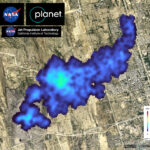
On September 19th, the imaging spectrometer on the Carbon Mapper’s Tanager-1 satellite detected this methane plume in Karachi, Pakistan, extending nearly 2-1/2 miles from a landfill. The spectrometer was designed at NASA JPL.
Image: Carbon Mapper / Planet Labs.

Using data from an instrument designed by NASA’s Jet Propulsion Laboratory the nonprofit Carbon Mapper has released the first methane and carbon dioxide detections from the Tanager-1 satellite — the detections highlight methane plumes in Pakistan and Texas, as well as a carbon dioxide plume in South Africa.

The data contributes to Carbon Mapper’s goal to identify and measure greenhouse gas point-source emissions on a global scale and make that information accessible and actionable. 

Enabled by Carbon Mapper, and built by Planet Labs PBC, Tanager-1 launched from Vandenberg Space Force Base in California on August 16 and has been collecting data to verify that its imaging spectrometer, which is based on technology developed at NASA JPL, is functioning properly. Both Planet Labs PBC and JPL are members of the philanthropically funded Carbon Mapper Coalition.

The data used to produce the Pakistan image (above) was collected over the city of Karachi on September 19th and shows a roughly 2.5-mile-long (4-kilometer-long) methane plume emanating from a landfill. Carbon Mapper’s preliminary estimate of the source emissions rate is more than 2,600 pounds (1,200 kilograms) of methane released per hour.

“The first greenhouse gas images from Tanager-1 are exciting and are a compelling sign of things to come,” said James Graf, director for Earth Science and Technology at JPL. “The satellite plays a crucial role in detecting and measuring methane and carbon dioxide emissions. The mission is a giant step forward in addressing greenhouse gas emissions.”

In the 1980s, JPL helped pioneer the development of imaging spectrometers with AVIRIS (Airborne Visible/Infrared Imaging Spectrometer), and in 2022, NASA installed the imaging spectrometer EMIT (Earth Surface Mineral Dust Source Investigation), developed at JPL, aboard the International Space Station.

A descendant of those instruments, the imaging spectrometer aboard Tanager-1 can measure hundreds of wavelengths of light reflected from Earth’s surface. Each chemical compound on the ground and in the atmosphere reflects and absorbs different combinations of wavelengths, which give it a “spectral fingerprint” that researchers can identify. Using this approach, Tanager-1 will help researchers detect and measure emissions down to the facility level.

Once in full operation, the spacecraft will scan about 116,000 square miles (300,000 square kilometers) of Earth’s surface per day. Methane and carbon dioxide measurements collected by Tanager-1 will be publicly available on the Carbon Mapper data portal.

More About Carbon Mapper
Carbon Mapper is a nonprofit organization focused on facilitating timely action to mitigate greenhouse gas emissions. Its mission is to fill gaps in the emerging global ecosystem of methane and carbon dioxide monitoring systems by delivering data at facility scale that is precise, timely, and accessible to empower science-based decision making and action. The organization is leading the development of the Carbon Mapper constellation of satellites supported by a public-private partnership composed of Planet Labs PBC, JPL, the California Air Resources Board, Arizona State University, and RMI, with funding from High Tide Foundation, Bloomberg Philanthropies, Grantham Foundation for the Protection of the Environment, and other philanthropic donors.

Filed Under: News

Microsatellite project to monitor objects in space over Canada + the South Pole

October 12, 2024 by editorial

University of Manitoba researchers in Magellan’s Advanced Satellite Facility (Photo: Business Wire)

The University of Manitoba (UM) and Magellan Aerospace (Magellan), in collaboration with Canada’s Department of National Defence (DND) science and technology organization, Defence Research and Development Canada (DRDC), and the United Kingdom’s Defence Science and Technology Laboratory (Dstl), are working together to to monitor and protect the Earth’s orbital environment.

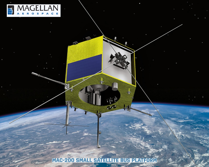
Magellan and UM, both based in Winnipeg, Manitoba, are currently partnered on the DND-funded Redwing space domain awareness (SDA) microsatellite project. Redwing is a research and development (R&D) microsatellite valued at $15.8 million that is being designed, built, and operated in Canada.

Screenshot

Redwing will monitor objects orbiting Earth to help reduce future risks to Canada’s space infrastructure from space debris or human-caused interference. Magellan is responsible for designing, building, and testing the Redwing spacecraft as well as for mission operations. Other Redwing mission partners include ABB Inc. (main optical payload), C-CORE (operations support), as well as York University and UM (R&D support).

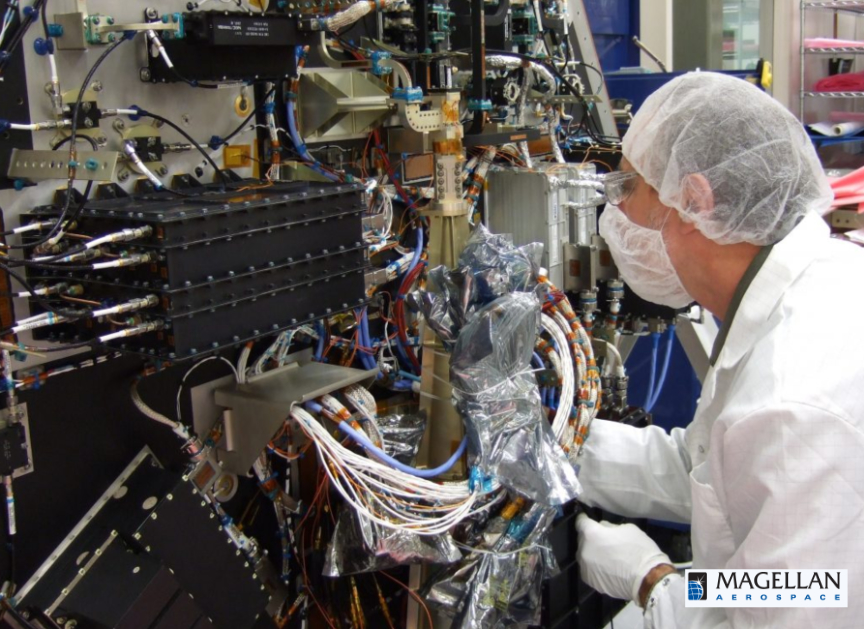
Building the Redwing smallsat, photo courtesy of Magellan Aerospace.

In April 2024, Canada’s DND signed a contract option with Magellan for $900,000 to add a companion nanosatellite to the Redwing mission. The nanosatellite, known as Little Innovator in Space Situational Awareness (LISSA), will be integrated with the Redwing satellite and will be deployed from Redwing sometime after launch once the two spacecraft have achieved an orbit at the designated altitude.

Leveraging the expertise provided by Ferguson and UM’s STARLab, Magellan is contracting the design and build of LISSA with UM. LISSA will follow in the same orbit as Redwing, operating some distance from it in a tandem in-track formation. In addition to performing its own observations, LISSA will serve as a convenient nearby object with which to exercise Redwing’s own monitoring and imaging capabilities.

LISSA will focus on observing satellites as they pass over the Earth’s South Pole, a region that is not well-covered by ground-based space surveillance sensors. Reflected light from ice and clouds during the Antarctic summer presents a significant technical challenge when imaging other space objects in visible light. For this reason, the UK’s Dstl is providing a short-wave infrared camera to be hosted on the LISSA nanosatellite, which will be less impacted by light scattered from the ice sheet. Also, many satellite materials are more reflective in the short-wave infrared increasing the likelihood of detecting them.

Both Redwing and LISSA are expected to launch in 2027. Both satellites will be operated by Magellan with support from UM’s STARLab, communicating through ground antenna stations owned by C-CORE in Inuvik, Northwest Territories and Happy Valley-Goose Bay, Newfoundland and Labrador. Mission data will be analyzed by DRDC and Dstl.

“Collaborations between industry, academia, and government are the foundation of innovation in the space sector. These partnerships merge cutting-edge research with industry expertise, accelerating advancements that will shape the future of space exploration and will cultivate the next generation of space professionals. By working together on LISSA and Redwing, we can yield superior results in space domain awareness that would be impossible in isolation,” said Corey Mack, Magellan’s Director of Engineering and Space Systems.

“With new launch companies providing unprecedented access to space, we need to research and develop new ways of monitoring space objects from small spacecraft to prevent collisions and to maintain space sustainability for the entire planet. This is a challenge of global scale, requiring international collaboration between industry and academia,” said Philip Ferguson, Associate Professor, Department of Mechanical Engineering and lead of UM’s Space Technology and Advanced Research Laboratory (STARLab). “Research partnerships are critical to the future of the global space industry. This project between the UM, Magellan, DND, and Dstl will create sustainable technologies for the next generation of satellite missions.”

“The space domain continues to change and evolve and requires space faring nations to innovate to keep informed of the security situation in the space domain. DRDC is thrilled to have Dstl participate in the Redwing mission to help grow both nations’ defence space programs,” said Scott McLelland, DRDC Director of R&D for the Defend North America strategic focus area.

“The collaboration with our Canadian partners will enable us to improve the characterisation of objects and maintain security in space to protect our mutual interests,” said Dr. Gemma Bagheri, Dstl Space Research and Development Program Manager.

About Magellan Aerospace Corporation
Magellan Aerospace Corporation is a global aerospace company that provides complex assemblies and systems solutions to aircraft and engine manufacturers, and defence and space agencies worldwide. Magellan designs and manufactures aeroengine and aerostructure assemblies and components for aerospace markets, advanced proprietary products for military and space markets, and provides engine and component repair and overhaul services worldwide. Magellan is a public company whose shares trade on the Toronto Stock Exchange (TSX: MAL), with operating units throughout North America, Europe, and India.

About University of Manitoba
The University of Manitoba is recognized as Western Canada’s first university. It is part of the U15, ranking among Canada’s top research-intensive universities and is Manitoba’s only medical-doctoral post-secondary institution. The University provides exceptional liberal arts, science and professional programs of study, inspiring undergraduate and post-graduate students to positively impact their communities as globally engaged citizens. UM campuses are located on the original lands of Anishinaabeg, Ininiwak, Anisininewuk, Dakota Oyate and Dene, and on the National Homeland of the Red River Métis. We respect the Treaties that were made on these territories, we acknowledge the harms and mistakes of the past, and we dedicate ourselves to move forward in partnership with Indigenous communities in a spirit of Reconciliation and collaboration.

Filed Under: News

HawkEye 360’s Pathfinder satellite trio to retire — Cluster 11 launch just ahead

October 10, 2024 by editorial

HawkEye 360 has announced the planned decommissioning of the firm’s pioneering Cluster 1 Pathfinder satellites by the end of 2024 — this decommissioning marks the conclusion of the first-generation satellite cluster that transformed the commercial RF industry and laid the foundation for the company’s growth and innovation.

In recognition of the significant achievements made during its service, HawkEye 360 will celebrate the satellites retirement this December, honoring the enduring legacy of the Pathfinder trio.

Launched in December of 2018, the Pathfinder satellites were HawkEye 360’s proof-of-concept mission. Pathfinder demonstrated that a commercial company could reliably provide RF data, a capability previously dominated by the government and classified sectors. Initially designed for a two-year mission, these resilient satellites far exceeded their life expectancy, thanks to the high-quality bus provided by Space Flight Laboratory (SFL). This novel design allowed Pathfinder to continue supporting research and became fully operational, successfully serving critical customer needs and supporting key missions worldwide.

Pathfinder’s success laid a strong foundation for HawkEye 360’s subsequent growth. The innovative approach to hardware development—enhancing antennas, filters, and frequency coverage — allowed the company to advance its capabilities continually. During Pathfinder’s six-year mission, HawkEye 360 validated the commercial viability of RF data collection. It helped expand the HawkEye 360 constellation to 31 satellites, setting new standards for reliability and performance in the industry.

As Pathfinder retires, Cluster 11 will take its place, significantly enhancing the constellation’s capabilities. Scheduled to launch by the end of 2024, Cluster 11 incorporates the latest technology and will operate in a mid-inclination orbit, complementing Clusters 6, 8, and 9 to expand coverage in the high-demand equatorial region.

Featuring a new antenna, the company is actively experimenting with global lower-frequency collection, enhancing the ability to detect and analyze a broader range of RF signals. Notably, this transition will not affect our customers, as our new clusters offer increased capacity to fulfill the mission previously handled by Cluster 1. Cluster 11, the first cluster vibe-tested at HawkEye 360’s Herndon facility, will usher in the company’s new era of advanced technology.

Filed Under: News

BlackSky wins 7 figure contract for advanced SDA Solutions

October 10, 2024 by editorial

BlackSky Technology Inc. (NYSE: BKSY) has won a seven figure contract to deliver non-Earth Imaging (NEI) services to support the customer’s Space Domain Awareness (SDA) capabilities — as part of the contract, BlackSky will integrate Gen-2 satellite imagery of on-orbit spacecraft into the customer’s collection of SDA assets.

Space Situational Awareness (SSA) is vital for identifying, characterizing, and tracking space objects and their operational environment. SSA data is critical for maintaining space safety and facilitating real-time space traffic coordination. The data is used to help space operators predict and avoid collisions between objects or avoid debris from fragmentation events, meteor storms, or other natural events that might also affect operations.

SSA is foundational to all space safety and real time space traffic coordination activities and is a critical component of SDA, which is the ability of decision makers to understand, as completely as necessary, their current and predicted operational environments.

Delivering NEI capabilities gives BlackSky the ability to leverage underutilized capacity typically associated with satellites passing over the ocean or satellites in eclipse, traveling across the dark side of Earth. This enhances BlackSky’s service offering and supports mission success across the realm of space security.

“BlackSky’s expansion into SDA unlocks additional value from our current high-resolution Gen-2 constellation and immediately meets our customer’s demand for NEI solutions,” said Brian O’Toole, BlackSky CEO. “Our continued momentum in the NEI space demonstrates technical agility and a strategic commitment to innovation that provides reliable, practical value to Space Situational Awareness operations.”

Filed Under: News

L3Harris’ 5th CrIS complete + ready for NOAA Weather Satellite integration

October 9, 2024 by editorial

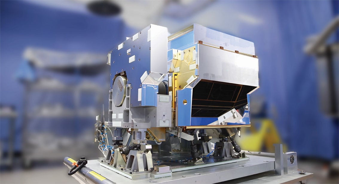
L3Harris’ Cross-track Infrared Sounder (CrIS) is the world’s most advanced hyperspectral sounder and a key sensor that uses advanced infrared technology to measure 3D temperature and moisture from the atmosphere. Image credit: L3Harris Technologies

L3Harris recently reached a significant milestone when it shipped its fifth Cross-track Infrared Sounder (CrIS), a critical component of the National Oceanic and Atmospheric Administration’s (NOAA’s) Joint Polar Satellite System (JPSS). 

Artistic renditions of NOAA’s Joint Polar Satellite System (JPSS)

The instrument captures sophisticated data on Earth’s atmosphere, oceans, and landscape that is used in seasonal, short-and long-term monitoring and forecasting. The CrlS is now ready for future integration onto the final spacecraft in the JPSS constellation.

L3Harris’ Cross-track Infrared System (CrIS)
L3Harris’ Cross-track Infrared Sounder (CrIS). Credit: L3Harris Technologies.

CrIS is the world’s most advanced hyperspectral sounder and a key sensor that uses advanced infrared technology to measure 3D temperature and moisture from the atmosphere. NOAA uses daily measurements from CrIS to enhance its weather prediction model forecasts, including enhanced rainfall predictions and more targeted tracking ability for severe storms including tornadoes and hurricanes.

In addition to measuring temperature atmospheric pressure, CrIS can detect the concentration of greenhouse gases and measuring changes in ocean surface temperatures. It is also used to track long range smoke movement, helping to better predict wildfire impacts across the U.S.

L3Harris’ Cross-track Infrared System (CrIS)
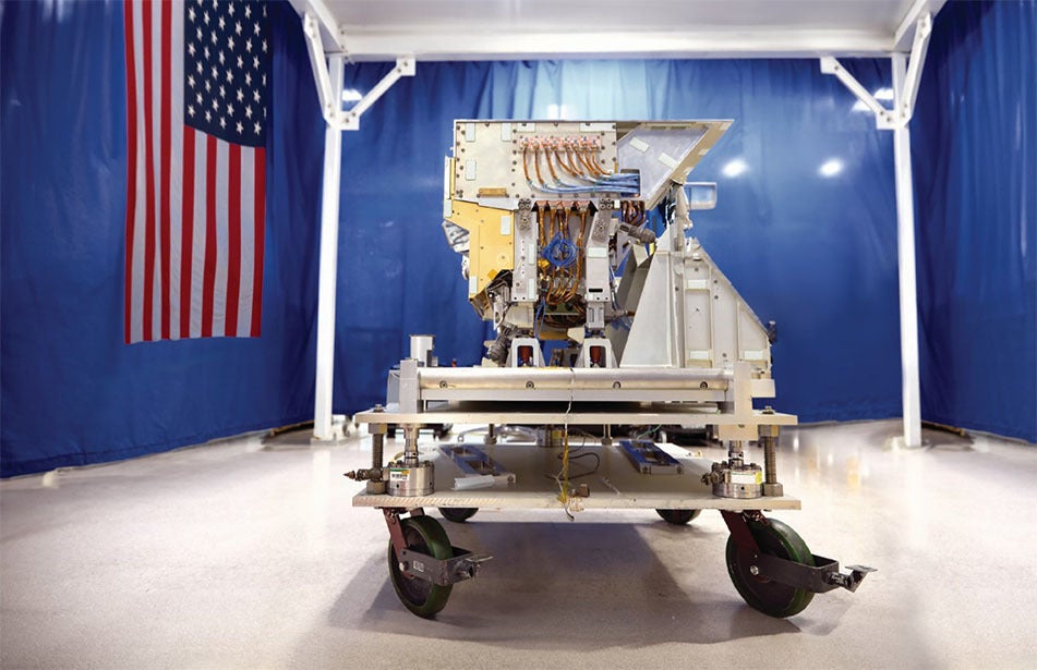
L3Harris’ Cross-track Infrared Sounder (CrIS). Credit: L3Harris Technologies.

L3Harris has provided the CrIS instruments on all of NOAA’s JPSS satellites, the first of which launched in November of 2017. Both JPSS-3 and JPSS-4 are scheduled to launch in the coming years to extend global coverage by these critical LEO assets through 2040.

The L3Harris-built CrIS, which was built at the company’s Ft. Wayne, Indiana, facility and is part of a suite of next-generation weather solutions that include the company’s proven Advanced Baseline Imager (ABI) and Geostationary Operational Environmental Satellite-R (GOES-R) ground heritage, both designed to improve short- and long-range forecast accuracy and severe storm tracking. These solutions include a GeoXO imager and modernized GOES-R ground system for the U.S. as well as imaging and sounding technology for Japan – all awarded as part of the more than $1 billion in weather-related contracts L3Harris received last year.

“This delivery is the culmination of decades of L3Harris dedication to meteorological precision on the JPSS program”, said Rob Mitrevski, L3Harris Vice President and General Manager of Spectral Solutions. “CrIS has improved NOAA’s forecasting models by providing the world’s leading high-resolution, three-dimensional data which elevates the accuracy and promptness of weather predictions. At L3Harris, we continue to leverage our 65-year legacy and deep subject matter expertise while innovating and evolving our sounding technologies to meet critical current and future weather monitoring needs across the world.”

Filed Under: News

  • « Go to Previous Page
  • Page 1
  • Interim pages omitted …
  • Page 4
  • Page 5
  • Page 6
  • Page 7
  • Page 8
  • Interim pages omitted …
  • Page 42
  • Go to Next Page »

Primary Sidebar

WEEKLY NEWSLETTER

Archives

  • August 2026
  • July 2026
  • June 2026
  • May 2026
  • April 2026
  • March 2026
  • February 2026
  • January 2026
  • December 2025
  • November 2025
  • October 2025
  • September 2025
  • August 2025
  • July 2025
  • June 2025
  • May 2025
  • April 2025
  • March 2025
  • February 2025
  • January 2025
  • December 2024
  • November 2024
  • October 2024
  • September 2024
  • August 2024
  • July 2024
  • June 2024
  • May 2024
  • April 2024
  • March 2024
  • February 2024
  • January 2024
  • December 2023
  • November 2023
  • October 2023
  • September 2023
  • August 2023
  • July 2023
  • June 2023
  • May 2023
  • April 2023
  • March 2023
  • February 2023
  • January 2023
  • December 2022
  • November 2022
  • October 2022
  • September 2022
  • August 2022
  • July 2022
  • June 2022
  • May 2022
  • April 2022
  • March 2022
  • February 2022
  • January 2022
  • December 2021
  • November 2021
  • October 2021
  • September 2021
  • August 2021
  • July 2021
  • June 2021
  • May 2021
  • April 2021
  • March 2021
  • February 2021
  • January 2021
  • December 2020
  • November 2020
  • October 2020
  • September 2020
  • August 2020
  • July 2020
  • June 2020
  • May 2020
  • April 2020
  • March 2020
  • February 2020
  • January 2020
  • December 2019
  • November 2019
  • October 2019

© 2019–2026 SatNews

Insert/edit link

Enter the destination URL

Or link to existing content

    No search term specified. Showing recent items. Search or use up and down arrow keys to select an item.
      x
      Sign Up Now!

      Enjoy a free weekly newsletter with recent headlines from the global SmallSat industry.

      Invalid email address
      We promise not to spam you. You can unsubscribe at any time.
      Thanks for subscribing! You will now receive weekly SmallSat News updates.
      We love our advertisers.
      And you will too!

      Please disable Ad Blocker to continue... We promise to keep it unobtrusive.
      We promise not to spam you. You can unsubscribe at any time.
      Invalid email address
      Thanks for subscribing!