• Skip to main content
  • Skip to primary sidebar
  • Home
  • News
  • Featured
  • More News ⌄
    • SatNews
    • SatMagazine
    • MilSatMagazine
  • Events ⌄
    • MilSat Symposium
    • SmallSat Symposium
    • Satellite Innovation
  • Contacts
  • SUBSCRIPTION

SmallSat News

You are here: Home / Archives for 2025

Archives for 2025

Globalstar to enter next era of mobile satellite connectivity with expanded operational frequencies

September 16, 2025 by editorial

Globalstar satellites on-orbit, courtesy of the company

Globalstar, Inc. (NASDAQ: GSAT) has plans to bring-into-use the company’s HIBLEO-XL-1 satellite system filing in preparation for its next era of mobile satellite connectivity.

Since 2000, Globalstar has been operating its current mobile satellite system (MSS) and providing service over the same Big Low Earth Orbit (LEO) frequency bands, investing billions of dollars to expand, innovate and commercialize mobile satellite services that are now at the fingertips of hundreds of millions of people around the world.

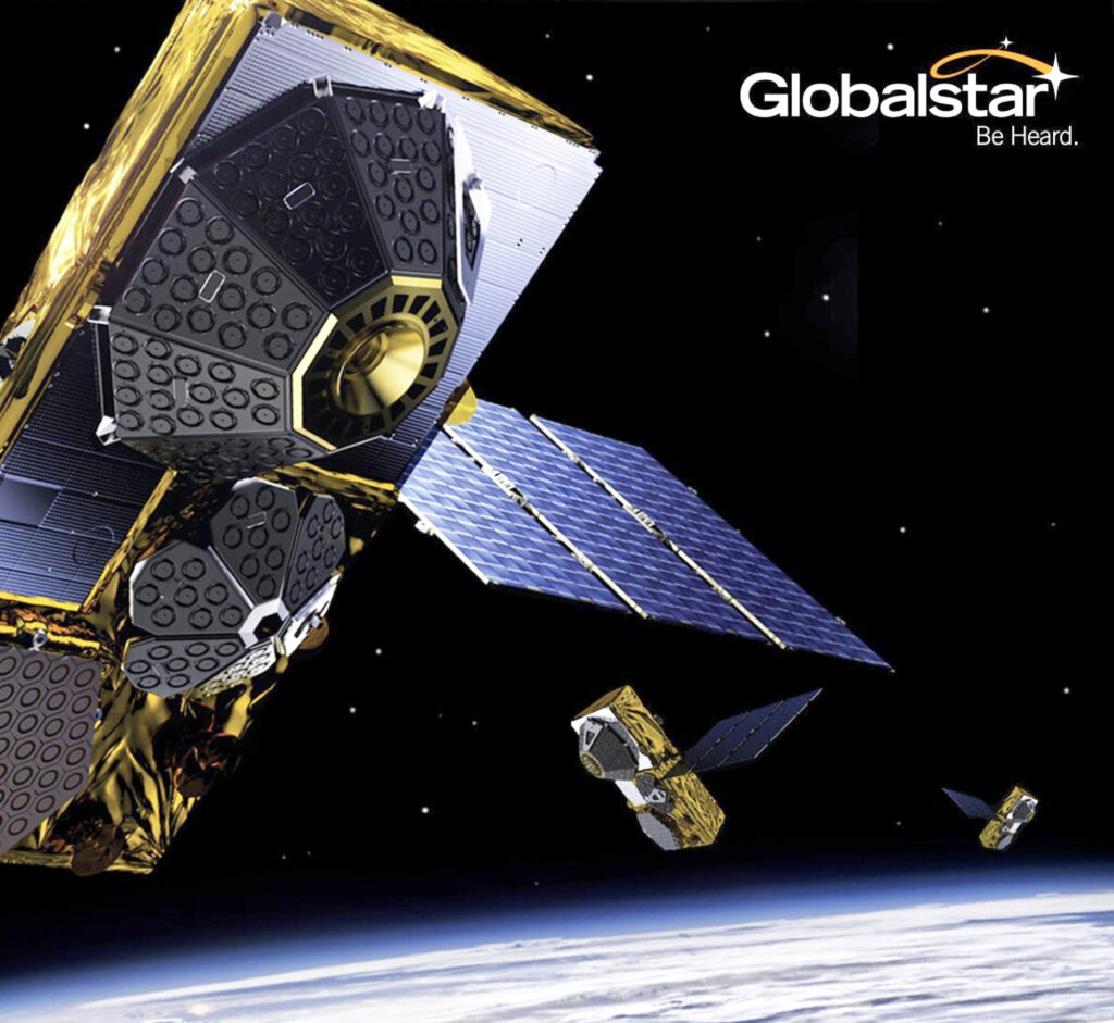
In November of 2024, Globalstar announced an additional investment of $1.5 billion in a third-generation mobile satellite system called C-3, which will include 48 additional satellites supported by approximately 90 new ground station antennas installed globally.

The company’s current system and C-3 satellites will operate over Globalstar’s same licensed Big LEO frequency bands, altitude and inclination. The C-3 System’s higher power downlink capabilities are expected to greatly improve the user experience for anyone accessing Globalstar to meet their communications needs.

With this announcement, Globalstar takes an important step toward further expansion of its global MSS capabilities with plans to bring its HIBLEO-XL-1 system into use. The HIBLEO-XL-1 system, filed through France, includes numerous additional satellites, orbital shells and frequency bands, including currently licensed L-, S- and C-band frequencies, as well as additional MSS bands for mobile uplink and downlink as well as additional feeder-link spectrum.

Dr. Paul Jacobs, Globalstar CEO, said, “We believe that bringing HIBLEO-XL-1 into use provides Globalstar with significant optionality as the Company grows as a major provider of connectivity in the global space economy that is expected to reach $1.8 trillion by 2035. We look forward to providing operational updates on our progress as we enter a new era in Globalstar’s expanding investments in connecting everyone, everywhere. Globalstar’s mission is mission-critical communications, which has led us to the forefront of LEO satellite communications, providing reliable and affordable solutions across to consumers and industries where and when they need us.”

Filed Under: News

Es’hailSat + neXat collaborate to improve access to managed services in MEA

September 15, 2025 by editorial

A new partnership between Qatari satellite company Es’hailSat (Qatar Satellite Company) and neXat will improve the way managed services are accessed and delivered across the Middle East and Africa.

Es’hailSat will use the award-winning neXat platform to make it easier for its channel partners—such as licensed resellers —to purchase the company’s managed services across the region. Es’hailSat will also benefit from improved access to resellers.

As well as managing the provision of managed services, neXat’s advanced tools will be used by Es’hailSat to manage their customer lifecycle. The platform is the first of its kind to unite the management of SATCOM services, customers and networks virtually.

Es’hailSat provides top-of-the-line managed VSAT services and associated communication solutions for government and enterprises, on two co-located satellites at MENA’s orbital hot slots. Es’hailSat aims to expand its managed services offering across the region, which includes end-to-end satellite connectivity with customizable bandwidth, data volume, and SLA options, supported by hardware provisioning, network monitoring, field engineering, and 24/7 technical support.

The service operates in Ku- and Ka-band, offering high-speed data transfer and seamless integration with other telecom networks for applications like cellular backhaul and maritime communications.

The platform will enable the operator to centralize management of multiple hubs, reduce operational overhead, and accelerate service rollout. neXat has been recognized by two award wins so far this year: the World Teleport Association’s Teleport Technology of the Year Award, in March, and the SatellitePRO Middle East Best Next-Gen Satellite Application, in May.

The OSS-BSS (Operational Support Systems – Business Support Systems) seamlessly integrates operators’ different hubs, simplifying operations, and brings multiple operational and business support systems together in one place to save operators time and money. It can also be used to offer customers new and better services including traffic shaping, bandwidth optimization, and VNO services.

neXat’s platform can help managed services providers address the higher costs and lower revenue per megahertz (MHz) in the current satellite market. The OSS-BBS helps operators reduce operational expenditures as they look to increase revenues by selling their MHz through managed services.

Our mission at neXat is to make managing and accessing satellite services easier, simpler and more cost effective. We’re excited for Es’hailSat, a major operator, to take advantage of our platform’s unique offerings to improve the access to their services across an important and growing region,” said neXat’s Senior VP APAC, Rajeev Nair.

At Es’hailSat, we are always looking at ways to enhance our service offerings to deliver the satellite, teleport and managed services needed for customers across Middle East and North Africa,” said Es’hailSat’s President and Chief Executive Officer, Mr. Ali Ahmed Al-Kuwari. “We believe that the highly robust and reliable services offered by this partnership between neXat and Es’hailSat, together with our Tier-4 certified teleport infrastructure, provide a strong base needed to serve end customers and our resellers across the region.”

Filed Under: Featured, News

York Space Systems establishes 1st contact + confirms health of all 21 satellites launched for SDA’s Tranche 1 Transport Layer mission

September 14, 2025 by editorial

York Space Systems (York) has received first contact and has confirmed the healthy status of all 21 satellites launched on September 10 from Vandenberg Space Force Base in support of the Space Development Agency’s (SDA) Proliferated Warfighter Space Architecture (PWSA) Tranche 1 Transport Layer (T1TL) mission.

Deploying and confirming the health of 21 satellites within hours of launch is a historic milestone. The achievement demonstrates the scalability and reliability of York’s space vehicle production and operations model, supporting SDA’s goals of resilient, low-latency satellite communications are available to U.S. and allied warfighters.

The 21 SDA T1TL mission satellites, photo courtesy of YORK Space Systems

York is the first of the prime contractors selected for the T1TL mission to launch and deploy. York will complete its T1TL contract launch and deployment campaign with an additional 21 satellites later this year. York is proud to continue to support SDA as it fields this critical capability for national security space.

York’s rapid first-contact success was powered, in part, by ATLAS Space Operations’ (ATLAS) software-led ground architecture. Acquired by York earlier this year, ATLAS provides a fully U.S.-owned, globally distributed ground station network and mission planning software. This integrated capability enables York to connect with its spacecraft faster and more efficiently than ever before. By streamlining connectivity across an expanding ground network, York is delivering the infrastructure required to rapidly field resilient defense architectures like Golden Dome and ensure decision advantage for the warfighter.

Confirming health so quickly across 21 satellites is proof that York’s high-rate production paired with disciplined mission operations delivers results. This success further highlights York’s central role in enabling the DOD’s vision for a proliferated architecture that ensures resilience and decision advantage for the warfighter,” said Melanie Preisser, VP and GM of York.

Filed Under: News

SSTL + IHI sign a collaboration agreement for a Japanese ISR constellation

September 11, 2025 by editorial

Artistic rendition of SSTL’s Carbonite satellite, courtesy of the company

Surrey Satellite Technology Limited (SSTL) and IHI Corporation of Japan have signed an agreement to collaborate on the development of a new, small satellite constellation to strengthen Japan’s intelligence, surveillance and reconnaissance (ISR) capabilities.

The signing occurred on September 10th during the DSEI exhibition in London, reflecting the growing strategic partnership between the UK and Japan in space and defence, as highlighted in the Hiroshima Accord (2023) and reaffirmed by both nations’ defence ministers at their Tokyo meeting in August of 2025.

Under the agreement, SSTL and IHI will work together to advance Japan’s sovereign ISR capabilities, leveraging SSTL’s proven satellite platforms and operational heritage. The collaboration also envisages opportunities to share imagery and capacity between SSTL’s UK-built constellations and those developed in Japan by IHI, ensuring resilience and enhanced coverage for both nations.

Photo of SSTL and IHI signing their agreement at DSEI in London

For SSTL, the partnership follows the success of TYCHE, the UK Ministry of Defence’s first sovereign ISR satellite, launched in 2024, and the signing of the more capable JUNO follow-on spacecraft. With over 70 satellites built and operated for global government and defence customers since 1985, SSTL brings world-class expertise in rapid, innovative, and cost-effective satellite solutions.

Artistic rendition by SSTL of the TYCHE satellite on-orbit

This collaboration between SSTL and IHI will not only contribute to Japan’s national security but will also support the growth of its domestic space industry, while deepening ties between Japan and the UK through shared technologies and operational experience.

Professor Sir Martin Sweeting, SSTL’s Executive Chairman, said, “Space has become critically important for national security in recent years, and increasingly nations are deploying satellites in support of their Intelligence Surveillance and Reconnaissance requirements, as they can provide global reach, privacy and priority. SSTL is a recognized pioneer and leader in this area, and not only designs and manufactures spacecraft but also has demonstrated dependable and reliable services from those satellites.”

Atsushi Sato, President of IHI’s Aero Engine, Space & Defense Business Area, said, “Today’s world is becoming increasingly unstable, and Japan’s National Security Strategy recognizes the importance of close cooperation with allied nations that share our strategic interests. This agreement with SSTL is an important first step towards developing the next-generation sovereign space capabilities that will be vital to Japan’s national security in the years ahead.”

Filed Under: Featured, News

Intellian + Eutelsat developing ultra-portable military-grade LEO manpack terminal

September 11, 2025 by editorial

Intellian Technologies Inc. and Eutelsat are developing an ultra-portable, fully integrated, military-grade Manpack for Eutelsat’s OneWeb LEO network.

Developed for Defense and Government, this military-grade unit provides the uninterrupted, dependable Eutelsat OneWeb LEO connectivity critical for mission success.

This terminal is a cornerstone of Intellian’s government sector growth strategy, tapping into the global military antenna market. It directly addresses the urgent need for next-generation LEO capabilities within the broader military satellite communications domain, as Defense sectors worldwide invest in secure, diverse, and resilient connectivity.

Designed for rapid deployment, the Manpack is small and light to fit a standard military rucksack. It features one-touch network acquisition for immediate operation even in the most demanding and high-pressure conflict regions and is optimized for low power consumption to maximize mission duration for up to five hours on external batteries depending on usage.

With auto detected Resilient Global Navigation Satellite System (R-GNSS), it enables external support of an Alternative Positioning, Navigation, and Timing (Alt-PNT) to ensure operation in GPS-denied environments.

Built to battlefield-ready specifications, the Manpack is designed for Ingress Protection (IP67), as well as the U.S. Military Standards for Environmental Engineering (MIL-STD-810H) and Electromagnetic Compatibility (MIL-STD-461). This ensures exceptional durability for Communications-On-The-Pause (COTP) to personnel on front lines and mission-critical operations.

Eric Sung, CEO at Intellian Technologies, said, “Our military-grade Manpack addresses the rapidly evolving demands of defense users for resilient OneWeb LEO connectivity. It’s a critical addition to our portfolio of OneWeb solutions across maritime, land fixed and land mobility, and will deliver essential global connectivity for military personnel, NGOs, and enterprise customers who require uncompromising durability and performance.”

Steve Mills, Eutelsat’s Vice President for Global Government, said, “We’re pleased to be expanding our user terminal portfolio with the addition of a manpack solution. Thanks to Intellian’s expertise and innovation, this development strengthens the ability of our OneWeb constellation to immediately provide reliable, portable and innovative connectivity options to government and defense users, and we look forward to bringing this solution to our partners together.”

Filed Under: News

Es’hailSat + neXat collaborate to improve access to managed services in MEA

September 9, 2025 by editorial

A new partnership between Qatari satellite company Es’hailSat (Qatar Satellite Company) and neXat will improve the way managed services are accessed and delivered across the Middle East and Africa.

Es’hailSat will use the award-winning neXat platform to make it easier for its channel partners—such as licensed resellers —to purchase the company’s managed services across the region. Es’hailSat will also benefit from improved access to resellers.

As well as managing the provision of managed services, neXat’s advanced tools will be used by Es’hailSat to manage their customer lifecycle. The platform is the first of its kind to unite the management of SATCOM services, customers and networks virtually.

Es’hailSat provides top-of-the-line managed VSAT services and associated communication solutions for government and enterprises, on two co-located satellites at MENA’s orbital hot slots. Es’hailSat aims to expand its managed services offering across the region, which includes end-to-end satellite connectivity with customizable bandwidth, data volume, and SLA options, supported by hardware provisioning, network monitoring, field engineering, and 24/7 technical support.

The service operates in Ku- and Ka-band, offering high-speed data transfer and seamless integration with other telecom networks for applications like cellular backhaul and maritime communications.

The platform will enable the operator to centralize management of multiple hubs, reduce operational overhead, and accelerate service rollout. neXat has been recognized by two award wins so far this year: the World Teleport Association’s Teleport Technology of the Year Award, in March, and the SatellitePRO Middle East Best Next-Gen Satellite Application, in May.

The OSS-BSS (Operational Support Systems – Business Support Systems) seamlessly integrates operators’ different hubs, simplifying operations, and brings multiple operational and business support systems together in one place to save operators time and money. It can also be used to offer customers new and better services including traffic shaping, bandwidth optimization, and VNO services.

neXat’s platform can help managed services providers address the higher costs and lower revenue per megahertz (MHz) in the current satellite market. The OSS-BBS helps operators reduce operational expenditures as they look to increase revenues by selling their MHz through managed services.

Our mission at neXat is to make managing and accessing satellite services easier, simpler and more cost effective. We’re excited for Es’hailSat, a major operator, to take advantage of our platform’s unique offerings to improve the access to their services across an important and growing region,” said neXat’s Senior VP APAC, Rajeev Nair.

At Es’hailSat, we are always looking at ways to enhance our service offerings to deliver the satellite, teleport and managed services needed for customers across Middle East and North Africa,” said Es’hailSat’s President and Chief Executive Officer, Mr. Ali Ahmed Al-Kuwari. “We believe that the highly robust and reliable services offered by this partnership between neXat and Es’hailSat, together with our Tier-4 certified teleport infrastructure, provide a strong base needed to serve end customers and our resellers across the region.”

Filed Under: News

AAC Clyde Space wins strategic order for first phase of ESA-backed satellite swarm mission

September 9, 2025 by editorial

COMCUBE-S is a technical project aiming to develop new capabilities for observing Gamma Ray Bursts (GRB)—short-lived and extremely powerful events in space. By delivering faster and more detailed information about these phenomena, the mission will support scientists in making new discoveries about the nature and origins of GRBs.

This project follows ESA’s established In-Orbit Demonstration process and begins with a so-called Phase A study, which assesses the mission’s technical feasibility.

AAC Clyde Space is responsible for the system design in this initial phase, working in close collaboration with the project lead, University College Dublin. A decision on further development is expected at the end of 2025, once the study is completed.

A central element of COMCUBE-S is the use of a satellite swarm: a coordinated network of many small satellites operating together in orbit. The swarm enables rapid, multi-angle observations of short-lived space phenomena and improves the ability to measure polarization, a key property of gamma-ray bursts that can help reveal how these violent events originate.

To achieve sufficient coverage and accuracy, the project ultimately aims to build a constellation as many as 27 satellites.

The assignment strengthens AAC Clyde Space’s position as a supplier of complete satellite missions—from design to operations—in technically advanced projects. It provides an opportunity to apply the company’s own components, systems engineering and methods for constellation development.

Experience gained through the ESA-funded xSPANCION program, in which AAC Clyde Space developed scalable solutions for satellite swarms, will be directly applicable. The work forms part of a broader collaboration with University College Dublin to advance the COMCUBE-S mission. The selection of COMCUBE-S from among seven European finalists in ESA’s SysNova Challenge confirms the strength of the technical concept and the partner constellation.

This project demonstrates how we translate technical expertise into real-world results. COMCUBE-S clearly illustrates our ability to take the lead in missions that combine scientific objectives with the highest technical demands,” said AAC Clyde Space CEO, Luis Gomes.

COMCUBE‑S represents a significant step forward in our ability to study gamma‑ray bursts and unlock new scientific insights into the most energetic events in the universe,” said Prof. Lorraine Hanlon Director at UCD Centre for Space Research.

Filed Under: News

Aechelon + partners Niantic Spatial, ICEYE, BlackSky and Distance debut Project Orbion

September 8, 2025 by editorial

Aechelon Technology has announced ‘Project Orbion,’ together with its partners — a groundbreaking, new initiative that will integrate best-of-class technology solutions to create a live Digital Twin of the Earth.

All of this is complete with accurate physics, real-time weather and more in full Synthetic Reality (SR). Aechelon’s Project Orbion is a living synthesis of real-time satellite imagery, radar intelligence, video photogrammetry and AI all combined with the most accurate rendition of the Earth, reconstructing and distributing our world in dynamic 3D. From monitoring wildfires to floods, from wartime troop movements to shipping routes in peacetime, from urban rescues to remote disasters—Project Orbion helps situational awareness, understanding and safe human decision making.

Synthetic Reality data supplied from Project Orbion is designed to train leading-edge defense and corporate AI models with real-world data -not just human-generated data, but actual ground truth conditions data. It’s where cutting-edge AI is fused into a digital twin of the planet. Project Orbion is capable of penetrating darkness, clouds and smoke to enable users to react to natural disasters and defense-oriented use cases—all with the most up-to-date 3D representation of the world.

Project Orbion partners include..

Niantic Spatial® (San Francisco) for its Large Geospatial Model reconstruction and visualization service

ICEYE® (Helsinki) for space-based imaging radar

BlackSky (Herndon, Virginia) for very high resolution, high-cadence Earth Observation (EO) imagery

Distance Technologies™ (Helsinki) for their Light Field 3D Displays.

A goal of the collaboration is to explore integrating forthcoming versions of Niantic Spatial’s Visual Positioning System (VPS) with Aechelon’s simulation systems. In GPS-denied environments where satellite signals are unavailable or compromised, VPS will allow ground teams to achieve centimeter-level localization and navigation. This capability is critical for complex and time-sensitive search-and-rescue operations.

All of these cutting-edge technologies are being integrated to use Aechelon’s military-grade, Synthetic Reality visualization, AI training and simulation systems.

Aechelon has spent decades creating the most realistic synthetic environments for mission-critical defense training,” said Nacho Sanz-Pastor, Co-Founder and Chief Technology Officer (CEO), Aechelon Technology. “The challenge has always been keeping pace with changes in the physical world and training humans and autonomous systems with realistic worldwide information. Our Skybeam™ product combines several innovative geospatial platforms with our own AI-driven, worldwide multi-sensor baseline to become a powerful new solution. The partnership with Niantic Spatial, ICEYE, BlackSky and Distance will enable Project Orbion (over the next months and years) to address dual-use, mission-critical applications that until now were just in the realm of science fiction.”

By combining our platform to scan, visualize and understand the world with Aechelon’s simulation technology, we can provide emergency and first responders the most accurate understanding of the environments in which they operate,” said Brian McClendon, Niantic Spatial’s Chief Technology Officer (CTO). “Geospatial understanding unlocks a new level of situational awareness that allows teams to plan and execute missions with greater confidence and safety.”

At ICEYE, we design, build and operate the world’s largest group of imaging radar satellites -that allows us to react to anything that happens on the ground, regardless of the conditions and very quickly,” said Pekka Laurila, ICEYE Co-Founder and Chief Strategy Officer (CSO).

Filed Under: News

QinetiQ + Xona increase resilience of GPS using new satellites

September 8, 2025 by editorial

QinetiQ and Xona Space Systems have demonstrated how GPS navigation can be bolstered by using LEO satellites during the first UK tests of Xona’s new satellite navigation system, Pulsar.

This marks a major milestone in the development of next generation Positioning, Navigation and Timing (PNT) capabilities, increasing resilience against jamming and spoofing, as well as improving GPS availability in congested or challenged environments. Satellite in space

The tests witnessed QinetiQ’s Q40 Global Navigation Satellite System (GNSS) receiver, which can already receive signals from multiple GNSS satellite constellations on multiple frequencies, acquire and track signals from Xona’s first, production-class satellite, Pulsar-0. The tests demonstrated that by supplementing GNSS with LEO satellite signals, such as the Pulsar X1, enhanced resilience in contested or poor-signal environments can be achieved.

A recent software upgrade to QinetiQ’s Q40 was developed under the European Space Agencies’ Navigation Innovation and Support Program (NAVISP) in the GNSS Receiver with Advanced Pulsar Enhancement (GRAPE) project.

GRAPE is a collaboration between QinetiQ and Xona, supported by the UK Space Agency and European Space Agency. Its goal is to explore how new LEO-based signals, can be integrated with existing GNSS, to enhance the accuracy and resilience of navigation services for defence, critical infrastructure, and future autonomous applications.

Chris Walker, Managing Director, Mission Systems Division, QinetiQ, said, “For the first time, we have demonstrated how signals from new LEO satellites can be used alongside existing GNSS to give users stronger, more resilient timing and position information. This is a huge step in increasing the protection of our defence, critical infrastructure and future autonomous systems against interference.”

Giorgio Taylor, Director of Business Development, UK & Europe, said, “Our Pulsar constellation is designed to deliver resilience and accuracy at a time when GNSS alone is no longer enough. The demonstration of QinetiQ’s Q40 receiver from our in-orbit signal proves this technology is ready to make a difference to users, from defence to commercial autonomy.”

Filed Under: News

General Atomics + Kepler Communications demo air-to-space optical comms capability

September 8, 2025 by editorial

General Atomics Electromagnetic Systems (GA-EMS) and Kepler Communications US, Inc. have successfully demo’d bi-directional, air-to-space, optical communications between the GA-EMS Optical Communication Terminal (OCT) mounted on an aircraft and a Space Development Agency (SDA) Tranche 0-compatible Kepler satellite in LEO.

The demonstration marks a milestone in advancing SDA’s Proliferated Warfighter Space Architecture, proving the ability to establish secure, high-data-rate connectivity between airborne and space-based assets in challenging operational environments.

GA-EMS designed its OCTs to scale and adapt for multi-domain communications across space, air, land, and sea platforms, as well as across various orbital regimes. GA-EMS mounted its OCT on a 12-inch Laser Airborne Communication turret (LAC-12) developed by General Atomics Aeronautical Systems, Inc. (GA-ASI) Precision Pointing Group for the test.

As part of the company’s expanding SDA-compatible LEO constellation, Kepler’s Pathfinder satellites are designed to demonstrate high-capacity data services and validate advanced communication technologies under mission-critical conditions—bridging the gap between space, air, and ground networks for defense and commercial applications.

This successful space-airborne communication demonstration represents a breakthrough improvement in building a resilient space architecture. Achieving multi-vendor interoperability validates SDA’s leadership in the optical communication arena,” said Gurpartap “GP” Sandhoo, SDA deputy director. “We are grateful for industry’s rapid acceptance of the SDA OCT Standard and their drive to innovate—pushing the boundaries of what is possible for the warfighter today and into the future.”

Our team achieved a proof-of-concept milestone,” said Scott Forney, president of GA-EMS. “The airborne OCT completed pointing, acquisition, tracking, and lock with the Tranche 0-compatible satellite, then transferred data packets to validate uplink and downlink capability. Our OCT is designed to close a communications gap, enabling secure, robust data transfers to support tactical and operational missions.”

This demonstration not just achieved the milestone for SDA-compatible communications across the air and space domains, but very importantly proved the robustness of the SDA standard for communications between OCT’s built by two different companies,” said Gregg Burgess, vice president of GA-EMS’ Space Systems division. “Under a separate SDA contract, GA-EMS designed and built two OCT systems that will fly on two GA-75 spacecraft to support future LEO airborne-to-space demonstrations for Tranche 1. Those spacecraft launch in 2026.”

By pairing Kepler’s on-orbit optical capabilities with GA-EMS’ OCT, we’ve shown what’s possible when space and aviation systems work seamlessly together,” said Robert Conrad, president of Kepler US. “This achievement builds on our milestone of establishing bi-directional space-to-ground communications with Kepler’s SDA Tranche 0-compatible satellites and reinforces how commercial space operators will be partners in delivering secure, high-throughput connectivity for the defense community and the broader commercial sector.”

Filed Under: News

  • « Go to Previous Page
  • Page 1
  • Interim pages omitted …
  • Page 11
  • Page 12
  • Page 13
  • Page 14
  • Page 15
  • Interim pages omitted …
  • Page 43
  • Go to Next Page »

Primary Sidebar

WEEKLY NEWSLETTER

Archives

  • March 2026
  • February 2026
  • January 2026
  • December 2025
  • November 2025
  • October 2025
  • September 2025
  • August 2025
  • July 2025
  • June 2025
  • May 2025
  • April 2025
  • March 2025
  • February 2025
  • January 2025
  • December 2024
  • November 2024
  • October 2024
  • September 2024
  • August 2024
  • July 2024
  • June 2024
  • May 2024
  • April 2024
  • March 2024
  • February 2024
  • January 2024
  • December 2023
  • November 2023
  • October 2023
  • September 2023
  • August 2023
  • July 2023
  • June 2023
  • May 2023
  • April 2023
  • March 2023
  • February 2023
  • January 2023
  • December 2022
  • November 2022
  • October 2022
  • September 2022
  • August 2022
  • July 2022
  • June 2022
  • May 2022
  • April 2022
  • March 2022
  • February 2022
  • January 2022
  • December 2021
  • November 2021
  • October 2021
  • September 2021
  • August 2021
  • July 2021
  • June 2021
  • May 2021
  • April 2021
  • March 2021
  • February 2021
  • January 2021
  • December 2020
  • November 2020
  • October 2020
  • September 2020
  • August 2020
  • July 2020
  • June 2020
  • May 2020
  • April 2020
  • March 2020
  • February 2020
  • January 2020
  • December 2019
  • November 2019
  • October 2019

© 2019–2026 SatNews

Insert/edit link

Enter the destination URL

Or link to existing content

    No search term specified. Showing recent items. Search or use up and down arrow keys to select an item.
      x
      Sign Up Now!

      Enjoy a free weekly newsletter with recent headlines from the global SmallSat industry.

      Invalid email address
      We promise not to spam you. You can unsubscribe at any time.
      Thanks for subscribing! You will now receive weekly SmallSat News updates.
      We love our advertisers.
      And you will too!

      Please disable Ad Blocker to continue... We promise to keep it unobtrusive.
      We promise not to spam you. You can unsubscribe at any time.
      Invalid email address
      Thanks for subscribing!