• Skip to main content
  • Skip to primary sidebar
  • Home
  • News
  • Featured
  • More News ⌄
    • SatNews
    • SatMagazine
    • MilSatMagazine
  • Events ⌄
    • MilSat Symposium
    • SmallSat Symposium
    • Satellite Innovation
  • Contacts
  • SUBSCRIPTION

SmallSat News

You are here: Home / Archives for editorial

editorial

Pixxel raises million$$ in additional funding for hyperspectral imaging solutions

December 10, 2024 by editorial

Pixxel, a U.S.-India-based space technology, has closed $24 million in additional funding as part of the firm’s Series B round — this new investment brings the total Series B funding to $60 million and, with this, Pixxel has raised a total of $95 million across all funding rounds to date.

The Series B extension round added new investors, M&G Catalyst and Glade Brook Capital Partners, who join existing backers Google, Radical Ventures, Lightspeed, and others. This funding positions Pixxel as one of the highest-funded space-tech startups in India and the highest-funded hyperspectral imaging company globally, reinforcing its mission to build a health monitor for the planet through advanced earth observation satellites and drive impactful climate action.

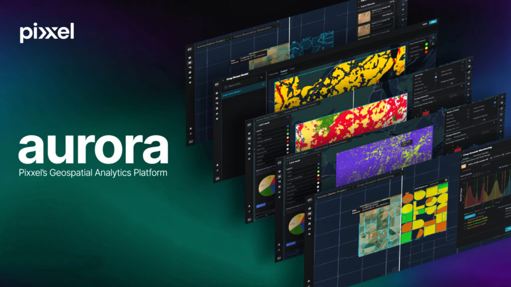
The funds will enable Pixxel to accelerate the development and launch of Pixxel’s entire constellation of 18 commercial hyperspectral satellites planned for the near future. The funding will also support the growth of Pixxel’s software offerings, including Aurora, its AI-driven Earth Observation platform, enabling seamless analysis and actionable insights for diverse applications from hyperspectral data. 

Additionally, the funds will drive Pixxel’s plans to expand its satellite manufacturing capacity, scale its operations for upcoming missions, and enhance its capability to provide a full spectrum of satellite manufacturing services—from small satellites to advanced imaging payloads for other organisations and governments.

Pixxel’s hyperspectral satellites are designed to capture data across 250+ spectral bands at an unparalleled 5 meter spatial resolution, spectrally fingerprinting the Earth and delivering details invisible to conventional imaging methods. 

The upcoming Fireflies constellation of 6 commercial-grade hyperspectral satellites, set for launch in early 2025, will provide enhanced global coverage with native 5 meter resolution, a 40 kilometer wide swath and daily revisit frequency anywhere on the planet. With applications spanning agriculture, climate monitoring, resource management, mining, environmental protection, energy, urban planning, and more, Pixxel’s technology equips organisations with the critical intelligence required to make informed, data-driven decisions.

This milestone represents another step forward in Pixxel’s vision of leveraging space technology to drive global progress, create impactful environmental solutions, and facilitate interplanetary travel, paving the way for a better tomorrow on Earth and beyond.

“This funding reflects the bold vision we’ve set out to achieve at Pixxel and echoes the investors’ confidence in Pixxel’s technological capabilities,” said Awais Ahmed, Founder and CEO of Pixxel. “The new infusion of capital will help us launch more satellites quicker, transforming how humanity understands and acts on the challenges of our time. We look forward to building a business that continues to make a meaningful impact for generations, creating a world where industries and governments can act faster and smarter for the greater good through Pixxel’s cutting-edge hyperspectral satellites.”

Praveg Patil, Head of Asia Pacific – M&G Impact & Private Equity, said, “Pixxel’s proprietary technology will be transformational and adaptable to monitor for enhancing crop health, climate change, managing resources more effectively and protecting our environment. This partnership underscores our commitment to support Pixxel’s growth plans and reflects our broader purpose-led strategy, demonstrating how innovative technology can generate positive environmental outcomes.”

Linda Guo, Partner, Glade Brook Capital Partners, said, “We are thrilled to partner with Pixxel as they advance the deployment of their hyperspectral satellite constellation. Awais, Kshitij, and the Pixxel team have demonstrated exceptional vision, innovation, and execution, and we are confident they will play a pivotal role in driving the growth and adoption of the hyperspectral satellite market.“

Filed Under: News

Rocket Lab sets the launch window for Synspective satellite deployment

December 6, 2024 by editorial

Photo of a previous Rocket Lab Electron launch of a Synspective mission, photo courtesy of Rocket Lab.

Rocket Lab USA, Inc. (Nasdaq: RKLB) has announced a launch window for an upcoming Electron mission to deploy the latest satellite in Synspective’s growing Earth Observation (EO) constellation.

The “Owl The Way Up” mission is scheduled to launch from Rocket Lab Launch Complex 1 in Mahia, New Zealand during a launch window that opens on December 18th NZDT (December 17 UTC). The mission will deploy a single StriX satellite to orbit for Synspective.

This mission will be the sixth in a total of 16 launches booked on Electron for Synspective, a Japanese EO company operating a constellation of synthetic aperture radar (SAR) satellites designed to deliver imagery that can detect millimeter-level changes to the Earth’s surface from space. Rocket Lab first launched for Synspective in December of 2020 and has been the sole launch provider for Synspective’s constellation to date.

Synspective’s small SAR satellites, StriX, are equipped with a SAR sensor, which can observe the Earth’s surface in any weather condition day or night. Not affected by clouds or rain, SAR is suitable for persistent monitoring of disasters and detailed changes to secure critical infrastructure and other facilities.

Example use cases include the following…

  • detecting anomalies in road, rail, energy and other infrastructure, resulting in lower maintenance costs and accident risk
  • monitoring crop growth conditions and analyzing soil and vegetation health to help reduce costs and increase efficiency for farmers
  • detecting illegal logging and fishing in the most remote parts of the world
  • providing rapid damage assessment after flooding, landslides and volcanic eruptions, as well as risk assessment for land subsidence
  • enabling the persistent monitoring of maritime traffic, border activities and other potential security threats, and advances maritime domain awareness
  • analyzing tree cover to calculate CO2 absorption and carbon credits

Rocket Lab founder and CEO, Sir Peter Beck, said, “As the sole launch provider for Synspective to date, we’ve developed an enduring relationship with their team built on trust and reliability across multiple Electron missions. By flying as the dedicated customer, rather than ridesharing, we’ve put Synspective in control of their launch schedule and mission parameters, affording them a level of control over their mission not traditionally afforded to small satellite operators. We’re looking forward to placing another StriX satellite in orbit and supporting Synspective’s vision to enable persistent monitoring of our planet to support disaster relief, agricultural development, maritime domain awareness and much more.”

Rocket Lab has launched 14 missions to date in 2024, besting the Company’s previous annual launch record of 10 missions achieved in 2023.

Filed Under: News

Spire Global names a new CEO + appoints industry vets to the executive team

December 5, 2024 by editorial

Spire Global (NYSE: SPIR) has named Theresa Condor, who currently serves as Chief Operating Officer and a board member, as the new Chief Executive Officer — she will assume the role on January 1, 2025, and Founder and CEO Peter Platzer will become Executive Chairman as part of a planned leadership transition.

After 12 years at the helm of the Company, Platzer’s tenure as CEO was marked with several milestones that he set out to achieve before transitioning into the Executive Chairman role, including rapidly scaling the Company from $10 million to more than $100 million in revenue and taking it public. He also oversaw the Company’s recent agreement to sell its maritime business for approximately $241 million, which Spire intends to use to retire all outstanding debt and invest in near-term growth opportunities.

As Executive Chairman, Platzer will guide Spire’s vision and lead the Board of Directors, as well as focus on securing major opportunities to drive the Company’s growth strategy. He will remain involved in select investor engagements and speak at events about the burgeoning commercial space opportunity.

Condor, who was part of the Company’s founding team, has led the expansion of Spire’s solution offerings and business lines, growing the Company’s customer base to more than 745 customers across 65 countries. As CEO, she intends to lead Spire into its next phase of growth with a focus on streamlining operations and strong execution at scale.

The Company has also appointed two aerospace industry veterans to join its executive bench. Celia Pelaz, a former Airbus executive, will serve as Chief Operating Officer, assuming responsibility for the Company’s revenue and operations. Most recently, Pelaz served as COO and a member of the Management Board of HENSOLDT AG, which focuses on sensor technologies for defense and security missions. Pelaz played a major role in the carve-out of HENSOLDT from the Airbus Group in 2017, its successful IPO in 2020 and shaping the strategic direction of the company. Today, HENSOLDT AG has a market cap of approximately 4.2 billion euros.

Gabriel Oehme will serve as Chief Transformation Officer. Oehme spent 22 years at Airbus in roles including operations, business development, procurement and sales. Most recently, he served as Managing Director and Chief Commercial Officer of Aerotech Peissenberg, an aerospace manufacturing company specializing in high-quality, zero defect precision machining at scale, where he oversaw the commercial business as well as operations and manufacturing. During his tenure, he drove business growth in civil and military aerospace markets while boosting company profitability and efficiency.

“Peter has an incredible vision for how satellite technology and space can improve our lives here on Earth, and that vision has guided the growth of Spire since the company was founded,” said Will Porteous, Spire Board Member. “Theresa has been instrumental in turning that vision into reality. She has a deep understanding of Spire’s customers, the business, and its operations that will be transformational for the company as it enters this next phase of growth as an increasingly profitable company.”

“Celia and Gabriel bring invaluable institutional knowledge of the aerospace industry and a wealth of expertise in operations, having effectively managed businesses centered on manufacturing and engineering,” said Condor. “With our recent agreement to sell our maritime business, we are at a transformational point as we seek to become a debt-free company with proven space infrastructure and technology. We are in a strong position to capitalize on significant near-term opportunities that generate long-term value. Celia and Gabriel’s experience will be integral in helping us seize these opportunities through focused execution and operational excellence at scale.”

Pelaz and Oehme will assume their positions on January 6, 2025.

Filed Under: News

Rivada tapped for VNO contract with U.S. Navy + establishes secure services office

December 4, 2024 by editorial

The United States Navy has contracted Rivada to develop and deliver Virtual Network Operator (VNO) capabilities via the company’s Outernet constellation.

The Rivada Outernet is a next-generation LEO satellite constellation. When fully deployed, it will provide gigabit speeds to any point on the globe, without needing to touch the public internet or any third-party infrastructure. Rivada has designed its Outernet to serve the most demanding enterprise and government customers—those who need highly secure, high-bandwidth connectivity in even the most far-flung locations.

Consistent and highly secure, global connectivity for Navy vessels remains a challenge for both ship-to-shore and ship-to-ship communications. Under the first phase of its contract with the U.S. Navy, Rivada will engage in joint engineering cooperation with the Navy to delineate a Virtual Network architecture specifically designed to meet the Navy’s needs on the Rivada Outernet.

A global low-latency point-to-point connectivity network of 600 low earth orbit (LEO) satellites, Rivada’s Outernet is a unique next-generation architecture combining inter-satellite laser links with advanced onboard processing that provide unique routing and switching capabilities to create an optical mesh network in space.

This approach to “orbital networking,” in which data stays in space from origin to destination, creates an ultra-secure satellite network with pole-to-pole coverage, offering end-to-end latencies much lower than terrestrial fiber over similar long distances. By routing traffic on a physically separated network, it provides a layer of defense for any organization that needs to securely share data between widely distributed sites.

Rivada’s Outernet is particularly well suited for the secure connectivity required by national governments and defense sectors. Leveraging the Outernet’s robust, resilient and secure space-based architecture, naval users can connect their assets on a global scale with low latency and without any third-party networks in the communication chain. Assets anywhere in the world can be connected back to home soil and between each other, platform-to-platform.

“The Rivada Outernet’s proliferated LEO architecture is resilient by design and built for exactly this type of use-case,” said Declan Ganley, CEO of Rivada Networks. “We are delighted that the U.S. Navy sees the value of what we are building and look forward to delivering an operational concept that meets its needs. Our Outernet is rapidly becoming the infrastructure of choice for secure data communications.”

Commander Nick Goddard, Director of Operations of U.S. Navy Cyber Command, said, “Rivada is building a uniquely capable LEO constellation focused on zero trust networking. The combination of security, symmetrical uplink and downlink speeds and global coverage are unique, and we are excited to collaborate with Rivada on how the Navy can best take advantage of Rivada’s gateway-less architecture for innovation today and in the future. As the adversary evolves, we must continue to out-innovate, maneuver, and drive outcomes to support our global Navy Operational Ecosystem.”

Rivada Secure Services Office established to serve U.S. Government + Defense Sector

Rivada Networks, Inc. has formed Rivada Secure Services, a new, wholly owned subsidiary established as a proxy organization to serve the specialized needs of U.S. government and defense customers.

The new subsidiary will be led by Michael Abad-Santos, who brings extensive experience in government and defense space systems. Rivada Secure Services will be headquartered in the Washington DC area to maintain close coordination with government customers and our reseller network.

A global low-latency point-to-point connectivity network of 600 LEO satellites, Rivada’s Outernet is a unique next-generation architecture combining inter-satellite laser links with advanced onboard processing that provide unique routing and switching capabilities to create an optical mesh network in space.

This approach to “orbital networking,” in which data stays in space from origin to destination, creates an ultra-secure satellite network with pole-to-pole coverage, offering end-to-end latencies much lower than terrestrial fiber over similar long distances. By routing traffic on a physically separated network, it provides a layer of defense for any organization that needs to securely share data between widely distributed sites.

Rivada’s Outernet is particularly well suited for the secure connectivity required by national governments and defense sectors.  Leveraging the Outernet’s robust, resilient and secure space-based architecture, DoD can connect their assets on a global scale with low latency and without any third-party networks in the communication chain. Assets anywhere in the world can be connected back to home soil and between each other, platform-to-platform.

The launch of Rivada Secure Services follows the recent award of a VNO contract with the U.S. Navy and positions Rivada to better support mission-critical government communications requirements through its innovative Outernet satellite constellation.

“The formation of Rivada Secure Services demonstrates our commitment to providing the highest level of secure, resilient communications to our government customers,” said Declan Ganley, CEO of Rivada Space Networks. “As a proxy organization, Rivada Secure Services will ensure we can fully support the unique mission requirements of U.S. defense and civilian agencies while maintaining the necessary security protocols.”

About Rivada Space Networks
Rivada Space Networks GmbH is deploying the first true “Outernet”: a global, low-latency, point-to-point connectivity network of LEO satellites. By connecting its satellites with lasers, Rivada will provide resellers and B2B customers with the ability to securely connect any two points on the globe with low latency and high bandwidth. The constellations, comprising 600 low-earth-orbit communications satellites, will represent a fundamental change in the availability of secure, global, end-to-end enterprise-grade connectivity for Telecom, Enterprise, Maritime, Energy and Government Services markets. Rivada Space Networks is a wholly owned subsidiary of Rivada Networks, Inc. 

Filed Under: News

ArkEdge Space selected by JAXA to develop lunar navigation system

December 4, 2024 by editorial

ArkEdge Space 6U Satellites Series
Compact, with dimensions of 10cm x 20cm x 30cm, these microsatellites are making strong strides in a variety of mission portfolios, ranging from Earth-based constellations, covering observation, navigation, and communication for both Earth and lunar missions, and even beyond toward exploration in deep space.

ArkEdge Space Inc. has been selected by the Japan Aerospace Exploration Agency (JAXA) under its Space Strategy Fund to lead the development of advanced lunar navigation technology.

JAXA Slim Rover lunar rover

The company will use its expertise in the planning and design to mass production and operation of smallsat constellations to lead the development of a next-generation Lunar Navigation Satellite System (LNSS), a vital component to the International LunaNet initiative, driven by NASA , ESA and JAXA.

Conceptual diagram of the lunar positioning demonstration mission

LunaNet seeks to establish essential infrastructure to support sustainable lunar exploration and foster growth of the lunar economy.

LunaNet: Bringing terrestrial internet capabilities to astronauts, rovers, and orbiters.
NASA / Reese Patillo

This program, supported by up to 5 billion yen ($32.5 million) over four years, tasks ArkEdge Space with developing a 100 kg class microsatellite, developing crucial technology including the:

  1.  Lunar navigation payload
  2.  Demonstration satellite platform, along with a system operations plan
  3. Establishment of an approach to mission evaluationy

These efforts will help reduce development costs and timeframes while advancing core LNSS technologies and enabling the development of future lunar navigation system demonstration satellite.

ArkEdge Space’s work on LNSS leverages its expertise in satellite technology and builds on its ongoing collaboration with JAXA. A key innovation of the project involves the use of faint GNSS (Global Navigation Satellite Systems) signals, originally designed for Earth, to determine satellite position and time in lunar orbit—approximately 380,000 kilometers from Earth.

Additionally, LNSS complements advancements in Low Earth Orbit Positioning Navigation and Timing (LEO-PNT) systems, which use small satellite constellations at LEO altitudes. These systems provide high-precision, robust navigation services globally, enhancing existing GNSS infrastructure.

Conceptual diagram: the features of the LEO-PNT. Credit: qzss.go.jp

To enable LNSS satellites to transmit accurate positioning signals to the Moon, it is critical to determine the position (orbit) and time of the LNSS satellite itself with high accuracy. ArkEdge Space, in collaboration with JAXA, has developed an innovative method to achieve this. The approach involves capturing weak GNSS (Global Navigation Satellite System) signals that travel an extraordinary distance of approximately 380,000 kilometers from Earth’s orbit to the lunar domain. These signals are then processed on-board to determine their orbital position and time.

As part of this development, the project focuses on the creation and integration of key subsystems, including an advanced navigation system and a highly stable timing system. These cutting-edge technologies will be validated by a dedicated lunar positioning system demonstration mission in lunar orbit, laying the foundation for a high-precision lunar navigation infrastructure.

As lunar exploration accelerates—driven by initiatives including Artemis and other international efforts—high-precision infrastructure has become indispensable for activities such as rover navigation, base construction, and in-situ resource use. LNSS supports lunar operations as well as serves as a stepping stone for future exploration of Mars and deep space.

The LNSS initiative comes at a pivotal time as nations worldwide consider developing regular lunar positioning services to support diverse lunar activities. To safely and efficiently enable these operations, the Moon requires real-time, high-accuracy positioning services like those of Earth-based GNSS.

ArkEdge Space has been developing essential communications and navigation infrastructure for lunar missions since 2021 under the Stardust Program (Strategic Program for Accelerating Research, Development, and Utilization of Space Technology). The company also intends to support Initial Operational Capability (IOC) for globally coordinated, high-precision navigation services. By leading LNSS development, ArkEdge Space will advance Japan’s space technology and strengthen its international competitiveness. We remain committed to supporting lunar and deep space exploration, helping establish a foundation for the new economic frontier.

An illustration of NASA’s Stardust / Stardust NExT spacecraft.
Credit: NASA/JPL-Caltech

In October 2024, ArkEdge Space initiated a joint study with JAXA to explore the development of a LEO-PNT system. LEO-PNT is envisioned as a revolutionary satellite constellation of LEO satellites designed to provide higher-intensity, and higher-precision positioning data globally, surpassing the capabilities of traditional GNSS. The system works by receiving GNSS signals, processing the observational data on-board the satellite, and generating precise positioning signals for distribution.

This innovative approach builds on the advanced technologies and expertise developed during the development of key LNSS subsystems. By leveraging these technological advances, ArkEdge Space aims to continually  improve its satellite navigation capabilities and apply the results to broader Earth orbit-based business ventures.

Filed Under: News

Umbra selected for NRO’s Strategic Commercial Enhancements Stage III

December 3, 2024 by editorial

Umbra has been awarded the Stage III option of the National Reconnaissance Office‘s (NRO) Commercial Radar Capabilities contract — this contract, part of the NRO’s Strategic Commercial Enhancements (SCE) initiative, evaluates and leverages innovative commercial ISR (Intelligence, Surveillance, and Reconnaissance) solutions to strengthen the U.S. Government’s overhead intelligence architecture.

Building on the success of Stage II, Stage III emphasizes scaling SAR data delivery to the U.S. Government to meet critical needs such as disaster response, environmental monitoring, and crisis management. Umbra’s advancement follows the successful validation of its on-orbit performance and mission utility in earlier stages, positioning the company to further integrate domestic SAR capabilities into the wider U.S. Government’s ISR framework.

Umbra’s SAR satellites collect up to five times more data than other providers, offering unprecedented value through both quantity and affordability.

“Advancing to Stage III marks a pivotal moment in the evolution of Umbra’s SAR capabilities,” said Omar Wheatley, Director, Strategic Programs. “We’re excited to deepen our collaboration with the NRO and continue delivering our industry-leading high-quality SAR data that strengthens the nation’s intelligence and defense capabilities.”

“As a fully American company,we’re proud to maximize taxpayer value by delivering the most data and the best data to the NRO at the lowest cost,” said David Langan, CEO of Umbra.

Umbra has a long-standing relationship with the NRO, having previously been selected for the Stage II option of its Commercial Radar Capabilities contract in late 2022, and a second Stage II option under the Commercial RF Capabilities focus area in early 2024. Earlier this month, the 2024 Commercial Remote Sensing Global Rankings named Umbra first in SAR data quality worldwide and second in SAR persistence.

Screenshot

Since its establishment in 2015,Umbra has emerged as a leader in remote sensing, offering breakthrough SAR imaging technology and patented satellite solutions that provide all-weather, day-and-night monitoring. Umbra continues to set new standards in reliability, precision, and intelligence gathering,helping government and commercial customers alike achieve mission success.

About Umbra
Umbra is a vertically integrated space technology company providing satellite technologysolutions and intelligence data as a service to commercial and government customers. Ourcutting-edge products help customers solve complex business, environmental, and securitychallenges. Umbra is founded, funded, built and operated in the USA with headquarters in Santa Barbara, California, and has a presence in Austin, Texas, and Washington D.C.

Filed Under: News

Forrester’s Digest: China outlines Beidou constellation

December 3, 2024 by editorial

China already has a total of 44 GPS satellites on-orbit (at the end of 2023), known as the Beidou constellation. The country’s China Satellite Navigation System Management Office (CNSO) has explained how this existing system will be augmented.

According to Xinhua News Agency, CNSO says that by the end of 2025 it will have completed a design update and plans to launch three test satellites during 2027 into LEO to ensure all is working well.

The new Beidou fleet will start launching in 2029 and be completed by 2035. These ‘next-gen’ craft “will provide highly accurate navigation, positioning and timing in real time, with accuracy levels ranging from meters to decimeters.”

Beidou’s deputy chief designer Xie Jun told Global Times that its existing constellation would serve as the core for the upgraded system featuring new LEO satellites. Beidou products are currently exported to more than 140 countries and regions.

The new technology is intended to be an improvement on China’s existing GPS satellites.

Filed Under: News

Exolaunch set to deploy 22 customer satellites during the Bandwagon-2 mission with SpaceX

December 2, 2024 by editorial

Exolaunch personnel preparing the CarboNIX microsat separation rings for the upcoming launch and deployment. Image: © Exolaunch

Exolaunch is ready for its next major launch: the Bandwagon-2 Rideshare mission with SpaceX — this launch will build upon the success of the inaugural Bandwagon mission that occurred earlier this year, and Exolaunch will once again integrate and deploy satellites into orbit for a diverse range of international customers. The Bandwagon-2 mission is scheduled to lift off no earlier than December of 2024 from Vandenberg Space Force Base in California.

Bandwagon-2 is a unique, mid-inclination rideshare mission, offering a rare orbital opportunity for diverse satellite deployments. As part of this mission, the launch campaign at Vandenberg Space Force Base is currently underway for Exolaunch’s roster of 22 customer satellites, including 15 cubesats and 7 microsatellites. Exolaunch’s customers represent a broad spectrum of space exploration, with missions originating from countries including Bulgaria, Croatia, Czechia, Djibouti, Finland, Mongolia, and the United States.

This is Exolaunch’s seventh mission in 2024, after successfully deploying 83 satellites into orbit across the Bandwagon-1, Transporter-10, and Transporter-11 Rideshare missions with SpaceX, two dedicated missions with Rocket Lab, and ESA’s Ariane 6 maiden flight.

Exolaunch’s flight-proven satellite separation hardware will play a critical role in this mission. The CarboNIX microsatellite separation rings and EXOpod Nova deployers will ensure the safe and reliable deployment of over 700 kg of customer payloads into orbit. Additionally, Exolaunch will fly its versatile EXOport adapter, enabling the accommodation and deployment of multiple customer satellites on a single launch.

Known for their lightweight yet robust designs, these systems offer unmatched precision and safety during satellite deployments, minimizing shock and vibration to ensure payload integrity. These systems are engineered to perform in the most demanding space environments, renowned for their reliability and effectiveness across numerous missions. Exolaunch’s continuous innovation in satellite separation technology solidifies its leadership in the smallsat launch segment, delivering trusted solutions to customers worldwide.

Integration of the EXOport multi-satellite adapter carrying customer satellites via EXOpod Nova deployers on Transporter-7 with the Falcon 9 launch vehicle. Image: © SpaceX

Exolaunch provides comprehensive launch procurement and top-tier mission management expertise, ensuring seamless operations from start to finish. From the initial contract to final deployment, Exolaunch guides customers through the complexities of their launch planning, global shipping and logistics for sensitive space hardware, managing regulatory compliance, integration, and more. With a decade of experience in managing high-stakes satellite missions, Exolaunch is a trusted partner in navigating the technical, logistical, and legal challenges of getting payloads into space. This all-inclusive service guarantees that customer satellites are delivered safely and on time, ready for integration and launch.

“We’re honored to work with SpaceX on the mid-inclination Bandwagon-2 mission. Our long-standing relationship has been instrumental in Exolaunch’s growth, and this mission demonstrates our commitment to pushing the boundaries of global access to space,” said Robert W. Sproles, chief executive officer at Exolaunch. “With each mission, we continue to raise the bar for satellite integration and deployment, and we’re proud to support the innovative and impactful work of our new and existing customers flying on Bandwagon-2.”

Filed Under: Featured, News

Eseye + Sateliot join forces for global IoT via seamless satellite-terrestrial integration

December 1, 2024 by editorial

Eseye has partnered with Sateliot to deliver reliable and global 5G from space IoT solutions using advanced LPWAN satellite technology. 

The partnership aims to enable seamless and ubiquitous global connectivity in locations where there is no cellular coverage from a Mobile Operator. It uses the new 3GPP Release 17 (Rel.17) standard to achieve multi-RAT connectivity to non-terrestrial networks (NTN) from a single SIM solution.

Sateliot is the first company to operate a LEO 5G / NB-IoT satellite constellation that functions to provide a seamless extension of existing cellular networks using the advanced Rel.17 protocol to cover 100% of the planet.

The technology provides seamless connectivity, allowing cellular-enabled IoT devices to connect directly to its satellite network when terrestrial cellular coverage is unavailable. This process functions as standard roaming, providing a smooth and reliable user experience. This ensures customer devices can enjoy uninterrupted and reliable IoT connectivity across both terrestrial and satellite infrastructures, providing ultra-high-quality connectivity in the remotest environments. 

Positioned in polar orbits, the satellites provide:

  • Complete global coverage by
    geographic coordinate 
  • Reaching even the most remote and underserved areas of the planet.
  • Paving the way for IoT use case
    innovation and global adoption.

Sateliot’s partnership with Eseye will provide comprehensive IoT connectivity solutions that cater to a wide range of applications and industries, driving innovation and operational excellence worldwide. 

With the advancements of Eseye’s multi-RAT flexibility to use Sateliot’s satellite-based connectivity, urban and industrial IoT deployments will be able to access secure global coverage as well as reliability in remote and underserved areas where zero cellular coverage from any operator is available. 

Release 17 standardizes using satellites with cellular modems and antennas, enabling connections to geostationary satellites and LEO constellations. Even in areas with poor terrestrial coverage, devices can switch to satellite networks, ensuring uninterrupted connectivity on highways, in forests, or in remote locations.

Leveraging partnerships with more than 700 operators in 190 countries, Eseye already ensures broad and reliable network access for IoT deployments.  With its multi-RAT capabilities, Eseye supports various radio access technologies (e.g., LTE, eMTC) to enhance connectivity resilience and flexibility. With a focus on Urban and Industrial IoT, Eseye solutions are ideal for applications in smart grids, EV charging, manufacturing, and smart cities where robust terrestrial networks are essential.

Offering scalable global connectivity, Sateliot ensures IoT devices remain operational regardless of geographical challenges. While targeting applications and industries operating in remote or globally dispersed locations, its solutions are specifically designed to support agriculture, logistics, and environmental monitoring.

Employing satellite-based LPWAN and NTN NB-IoT technologies to extend IoT connectivity, Sateliot goes beyond traditional terrestrial limits by delivering cutting-edge satellite-based IoT connectivity and thus extending coverage to remote and underserved areas where terrestrial networks are limited or unavailable.

Gianluca Redolfi, Sateliot’s CCO, said, “Our strength comes from being ahead in operations, sales, and regulatory compliance. While many competitors face challenges like landing rights or sales, Sateliot stands out because we started working on the standard early, were the first to support it, and have gained strong backing from the industry.”

Adam Hayes, COO at Eseye, said, “Customers want their devices to connect and by working with Sateliot we can extend coverage beyond the current cellular offer. Together, we are paving the way for seamless, global connectivity that takes Eseye’s already highly resilient network to new heights to enable the interconnected world of tomorrow.”

Filed Under: News

Spire Global selected by LatConnect60 to improve sustainable agriculture practices  

November 25, 2024 by editorial

Spire Global (NYSE: SPIR) has been selected by LatConnect60 to provide Global Navigation Satellite System Reflectometry (GNSS-R) data and Soil Moisture Insights.   

The World Bank reports that investments in climate-resilient agriculture can yield returns of three to eight times the costs, making accurate environmental data essential for today’s farmers. LatConnect60 will integrate Spire’s Soil Moisture Insights and GNSS-R data into its web-based platforms, delivering actionable intelligence for water management, usage efficiency, and crop stress levels. These insights are crucial for farmers, resource managers, and policymakers.

Soil moisture in New South Wales, Australia, shown from
6 km to 500 m down to 100 m. Image courtesy of Spire Global.

LatConnect60 will combine data from its satellite fleet—which includes optical imagery and shortwave infrared technology—with Spire’s GNSS-R data to deliver a detailed view of environmental conditions and resource needs. Through this, its customers across Southeast Asia and Australia will have access to dynamic maps and detailed dashboards, allowing them to monitor specific areas, track water use, assess crop health, access daily updates and integrate multispectral satellite data for more informed decision-making. 

Spire’s Soil Moisture Insights leverages its GNSS-R satellite constellation to deliver high-resolution, daily soil moisture insights at 500-meter and six-kilometer resolutions, covering any location worldwide. Designed for diverse sectors this product helps optimize crop yield, manage environmental risks, and assess ground stability. Accessible via API, the product integrates seamlessly into existing systems, providing precise, actionable insights for applications such as drought and flood forecasting, irrigation planning, commodity price forecasting, hydrological modeling and more.

“LatConnect 60 looks forward to working closely with Spire to make this combined capability easily accessible to our end users across the Southeast Asian and Australian continents,” said Venkat Pillay, CEO and Founder of LatConnect60. “We envisage tremendous demand for the insights that will be made available, particularly in agricultural or forestry areas that are not easily accessible for manual data collection, while leveraging the ability for the GNSS-R data to enable daily soil moisture readings even in heavy cloud cover and dense canopy environments.”  

“Predicting biomass growth and understanding soil moisture conditions are essential for building climate resilience,” said Michael Eilts, general manager of Weather and Climate, Spire. “By combining our GNSS-R technology with LatConnect60’s analytical platforms, we are setting new benchmarks for accuracy in soil moisture data and comprehensive environmental monitoring in any corner of the globe.”  

  Learn more about Spire’s advanced Soil Moisture Insights at this direct link…  

Filed Under: News

  • « Go to Previous Page
  • Page 1
  • Interim pages omitted …
  • Page 46
  • Page 47
  • Page 48
  • Page 49
  • Page 50
  • Interim pages omitted …
  • Page 338
  • Go to Next Page »

Primary Sidebar

WEEKLY NEWSLETTER

Archives

  • June 2026
  • May 2026
  • April 2026
  • March 2026
  • February 2026
  • January 2026
  • December 2025
  • November 2025
  • October 2025
  • September 2025
  • August 2025
  • July 2025
  • June 2025
  • May 2025
  • April 2025
  • March 2025
  • February 2025
  • January 2025
  • December 2024
  • November 2024
  • October 2024
  • September 2024
  • August 2024
  • July 2024
  • June 2024
  • May 2024
  • April 2024
  • March 2024
  • February 2024
  • January 2024
  • December 2023
  • November 2023
  • October 2023
  • September 2023
  • August 2023
  • July 2023
  • June 2023
  • May 2023
  • April 2023
  • March 2023
  • February 2023
  • January 2023
  • December 2022
  • November 2022
  • October 2022
  • September 2022
  • August 2022
  • July 2022
  • June 2022
  • May 2022
  • April 2022
  • March 2022
  • February 2022
  • January 2022
  • December 2021
  • November 2021
  • October 2021
  • September 2021
  • August 2021
  • July 2021
  • June 2021
  • May 2021
  • April 2021
  • March 2021
  • February 2021
  • January 2021
  • December 2020
  • November 2020
  • October 2020
  • September 2020
  • August 2020
  • July 2020
  • June 2020
  • May 2020
  • April 2020
  • March 2020
  • February 2020
  • January 2020
  • December 2019
  • November 2019
  • October 2019

© 2019–2026 SatNews

Insert/edit link

Enter the destination URL

Or link to existing content

    No search term specified. Showing recent items. Search or use up and down arrow keys to select an item.
      x
      Sign Up Now!

      Enjoy a free weekly newsletter with recent headlines from the global SmallSat industry.

      Invalid email address
      We promise not to spam you. You can unsubscribe at any time.
      Thanks for subscribing! You will now receive weekly SmallSat News updates.
      We love our advertisers.
      And you will too!

      Please disable Ad Blocker to continue... We promise to keep it unobtrusive.
      We promise not to spam you. You can unsubscribe at any time.
      Invalid email address
      Thanks for subscribing!