• Skip to main content
  • Skip to primary sidebar
  • Home
  • News
  • Featured
  • More News ⌄
    • SatNews
    • SatMagazine
    • MilSatMagazine
  • Events ⌄
    • MilSat Symposium
    • SmallSat Symposium
    • Satellite Innovation
  • Contacts
  • SUBSCRIPTION

SmallSat News

You are here: Home / Archives for News

News

Building a Dozen … NanoAvionics Builds Nano-satellites for aLeMPSat Research Mission

November 12, 2019 by editorial

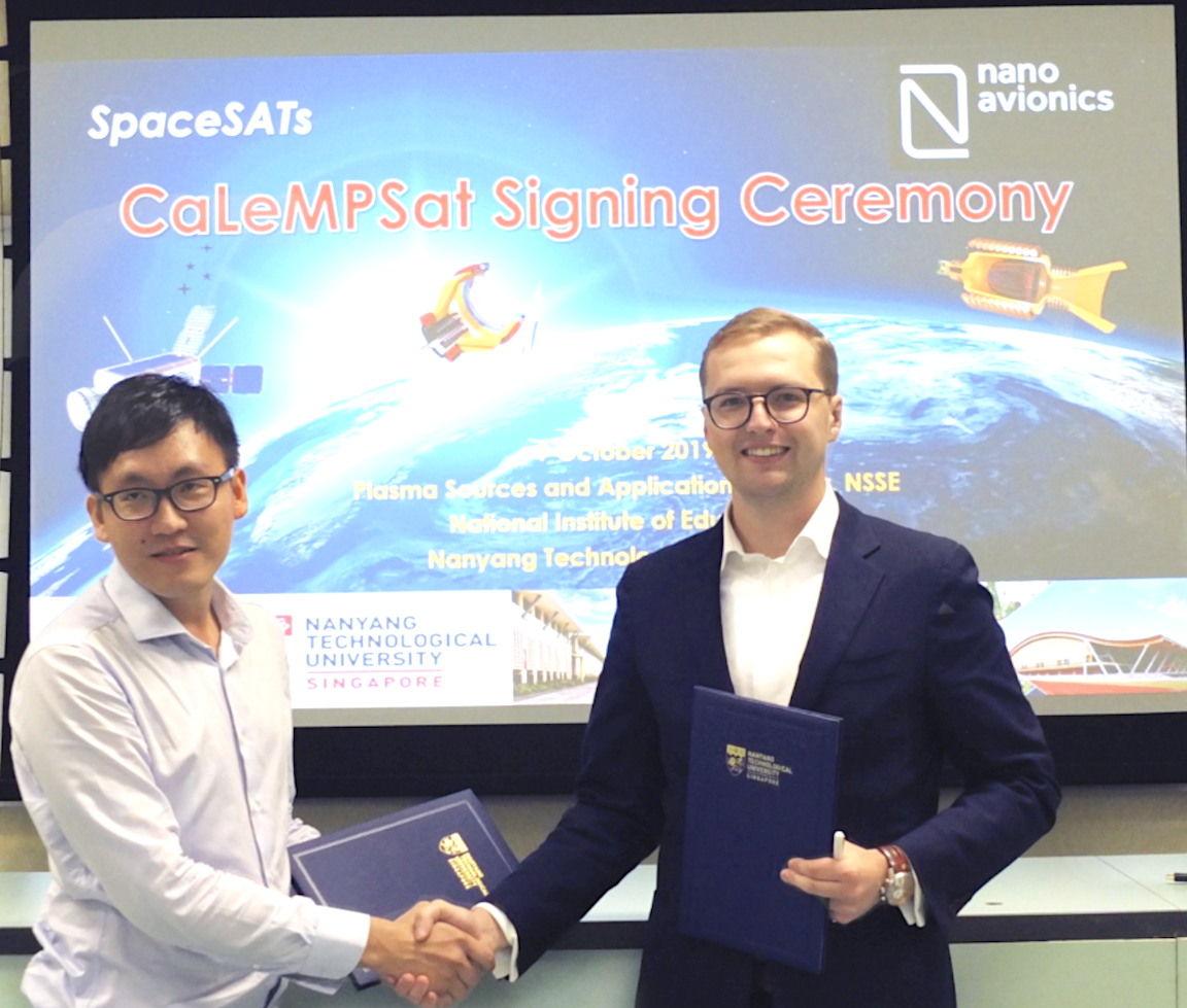
Another contract for small sats, and this one is for a Singaporean research mission —  nano-satellite mission integrator NanoAvionics received a contract to build a 12U nano-satellite bus for the Singaporean research mission “Cathode-Less Micro Propulsion Satellite” (CaLeMPSat). 

Developed by SpaceSATS, Plasma Innovation Labs (PILS) and the Plasma Source and Application Center (PSAC) at National Institute of Education (an autonomous institute of Nanyang Technological University), CaLeMPSat will test miniature Hall effect thrusters (HETs) that operate at power classes never before achieved.

The CaLeMPSat mission will test miniature HETs that operate at power classes far below the 100W-class thrusters of the current satellite industry. The research payload will consist of a 60W HET, an integrated 30W HET (in a 1.5U volume), and two 10W Hall Effect Micro Jets (HEM-Jets). A 3-axial, 5-nozzle cold gas thruster will round out the experimental thruster payload. The consortium will test additional miniaturized systems for plasma propulsion including:
 

  • 8-channel gas feeding unit,
  • plasma diagnostic unit,
  • power processing and control unit,
  • Earth magnetic field measurement unit.

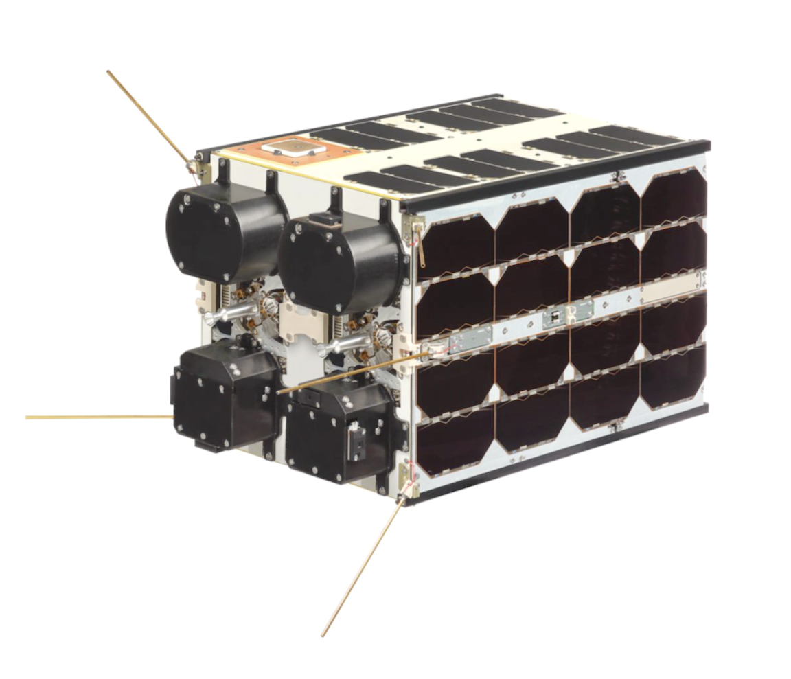
NanoAvionics will provide its nano-satellite bus in a 12U configuration, of which CaLeMPSat will occupy more than 9U of payload volume. To support that payload, the nano-satellite bus will provide an average orbit power generation exceeding 20W as well as UHF and S-band communications. The spacecraft’s orientation will be managed by NanoAvionics’ Attitude Control and Determination System which includes reaction wheels, magnetorquers, an IMU, GPS, solar sensors, and a star tracker.

NanoAvionics has committed to deliver the satellite bus before the end of February 2020 and SpaceSATS and its partners are targeting launch of CaLeMPSat in late 2020.

 

NanoAvionics CEO Vytenis J. Buzas said that the propulsion technology that SpaceSATS and its collaborators will demonstrate on CaLeMPSat will open the door to new mission opportunities for nano-satellites. NanoAvionics is pleased to have been chosen to support such an innovative project with their multi-purpose nano-satellite bus, which has a proven track record of serving in-orbit demonstration missions in the past.

Miniaturized HETs will allow nano-satellites to perform high-impulse maneuvers such as orbital maintenance or formation flying as well as the decommissioning maneuvers needed to minimize space debris.

Dr. CHAN Chia Sern, Chief Executive Officer of SpaceSATS and Plasma Innovation Labs added that the robustness of NanoAvionics’ technology, its track record of successful nano-satellite missions and short lead times made NanoAvionics the ideal choice for the CaLeMPSat mission. The NanoAvionics team has given a great amount of support to provide the best possible technical solution, even before signing the contract, and they look forward to working together through integration, launch, and operation to achieve CaLeMPSat’s pioneering mission objectives.

 

Filed Under: News

SpaceX Success… the 60 Satellite Starlink Mission Launches from Cape Canaveral Aboard Repurposed Falcon 9 Rocket

November 11, 2019 by editorial

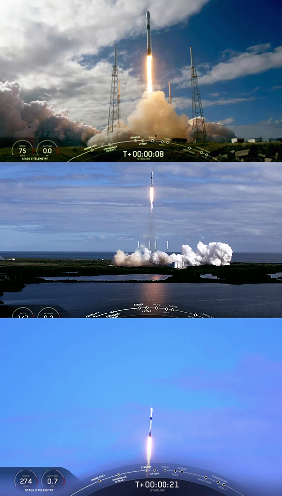
SpaceX is targeting On Monday, November 11, at 9:56 a.m.EST, 14:56UTC, SpaceX launched 60 Starlink satellites from Space Launch Complex 40 (SLC-40) at Cape Canaveral Air Force Station, Florida.

Falcon 9’s first stage previously supported the Iridium-7, SAOCOM-1A, and Nusantara Satu missions, and this Starlink mission’s fairing was previously flown on Falcon Heavy’s Arabsat-6A mission earlier this year.

Following stage separation, SpaceX landed Falcon 9’s first stage on the “Of Course I Still Love You” droneship, which is stationed in the Atlantic Ocean. There was no attempt to capture the fairing as previously planned by the recovery vessels, Ms. Tree and Ms. Chief, due to concerns regarding heavier than expected seas in the Atlantic Ocean. 

The Starlink satellites deployed at an altitude of 280 km. Prior to orbit raising, SpaceX engineers conducted data reviews to ensure all Starlink satellites are operating as intended — the satellites then used their onboard ion thrusters to move into their intended orbits.

SpaceX is developing a low latency, broadband internet system to meet the needs of consumers across the globe. Enabled by a constellation of LEO satellites, Starlink will provide fast, reliable internet to populations with little or no connectivity, including those in rural communities and places where existing services are too expensive or unreliable. As the most recent launch of Starlink satellites in May, SpaceX has increased spectrum capacity for the end-user through upgrades in design that maximize the use of both Ka- and Ku-bands.


The first stage of the Falcon 9 rocket that uplifted the SpaceX Starlink mission to orbit re-lands on the “Of Course I Still Love You” droneship.

Additionally, components of each satellite are 100% demisable and will quickly burn up in Earth’s atmosphere at the end of their life cycle — a measure that exceeds all current safety standards. Starlink is targeted to offer service in parts of the U.S. and Canada after six launches, rapidly expanding to global coverage of the populated world after 24 launches.

Additional information on the system can be found at the SpaceX Starlink infosite.

Filed Under: News

Drifting on an Arctic Ice Sheet for a Year Scientists Use Kepler’s World’s First High-Bandwidth Satellite

November 11, 2019 by editorial

Don’t know if any penguins were involved in the successful experiment that Kepler Communications demonstrated delivering over 100Mbps connectivity service in the Arctic region to the German icebreaker Polarstern.

The vessel is located around 85 degrees N and is the home to the MOSAiC scientific expedition. The demonstration marks the first time in history that the central Arctic is successfully connected through a high-bandwidth satellite network. 

Kepler’s two polar-orbiting satellites are being used to transfer data for scientists taking part in MOSAiC, the most extensive research expedition ever to the North Pole. MOSAiC is an international expedition consisting of hundreds of scientists and operations crew, which will remain locked into the Arctic ice sheet to study the environment. The team will spend the next 12 months drifting along with the ice sheet, with the purpose of the mission being to take the closest look ever at the effects of climate change on the Arctic. 

Kepler has provided the Polarstern is equipped witthe world’s only high-bandwidth satellite data link delivered from low-Earth orbit (LEO) that is available in the Arctic. With the vessel operating well outside the range of traditional high-throughput satellites, Kepler is providing 100x higher data speeds, when the satellite passes the vessel than would be otherwise available to the ship. This improved data transfer capability means scientists can share large data files between ship and shore, improving the ability to share, analyze, and disseminate information.


MOSAiC scientists setting up camp in the North Pole.
Photo by Stephan Hendricks.

Mina Mitry, CEO at Kepler said that their Global Data Service provides a cost-effective means to transfer large data volumes that will be gathered over the course of MOSAiC. Rather than only storing data locally and analyzing once physical storage can be sent back with supply vessels, they are giving scientists the ability to continuously transfer test and housekeeping data sets over their unique LEO satellite network. 

Kepler’s Global Data Service™ will save time, money and, most importantly, improve the ability for MOSAiC scientists to carry out their critical mission of studying climate change.

In charge of MOSAiC’s logistics is the Alfred Wegener Institute Helmholtz Centre for Polar and Marine Research (AWI), from Germany. They are responsible for leading this international expedition that involves the joint efforts of 19 countries around the world. With over USD 158 million in funding, the most advanced technology on a research icebreaker, and an astonishing quantity of planning and logistics, MOSAiC is the largest expedition to the North Pole ever in history.

Professor Markus Rex, MOSAiC project leader and atmospheric scientist at the Alfred Wegener Institute in Potsdam added that the high polar regions are the last frontiers of the globe where high bandwidth data connections could not be established so far. Kepler’s new Global Data Service now enables them to send back bulk data, including key data files for monitoring the status of instruments together with experts at home. This will contribute to the success of MOSAiC.

The MOSAiC expedition began when the Polarstern set sail from Norway this past September and will continue for more than a year. Findings from the mission will help better assess the future of Earth’s climate, and provide valuable information to help fight climate change. 

Kepler is the world’s only provider of high-bandwidth satellite services in the poles. Aboard the Polarstern, Kepler has demonstrated data rates of 38 Mbps downlink and 120 Mbps uplink to a 2.4m Ku-band VSAT (Very Small Aperture Terminal). 


Filed Under: News

SSTL Ships Target Satellite to Tokyo for Astroscale’s ELSA-d Mission

November 8, 2019 by editorial

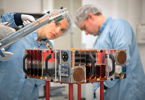
Surrey Satellite Technology Ltd. (SSTL) has shipped a 16 kg. Target satellite for Astroscale’s End-of-Life Services by Astroscale demonstration (ELSA-d) mission to Tokyo, where it will be bolted to the Chaser satellite for environmental testing ahead of the launch in 2020.

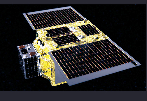
The ELSA-d mission is designed to simulate capture of orbital debris and validate key technologies for end-of-life spacecraft retrieval and disposal services. The Target and Chaser satellites will be attached for launch and de-orbit, but while on-orbit at 500 to 600 km., they will be deployed in a series of increasingly complex separation and capture maneuvers using search, identification, rendezvous, docking, and de-orbit technologies.


The ELSA-d mission comprises of a Chaser satellite and the Target satellite, and will demonstrate key technologies for orbital debris removal.

Photo is courtesy of SSTL.

The ELSA-d Target satellite was designed and manufactured by SSTL in Guildford, UK, and incorporates S-band communications, GPS positioning, and a 3-axis control system. It will also fly an HD camera and lighting to record the capture sequences during eclipse. A ferromagnetic docking plate with optical markers is attached to the Target, allowing the ~180 kg. Chaser satellite to identify and estimate attitude before deploying a capture extension mechanism with a magnetic plate to latch on to the Target satellite.

While rendezvous has been performed on-orbit in the past, ELSA-d will demonstrate the first semi-autonomous capture of a non-responsive, tumbling Target, as well as the first identification of a Target that is outside of the field of view of the relative navigation sensors on the Chaser. Once the demonstration concludes, the linked satellites will be moved to a lower orbit in readiness to re-enter the atmosphere where they will burn up.


Artistic rendition of the ELSA-d satellite. This mission is Astroscale’s on-orbit demonstration that aims to test several capabilities and technologies needed for future services.

Image is courtesy of Astroscale.

ELSA-d is scheduled to launch in 2020 on a Soyuz from the Baikonur Cosmodrome in Kazakhstan.

Sarah Parker, Managing Director of SSTL, said it is vital that the international space community tackles the issue of space junk and the company is pleased to be involved in Astroscale’s ELSA-d inaugural end-of-life spacecraft retrieval demonstration mission. SSTL is looking forward to following the on-orbit operations of this milestone mission.

Nobu Okada, Founder & CEO of Astroscale, added the company is delighted to receive SSTL’s Target satellite at the firm’s Tokyo headquarters as the next step is taken in this groundbreaking mission. Astroscale thanks SSTL for the commitment to ELSA-d and for working together to address the ongoing buildup of hazardous space debris in LEO.


Filed Under: News

SSTL Engages in a NovaSAR-1 Tasking and Data Acquisition Arrangement with the Philippines

November 7, 2019 by editorial

Surrey Satellite Technology Limited (SSTL) has signed an agreement with Republic of the Philippines’ Department of Science and Technology-Advanced Science and Technology Institute (DOST-ASTI) to provide a share of the tasking and data acquisition services from NovaSAR-1, the innovative S-Band radar smallsat launched into a 580 km. SSO in September of 2018.

The agreement gives DOST ASTI tasking priorities over the Philippines and the ability to access the raw data directly from the satellite, with a license to use and share the data with their partners over an initial five year period, extendable to the actual lifespan of the satellite.


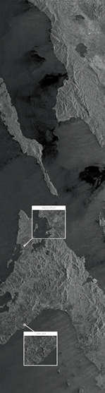
NovaSAR-1 S-band SAR image of the Cebu city area of Cebu Island and shows Mactan-Cebu International airport, boats and sea-going vessels around the shipping port, and the rugged terrain of the interior of the island.

Image is courtesy of SSTL.

Synthetic Aperture Radar (SAR) has the ability to image the Earth through cloud cover and at night, and DOST-ASTI will use data from NovaSAR-1 in support of a number of applications, including disaster monitoring, agricultural and forestry management, and coastal and maritime applications such as ship detection.

The target area for the first image acquisition was Cebu city and the nearby Mactan-Cebu International Airport. The captured image shows sea-going vessels around the shipping port together with the rugged terrain of the interior of Cebu Island.  Masbate Island in the Bicol region of the Philippines serves as the target area of the second image acquisition.  The resulting image reveals a crater site hidden by forest canopy that is not visible in optical satellite images.  Other features such as aquaculture sites along the coast and the rolling hills in the central region of the island were also captured in the image. 


Artistic rendition of NovaSAR-1 on-orbit.

NovaSAR-1 was designed and manufactured at SSTL, with an S-band payload developed by Airbus Defence and Space in Portsmouth, UK, and an Automatic Identification Receiver supplied by Honeywell Aerospace. The SAR payload has a dedicated maritime mode designed with a very wide swath area of 400km to enable the monitoring of the marine environment and will provide direct radar ship detection information simultaneously with AIS ship tracking data to assist with the identification and tracking of sea-going vessels.  

Mission partners already under contract for NovaSAR-1 data include the UK Space Agency, Australia’s Commonwealth Scientific and Industrial Research Organisation (CSIRO) and the Indian Space Research Organisation (ISRO). 

NovaSAR-1 is owned and operated by SSTL.

Andrew Cawthorne, Director of Earth Observation at SSTL, said the company is delighted to welcome DOST-ASTI colleagues to the NovaSAR-1 data team. SSTL anticipates that the Philippines will benefit greatly from NovaSAR-1 data, particularly as the country has a tropical climate with frequent cloud cover, and an extensive coastline and maritime territory.

Dr. Joel Marciano, Jr., Acting Director of DOST-ASTI, added the SAR imaging capability of NovaSAR-1 is a timely and powerful resource as the institute continues to push scientific data, computing and space technology in support of evidence-based politics and decision-making in the country.

Mr. Alvin Retamar, Chief Science Research Specialist at DOST-ASTI, commented that NovaSAR-1’s simultaneous acquisition of SAR and Automatic Identification System (AIS) data targets enhanced maritime domain awareness that is expected to lead to more effective interventions.

Filed Under: News

Arctic High-Bandwidth Satellite Service for the Largest Polar Expedition Successfully Implemented by Kepler

November 7, 2019 by editorial

Kepler Communications has delivered more than 100 Mbps connectivity service in the Arctic region to the German icebreaker Polarstern.

The vessel is located around 85°N and is the home to the MOSAiC scientific expedition. The demonstration marks the first time in history that the central Arctic is successfully connected through a high-bandwidth satellite network.

Kepler’s two polar-orbiting satellites are being used to transfer data for scientists taking part in MOSAiC, the most extensive research expedition ever to the North Pole.

MOSAiC is an international expedition consisting of hundreds of scientists and operations crew, which will remain locked into the Arctic ice sheet to study the environment. The team will spend the next 12 months drifting along with the ice sheet, with the purpose of the mission being to take the closest look ever at the effects of climate change on the Arctic.

Thanks to Kepler, the Polarstern is equipped with the world’s only high-bandwidth satellite data link delivered from LEO that is available in the Arctic. With the vessel operating well outside the range of traditional high-throughput satellites, Kepler is providing 100x higher data speeds, when the satellite passes the vessel than would be otherwise available to the ship. This improved data transfer capability means scientists can share large data files between ship and shore, improving the ability to share, analyze, and disseminate information.

In charge of MOSAiC’s logistics is the Alfred Wegener Institute Helmholtz Centre for Polar and Marine Research (AWI), from Germany. They are responsible for leading this international expedition that involves the joint efforts of 19 countries around the world. With over $158 million in funding, the most advanced technology on a research icebreaker, and an astonishing quantity of planning and logistics, MOSAiC is the largest expedition to the North Pole ever in history.

The MOSAiC expedition began when the Polarstern set sail from Norway this past September and will continue for more than a year. Findings from the mission will help better assess the future of Earth’s climate, and provide valuable information to help fight climate change.

Kepler is the world’s only provider of high-bandwidth satellite services in the poles. Aboard the Polarstern, Kepler has demonstrated data rates of 38 Mbps downlink and 120 Mbps uplink to a 2.4m Ku-band VSAT (Very Small Aperture Terminal).

Mina Mitry, CEO at Kepler, said that the firm’s Global Data Service provides a cost-effective means to transfer large data volumes that will be gathered over the course of MOSAiC. Rather than only storing data locally and analyzing once physical storage can be sent back with supply vessels, the company is giving scientists the ability to continuously transfer test and housekeeping data sets over outhe firm’s unique LEO satellite network.

Professor Markus Rex, MOSAiC project leader and atmospheric scientist at the Alfred Wegener Institute in Potsdam, added that the high polar regions are the last frontiers of the globe where high bandwidth data connections could not be established so far. Kepler’s new Global Data Service now enables the institute to send back bulk data, including key data files for monitoring the status of instruments together with experts at home. This will contribute to the success of MOSAiC.

Kepler’s LEO satellites spin around the Earth at 575 km. altitude, completing an orbit every 90 minutes and deliver total coverage to the planet. From pole-to-pole, each satellite can transport hundreds of GB every day for customers.


Filed Under: News

Cubesat Products from GomSpace to be Supplied to the United Arab Emirates University

November 6, 2019 by editorial

The National Space Science and Technology Center at United Arab Emirates University (NSSTC-UAEU) and GomSpace have signed a contract with a value of approximately 780,000 euros for the purpose of supplying cubesat products, training and support over the next 18 months

GomSpace Group AB’s business operations are mainly conducted through the wholly-owned Danish subsidiary, GomSpace A/S, with operational office in Aalborg, Denmark.

GomSpace is a space company with a mission to be engaged in the global market for space systems and services by introducing new products, i.e., components, platforms and systems based on innovation within professional smallsats.

Filed Under: News

Australia’s Department of Defence Awards CyberOps Smallsat Security Development Contract

November 6, 2019 by editorial

South Australian CyberOps Pty Ltd has collected an out-of-this-world deal with the Australia Department of Defence — the company has been awarded an AUD $299K contract to develop a security framework for smallsat development programs and operating systems, according to the Department.

The Australian Federal Minister for Defense Industry, Melissa Price, said in a press release that the rapid growth in space tech reinforced that security must be a priority, adding that the contract with CyberOps aims to improve Australia’s growing sovereign space industry by increasing the security and resilience of the nation’s military space systems.

Since the agency’s inception, the Australian Defence Innovation Hub has invested more than $23 million in space related innovations ranging from smallsats to radar systems that will enhance SSA.

South Australian MP James Stevens also congratulated CyberOps for securing the contract and said that companies working with Defence through the Defence Innovation Hub are developing cutting-edge and world-first technologies to equip Australian warfighters with some of the most advanced capabilities”

Founded in 2016, CyberOps specialties include space and defence consulting, process and architecture, governance and risk, security design and testing plus blockchain consulting.

Filed Under: News

Horizon Technologies at Airborne ISR Conference Talk Trends … SIGINT Platforms, FlyingFish™ and More

November 5, 2019 by editorial

Horizon Technologies CEO, John Beckner, spoke at the Airborne ISR Conference in London on October 23-24, 2019.

Beckner gave a presentation on trends in Sat Phone SIGINT for ISR and emphasized how airborne and ground-based strategic SIGINT platforms and their output will be merged with the upcoming availability of space-driven Amber data next year.

Amber is the public/private partnership with the UK Government to launch a cubesat constellation to provide a Maritime Intelligence data product for its government users.

At the Conference, Beckner announced that Horizon Technologies had recently been awarded a “plus-up” to a current NATO-user FlyingFish™ contract worth over £2.4 million through 2024.

The 5th Annual Airborne ISR conference in London covered Maritime Patrol, Data Dissemination, UAV Technology, International Surveillance Cooperation, AWACS, 5th Generation ISR, Industrial Engagement, and Threat Evolution in detail. During the UAV ISR sessions, Horizon Technologies discussed the upcoming deployment of UAVs being tasked on FRONTEX missions to include Horizon Technologies miniature Xtender SIGINT technology.

Beckner also presented at the Global Maritime Forum Annual Summit in Singapore. Asia is a key market for both FlyingFish™ and the Amber maritime intelligence data service. Beckner and the Horizon Technologies team met with customers and decision makers from all over the world at the Summit which convened leaders from across the maritime spectrum who need to address the burning issues facing the maritime industry.

Working together and building on the outcomes of the Global Maritime Forum’s Annual Summit in Hong Kong, they are developing solutions for a safe, clean, inclusive and efficient maritime industry – goals that can unleash the potential of global seaborne trade and increase sustainable long-term economic development and human well-being. Horizon Technologies Amber data, and the governments who use it, will have a major positive impact on meeting these goals.

Filed Under: News

Hiber’s Smallsat IoT Network is Now Live

November 5, 2019 by editorial

Following the launch of its first smallsats into the stratosphere in late 2018, Dutch startup Hiber has announced that the firm’s Internet of Things (IoT) network is now live.

After only three years of product development, the commercial launch of the fully automated end-to-end service known as Hiberband, marks the latest step for Hiber, where it will see its first customers trialing the technology.

Hiber’s first customers will be trialing the service over the coming months with projects based in the 90% of the world that have previously lacked a network. Hiber is unlocking a $100 billion opportunity for growth in the wider IoT market and the network will power projects working hard to improve people’s lives and make a positive impact on the environment. 


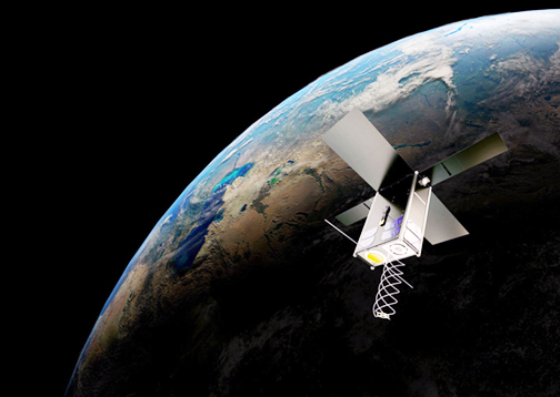
Artistic rendition of a Hiber smallsat on-orbit.

Existing terrestrial networks (such as Lora, NB-IoT or GSM) only work in urban areas, while traditional satellites that provide wider coverage are expensive and power hungry. Hiberband is disrupting global connectivity by empowering individuals and organisations to reliably transmit data (text message size) from the world’s most hard-to-reach places for less than a dollar per month per device with its state of the art end-to-end service. 

With more than 70 customers already signed up, projects on every continent will benefit from Hiberband. Any industry operating in remote and developing areas can use the network, with early adopters being from government, environment, transport & logistics, agriculture and mining. A sample of some of the first uses cases to trial the network include:

– Soil Moisture Monitoring – Monitoring soil moisture levels on farms helps farmers understand whether their crops need water. The sensors developed by Hiber partner Royal Eijkelkamp ensure that farmers make the right irrigation decisions, reducing water waste and increasing crop yields. Hiberband makes this solution globally available.

– Beehive Monitoring – Bees have been facing the threat of extinction for more than fifteen years, and Hiberband’s technology will be instrumental in ensuring successful cultivation and preservation of bee colonies. Bee farmers can monitor the environment inside hives anywhere on the globe using sensors connected via Hiberband, ensuring that the conditions are optimal for bee survival and honey production.

– Crop Monitoring / Post Harvest – Monitoring crops will help farmers across the world reduce food waste and spoiled crops. Centaur Analytics has developed an “Internet-of-Crops™” platform that monitors the condition of harvests all the way from the farm to the consumer. Hiber enables Centaur to provide customers in the US and globally with updates on crop conditions no matter where they are in the world.

Hiber will introduce two networks, Hiberband Direct (a modem + antenna that talks directly to Hiber’s satellites) and a gateway solution, Hiberband Via, which can operate on LoRa (a network widely used for IoT connectivity), Bluetooth or WiFi. Hiber launched its first two satellites from sites in Sriharikota, India and California, USA in November and December, 2018. It will be launching its third and fourth satellites in Q1 2020 also in Sriharikota, India.

Laurens Groenendijk, Managing Director Commercial and co-founder at Hiber (and co-founder of JustEat and Treatwell) said, “We are extremely proud to announce that after only 3 years of hard work, Hiberband is the first network of its kind to become operational on a global scale. We have the team, partners, technology and regulatory building blocks in place to shortly be the industry leader. With full freedom to operate everywhere in the world, we are looking forward to supporting our customers wherever they need to be.” 

Sotiris Bantas, CEO at Centaur Analytics said, “Earth’s growing population combined with climate change is placing enormous stress on the world’s food supply chain. The lack of transparency in the chain is causing about one third of the crops in the world to be wasted before consumption. Together with Hiber, we are now able to effectively monitor crops after harvest globally – no matter the location. This means that Centaur and Hiber together combat food waste and promote sustainability, while at the same time providing new business opportunities for producers, traders, and CPG companies.”

Filed Under: News

  • « Go to Previous Page
  • Page 1
  • Interim pages omitted …
  • Page 332
  • Page 333
  • Page 334
  • Page 335
  • Page 336
  • Interim pages omitted …
  • Page 339
  • Go to Next Page »

Primary Sidebar

WEEKLY NEWSLETTER

Archives

  • May 2026
  • April 2026
  • March 2026
  • February 2026
  • January 2026
  • December 2025
  • November 2025
  • October 2025
  • September 2025
  • August 2025
  • July 2025
  • June 2025
  • May 2025
  • April 2025
  • March 2025
  • February 2025
  • January 2025
  • December 2024
  • November 2024
  • October 2024
  • September 2024
  • August 2024
  • July 2024
  • June 2024
  • May 2024
  • April 2024
  • March 2024
  • February 2024
  • January 2024
  • December 2023
  • November 2023
  • October 2023
  • September 2023
  • August 2023
  • July 2023
  • June 2023
  • May 2023
  • April 2023
  • March 2023
  • February 2023
  • January 2023
  • December 2022
  • November 2022
  • October 2022
  • September 2022
  • August 2022
  • July 2022
  • June 2022
  • May 2022
  • April 2022
  • March 2022
  • February 2022
  • January 2022
  • December 2021
  • November 2021
  • October 2021
  • September 2021
  • August 2021
  • July 2021
  • June 2021
  • May 2021
  • April 2021
  • March 2021
  • February 2021
  • January 2021
  • December 2020
  • November 2020
  • October 2020
  • September 2020
  • August 2020
  • July 2020
  • June 2020
  • May 2020
  • April 2020
  • March 2020
  • February 2020
  • January 2020
  • December 2019
  • November 2019
  • October 2019

© 2019–2026 SatNews

Insert/edit link

Enter the destination URL

Or link to existing content

    No search term specified. Showing recent items. Search or use up and down arrow keys to select an item.
      x
      Sign Up Now!

      Enjoy a free weekly newsletter with recent headlines from the global SmallSat industry.

      Invalid email address
      We promise not to spam you. You can unsubscribe at any time.
      Thanks for subscribing! You will now receive weekly SmallSat News updates.
      We love our advertisers.
      And you will too!

      Please disable Ad Blocker to continue... We promise to keep it unobtrusive.
      We promise not to spam you. You can unsubscribe at any time.
      Invalid email address
      Thanks for subscribing!