• Skip to main content
  • Skip to primary sidebar
  • Home
  • News
  • Featured
  • More News ⌄
    • SatNews
    • SatMagazine
    • MilSatMagazine
  • Events ⌄
    • MilSat Symposium
    • SmallSat Symposium
    • Satellite Innovation
  • Contacts
  • SUBSCRIPTION

SmallSat News

You are here: Home / 2025 / Archives for September 2025

Archives for September 2025

AAC Clyde Space wins strategic order for first phase of ESA-backed satellite swarm mission

September 9, 2025 by editorial

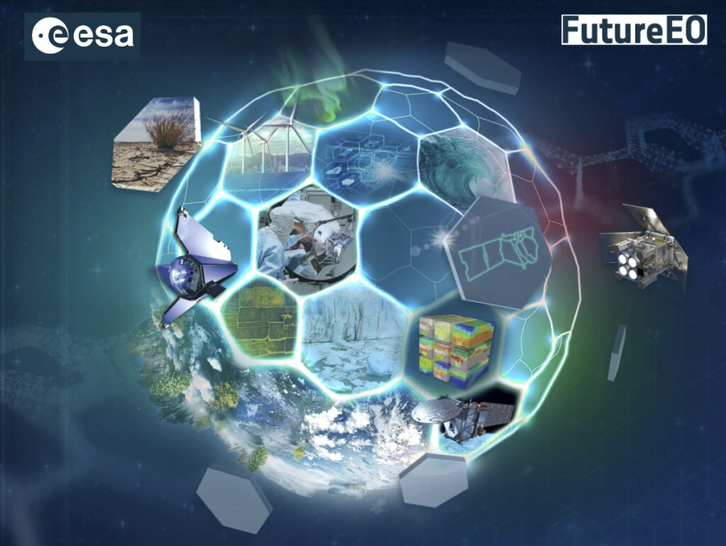
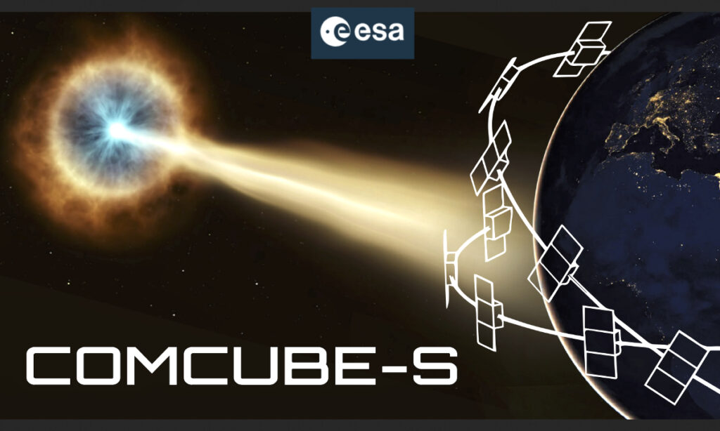
COMCUBE-S is a technical project aiming to develop new capabilities for observing Gamma Ray Bursts (GRB)—short-lived and extremely powerful events in space. By delivering faster and more detailed information about these phenomena, the mission will support scientists in making new discoveries about the nature and origins of GRBs.

This project follows ESA’s established In-Orbit Demonstration process and begins with a so-called Phase A study, which assesses the mission’s technical feasibility.

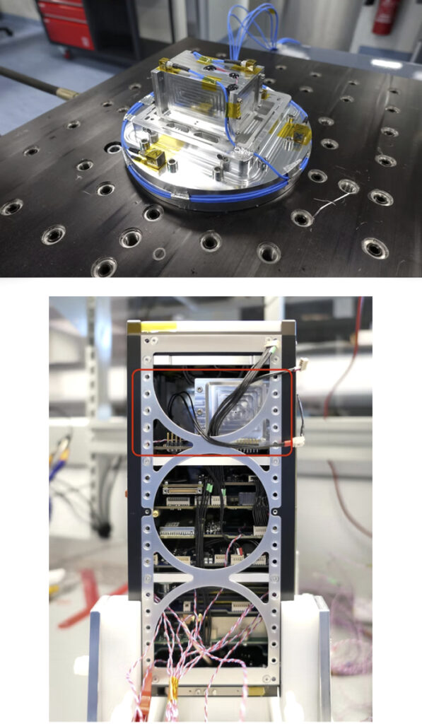
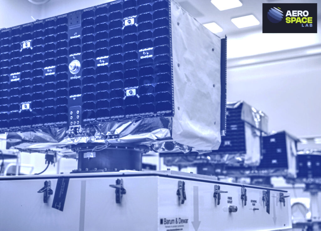
AAC Clyde Space is responsible for the system design in this initial phase, working in close collaboration with the project lead, University College Dublin. A decision on further development is expected at the end of 2025, once the study is completed.

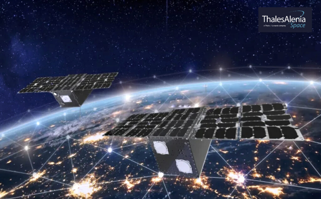
A central element of COMCUBE-S is the use of a satellite swarm: a coordinated network of many small satellites operating together in orbit. The swarm enables rapid, multi-angle observations of short-lived space phenomena and improves the ability to measure polarization, a key property of gamma-ray bursts that can help reveal how these violent events originate.

To achieve sufficient coverage and accuracy, the project ultimately aims to build a constellation as many as 27 satellites.

The assignment strengthens AAC Clyde Space’s position as a supplier of complete satellite missions—from design to operations—in technically advanced projects. It provides an opportunity to apply the company’s own components, systems engineering and methods for constellation development.

Experience gained through the ESA-funded xSPANCION program, in which AAC Clyde Space developed scalable solutions for satellite swarms, will be directly applicable. The work forms part of a broader collaboration with University College Dublin to advance the COMCUBE-S mission. The selection of COMCUBE-S from among seven European finalists in ESA’s SysNova Challenge confirms the strength of the technical concept and the partner constellation.

This project demonstrates how we translate technical expertise into real-world results. COMCUBE-S clearly illustrates our ability to take the lead in missions that combine scientific objectives with the highest technical demands,” said AAC Clyde Space CEO, Luis Gomes.

COMCUBE‑S represents a significant step forward in our ability to study gamma‑ray bursts and unlock new scientific insights into the most energetic events in the universe,” said Prof. Lorraine Hanlon Director at UCD Centre for Space Research.

Filed Under: News

Aechelon + partners Niantic Spatial, ICEYE, BlackSky and Distance debut Project Orbion

September 8, 2025 by editorial

Aechelon Technology has announced ‘Project Orbion,’ together with its partners — a groundbreaking, new initiative that will integrate best-of-class technology solutions to create a live Digital Twin of the Earth.

All of this is complete with accurate physics, real-time weather and more in full Synthetic Reality (SR). Aechelon’s Project Orbion is a living synthesis of real-time satellite imagery, radar intelligence, video photogrammetry and AI all combined with the most accurate rendition of the Earth, reconstructing and distributing our world in dynamic 3D. From monitoring wildfires to floods, from wartime troop movements to shipping routes in peacetime, from urban rescues to remote disasters—Project Orbion helps situational awareness, understanding and safe human decision making.

Synthetic Reality data supplied from Project Orbion is designed to train leading-edge defense and corporate AI models with real-world data -not just human-generated data, but actual ground truth conditions data. It’s where cutting-edge AI is fused into a digital twin of the planet. Project Orbion is capable of penetrating darkness, clouds and smoke to enable users to react to natural disasters and defense-oriented use cases—all with the most up-to-date 3D representation of the world.

Project Orbion partners include..

Niantic Spatial® (San Francisco) for its Large Geospatial Model reconstruction and visualization service

ICEYE® (Helsinki) for space-based imaging radar

BlackSky (Herndon, Virginia) for very high resolution, high-cadence Earth Observation (EO) imagery

Distance Technologies™ (Helsinki) for their Light Field 3D Displays.

A goal of the collaboration is to explore integrating forthcoming versions of Niantic Spatial’s Visual Positioning System (VPS) with Aechelon’s simulation systems. In GPS-denied environments where satellite signals are unavailable or compromised, VPS will allow ground teams to achieve centimeter-level localization and navigation. This capability is critical for complex and time-sensitive search-and-rescue operations.

All of these cutting-edge technologies are being integrated to use Aechelon’s military-grade, Synthetic Reality visualization, AI training and simulation systems.

Aechelon has spent decades creating the most realistic synthetic environments for mission-critical defense training,” said Nacho Sanz-Pastor, Co-Founder and Chief Technology Officer (CEO), Aechelon Technology. “The challenge has always been keeping pace with changes in the physical world and training humans and autonomous systems with realistic worldwide information. Our Skybeam™ product combines several innovative geospatial platforms with our own AI-driven, worldwide multi-sensor baseline to become a powerful new solution. The partnership with Niantic Spatial, ICEYE, BlackSky and Distance will enable Project Orbion (over the next months and years) to address dual-use, mission-critical applications that until now were just in the realm of science fiction.”

By combining our platform to scan, visualize and understand the world with Aechelon’s simulation technology, we can provide emergency and first responders the most accurate understanding of the environments in which they operate,” said Brian McClendon, Niantic Spatial’s Chief Technology Officer (CTO). “Geospatial understanding unlocks a new level of situational awareness that allows teams to plan and execute missions with greater confidence and safety.”

At ICEYE, we design, build and operate the world’s largest group of imaging radar satellites -that allows us to react to anything that happens on the ground, regardless of the conditions and very quickly,” said Pekka Laurila, ICEYE Co-Founder and Chief Strategy Officer (CSO).

Filed Under: News

QinetiQ + Xona increase resilience of GPS using new satellites

September 8, 2025 by editorial

QinetiQ and Xona Space Systems have demonstrated how GPS navigation can be bolstered by using LEO satellites during the first UK tests of Xona’s new satellite navigation system, Pulsar.

This marks a major milestone in the development of next generation Positioning, Navigation and Timing (PNT) capabilities, increasing resilience against jamming and spoofing, as well as improving GPS availability in congested or challenged environments. Satellite in space

The tests witnessed QinetiQ’s Q40 Global Navigation Satellite System (GNSS) receiver, which can already receive signals from multiple GNSS satellite constellations on multiple frequencies, acquire and track signals from Xona’s first, production-class satellite, Pulsar-0. The tests demonstrated that by supplementing GNSS with LEO satellite signals, such as the Pulsar X1, enhanced resilience in contested or poor-signal environments can be achieved.

A recent software upgrade to QinetiQ’s Q40 was developed under the European Space Agencies’ Navigation Innovation and Support Program (NAVISP) in the GNSS Receiver with Advanced Pulsar Enhancement (GRAPE) project.

GRAPE is a collaboration between QinetiQ and Xona, supported by the UK Space Agency and European Space Agency. Its goal is to explore how new LEO-based signals, can be integrated with existing GNSS, to enhance the accuracy and resilience of navigation services for defence, critical infrastructure, and future autonomous applications.

Chris Walker, Managing Director, Mission Systems Division, QinetiQ, said, “For the first time, we have demonstrated how signals from new LEO satellites can be used alongside existing GNSS to give users stronger, more resilient timing and position information. This is a huge step in increasing the protection of our defence, critical infrastructure and future autonomous systems against interference.”

Giorgio Taylor, Director of Business Development, UK & Europe, said, “Our Pulsar constellation is designed to deliver resilience and accuracy at a time when GNSS alone is no longer enough. The demonstration of QinetiQ’s Q40 receiver from our in-orbit signal proves this technology is ready to make a difference to users, from defence to commercial autonomy.”

Filed Under: News

General Atomics + Kepler Communications demo air-to-space optical comms capability

September 8, 2025 by editorial

General Atomics Electromagnetic Systems (GA-EMS) and Kepler Communications US, Inc. have successfully demo’d bi-directional, air-to-space, optical communications between the GA-EMS Optical Communication Terminal (OCT) mounted on an aircraft and a Space Development Agency (SDA) Tranche 0-compatible Kepler satellite in LEO.

The demonstration marks a milestone in advancing SDA’s Proliferated Warfighter Space Architecture, proving the ability to establish secure, high-data-rate connectivity between airborne and space-based assets in challenging operational environments.

GA-EMS designed its OCTs to scale and adapt for multi-domain communications across space, air, land, and sea platforms, as well as across various orbital regimes. GA-EMS mounted its OCT on a 12-inch Laser Airborne Communication turret (LAC-12) developed by General Atomics Aeronautical Systems, Inc. (GA-ASI) Precision Pointing Group for the test.

As part of the company’s expanding SDA-compatible LEO constellation, Kepler’s Pathfinder satellites are designed to demonstrate high-capacity data services and validate advanced communication technologies under mission-critical conditions—bridging the gap between space, air, and ground networks for defense and commercial applications.

This successful space-airborne communication demonstration represents a breakthrough improvement in building a resilient space architecture. Achieving multi-vendor interoperability validates SDA’s leadership in the optical communication arena,” said Gurpartap “GP” Sandhoo, SDA deputy director. “We are grateful for industry’s rapid acceptance of the SDA OCT Standard and their drive to innovate—pushing the boundaries of what is possible for the warfighter today and into the future.”

Our team achieved a proof-of-concept milestone,” said Scott Forney, president of GA-EMS. “The airborne OCT completed pointing, acquisition, tracking, and lock with the Tranche 0-compatible satellite, then transferred data packets to validate uplink and downlink capability. Our OCT is designed to close a communications gap, enabling secure, robust data transfers to support tactical and operational missions.”

This demonstration not just achieved the milestone for SDA-compatible communications across the air and space domains, but very importantly proved the robustness of the SDA standard for communications between OCT’s built by two different companies,” said Gregg Burgess, vice president of GA-EMS’ Space Systems division. “Under a separate SDA contract, GA-EMS designed and built two OCT systems that will fly on two GA-75 spacecraft to support future LEO airborne-to-space demonstrations for Tranche 1. Those spacecraft launch in 2026.”

By pairing Kepler’s on-orbit optical capabilities with GA-EMS’ OCT, we’ve shown what’s possible when space and aviation systems work seamlessly together,” said Robert Conrad, president of Kepler US. “This achievement builds on our milestone of establishing bi-directional space-to-ground communications with Kepler’s SDA Tranche 0-compatible satellites and reinforces how commercial space operators will be partners in delivering secure, high-throughput connectivity for the defense community and the broader commercial sector.”

Filed Under: News

China’s CERES-1 rocket launches new satellites

September 8, 2025 by editorial

CERES-1 launch photo is courtesy of Wang Heng/Xinhua

At 7:39 p.m., Beijing time, the Jiuquan Satellite Launch Center in northwest China China was the location of a CERES-1 carrier rocket liftoff on September 5th.

Photo of the Jiuquan Satellite Launch Center in China

Aboard the rocket were the Kaiyun-1, Yunyao-1 27 and Yuxing-3 08 satellites, all successfully posted to their assigned orbital slots.

  • The Kaiyun-1 incorporates EO and space sensing instruments and its stated purpose is to engage in scientific research.
  • Equipped with a GNSS object recognition instrument, the Yunyao-1 27 will also acquire a variety of data, ranging from temperatures of the atmosphere to measuring ionosphere electron densities.
  • Yuxing-3 08 packs a 5-meter resolution camera aboard and, in addition to EO, will also experiment with temperature adaptive materials.

Filed Under: News

JetBlue selects Amazon’s Project Kuiper for in-flight Wi-FI

September 7, 2025 by editorial

Project Kuiper, Amazon’s LEO satellite network, has a simple mission: deliver fast, reliable connectivity to customers and communities around the world. The service will reach a wide range of customers on the ground as well as residential households to schools, hospitals, businesses, and emergency services—and it will also improve connectivity for planes, ships, and other vehicles traveling beyond the reach of traditional networks.

JetBlue is the first airline with plans to bring Amazon’s satellite internet network to its commercial airline customers. The collaboration will enhance in-flight connectivity, enabling travelers to better stream, scroll, and share while flying JetBlue.

Amazon’s Project Kuiper has now reached more than 100 satellites,
photo of the Kuiper satellite launch, courtesy of SpaceX

JetBlue introduced free high-speed Wi-Fi with its Fly-Fi service in 2013 and will continue offering complimentary connectivity to all customers with the Kuiper-powered system. The demand for in-flight Wi-Fi has increased in recent years as the use of streaming services, social media, and cloud platforms among travelers has climbed.

Unlike traditional GEO satellites that orbit approximately 22,369 miles (36,000 km) above the planet, LEO systems operate at much lower altitudes. In the case of Kuiper, satellites orbit between 367 and 391 miles (590 and 630 km) above Earth, which translates to lower latency and more reliable service for travelers on board. Project Kuiper also represents a step forward for LEO systems serving the aviation industry.

Amazon’s aviation-specific customer terminal is based on Kuiper’s most powerful terminal—a full-duplex, Ka-band phased array antenna that can support download speeds up to 1 Gbps on a single device. With best-in-class downlink and uplink performance, the firm’s aviation antenna will provide substantial bandwidth for streaming and other data-intensive activities.

Beyond JetBlue, Amazon recently signed an agreement with European plane maker Airbus to integrate Project Kuiper’s connectivity solution into their aircraft catalog. As Amazon expands the Kuiper constellation for its commercial launch, this partnership with JetBlue represents a significant step in bringing improved satellite internet to travelers—supporting Amazon’s vision to keep customers on planes connected, no matter where they’re headed.

Amazon’s $140 million site at Kennedy Space Center can support as many as three simultaneous launch campaigns for its satellite internet network. With four rocket launches in four months, Amazon now has more than 100 Kuiper satellites in orbit, and we’re continuing to accelerate our production, processing, and deployment rates. The company’s goal is to begin delivering service to the first customers later this year, and to roll out more widely as coverage and capacity area added to the network.

Our agreement with Project Kuiper marks an exciting leap forward for us as the hands-down leader in onboard connectivity,” said Marty St. George, president of JetBlue. “Whether it’s binge-watching a favorite show, staying connected with loved ones, or wrapping up a work project, we’re always looking for ways to make our customers’ time in the air as connected and productive as they want it to be.”

Staying connected is part of everyday life, even when you’re traveling,” said Panos Panay, senior vice president of Amazon Devices & Services. “With Project Kuiper, we’re working to ensure you have a high-speed connectivity experience wherever you are—at home or 35,000 feet in the air.”

Filed Under: News

One giant leap for Irish spaceflight—EIRSAT-1

September 7, 2025 by editorial

Artistic rendition of EIRSAT-1 courtesy of University College Dublin, Ireland

EIRSAT-1, developed by a team of students and staff at University College Dublin through ESA’s Fly Your Satellite! program, has made history as Ireland’s first satellite.

Technicians at work building a smallsat as part of the Fly Your Satellite program, photo courtesy of ESA

Over more than six years of work, the mission grew from an ambitious proposal into a fully-fledged spaceflight success story – and an educational inspiration. With a long list of successes behind it and its mission accomplished, the CubeSat has now deorbited.

EIRSAT-1 student team at University College Dublin

EIRSAT-1 sent its final beacons on September 4th and burned up on re-entry of Earth’s atmosphere. The deorbiting occurred in line with ESA’s commitment to the sustainable use of space – which includes minimizing space debris and ensuring that missions leave no long-term footprint in orbit. Science in orbit

Launched in December of 2023, EIRSAT-1 carried three payloads that proved to be successful. Worthy of particular note is GMOD, a compact gamma-ray detector that has detected 10 cosmological gamma-ray bursts – some of the universe’s most energetic and distant events – as well as two solar flares. The scientific success marked a leap from Technology Readiness Level 1 all the way to 9, completing the full arc from concept to space-proven system.

GMOD (shown by the red box) in the final flight configuration in the CubeSat. Gamma-ray detectors such as GMOD have been in development by Profs. Lorraine Hanlon and Sheila McBreen of the UCD Space Science group in the School of Physics for more than a decade.

As a final flourish, a software update to another payload, WBC, was uplinked to the spacecraft, enabling experiments with new magnetic control algorithms. These aim to detumble the satellite and stabilise it about a desired axis, which are key capabilities for future missions.

EIRSAT-1 was not just Ireland’s first satellite; it was Ireland’s first space mission. This posed some unusual challenges. With limited space infrastructure, the University College Dublin team worked with over 100 ESA experts, the Irish Department of Enterprise, Trade and Employment, and other government departments and agencies, to ensure all of the technical, legal, and programmatic aspects of the mission met strict international standards.

A Dáil (Irish Parliament) debate was required to pass the necessary legislation to allow EIRSAT-1 become an Irish satellite and listed on the UN register of objects launched into outer space. Navigating this complex environment required innovation, persistence, and a deep commitment from all involved.

Through ESA Education’s Fly Your Satellite! initiative, students were supported every step of the way, from vibration testing to thermal vacuum trials, and from licensing procedures to launch. More than 50 students, including 13 PhD researchers supported by the Irish Research Council, took part in the project. Disciplines ranged from Physics and Mechanical Engineering to Mathematics and Computer Science.

The mission’s legacy continues. In 2024, University College Dublin introduced a new Spacecraft Operations module for their Space Science & Technology MSc, training an additional 20 students to become satellite operators, with some even working directly with EIRSAT-1 in orbit.

EIRSAT-1 also sparked interest across the country as more than 64,000 people watched the live launch broadcast, while 3000 schoolchildren participated in mission-themed educational activities.

EIRSAT-1 alumni have gone on to careers in Irish space companies, which partnered on follow-on projects such as NSSPI, a national satellite systems initiative funded by Ireland’s Disruptive Technologies Innovation Fund. Others have found new paths in data analytics, medical physics, and international space organizations.

The mission also laid the foundations for COMCUBE-S, a next-generation CubeSat, building directly on GMOD’s heritage. Now in Phase A study with ESA, COMCUBE-S aims to implement a more advanced Compton telescope system on multiple spacecraft, capable of not just detecting but localizing high-energy transient events and even performing polarization measurements to better understand their source mechanisms.

Another project, GIFTS (funded by the Research Ireland), further develops the GMOD concept, demonstrating how Ireland’s first satellite is influencing new missions even before it re-entered the atmosphere. A poetic farewell

On it’s slow decent back to Earth EIRSAT-1 was transmitting a final message – drawing on Ireland’s long association with literature. The satellite broadcasted a sequence of seven short messages, each containing a line from a poem called All Ways Home, which was written collaboratively by school pupils from across the country specifically for the EIRSAT-1 mission. Amateur radio operators across the world received and decoded the messages in a fittingly creative and symbolic closure to the mission.

Thanks to EIRSAT-1, Ireland has proven its ability to develop, launch, and operate a spacecraft entirely from within its borders, and is officially a spacefaring nation This milestone was made possible through Ireland’s membership of ESA and their support via ESA Education’s Fly Your Satellite! program, which provided expert guidance, training, and technical resources to the student team at University College Dublin throughout the mission.

With the support of the Irish ESA delegation, along with civil servants across many government departments, but especially the Irish Department of Enterprise, Trade and Employment, EIRSAT-1 stands as a national achievement and a clear example of how ESA’s educational initiatives can inspire the public and empower the next generation of space professionals.

Filed Under: News

Thales Alenia Space selects NanoAvionics for ESA-led urban heat monitoring constellation study

September 7, 2025 by editorial

Kongsberg NanoAvionics (NanoAvionics) has been selected by Thales Alenia Space to join a consortium studying the European Space Agency’s (ESA) FutureEO program mission, SIRIUS (Space Based Infra-Red Imager for Urban Sustainability).

NanoAvionics will contribute its small satellite expertise, including the flight-proven MP42H microsatellite bus and its flight operations segment design, to meet the technical requirements for the SIRIUS mission.

SIRIUS is a next-generation Earth observation mission concept focused on frequent, high-resolution, night-time monitoring of Europe’s urban areas using thermal infrared (TIR). This allows for measuring building, infrastructure, and land surface temperature from space. The study will define the space and ground segment architecture to address challenges such as urban heat islands, urban planning, and the development of effective climate policies.

Led by Thales Alenia Space, the consortium includes EO specialists and scientists from across Europe.

The SIRIUS study is part of ESA’s Scout missions, intended as an agile, fast, and low-cost approach to prove new concepts in Earth observation, with a focus on scientific research.

NanoAvionics has a strong history of successful collaboration with Thales Alenia Space and ESA, having provided our small satellite design, manufacturing, and operations expertise for missions that are already working in orbit,” said Atle Wøllo, CEO of Kongsberg NanoAvionics. “Continuing our collaboration in the SIRIUS mission study to advance urban heat monitoring and sustainable city planning highlights the strength of combining the unique capabilities of small satellites with those of a legacy prime to deliver efficient and impactful solutions.”

Filed Under: News

Aerospacelab secures 94 million euros ($110 million)

September 5, 2025 by editorial

Aerospacelab has closed an extended Series B funding round totaling 94 million euros ($110 million) throughout a dual-tranche funding of 56 million euros ($66 million) alongside a 38 million euros ($44 million) commitment from a European financial institution.

This Series B round has been strategically implemented to align with Aerospacelab’s ambitious industrial roadmap and solidify its position as a major force in the aerospace industry.

This substantial investment has served to propel Aeropacelab’s growth trajectory and fuel its products’ readiness, resulting in a fleet of ready-to-sell satellites to demanding customers active in a variety of industries (e.g. Earth Observation (EO), telecom, etc). Additionally, it has been directed towards the full verticalization of all key subsystems, reinforcing its industrial autonomy and accelerating its product development.

Aerospacelab’s Megafactory, a cornerstone of its industrial strategy, has already benefited from the Series B funding, enabling the company to build one of the most advanced satellite production sites in Europe, with a manufacturing capacity of up to 500 satellites per year.

The capital has also been instrumental in accelerating R&D, attracting top-tier engineering talent, and fully verticalizing subsystems—all of which directly enhance the reliability, performance, and delivery timelines for telecommunications customers and other commercial partners. Construction of the Megafactory began in 2024, with its first satellites’ production expected in 2026 and with a full production capacity to be reached by 2027.

Backed by a strong coalition of investors, including both returning and new partners, this round reflects the market’s growing confidence in Aerospacelab’s mission to drive innovation, speed, and performance through its vertically integrated technology stack.

This Series B is more than just capital — it’s a strong endorsement of our vision to deliver and scale our manufacturing capabilities powering the next generation of constellations”, said Benoît Deper, CEO and Founder of Aerospacelab. “It reinforces our position at a pivotal moment: our products are mature and ready to deploy, our industrial infrastructure is scaling up for mass production, and we are prepared to meet rising global demand with speed and precision. We are ready for what’s next.”

Filed Under: News

GHGSat satellites deployed to monitor methane at scale across ExxonMobil’s onshore operations

September 4, 2025 by editorial

ExxonMobil Corporation and GHGSat are now in a new partnership to monitor and mitigate methane at scale across ExxonMobil’s onshore operations in North America and Asia, including the United States, Canada, Papua New Guinea, and Indonesia.

This collaboration marks a significant investment by ExxonMobil in satellite-based emissions monitoring, reflecting the company’s commitment to reducing methane emissions, deploying innovative technologies, and leading the energy industry in environmental stewardship.

ExxonMobil has a demonstrated track record of industry-leading initiatives to drive methane reduction, cutting emissions intensity by more than 60 percent since 2016 and eliminating routine flaring in Permian Basin-operated assets. By 2030, ExxonMobil is on track to achieve methane reductions of 70 to 80 percent.

Data from the GHGSat platform will feed ExxonMobil’s pioneering Center for Operations and Methane Emissions Tracking (COMET). Launched in 2022, COMET continuously monitors and analyzes methane emissions data from a network of measurement technologies. Today, it’s part of ExxonMobil’s Vantage team – integrated with remote Upstream operations and serves as a model for oil & gas operators seeking to systematically identify and reduce emissions across their operations.

GHGSat’s state-of-the-art satellites, purpose-built to support industrial operators to reduce emissions, pinpoint the source of methane leaks as small as 100 kg/hr, typically down to individual pieces of equipment. With 14 satellites launched since 2016, GHGSat monitors millions of industrial facilities annually, monitoring at a near-continuous cadence to provide the most comprehensive global coverage in the market.

Leveraging an unmatched revisit rate, GHGSat delivers data to operators within hours, empowering them to address emissions swiftly and with confidence. Working hand-in-hand with industry as a trusted partner, GHGSat has supported the mitigation of over 20MT CO2E of methane since beginning operations.

Methane has a warming effect roughly 80 times stronger than carbon dioxide over a 20-year period. Reducing methane emissions is recognized as one of the most immediate and impactful ways to slow planetary warming.

Reducing methane is environmentally responsible and is also economically sound. Keeping methane in the pipeline, rather than the atmosphere, increases yields for oil and gas producers, reducing the financial losses stemming from lost product. Accurate data on methane emissions also safeguards an operator’s ability to export to nations with more stringent regulatory policies on emissions intensity. This increased efficiency creates a competitive edge in today’s rapidly evolving energy sector.

With this partnership, ExxonMobil and GHGSat make a steadfast commitment to reducing methane emissions and ensuring resilient energy systems around the globe.

This partnership demonstrates the power of the intersection of innovative technology and industry leadership to truly move the needle on methane,” said Stephane Germain, GHGSat CEO. “GHGSat is laser focused on designing its satellites to solve operational challenges for operators, providing insights—the exact source of an emission, delivered at a speed that is operationally useful—that enable action. As global demand grows for high-quality emissions data, this collaboration underscores the trust leading companies place in our technology to drive meaningful impact.”

When it comes to reducing methane, ExxonMobil has led from the front, pursuing aggressive reductions across our own operations and sharing best practices across the industry,” said Matt Kolesar, ExxonMobil Chief Environmental Scientist. “To execute our ambitious goals, Exxon is in constant pursuit of innovative technology and partnerships that can drive impact. By leveraging GHGSat’s cutting-edge satellite constellation—and the comprehensive data and insights it delivers—we are able to monitor assets at scale via satellite for the first time, informing mitigation strategy and action.”

Filed Under: News

  • « Go to Previous Page
  • Go to page 1
  • Go to page 2
  • Go to page 3
  • Go to page 4
  • Go to Next Page »

Primary Sidebar

WEEKLY NEWSLETTER

Archives

  • October 2025
  • September 2025
  • August 2025
  • July 2025
  • June 2025
  • May 2025
  • April 2025
  • March 2025
  • February 2025
  • January 2025
  • December 2024
  • November 2024
  • October 2024
  • September 2024
  • August 2024
  • July 2024
  • June 2024
  • May 2024
  • April 2024
  • March 2024
  • February 2024
  • January 2024
  • December 2023
  • November 2023
  • October 2023
  • September 2023
  • August 2023
  • July 2023
  • June 2023
  • May 2023
  • April 2023
  • March 2023
  • February 2023
  • January 2023
  • December 2022
  • November 2022
  • October 2022
  • September 2022
  • August 2022
  • July 2022
  • June 2022
  • May 2022
  • April 2022
  • March 2022
  • February 2022
  • January 2022
  • December 2021
  • November 2021
  • October 2021
  • September 2021
  • August 2021
  • July 2021
  • June 2021
  • May 2021
  • April 2021
  • March 2021
  • February 2021
  • January 2021
  • December 2020
  • November 2020
  • October 2020
  • September 2020
  • August 2020
  • July 2020
  • June 2020
  • May 2020
  • April 2020
  • March 2020
  • February 2020
  • January 2020
  • December 2019
  • November 2019
  • October 2019

© 2019–2025 SatNews

x
Sign Up Now!

Enjoy a free weekly newsletter with recent headlines from the global SmallSat industry.

Invalid email address
We promise not to spam you. You can unsubscribe at any time.
Thanks for subscribing! You will now receive weekly SmallSat News updates.
We love our advertisers.
And you will too!

Please disable Ad Blocker to continue... We promise to keep it unobtrusive.
We promise not to spam you. You can unsubscribe at any time.
Invalid email address
Thanks for subscribing! Please check your email for further instructions.