• Skip to main content
  • Skip to primary sidebar
  • Home
  • News
  • Featured
  • More News ⌄
    • SatNews
    • SatMagazine
    • MilSatMagazine
  • Events ⌄
    • MilSat Symposium
    • SmallSat Symposium
    • Satellite Innovation
  • Contacts
  • SUBSCRIPTION

SmallSat News

You are here: Home / Archives for editorial

editorial

HawkEye 360’s Pathfinder satellite trio to retire — Cluster 11 launch just ahead

October 10, 2024 by editorial

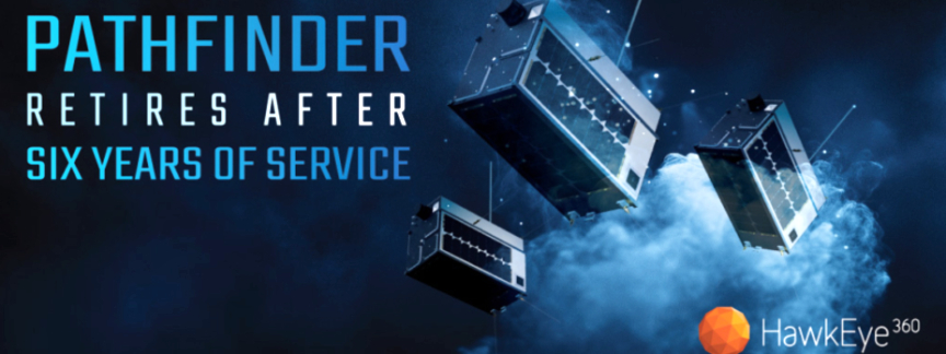
HawkEye 360 has announced the planned decommissioning of the firm’s pioneering Cluster 1 Pathfinder satellites by the end of 2024 — this decommissioning marks the conclusion of the first-generation satellite cluster that transformed the commercial RF industry and laid the foundation for the company’s growth and innovation.

In recognition of the significant achievements made during its service, HawkEye 360 will celebrate the satellites retirement this December, honoring the enduring legacy of the Pathfinder trio.

Launched in December of 2018, the Pathfinder satellites were HawkEye 360’s proof-of-concept mission. Pathfinder demonstrated that a commercial company could reliably provide RF data, a capability previously dominated by the government and classified sectors. Initially designed for a two-year mission, these resilient satellites far exceeded their life expectancy, thanks to the high-quality bus provided by Space Flight Laboratory (SFL). This novel design allowed Pathfinder to continue supporting research and became fully operational, successfully serving critical customer needs and supporting key missions worldwide.

Pathfinder’s success laid a strong foundation for HawkEye 360’s subsequent growth. The innovative approach to hardware development—enhancing antennas, filters, and frequency coverage — allowed the company to advance its capabilities continually. During Pathfinder’s six-year mission, HawkEye 360 validated the commercial viability of RF data collection. It helped expand the HawkEye 360 constellation to 31 satellites, setting new standards for reliability and performance in the industry.

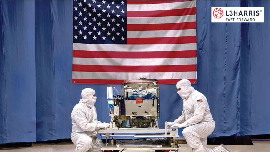
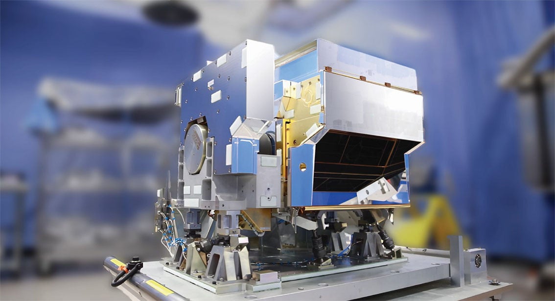
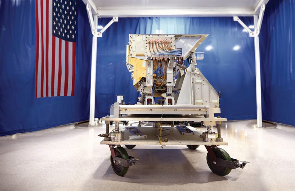
As Pathfinder retires, Cluster 11 will take its place, significantly enhancing the constellation’s capabilities. Scheduled to launch by the end of 2024, Cluster 11 incorporates the latest technology and will operate in a mid-inclination orbit, complementing Clusters 6, 8, and 9 to expand coverage in the high-demand equatorial region.

Featuring a new antenna, the company is actively experimenting with global lower-frequency collection, enhancing the ability to detect and analyze a broader range of RF signals. Notably, this transition will not affect our customers, as our new clusters offer increased capacity to fulfill the mission previously handled by Cluster 1. Cluster 11, the first cluster vibe-tested at HawkEye 360’s Herndon facility, will usher in the company’s new era of advanced technology.

Filed Under: News

BlackSky wins 7 figure contract for advanced SDA Solutions

October 10, 2024 by editorial

BlackSky Technology Inc. (NYSE: BKSY) has won a seven figure contract to deliver non-Earth Imaging (NEI) services to support the customer’s Space Domain Awareness (SDA) capabilities — as part of the contract, BlackSky will integrate Gen-2 satellite imagery of on-orbit spacecraft into the customer’s collection of SDA assets.

Space Situational Awareness (SSA) is vital for identifying, characterizing, and tracking space objects and their operational environment. SSA data is critical for maintaining space safety and facilitating real-time space traffic coordination. The data is used to help space operators predict and avoid collisions between objects or avoid debris from fragmentation events, meteor storms, or other natural events that might also affect operations.

SSA is foundational to all space safety and real time space traffic coordination activities and is a critical component of SDA, which is the ability of decision makers to understand, as completely as necessary, their current and predicted operational environments.

Delivering NEI capabilities gives BlackSky the ability to leverage underutilized capacity typically associated with satellites passing over the ocean or satellites in eclipse, traveling across the dark side of Earth. This enhances BlackSky’s service offering and supports mission success across the realm of space security.

“BlackSky’s expansion into SDA unlocks additional value from our current high-resolution Gen-2 constellation and immediately meets our customer’s demand for NEI solutions,” said Brian O’Toole, BlackSky CEO. “Our continued momentum in the NEI space demonstrates technical agility and a strategic commitment to innovation that provides reliable, practical value to Space Situational Awareness operations.”

Filed Under: News

L3Harris’ 5th CrIS complete + ready for NOAA Weather Satellite integration

October 9, 2024 by editorial

L3Harris’ Cross-track Infrared Sounder (CrIS) is the world’s most advanced hyperspectral sounder and a key sensor that uses advanced infrared technology to measure 3D temperature and moisture from the atmosphere. Image credit: L3Harris Technologies

L3Harris recently reached a significant milestone when it shipped its fifth Cross-track Infrared Sounder (CrIS), a critical component of the National Oceanic and Atmospheric Administration’s (NOAA’s) Joint Polar Satellite System (JPSS). 

Artistic renditions of NOAA’s Joint Polar Satellite System (JPSS)

The instrument captures sophisticated data on Earth’s atmosphere, oceans, and landscape that is used in seasonal, short-and long-term monitoring and forecasting. The CrlS is now ready for future integration onto the final spacecraft in the JPSS constellation.

L3Harris’ Cross-track Infrared System (CrIS)
L3Harris’ Cross-track Infrared Sounder (CrIS). Credit: L3Harris Technologies.

CrIS is the world’s most advanced hyperspectral sounder and a key sensor that uses advanced infrared technology to measure 3D temperature and moisture from the atmosphere. NOAA uses daily measurements from CrIS to enhance its weather prediction model forecasts, including enhanced rainfall predictions and more targeted tracking ability for severe storms including tornadoes and hurricanes.

In addition to measuring temperature atmospheric pressure, CrIS can detect the concentration of greenhouse gases and measuring changes in ocean surface temperatures. It is also used to track long range smoke movement, helping to better predict wildfire impacts across the U.S.

L3Harris’ Cross-track Infrared System (CrIS)
L3Harris’ Cross-track Infrared Sounder (CrIS). Credit: L3Harris Technologies.

L3Harris has provided the CrIS instruments on all of NOAA’s JPSS satellites, the first of which launched in November of 2017. Both JPSS-3 and JPSS-4 are scheduled to launch in the coming years to extend global coverage by these critical LEO assets through 2040.

The L3Harris-built CrIS, which was built at the company’s Ft. Wayne, Indiana, facility and is part of a suite of next-generation weather solutions that include the company’s proven Advanced Baseline Imager (ABI) and Geostationary Operational Environmental Satellite-R (GOES-R) ground heritage, both designed to improve short- and long-range forecast accuracy and severe storm tracking. These solutions include a GeoXO imager and modernized GOES-R ground system for the U.S. as well as imaging and sounding technology for Japan – all awarded as part of the more than $1 billion in weather-related contracts L3Harris received last year.

“This delivery is the culmination of decades of L3Harris dedication to meteorological precision on the JPSS program”, said Rob Mitrevski, L3Harris Vice President and General Manager of Spectral Solutions. “CrIS has improved NOAA’s forecasting models by providing the world’s leading high-resolution, three-dimensional data which elevates the accuracy and promptness of weather predictions. At L3Harris, we continue to leverage our 65-year legacy and deep subject matter expertise while innovating and evolving our sounding technologies to meet critical current and future weather monitoring needs across the world.”

Filed Under: News

Forrester’s Digest: Project Kuiper wants to offer D2D connectivity

October 8, 2024 by editorial

UK telecom regulator Ofcom has published in its consultation documentation that Amazon’s proposed constellation of broadband satellites (‘Project Kuiper’) is developing technical solutions for Direct-to-Device (D2D) cellular connectivity. The Ofcom consultation document is designed to assess future spectrum demand.

Ofcom, in its consultation questionnaire, asked whether Kuiper “had an interest in offering D2D services or expanding an existing service in the UK?” It also asked “Would your D2D service compliment or compete with services delivered over existing mobile?”

The Project Kuiper response said, “Amazon is exploring options for S2D services and is seeking to develop the most versatile technical solutions for S2D offerings. Certainly, the value proposition is for D2D services to compliment the use case of existing terrestrial mobile wireless service because D2D offers service beyond the reach of existing terrestrial mobile networks.”

Kuiper added, “Amazon respectfully urges Ofcom to base new rules for D2D services on the outcome of WRC-27. Any services introduced prior to the next WRC are likely to be limited bandwidth services for messaging. While these services are an important milestone, we expect any D2D service offering 5G experience are likely to come after the [WRC] Conference.”

Filed Under: News

NOVI unveils STORM space-edge computing platform

October 8, 2024 by editorial

Screenshot

NOVI has launched STORM™ (Space-edge Technology for Orbital Real-time Monitoring), a groundbreaking space-edge computing platform that is poised to redefine how satellite data is processed and used in real-time. 

STORM will empower industries, analytics firms, researchers, and developers to tap into satellite-based data directly from orbit, enabling real-time, in-space data processing and analysis. This technology will significantly reduce costs and latency, delivering actionable intelligence faster than ever before, crucial for industries where cost and/or rapid decision-making are important. 

As demand for Earth Observation (EO) data soars, STORM will further allow users to develop, test, and refine edge-processing algorithms on NOVI’s multi-sensor satellites (expected to launch within the next 18 months), transforming real-time, autonomous decision-making on-orbit. 

NOVI invites enterprises and developers to access STORM and collaborate with NOVI on their proposed use-cases. Selected Beta users will play an integral role in shaping this cutting-edge technology and applying it to critical edge-processing tasks within a relevant environment. 

STORM represents a giant leap forward in space-edge computing, with wide-ranging applications in agriculture, defense, energy, environmental monitoring, disaster response, and beyond. By dramatically lowering the cost of space-based intelligence, STORM democratizes access and accelerates the development of transformative applications across industries for enterprises and a diverse marketplace of developer and user communities. 

“STORM enables satellites to process data in real-time without the need to constantly downlink large amounts of raw imagery to Earth, unlocking massive efficiencies for space-sensor usage and autonomy,” said Michael Bartholomeusz, CEO of NOVI. “Our goal is to open access to space-derived intelligence, providing lower costs and latency, which will stimulate the creation of new applications and innovation across multiple sectors.” 

About NOVI 
NOVI is at the forefront of space-edge processing, delivering innovative hardware and AI technologies that are reshaping the future of aerospace and satellite operations. With flight-proven edge-processing hardware delivered for testing on the ISS, and upcoming Transporter launches featuring its second-generation edge processor built on AMD Versal architecture, NOVI is set to revolutionize the collection and widespread proliferation of EO intelligence

Filed Under: News

ICEYE announces new imaging mode — Dwell Precise — that provides 25 cm resolution

October 7, 2024 by editorial

ICEYE has introduced Dwell Precise, a new imaging mode that adds advanced capability to ICEYE’s line of Dwell products and builds on the release of Dwell Fine that occurred in March of 2024.

Dwell Precise provides a 25 centimeter resolution and is based on the 1200 MHz radar bandwidth announced earlier this year. 1200 MHz is currently the maximum that commercial satellites are allowed to use.

ICEYE’s Dwell Precise uniqueness comes from the combination of high-quality data with high resolution, and it will make a difference when the identification of smaller objects or targets is required, e.g. types of vehicles and types of military equipment, without the need for additional intelligence sources.

As a SAR satellite orbits the Earth its radar signals focus on a specific area of the planet’s surface to create an image based on return data. Like other modes in the Dwell product line, Dwell Precise data are taken from a much more comprehensive range of angles, allowing it to spot objects through tree cover and foliage. 

ICEYE owns and operates the world’s largest constellation of SAR satellites. The company first introduced Dwell mode in May of 2023, and with the introduction of Dwell Fine in March of 2024 and the launch of Dwell Precise, ICEYE further underlines its commitment to constant innovation in serving private and public sector organizations globally with the most advanced commercial Earth Observation (EO) capabilities and SAR satellite data. 

John Cartwright, ICEYE’s SVP and Head of Data Product, said, “Dwell Precise will be the industry’s highest fidelity 25 cm product. Dwell Precise represents the culmination of the industry’s best imaging capabilities and adds significant depth to our line of Dwell products. The increased resolution will allow ICEYE’s customers to identify objects and features on the earth’s surface with far greater clarity than was available previously, all while benefiting from the day/night all-weather imaging capabilities of SAR.” 

“The launch of Dwell Precise highlights ICEYE’s commitment to meeting the evolving mission sets of our customers through constant innovation and identification of ways to improve our products and services,” said Eric Jensen, CEO of ICEYE US.

Filed Under: News

Kepler enters Space Act Agreement with NASA’s Communications Services Project

October 7, 2024 by editorial

Screenshot

Kepler Communications US Inc., a subsidiary of Kepler Communications, is partnering with NASA to exchange information and explore demonstration opportunities through a non-reimbursable Space Act Agreement under the agency’s Communications Services Project (CSP).

This agreement will provide NASA insights into Kepler’s space data-relay capabilities, which complement the set of existing funded Space Act Agreements under CSP. Kepler will collaborate with NASA on current and future on-orbit capabilities that provide meaningful demonstrations of key NASA mission use cases.

Additionally, the demonstrations will provide valuable feedback to Kepler as the company launches its space data relay network. The Kepler Network provides customers with always-available coverage in LEO with sub-second end-to-end latency, gigabit throughputs, and onboard processing to enable access to space-generated data in near-real time.

NASA’s CSP was created to transition near-Earth missions from government to commercially owned space-relay communication networks. The project plans to deliver operational services to the Near Space Network by 2031.

“The hybrid architecture of our optical pathfinder satellites could provide many space-relay demonstration opportunities for NASA,” said Robert Conrad, Vice President of Business Development for Kepler Communications US. “Kepler is well-positioned to support NASA as they explore options to transition to commercially owned and operated communications systems.”

Filed Under: News

AAC Clyde Space completes acquisition of Spacemetric AB

October 6, 2024 by editorial

In connection with closing, the board of directors in AAC Clyde Space, with support from the authorization granted at the annual general meeting held on May 23, 2024, resolved to issue 188,000 shares and 106,800 warrants to the current shareholders in Spacemetric, entailing a total increase of AAC Clyde Space’s share capital with 589,600 Swedish Krona, provided that all earn-out milestones are fulfilled and that the warrants are exercised for subscription of shares.

The consideration shares received as payment on closing are subject lock-up undertakings, whereby one third of the shares are subject to a lock-up for 360 days, one third of the shares are subject to a lock-up for 630 days and one third of the shares are subject to a lock-up for 810 days. Shares issued by exercise of the warrants will be subject to a lock-up for 360 days.

Luís Gomes, AAC Clyde Space CEO said, “I would like to welcome our new colleagues from Spacemetric to the AAC Clyde Space group. Their expertise will be invaluable in the expansion of our Earth Observation operations, both for our own Data & Services offerings and for our EO satellite customers, to whom we can now offer the complete solution to process and manage imaging data together with their satellite. Together we will make it easier for user to access the Earth Observation data that they need.”

Filed Under: Featured, News

AAC Clyde Space wins Starbuck order

October 6, 2024 by editorial

AAC Clyde Space has won a EUR 0.5 million euros (approx. SEK 5.8 M) order for a Starbuck power system and related services — the company expects to have completed delivery of this order during the third quarter of 2025.

The client, a repeat customer for the Group, has opted to remain unnamed.

“Our Starbuck power systems have become a standard for small satellites, illustrating the strength of our strategy to standardize components for this category of satellites. It enables both us and our clients a robust and efficient process when selecting key components for different missions,” said AAC Clyde Space CEO, Luis Gomes.

Filed Under: News

Sidus Space announces LizzieSat™-2 is ready for launch

October 3, 2024 by editorial

Artistic rendition of LizzieSat™ on-orbit, courtesy of Sidus Space.

Sidus Space (NASDAQ: SIDU) has successfully completed a critical milestone: the environmental testing of LizzieSat™-2 (LS-2) — this key achievement comes as the Company prepares for the upcoming launch, which is planned to carry LS-2 into LEO later this year.

The environmental testing, conducted by Element U.S. Space & Defense in Orlando, subjected the fully integrated LS-2 satellite to comprehensive random vibration tests, simulating launch conditions and verifying its structural integrity. These tests confirmed that LS-2 and its instruments can withstand more than three times the maximum predicted launch environment while maintaining full functionality in orbit.

Carol Craig, CEO of Sidus Space said, “The completion of environmental testing represents a crucial milestone for Sidus Space as we move towards the launch of LizzieSat™-2. This testing validates that our satellite can withstand the rigorous conditions of launch and space. I commend our team for their diligent efforts in refining our processes based on insights from our inaugural LizzieSat™ mission in March. We are focused on the upcoming launch and the expansion of our LizzieSat™ offerings, which will be a key driver of our growth strategy.”

“LizzieSat™-1, which has now been in orbit for over 200 days since launching in March, is performing well,” said John Curry, Chief Mission Operations Officer. “Not all companies are fortunate to celebrate first-launch success.  The Sidus team worked tirelessly to gather insights and lessons from LS-1, enabling us to swiftly implement enhancements for LS-2 to not only address increasing customer demands but expand data collection capabilities.”

Filed Under: News

  • « Go to Previous Page
  • Page 1
  • Interim pages omitted …
  • Page 51
  • Page 52
  • Page 53
  • Page 54
  • Page 55
  • Interim pages omitted …
  • Page 338
  • Go to Next Page »

Primary Sidebar

WEEKLY NEWSLETTER

Archives

  • July 2026
  • June 2026
  • May 2026
  • April 2026
  • March 2026
  • February 2026
  • January 2026
  • December 2025
  • November 2025
  • October 2025
  • September 2025
  • August 2025
  • July 2025
  • June 2025
  • May 2025
  • April 2025
  • March 2025
  • February 2025
  • January 2025
  • December 2024
  • November 2024
  • October 2024
  • September 2024
  • August 2024
  • July 2024
  • June 2024
  • May 2024
  • April 2024
  • March 2024
  • February 2024
  • January 2024
  • December 2023
  • November 2023
  • October 2023
  • September 2023
  • August 2023
  • July 2023
  • June 2023
  • May 2023
  • April 2023
  • March 2023
  • February 2023
  • January 2023
  • December 2022
  • November 2022
  • October 2022
  • September 2022
  • August 2022
  • July 2022
  • June 2022
  • May 2022
  • April 2022
  • March 2022
  • February 2022
  • January 2022
  • December 2021
  • November 2021
  • October 2021
  • September 2021
  • August 2021
  • July 2021
  • June 2021
  • May 2021
  • April 2021
  • March 2021
  • February 2021
  • January 2021
  • December 2020
  • November 2020
  • October 2020
  • September 2020
  • August 2020
  • July 2020
  • June 2020
  • May 2020
  • April 2020
  • March 2020
  • February 2020
  • January 2020
  • December 2019
  • November 2019
  • October 2019

© 2019–2026 SatNews

Insert/edit link

Enter the destination URL

Or link to existing content

    No search term specified. Showing recent items. Search or use up and down arrow keys to select an item.
      x
      Sign Up Now!

      Enjoy a free weekly newsletter with recent headlines from the global SmallSat industry.

      Invalid email address
      We promise not to spam you. You can unsubscribe at any time.
      Thanks for subscribing! You will now receive weekly SmallSat News updates.
      We love our advertisers.
      And you will too!

      Please disable Ad Blocker to continue... We promise to keep it unobtrusive.
      We promise not to spam you. You can unsubscribe at any time.
      Invalid email address
      Thanks for subscribing!