• Skip to main content
  • Skip to primary sidebar
  • Home
  • News
  • Featured
  • More News ⌄
    • SatNews
    • SatMagazine
    • MilSatMagazine
  • Events ⌄
    • MilSat Symposium
    • SmallSat Symposium
    • Satellite Innovation
  • Contacts
  • SUBSCRIPTION

SmallSat News

You are here: Home / 2020 / Archives for October 2020

Archives for October 2020

October 28, 2020 by editorial

An employee at Tyvak International in Turin, Italy, inspects the computing and camera assembly of the FSSCat/Phi-sat-1 satellite. Intel’s Myriad 2 Vision Processing Unit brings onboard artificial intelligence to the system built by Ubotica Technologies and paired with a hyperspectral-thermal camera from cosine measurement systems. (Credit: Tim Herman/Intel Corporation)

Artificial intelligence (AI) is certainly the ‘flavor of the month’ and has become a part of our daily lives. However, there is one area that, until now, hasn’t been involved in AI…

As ubiquitous as artificial intelligence has become in modern life — from boosting the understanding of the cosmos to surfacing entertaining videos on a phone — AI hasn’t yet found its way into orbit.

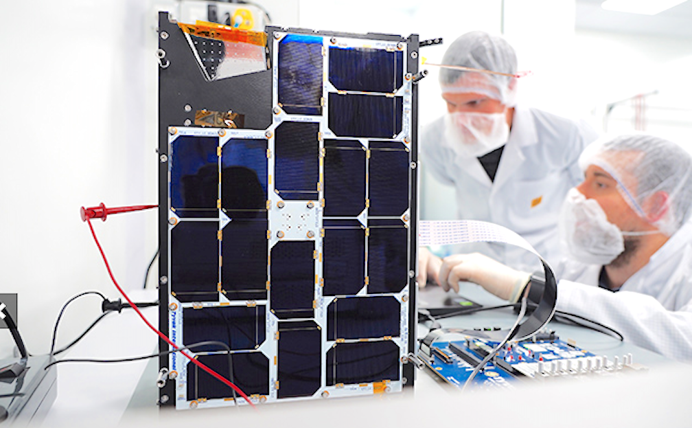
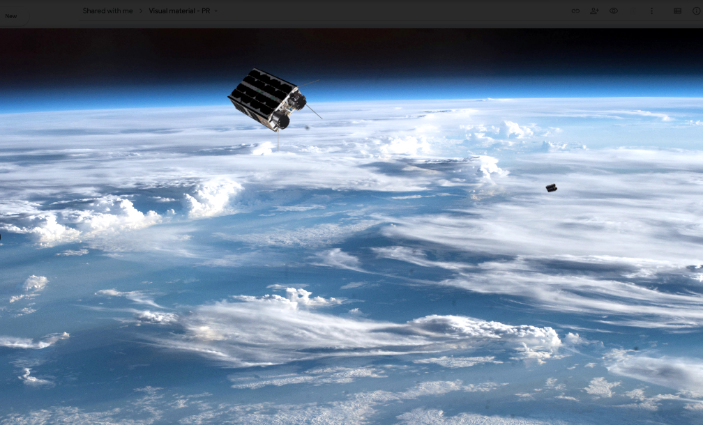
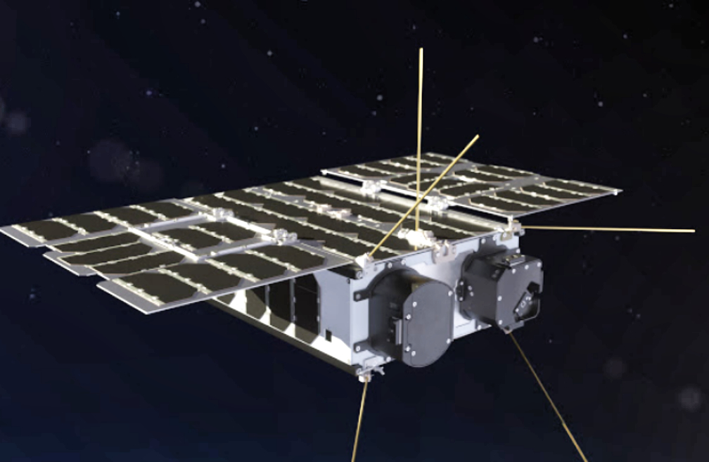
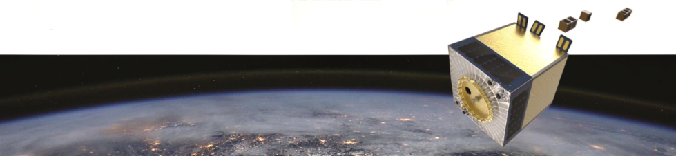
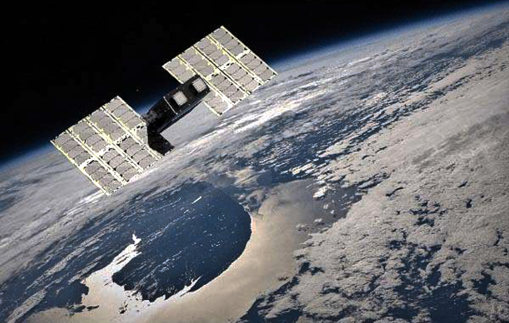
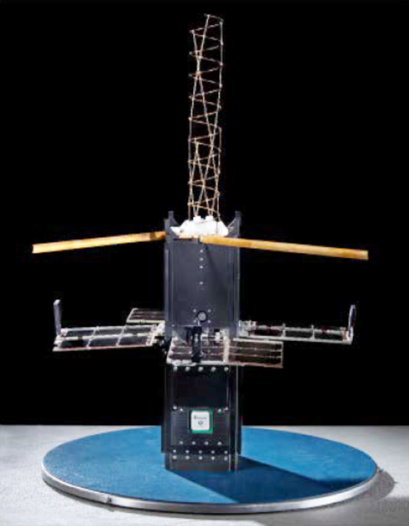
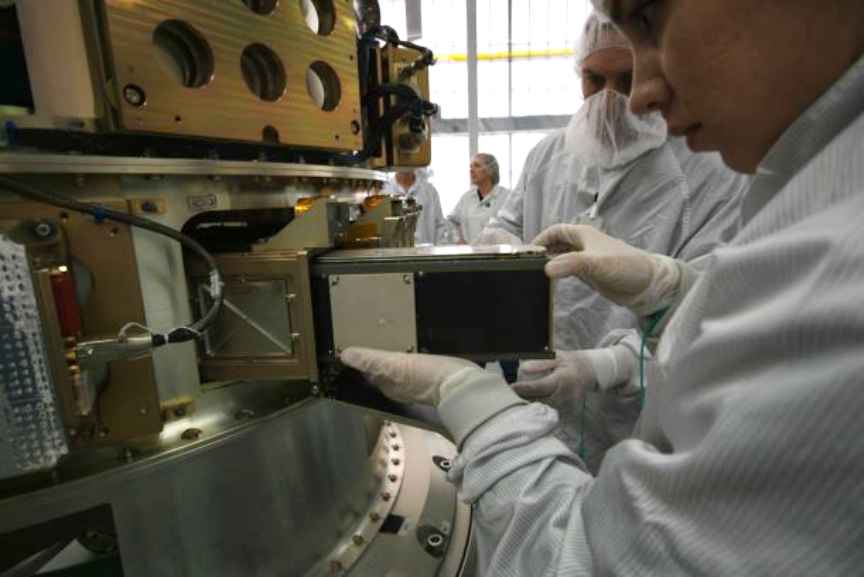
That is until September 2, when an experimental satellite about the size of a cereal box was ejected from a rocket’s dispenser along with 45 other similarly small satellites. The satellite, named PhiSat-1, is now soaring at over 17,000 mph (27,500 kmh) in sun-synchronous orbit about 329 miles (530 km) overhead.

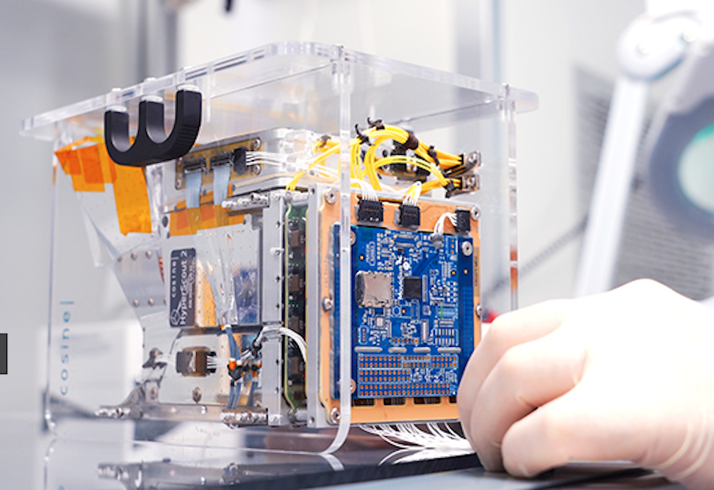
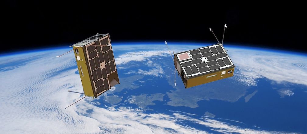
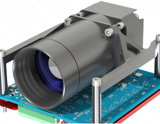
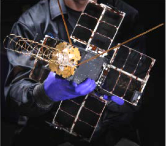
PhiSat-1 contains a new hyperspectral-thermal camera and onboard AI processing from an Intel® Movidius™ Myriad™ 2 Vision Processing Unit (VPU) — the same chip inside many smart cameras and even a $99 selfie taken by a drone on Earth. PhiSat-1 is one of a pair of satellites on a mission to monitor polar ice and soil moisture, while also testing intersatellite communication systems in order to create a future network of federated satellites.

The first challenge that the Myriad 2 is helping to solve is, how to handle the large amount of data generated by high-fidelity cameras like, similar to the one on PhiSat-1. “The capability that sensors have to produce data increases by a factor of 100 every generation, while our capabilities to download data are increasing, but only by a factor of three, four, five per generation,” says Gianluca Furano, data systems and onboard computing lead at the European Space Agency, which led the collaborative effort behind PhiSat-1.

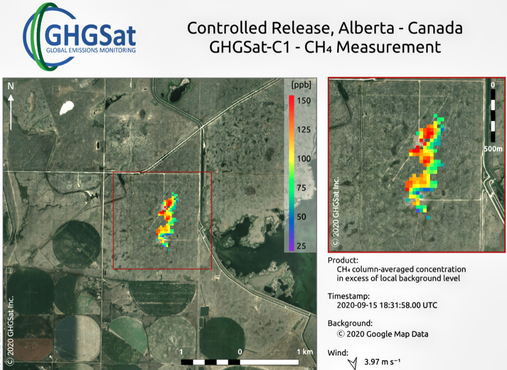
At the same time, about two-thirds of the planet’s surface is covered in clouds at any given time. That means a whole lot of useless images of clouds are typically captured, saved, sent over precious down-link bandwidth to Earth, saved again, reviewed by a scientist (or an algorithm) on a computer hours or days later — only to be deleted.

“And artificial intelligence at the edge came to rescue us, the cavalry in the Western movie,” says Furano. The idea the team rallied around was to use onboard processing to identify and discard cloudy images — thus saving about 30 percent of bandwidth.

“Space is the ultimate edge,” says Aubrey Dunne, chief technology officer of Ubotica. The Irish startup built and tested PhiSat-1’s AI technology, working in close partnership with cosine, maker of the camera, in addition to the University of Pisa and Sinergise to develop the complete solution. “The Myriad was absolutely designed from the ground up to have an impressive compute capability but in a very low power envelope, and that really suits space applications.”

The Myriad 2, however, was not intended for orbit. Spacecraft computers typically use very specialized “radiation-hardened” chips that can be “up to two decades behind state-of-the-art commercial technology,” explains Dunne. And AI has not been on the menu.

Dunne and the Ubotica team performed “radiation characterization,” putting the Myriad chip through a series of tests to determine how to handle any resulting errors or wear-and-tear.

Recreation of the two CubeSats, named ³Cat-5/A and ³Cat-5/B, orbiting the Earth to carry out the FSSCat mission.

ESA “had never tested a chip of this complexity for radiation,” says Furano. “We were doubtful we could test it properly … we had to write the handbook on how to perform a comprehensive test and characterization for this chip from scratch.”

The first test, 36 straight hours of radiation-beam blasting at CERN in late 2018, “was a very high pressure situation,” Dunne says. But that test and two follow-ups “luckily turned out well for us.” The Myriad 2 passed in off-the-shelf form, no modifications needed.

This low-power, high-performance computer vision chip was ready to venture beyond Earth’s atmosphere, however, then there was another challenge.

Typically, AI algorithms are built, or “trained,” using large quantities of data to “learn” — in this case, what’s a cloud and not a cloud. But given the camera was so new, “we didn’t have any data,” says Furano. “We had to train our application on synthetic data extracted from existing missions.”

All this system and software integration and testing, with involvement of a half-dozen different organizations across Europe, took four months to complete. “We were very proud to be able to be so quick and so efficiently flexible, to put everything on board in such a short time,” says Max Pastena, PhiSat officer at ESA. As far as spacecraft development goes, the timeline “is a miracle,” adds Furano.

“Intel has given us background support on the Myriad device when we’ve needed it, to enable PhiSat-1’s AI using our CVAI Technology,” says Dunne. “That’s very much appreciated.”

Unfortunately, a series of unrelated events — delays with the rocket, the coronavirus pandemic and unfriendly summer winds — meant the teams had to wait more than a year to find out if PhiSat-1 would function in orbit as planned.

The September 2 launch from French Guiana — a first-of-its-kind satellite ride-share run by Arianespace — went fast and flawlessly. For the initial verification, the satellite saved all images and recorded its AI cloud detection decision for each, so the team on the ground could verify that its implanted brain was behaving as expected.

After a three-week deep breath, Pastena was able to proclaim,“We have just entered the history of space.”

ESA announced the joint team was “happy to reveal the first-ever hardware-accelerated AI inference of Earth observation images on an in-orbit satellite.”

By only sending useful pixels, the satellite will now “improve bandwidth utilization and significantly reduce aggregated downlink costs” — not to mention saving scientists’ time on the ground.

Looking forward, the usages for low-cost, AI-enhanced very small satellites are innumerable — particularly when you add the ability to run multiple applications.

“Rather than having dedicated hardware in a satellite that does one thing, it’s possible to switch networks in and out,” says Jonathan Byrne, head of the Intel Movidius technology office. Dunne calls this “satellite-as-a-service.”

Consider, that when flying over areas prone to wildfire, a satellite can spot fires and notify local responders in minutes rather than hours. Over oceans, which are typically ignored, a satellite can spot rogue ships or environmental accidents. Over forests and farms, a satellite can track soil moisture and the growth of crops. Over ice, it can track thickness and melting ponds to help monitor climate change.

Many of these possibilities will soon be tested. ESA and Ubotica are working together on PhiSat-2, which will carry another Myriad 2 into orbit. PhiSat-2 will be “capable of running AI apps that can be developed, easily installed, validated and operated on the spacecraft during their flight using a simple user interface.”

For Intel, the potential impact is unquestionable. As Pastena puts it, we can eventually understand “the pulse of our planet.”

https://smallsatnews.com/2020/10/28/3560/

Filed Under: News

Momentus To Fly A Gran Systems Smallsat In December

October 27, 2020 by editorial

Momentus Inc. and Gran Systems have signed a service agreement for Gran System’s 2U CubeSat NUTSAT to fly on Momentus’ December 2020 Vigoride demo mission.

The 2U NUTSAT was designed by the National Formosa University with the backing of the National Space Organization (NSPO) in Taiwan. One of the three NSPO cubesats launching this year, NUTSAT is a systems engineering training education program integrating an ADS-B receiver onto the cubesat to demonstrate and enhance commercial aviation safety technology. NUTSAT is the first of the three cubesats to go for the launch integration.

Executive Comments

“We are pleased that Momentus will accommodate NUTSAT,” said Kaung-Han Ke, CEO of Gran Systems. “NUTSAT was shipped and delivered to Momentus the same hour that Momentus made a big announcement which upped their profile in investor relations, and we are very happy to be onboard.”

Mikhail Kokorich

“This is the first NSPO cubesat mission that Momentus will support,” said Mikhail Kokorich, CEO of Momentus. “We are thrilled to be expanding business opportunities and growing with the Taiwanese new space sector where our technology is uniquely positioned.”

Filed Under: News

SpaceX Launches Another 60 Starlink Satellites and Celebrates a Falcon’s 100th Flight

October 24, 2020 by editorial

A launch delay on Thursday due to a small technical issue was corrected enabling today’s successful launch on Saturday, October 24, at 11:31 a.m. EDT, 11:31 UTC launch of SpaceX’s 60 Starlink satellites. The launch to orbit took place from Space Launch Complex 40 (SLC-40) at Cape Canaveral Air Force Station in Florida. The rocket launched at 11:31 a.m. during the instantaneous window, in which SpaceX did not have a longer timeframe to wait out possible weather violations. This mission also marked the 100th successful flight of a Falcon rocket since Falcon 1 first flew to orbit in 2008.

Falcon 9’s first stage previously supported the GPS III Space Vehicle 03 mission in June 2020 and a Starlink mission in September 2020. Following stage separation, SpaceX landed Falcon 9’s first stage on the “Just Read the Instructions” droneship, which was stationed in the Atlantic Ocean. The Starlink satellites deployed approximately 1 hour and 3 minutes after liftoff.

On Thursday, SpaceX CEO Elon Musk said in a tweet that the team reported “a small-seeming issue with loss of upper stage camera,” referring to the rocket’s second stage. “Probably nothing serious, but standing down to re-examine (the) whole vehicle just in case.”

Leading up to Saturday’s launch, SpaceX lead manufacturing engineer Jessica Anderson said the issue was resolved and the rocket was healthy.

SpaceX landed the booster about eight minutes after launch on the droneship called Just Read the Instruction already waiting in the Atlantic Ocean, marking the third flight for this rocket first-stage. SpaceX wasn’t attempting to catch the fairings for this launch but will retrieve them after they land in the water.

Filed Under: News

NanoAvionics Reveals Remaining Three Payloads For Their Upcoming Rideshare Mission

October 23, 2020 by editorial

NanoAvionics has revealed the remaining three payloads of the firm’s ‘D-2/AtlaCom-1’ rideshare mission hosted on board their M6P 6U smallsat bus.

The additional payloads, a camera for hyperspectral remote sensing, a new high-gain X-band antenna and an upgraded X-Band downlink transmitter, are all part of an international collaboration by an international consortium and its partners called “HyperActive”.

NanoAvionics 6U cubesat.

The consortium partners for this international collaboration comprise Dragonfly Aerospace (South Africa), Space JLTZ (Mexico) and NanoAvionics US as a supplier to the consortium, as well as mission contributors Polytechnical University of Atlacomulco (Mexico), and CubeCom (South Africa).

Expected to launch in mid-2021, the primary aim of the HyperActive program is a flight demonstration of the hyperspectral imaging and communication payloads. The secondary aim is to evaluate market interest for hyperspectral imaging data captured and processed as part of the program.

Dragonfly Mantis smallsat.

Within this collaboration, NanoAvionics will act as the supplier to the HyperActive consortium, taking care of all aspects related to the satellite mission including among others payload integration, performance testing, spacecraft registration and logistics, frequency allocation and payload on-orbit operations.

Responsible for processing the collected hyperspectral data and distributing it to interested parties around the world is Space JLTZ, a space company from Puebla, Mexico. The generated data can be used to develop innovation solutions and optimize various industries such as agriculture yield, mining, livestock, detection of changes in vegetation, pollutants and urban changes including monitoring of vehicles.

For example, a hyperspectral sensor can ‘see’ the spectral signature of an invasive disease threatening an entire harvest, allowing farmers to take preventive steps. Initially, the data will be openly available to all interested parties worldwide, including the Polytechnical University of Atlacomulco, which will allow its students to explore and discover possible applications.

Executive Comments

F. Brent Abbott

“This program shows how important international collaboration can be to the NewSpace sector and how it enables low barrier entry for space data businesses,” said F. Brent Abbott, CEO of NanoAvionics US. “I’m very proud that NanoAvionics is part of this effort as well as stimulating education development and contributing to global social benefits such as ocean and agricultural monitoring. NanoAvionics also values its role as a strategic ally for space development in Mexico. Mexico’s participation in the AtlaCom-1 project is possible thanks to the support of Space JLTZ, its extraordinary team and its visionary CEO and president, José Luis Terreros Corrales, The long-term vision and the efforts around AtlaCom-1 by the Mexican Space Agency, and especially the exemplary support of the Municipality of Atlacomulco of Mexico and its space enthusiastic Mayor and engineer, Roberto Tellez Monroy, this team is making history and have laid the ground work to establish a nanosatellite infrastructure for future space missions in Mexico.”

Bryan Dean

“The team at Dragonfly Aerospace is excited to be working with these great partners on this mission,” said Bryan Dean, CEO of Dragonfly Aerospace. “It fits very well with our plans to team up with leading satellite bus and image processing partners to provide compelling solutions to end users. The Mantis imager is the latest addition to our range of cost-effective hyperspectral imagers which also includes the Chameleon imager that we delivered for flight earlier this year.”

José Luis Terreros Corrales

José Luis Terreros Corrales, CEO and President of Space JLTZ, said, “It is a well-known truth that space exploration is the next step for humankind. Speaking as president of Space JLTZ but mostly as a Mexican I couldn’t be more excited and prouder of launching this project and sending Mexico onto a space path. We know this alliance with two giants, NanoAvionics and Dragonfly, is only the beginning of a great partnership that will change the course of the space industry in Mexico.”

NanoAvionics satellite in space.

Filed Under: News

Axelspace Delivers Business Continuity Plan Using Satellite Data

October 23, 2020 by editorial

Axelspace Corporation has launched their business continuity plan (BCP) support service to conduct timely situational analysis in response to accidents and natural disasters, using satellite imagery data.

In preparation for occurrence of incidents, including unexpected events and accidents, BCP support service will periodically monitor the designated areas by capturing with satellite imagery data. It allows to take immediate control of the crisis situation, verify the situation of target assets and the surrounding environment in a confidential manner, by conducting emergency capturing based on predetermined terms.

In addition, monitoring of the current situation and verification of the surrounding environment during the recovery phase is made possible, without going to the actual location, because of periodic monitoring prior to the occurrence of the incident.

In many cases, situational analysis is conducted in an unplanned approach as the crisis unfolds, leading to difficulty in conducting verification, especially in areas restricted to enter. On the other hand, the conventional satellite imagery data takes time to arrange for the capture and has the issue of high cost for emergency capturing order.

With this BCP support service, the plan starts as low as US$500/month to capture every three months during the normal times and in times of crisis, will automatically capture, deliver the data and in addition, can provide data analysis service based on the client’s needs.

Compared to putting a new order request at the time of incident occurrence, the BCP support service plan has a huge advantage on ease of ordering, handling speed and cost, although there will be a separate emergency handling service cost.

Reach out for details, as the emergency handling cost will be different, based on the kind of service required at the time of crisis and the latency requirements upon the occurrence of the incidents.

In delivering the BCP support service, Axelspace will mainly be using AxelGlobe, the company’s proprietary rapid Earth observation monitoring platform, currently in development.

The first GRUS, the satellite used for AxelGlobe, was launched in December 2018 and in service already. 4 additional satellites will be launched soon, making it a 5-satellite system, allowing to monitor anywhere in the world every 3 days.

Filed Under: Featured, News

SpaceX Ready to Launch 60 More Starlinks

October 22, 2020 by editorial

Yet another SpaceX Starlink mission is planned targeting Thursday, October 22 at 12:14 p.m. EDT, 16:14 UTC, for its fifteenth Starlink mission, which will launch 60 Starlink satellites to orbit. Falcon 9 will lift off from Space Launch Complex 40 (SLC-40) at Cape Canaveral Air Force Station. There is a backup opportunity available on Friday, October 23 at 11:53 a.m. EDT, 15:53 UTC.

Falcon 9’s first stage previously supported the GPS III Space Vehicle 03 mission in June 2020 and a Starlink mission in September 2020. Following stage separation, SpaceX will land Falcon 9’s first stage on the “Just Read the Instructions” droneship, which will be stationed in the Atlantic Ocean. You can watch the launch webcast live starting about 15 minutes before liftoff.  

Earlier this week, Ector County Independent School District in Texas announced their participation in a pilot program to help local students and their families access high-speed, low-latency internet. Similar to other rural communities, many residents of Ector County have limited to no connectivity.

This issue was brought to the forefront for the school district earlier this year when COVID-19 forced school building closures and nearly two in five students did not have access to reliable high-speed internet at home. Starting in 2021, Starlink will connect up to 45 households in the community as part of the pilot program. As network capabilities continue to grow, it will then expand service to an additional 90 households in the school district.

Filed Under: News

D-Orbit Secures 15M Euros Of Financing

October 22, 2020 by editorial

D-Orbit secured 15 million euros financing from the European Investment Bank (EIB) in September, marking the first time that the EIB has funded a space firm — the funds will advance the expansion of the company, whose goal is to redefine the standards of the orbital transportation industry.

In March, the company had already secured a funding round of more than $10 million led by the Italian Neva F.I.R.S.T., Intesa Sanpaolo’s Corporate Venture Capital investment vehicle managed by Neva SGR, and some new and existing investors. Among the new investors are 808 Ventures, an Australian tech investor, the US-based View Different, Savim and two Italian private investment vehicles Geostazionaria and ClubDealOnline (contributing about $3 million).

Existing investors, such as Seraphim Capital, Noosphere Ventures, Elysia Capital, CDP Venture Capital Sgr., Nova Capital and TT Venture, also reaffirmed their commitment and trust in the company by incrementing their initial investments.

D-Orbit recently launched their ION Satellite Carrier, a satellite platform developed and operated in house that is able to host several satellites and deploy them in their precise operational slot in one or more orbits and the firm is completing the ground testing campaign of a new satellite carrier destined for a second, fully booked ION mission.

Executive Comment

Luca Rossettini

“We are truly grateful to all our shareholders, those who have just joined our Company and those who have believed in us from the very beginning, like Indaco SGR, Comoventures, and Il Club degli Investitori,” said Luca Rossettini, Founder and CEO of D-Orbit. “Their trust and support have enabled us to carry on with our roadmap through these extraordinary times reaching exceptional objectives.”

Filed Under: Featured, News

Mynaric Selected By Telesat For Their CONDOR Optical Terminals For DARPA’s Blackjack Track B Program

October 21, 2020 by editorial

Mynaric has been selected by Telesat to supply multiple units of its flagship CONDOR optical, inter-satellite, link terminals to DARPA’s Blackjack Track B program.

The terminals are scheduled to be delivered in mid-2021 to DARPA’s Blackjack System Integrator with satellites scheduled to launch in the latter part of 2021. The launch will be the inaugural ride to space for Mynaric’s flagship CONDOR terminals – a key milestone and final trial for the product’s successful market introduction.

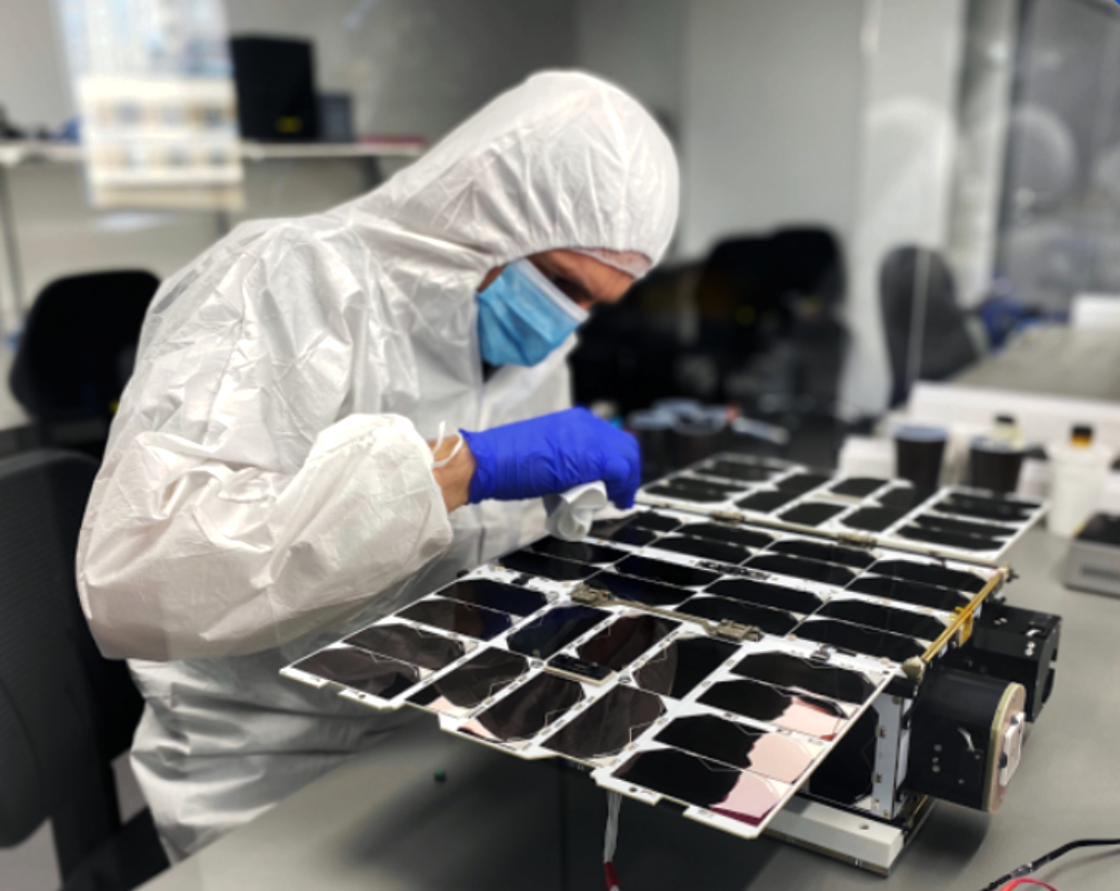
As part of the deal, Mynaric will also establish the industry’s first laser communication interoperability lab at its Los Angeles premises. The lab will be equipped with a link testbed capable of emulating conditions in space and testing inter-vendor operability – a key requirement of DARPA for its proliferated LEO constellation plans.

The soon-to-be-established interoperability lab will provide laser communication vendors selected as part of the Blackjack program with the opportunity to verify their compatibility with Mynaric’s terminals and between each other. It is intended to serve as a hub and enabler for testing interoperability and to help establish a common laser communication standard within the Blackjack program and potentially beyond.

Blackjack is a joint technology demonstration project by DARPA and the U.S. Space Force to evaluate utility and concepts of operation for a large-scale proliferated low Earth orbit satellite constellation. The overarching goal of the program is to leverage developments from the commercial sector to create a generic satellite bus and payloads for defense purposes. Mynaric’s CONDOR terminal, specifically developed for mass deployment and under stringent low size, weight, power and cost requirements (SWaP-C), is a natural fit for the program.

This award represents further validation that the laser communication market is now experiencing an inflection point and is moving from concept to implementation. Current developments are heavily driven by the fact that procurement for government is changing from acquiring bespoke projects to industrialized commercial products – especially in the USA.

Mynaric expects this to become the standard for how governmental agencies will work at large and globally in the future as it allows for the leveraging of commercial industrial achievements most effectively. As such, initial contract awards from the governmental markets are considered a precursor to the wider establishment of civil and commercial large-scale aerospace communication networks of the future.

Executive Comments

Bulent Altan

“We are very happy to welcome Telesat and DARPA as inaugural launch customers for our CONDOR terminals and we are very much looking forward to supporting the mission’s target to demonstrate interoperability between different vendors. Interoperability allows not just DARPA but all of our customers to de-risk their supply chains and we expect it to work as a catalyst accelerating the large-volume deployment of laser communication systems. Consequently, Mynaric aims to take a leading role in establishing open industry standards for laser communications and it is an honor to host the industry’s first interoperability lab at our facilities in Los Angeles,” said Bulent Altan, CEO, Mynaric.

Don Brown

“Optical Inter-Satellite Links are the essential building block for next generation commercial and government space networks. Mynaric has developed impressive laser communications terminals that we will be demonstrating on-orbit under the DARPA Blackjack program. We expect that Mynaric, as a part of Telesat’s Blackjack team, will show the way to affordable ultra-high bandwidth laser communications capability for future resilient government space networks,” said Don Brown, GM, Telesat U.S. Services.

Filed Under: Featured, News

GHGSat Captures Smallest Methane Emission Ever Detected

October 21, 2020 by editorial

Less than a week after the September launch of GHGSat-C1 (‘Iris’), built by Space Flight Laboratory (SFL), GHGSat Inc. recorded the smallsat’s first successful measurement of a methane emission from a known oil and gas facility in Turkmenistan. A week later, the satellite operator tasked Iris to measure a much smaller, controlled methane release from a test site in Alberta, Canada. The satellite-based measurement was successful and confirmed with an airborne sensor.

This image was taken on 15 September 2020, by GHGSat’s second satellite Iris, following her launch on 2 September 2020. Iris was tasked with measuring a controlled release of methane from a facility in Alberta, Canada. Ground measurements of the controlled release confirmed an emission rate of 260 kgCH4/hr.
Iris maps plumes of methane in the atmosphere down to 25m on the ground, detecting and measuring emissions from point sources 100 times smaller than any comparable system with a resolution 100 times higher, comparable to the emissions from a large landfill.

GHGSat Inc. created the sample image by colorizing the methane concentration measurements that exceeded normal background levels captured over the Alberta test site. The colorized measurements are overlaid on an aerial photograph to provide context.

Precise attitude control and sensor pointing are critical to the success of an atmospheric monitoring microsatellite like GHGSat-C1. The 20x30x40-centimeter satellite must keep its greenhouse gas measuring spectrometer pointed at an area of interest on the ground as the satellite continues on its path.

GHGSat-C1 (‘Iris’) was launched on September 2, 2020, aboard an Arianespace Vega rocket from the Guiana Space Center in French Guiana. Also on that launch was NEMO-HD, an Earth observation microsatellite built by SFL for Slovenia.

GHGSat Inc. awarded SFL the development contract for GHGSat-C1 after building the pathfinding GHGSat-D (“Claire”) smallsat in 2016. Using high-precision target tracking capabilities developed by SFL, Claire successfully demonstrated that sources of methane and other gas emissions could be detected and measured from space. SFL is currently developing another microsatellite, GHGSat-C2, for the company.

Executive Comments

Dr. Robert E. Zee

“The successful measurement of methane concentrations in the air above the oil and gas facility indicates the advanced microsatellite attitude control and precise point technologies developed by SFL and built into GHGSat-C1 are functioning as designed,” said SFL Director Dr. Robert E. Zee. “We have a very mature and high-performance attitude control system that can handle various maneuvers and pointing modes with relative ease” said Zee. “In particular, we fine-tuned the attitude control required for GHGSat-C1 by leveraging the results from the GHGSat-D demonstration mission in 2016.”

Established at the University of Toronto Institute for Aerospace Studies (UTIAS) in 1998, SFL has developed CubeSats, nanosatellites, and microsatellites that have achieved more than 128 cumulative years of operation in orbit. These microspace missions have included SFL’s trusted attitude control and, in some cases, formation-flying capabilities. Other core SFL-developed components include modular (scalable) power systems, onboard radios, flight computers, and control software.

Filed Under: News

TriSept Scores Launch Services Agreement With U.S. Army

October 21, 2020 by editorial

TriSept Corporation has signed a launch services contract with the U.S. Army’s Space and Missile Defense Command (SMDC) unit to broker and integrate a milestone cubesat technology demonstration mission scheduled to launch aboard a Rocket Lab Electron early next year.

U.S. Army’s Gunsmoke-J tech demo cubesat.

As part of the demonstration mission, the U.S. Army’s Space and Missile Defense Command will test a proven smallsat bus as host of its new 3U Gunsmoke-J technology initiative aimed at fostering the development of new, game-changing capabilities for the U.S. Army’s tactical ground forces.

TriSept secured both the U.S. Army’s rideshare slot and payload dispenser, which will release the 3U CubeSat into orbit once in space aboard the Rocket Lab Electron launch vehicle. TriSept will integrate the small satellite with the CubeSat dispenser at Rocket Lab’s Long Beach, California facility about 30 days before the scheduled launch date.

TriSept’s team will then travel to the Rocket Lab launch site in Mahia, New Zealand, where it will manage the integration and encapsulation of the dispenser device, carrying the satellite and electrical interfaces inside the fairing, about two to three weeks prior to liftoff atop Electron’s upper stage.

TriSept’s integration experience with government 3U test missions was a factor in the Army’s selection of TriSept for the SMDC mission.

Executive Comments

“Gunsmoke-J is a joint capability technology demonstration executed by the U.S. Army Space and Missile Defense Command and sponsored by both the Office of the Under Secretary of Defense and the U.S. Army,” said Eddie Johnson, Gunsmoke-J Program Manager, U.S. Army SMDC Technical Center. “This science and technology effort will demonstrate an entry-level capability in a 3U form factor relevant to U.S. Army warfighter needs. The mission will also help inform future acquisition decisions.”

Rob Spicer

“This leading-edge mission for the Army’s Space and Missile Defense Command will orbit aboard a satellite smaller than a loaf of bread, but will have a huge impact on milestone developments in warfighter capabilities on the battlefield and beyond,” said Rob Spicer, TriSept CEO. “TriSept is thrilled to have secured the rideshare slot, dispenser hardware, regulatory compliance in both nations, and spacecraft integration for this important technology demonstration in space. We look forward to integrating this small but game-changing payload aboard a Rocket Lab Electron in the coming months.”

Lars Hoffman,

“This rideshare exemplifies the very heart of our overall vision at Rocket Lab; that even the smallest of the small satellites can make a major difference in both commercial and government markets,” said Lars Hoffman, SVP of Global Launch Services for Rocket Lab. “The U.S. Army will be able to hone its capabilities around the world as a result of this CubeSat mission for the Space and Missile Defense Command. We look forward to another Electron launch with TriSept’s key launch integration and overall program support ahead of liftoff set for Q1 next year.”

Filed Under: News

  • « Go to Previous Page
  • Go to page 1
  • Go to page 2
  • Go to page 3
  • Go to page 4
  • Interim pages omitted …
  • Go to page 6
  • Go to Next Page »

Primary Sidebar

WEEKLY NEWSLETTER

Archives

  • May 2025
  • April 2025
  • March 2025
  • February 2025
  • January 2025
  • December 2024
  • November 2024
  • October 2024
  • September 2024
  • August 2024
  • July 2024
  • June 2024
  • May 2024
  • April 2024
  • March 2024
  • February 2024
  • January 2024
  • December 2023
  • November 2023
  • October 2023
  • September 2023
  • August 2023
  • July 2023
  • June 2023
  • May 2023
  • April 2023
  • March 2023
  • February 2023
  • January 2023
  • December 2022
  • November 2022
  • October 2022
  • September 2022
  • August 2022
  • July 2022
  • June 2022
  • May 2022
  • April 2022
  • March 2022
  • February 2022
  • January 2022
  • December 2021
  • November 2021
  • October 2021
  • September 2021
  • August 2021
  • July 2021
  • June 2021
  • May 2021
  • April 2021
  • March 2021
  • February 2021
  • January 2021
  • December 2020
  • November 2020
  • October 2020
  • September 2020
  • August 2020
  • July 2020
  • June 2020
  • May 2020
  • April 2020
  • March 2020
  • February 2020
  • January 2020
  • December 2019
  • November 2019
  • October 2019

© 2019–2025 SatNews

x
Sign Up Now!

Enjoy a free weekly newsletter with recent headlines from the global SmallSat industry.

Invalid email address
We promise not to spam you. You can unsubscribe at any time.
Thanks for subscribing! You will now receive weekly SmallSat News updates.
We love our advertisers.
And you will too!

Please disable Ad Blocker to continue... We promise to keep it unobtrusive.
We promise not to spam you. You can unsubscribe at any time.
Invalid email address
Thanks for subscribing! Please check your email for further instructions.