• Skip to main content
  • Skip to primary sidebar
  • Home
  • News
  • Featured
  • More News ⌄
    • SatNews
    • SatMagazine
    • MilSatMagazine
  • Events ⌄
    • MilSat Symposium
    • SmallSat Symposium
    • Satellite Innovation
  • Contacts
  • SUBSCRIPTION

SmallSat News

You are here: Home / Archives for 2021

Archives for 2021

Southern Launch’s Whaler’s Way Launch Site In Australia Approved By Australian Space Agency — Pad 1 Construction Underway

July 14, 2021 by editorial

Australia is one step closer to reaching the stars with Pad 1 at Southern Launch’s Whalers Way Orbital Launch Complex being approved by the Australian Space Agency.
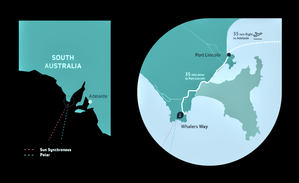
Whalers Way will host satellite launches into orbit around the Earth’s poles and support the growing Internet of Things (IoT), Earth Observation (EO) and space communications industries that supports improved farming, water management and logistics operations worldwide, setting South Australia up to start capturing part of the $5.5 billion global space launch market.

The Complex, located on the tip of the Eyre Peninsula in South Australia, is set to transform Port Lincoln and South Australia into a vibrant space hub and will attract space industry related jobs and growth to the region.

The License was signed by the Hon Christian Porter MP Federal Minister for Industry, Science and Technology, after Southern Launch completed the licensing process through the Australian Space Agency. The approval of the launch facility license comes after the announcement from Minister Porter of the new measures to support the growth of Australia’s civil space sector, including the deferral of cost recovery on launch applications for another year.

Construction of Pad 1 has begun, with the first of up to three test launches from the Whalers Way Orbital Launch Complex scheduled in the coming months. Pad 1 is positioned on an already cleared site at Whalers Way and will allow rockets to safely launch southwards over the Great Australian Bight. The launch pad was designed by Southern Launch with the construction awarded to local Port Lincoln company, Owen Construct and Design.

Southern Launch CEO Lloyd Damp said, “This is a momentous occasion for our team, to have been granted Australia’s first fixed space launch facility license, enabling Southern Launch to host rocket launches into space from Australian shores. Our team is now on track to commence the testing of three rocket launches from Whalers Way before the end of 2021. These tests signify a very real opportunity for Australia – becoming once again a space fairing nation.”

Filed Under: News

Reusable Space Ecosystems Under Development By Modularity Space and Orbital Transports

July 13, 2021 by editorial

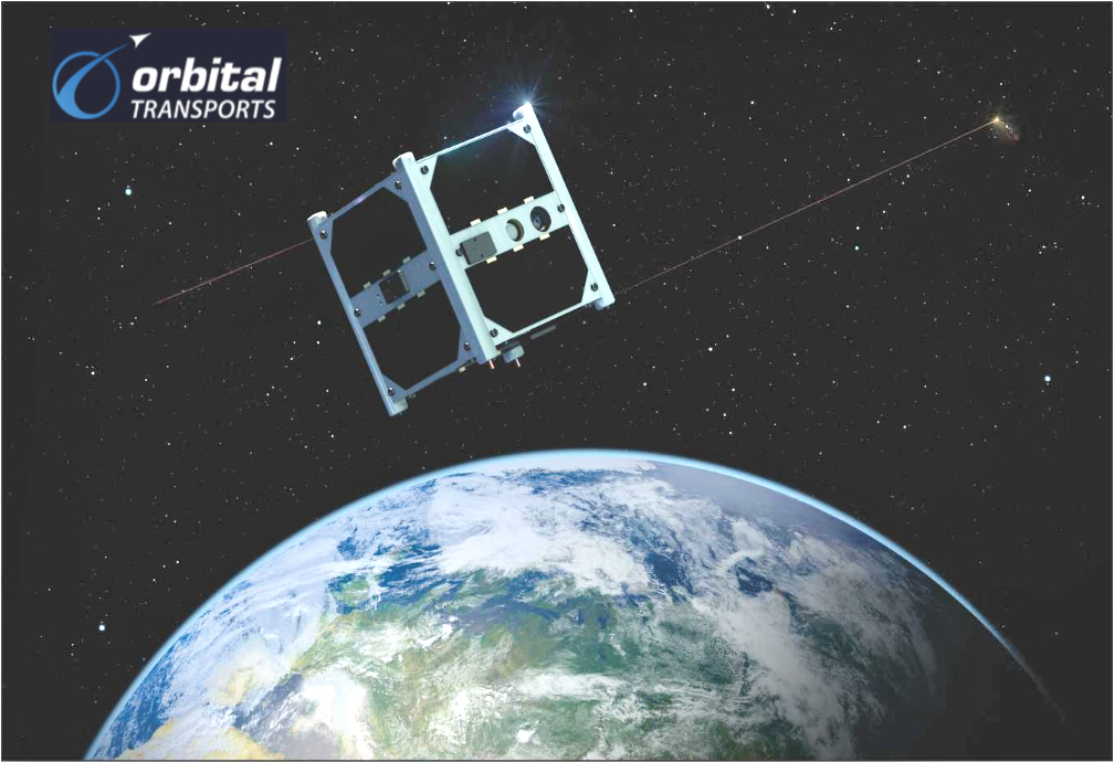
Modularity Space and Orbital Transports now have a partnership to create a reusable ecosystem of suppliers, manufacturers and rideshare opportunities for payloads — by combining mission planning and supply chain management services provided by Orbital Transports with reusable spacecraft engineering from Modularity Space, the companies can offer affordable opportunities for payloads to get to orbit with a full, turn-key, mission package. The combined service provides an easy on-ramp to space for payload types ranging from technology demonstration and qualification missions to full constellation-scale deployments.

With flights starting in 2022, Modularity Space is mass producing reusable satellites and renting them to space companies for use in hosting their technology. Much like an apartment rental, customers pay a deposit before move-in and then pay monthly throughout the duration of their mission. Space companies can now benefit from rapid manufacturing timelines, affordable financing to get to space, and the reliability that comes from effective on-orbit satellite servicing.

“We’re over the Moon to partner with Modularity Space to deliver reusable satellites,” said David Hurst, CEO of Orbital Transports. “As a space logistics provider, Orbital Transports delivers complete small satellite programs from initial concept through completed mission. Under the agreement with Modularity Space, Orbital Transports will provide mission services, including systems engineering, design, development, payload testing and integration; and supply chain management services including smallsat products and services procurement, delivery schedule monitoring, product quality assessment, regulatory review, and shipping logistics. “If you want to put a payload in space or even deploy instruments in a constellation, there’s no longer any reason to build your own satellite. Let us handle the space logistics of getting you there so you can focus on your primary mission objectives.”

“Our partnership with Orbital Transports signifies a major milestone in the transition to reusable space as we are enabling standardization, automation, and mass production of reusable space systems,” said Scott Weintraub, CEO of Modularity Space. “By partnering with Orbital Transports, leveraging their expertise, and building a constellation of satellites designed to be serviced in space, and then renting the space on each satellite in the constellation, space companies can build an entire constellation of sensors in space, without ever having to build an actual satellite. Combine this with the space tug companies coming online in search of spacecraft to service in space, and together, Modularity Space and Orbital Transports are enabling a reusable space ecosystem to be born.”

Orbital Transports is bringing the smallsat supply chain online with the SmallSat Catalog, a digital portal showcasing products and services from some of the industry’s most innovative and reliable companies. The SmallSat Catalog is a one-stop shop for all your smallsat supply chain needs, and features CubeSat and smallsat buses, COTS nanosatellite hardware components, ground station services, satellite servicing and refueling technologies, development and test equipment, space biotech experiment modules, and more. The SmallSat Catalog provides a convenient go-to resource to check out the latest and greatest that the smallsat industry has to offer.

Filed Under: Featured, News

Satcube Awarded Grant To Develop New, Low Cost, LEO Satellite Terminal

July 12, 2021 by editorial

Swedish public innovation agency, Vinnova, has awarded an SEK 4 million development grant to a Swedish project group aimed at boosting development of a next generation, low-cost, LEO (Low Earth Orbit) satellite terminal — the award is part of Vinnova’s Electronic components & systems — research and innovation projects 2021.

The project group, led by Satcube and including Chalmers University of Technology, Gapwaves and Forsway Scandinavia, have joined forces to develop a benchmark satellite terminal featuring dramatically lower cost, size and weight compared to existing LEO offerings.

As the most important cost driver for a highly cost-efficient terminal is the antenna, the collaborators will focus primarily on developing a benchmark planar Ka-band antenna array, assessing features such as electronic / mechanic beam steering, gap waveguide technology and receive-only architecture.

As a broad playing field of organizations and leading SATCOM providers are currently deploying LEO satellite constellations, many leading industry proponents believe these initiatives can be an important force in reducing current global digital divide, tapping the ubiquitous provision of satellite broadband coverage based on new cost-effective satellites.

Existing LEO end-user satellite terminals are expensive, hindering mass market adoption – particularly in economically less developed rural areas where incomes and resources are relatively low. Developing a robust, low-cost satellite terminal will be key to driving change.

Filed Under: News

Planet Is SPAC’d

July 7, 2021 by editorial

Planet Labs Inc. (“Planet”) has entered into a definitive merger agreement with dMY Technology Group, under which Planet will become a publicly-traded company. Upon closing, the combined company will retain the Planet name and be listed on the NYSE under the ticker symbol “PL.”

The transaction values Planet at a post-transaction equity value of approximately $2.8 billion.Planet has a proven track record of success, generating more than $100 million in revenue in its last fiscal year ended January 31, 2021, and currently serves more than 600 customers across 65 countries, for example:

  • In agriculture, Planet’s data helps farmers increase crop yields and revenue, decrease costs such as fertilizer use, and adopt sustainable agriculture practices.
  • Governmental organizations use Planet’s data to increase global security and transparency by monitoring threats, responding to emergencies, and enforcing local permitting.
  • In forestry, Planet’s data is used to measure and stop deforestation and to monitor sustainability initiatives.
  • In mapping, Planet’s imagery helps keep digital maps up to date as the world changes, whether through environmental effects or urban development.Planet delivers a unique data set: a daily scan of Earth’s entire landmass.

This data systematically and consistently documents change across the planet on a daily basis. Planet largely operates a subscription-based business model in which customers purchase proprietary data feeds. Planet views its one-to-many model as differentiated, as the data andanalytics can be sold multiple times to multiple customers, enabling high profit margins. Through this transaction, Planet will invest to accelerate its growth by further expanding into existing and new markets, as well as building additional software and machine-learning-enabled data products and solutions.

“At Planet our goal is to use space to help life on Earth. We have this huge new dataset — an image of the entire Earth landmass every day — which we serve up via a Bloomberg-like terminal for Earth data, making it simple to consume and expanding reach to potentially millions of users across dozens of verticals,” said Planet CEO and Co-founder, Will Marshall. “As the world shifts to a more sustainable 2economy and more companies and governments settheir sustainability and ESG goals, the first step in achieving these objectives is measurement. Planet’s daily, global data is foundational to making that transition. We’re excited to reach this important milestone of taking Planet public to significantly accelerate our mission, and to be doing so with dMY and other great investors.”

“We believe Planet is a new kind of data company, delivering mission-critical insights and solutions to some of the world’s most influential companies and governmental organizations,” said Niccolo de Masi, CEO of dMY IV. “The Company’s daily, global dataset is impressive and we believe serves as the foundation of a rapidly growing and scalable data-as-a-service subscription business, which we believe is poised for significant growth as data increasingly becomes the fuel that powers the global economy. When you combine their visionary leadership team, talented workforce, vast dataset and transformational technology, it’s an indication that Planet is on a path to become one of the most consequential companies in a generation.”

“Global sustainability requires data and analytics for global action,” said Marc Benioff. “Planet, and its key initiatives like Carbon Mapper, deliver radical transparency on our rapidly changing climate.”

The company stated that their data is critical to enabling decisions for many companies as they undergo the data-driven digital transformation. Within governments and across the broader economy, Planet’s daily information feeds are helping to define new methods to monitor resources and account for environmental assets, which is foundational for the ESG transition to enabling a sustainable economy. The company’s data is optimized for machine learning and delivered via a cloud-native platform, transforming the way companies and governments leverage satellite data and derived products,and delivering insights on a daily basis.

This powerful dataset is collected by a fleet of about 200 satellites — the largest EO satellite fleet ever — which Planet designs, builds, and operates in house. This constellation captures over 3 million images per day, covering over 300 million square kilometers and generating approximately 25 terabytes of data per day. With this data captured and archived every day, Planet has an extensive catalogue of high-resolution Earth images — more than 1,500 on average for every point on the Earth’s land mass — providing the ability to go back through time and analyze historical change as well as fuel powerful machine learning applications.P

This transaction values Planet at a post-transaction equity value of approximately$2.8 billion. Existing Planet stockholders will retain 77% ownership in the pro forma company and may receive up to an additional 27 million new Planet shares, depending on the performance of the share price during the five year period following the closing. Concurrently, with the consummation of the transaction, additional investors have committed to participate in the proposed business combination by purchasing shares of Class Acommon stock of dMY IVin a private placement (the “PIPE”). The $200 million PIPE investment is led by funds and accounts managed by BlackRock, with participation from Koch Strategic Platforms, Marc Benioff’s TIME Ventures, and Google.

After paying transaction expenses and paydown of Planet’s existing debt, the balance of the $345 million in cash held in dMY IV’s trust account (assuming no redemptions), together with the approximately $200 million in PIPE proceeds, will be used to fund operations and support new and existing growth initiatives. The transaction, which has been unanimously approved by dMY IV’s Board of Directors and Planet’s Board of Directors, is expected to close later this year, subject to approval by dMY IV’s and Planet’s stockholders and other customary closing conditions.

Planet’s management team, led by CEO,Co-Founder and Chair, Will Marshall, and Chief Strategy Officer,Co-Founder and Director, Robbie Schingler, CFO/COO Ashley Johnson and President, Product and Business Strategy, Kevin Weil, will continue to lead the public company following the transaction. Additionally, dMY IV will nominate one director to serve on the board of directors of the public company following the transaction, with such director being reasonably acceptable to Planet.

Goldman Sachs & Co. LLC is acting as exclusive financial advisor to Planet. Morgan Stanley & Co. LLC and Needham & Company, LLC are acting as financial advisors to dMY IV. Goldman Sachs & Co. LLC and Morgan Stanley & Co. LLC acted as co-lead placement agents for dMY IV in connection with the PIPE transaction. Latham & Watkins LLP is serving as legal advisor to Planet. White & Case LLP is serving as legal advisor to dMY IV.`

Filed Under: Featured, News

Korean Air Entering The Smallsat Product Arena

July 7, 2021 by editorial

Recently, Korean Air announced the company will develop common bulkhead propellant tanks for smallsat launch vehicles as part of the Ministry of Science and ICT’s “Space Pioneer” project.

The Ministry of Science and ICT plans to invest a total of KRW 211.5 billion by 2030 in the “Space Pioneer” project that aims to strengthen the global competitiveness of the domestic aerospace industry by reducing dependence on overseas products.

With a budget of KRW 32 billion, Korean Air has formed an industry and academic consortium with the Korea Aerospace Research Institute, NDT Engineering & Aerospace and Korea Aerospace University to develop common bulkhead propellant tanks for smallsat launch vehicles by 2026. The common bulkhead propellant tank combines fuel and oxidizer tanks into a single tank using the latest metal welding and insulation technology. This new technology will increase the competitiveness of the smallsat launch vehicle market in Korea, as it will reduce the number of satellite launch vehicle parts, simplify structures, decrease vehicle weights by 30%, and cut down production costs.

The common bulkhead propellant tank is expected to dramatically reduce the cost of sending 500 kg small- and medium-sized satellites or smallsat constellations into LEO.

On June 23, 20 engineers and officials from Korean Air, the Korea Aerospace Research Institute, and NDT Engineering & Aerospace gathered at the Korean Air R&D Center in Daejeon to discuss development plans, a future roadmap and the scope of cooperation.

Korean Air will manage the risk and quality assurance system as well as testing and evaluation for certification. The developed common bulkhead propellant tank will be used as a major component of a 500 kg smallsat launch vehicle, which is to be developed by Korean Air and the Korea Aerospace Research Institute.

In 2012, Korean Air developed and assembled Korea’s first space launch vehicle, Naro (KSLV-1), and the company has core technology capabilities such as aircraft system integration and aircraft structure development.

Filed Under: News

HawkEye 360’s Maritime Domain Awareness Product Adds Trawling Detection Analytics

July 7, 2021 by editorial

HawkEye 360 Inc. has incorporated a new trawling behavior detection capability to the company SEAker™ , the company’s maritime domain awareness product — this feature is a part of a series of new functionalities to be added within the year that will enable organizations to more comprehensively minimize maritime risk and protect national interests.

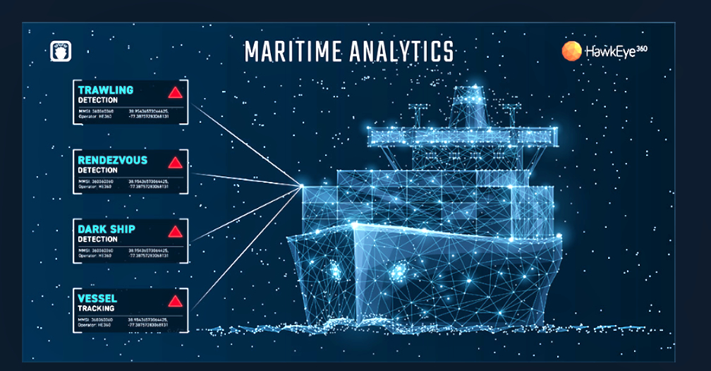
Leveraging open fishing data, location data, and other fused maritime data sets, the deep learning algorithm can identify the underlying behaviors associated with trawling activity. SEAker analytics can similarly identify ship-to-ship rendezvous and “dark ship” activity, or vessels that do not broadcast Automatic Identification System (AIS) transmissions for extended periods of time. When correlated with HawkEye 360’s RFGeo analytics and fused contextual information, these detection capabilities create invaluable insight into the opaque maritime domain.

IUU fishing poses grave threats to global fish stocks and marine environments. The common practice of bottom trawling specifically can disrupt fragile ocean floor environments and capture significant amounts of by-catch, including sea turtles, dolphins, porpoises and more.

The economic consequences of IUU fishing are also significant. It is estimated to cost the seafood industry as much as $50 billion each year, cutting into the incomes of honest fishing businesses globally. IUU fishing operations are also frequently linked to forced labor and human rights abuses — confronting IUU fishing, therefore, could protect both the environment and vulnerable labor populations.

IUU fishing thrives on a complex, hard-to-regulate supply chain. With limited and varying regulations across the globe, legitimate maritime activity blends in with illegal activity. While AIS data could drastically improve visibility with strict enforcement, it does not account for vessels intentionally turning off the tracking devices so the depth of IUU fishing problems could be greater than public information suggests.

HawkEye 360’s growing constellation of satellites geolocate a diverse set of radio frequency signals emitted by ships, such as X-band and S-band marine navigation radars and VHF radios, offering a trusted way to independently validate vessel positions.

“In order to police the illegal activities of the vast ocean, the world needs — but does not yet have — timely, consistent, and actionable intelligence on illicit vessel behaviors across the globe,” said HawkEye 360 CEO John Serafini. “HawkEye 360 is proud to launch unparalleled commercial capabilities, made possible by our expanding constellation and analytics portfolio, that allow authorities worldwide to monitor and take action against bad actors involved in IUU fishing.”

“It’s a long, arduous task for analysts to manually and accurately identify fishing behavior. By automating pattern recognition, we’re saving analysts valuable time by providing those insights up front for them that may have otherwise been lost in the noise,” said Tim Pavlick, VP of Product, HawkEye 360. “Our maritime domain awareness solutions will now have an even more drastic impact in the fight against IUU fishing for our customers, helping them reliably identify illicit maritime activity and take appropriate action — including vessel interdictions and legal convictions.”

Filed Under: News

Satellogic Is SPAC’d

July 6, 2021 by editorial

Nettar Group, Inc. (“Satellogic” or the “Company”) and CF Acquisition Corp. V (Nasdaq: CFV) (“CFAC V”), a SPAC sponsored by Cantor Fitzgerald, have entered into a definitive merger agreement that will result in Satellogic becoming a publicly traded company.

The transaction is expected to be completed early during the fourth quarter of 2021, subject to regulatory approvals and other customary closing conditions. After closing, Satellogic will trade on the Nasdaq under ticker symbol SATL.

Using their proven technology at scale, Satellogic will be positioned to remap the Earth daily in high resolution and at an affordable price-point, fundamentally changing the way people access and use satellite data. The Company’s patented camera design captures 10 times more data from a single satellite than any other EO smallsat.

Satellogic currently has 17 commercial satellites on-orbit, including four that were launched on June 30. At 70 centimeters per pixel, the company stated that the high-resolution images of Earth produced by their satellites add up to more capacity than the next four competitors combined. Each satellite collects approximately 300,000 sq km of data per day and produces full-motion videos(FMV) o fas much aso two minutes in length.

Satellogic was founded to help solve some of the greatest challenges of our time: resource utilization and distribution. From tradeoffs between food, energy and water supplies, to monitoring the impacts of natural disasters, global health and humanitarian crises in the midst of a looming climate emergency; access to a continually refreshed source of global, high-quality data is critical to confronting some of the world’s most crucial issues.

Satellogic designs and manufactures every core component that goes into creating and manufacturing their satellites. This vertical integration provides a significant cost advantage, enabling the firm to produce and launch satellites for less than one-tenth the cost of their competitors, which buy components and use third-party assemblers.These capabilities also result in shorter R&D cycles as well as the ability to efficiently scale, all the while maintaining overall quality. By comparison, Satellogic is achieving more than 60 times better unit economics than the firm’s closest peers in the NewSpace sector, and more than 100 times better unit economics than legacy competitors.

Satellogic recently signed a multiple-launch agreement with SpaceX to deploy the full constellation of 300+ satellites, which is expected to completed by 2025. Once fully deployed, Satellogic will be the only company capable of remapping the world at resolutions as high as 30 centimeters and at the frequency required to address virtually all commercial applications.

On July 5, 2021, Satellogic entered into a definitive merger agreement with CFAC V. The transaction reflects an implied pro forma enterprise value of $850 million for Satellogic, representing a multiple of approximately 1.1x projected revenue of approximately $800 million by 2025.

The transaction is expected to result in cash on the balance sheet of up to approximately $274 million, after transaction expenses and debt repayment, through the contribution of up to $250 million of cash held in CFAC V’s trust account (assuming no redemptions by CFAC V’s public stockholders), and a concurrent PIPE offering of $100 million led by SoftBank’s SBLA Advisers Corp. and Cantor Fitzgerald, among other top-tier institutional investors.

The transaction, which has been unanimously approved by the Boards of Directors of Satellogic and CFAC V, is subject to approval by CFAC V’s stockholders and other customary closing conditions.

Emiliano Kargieman, CEO & Co-Founder of Satellogic, said, “Since our founding, Satellogic has been committed to our mission of democratizing access to geospatial data to help solve the world’s most pressing problems. Today’s transaction is a significant milestone and brings us one step closer to fulfilling that goal. The merger will allow us to continue building out our constellation of satellites and maintain our position as a global leader in sub-meter imagery. Satellogic is poised to be the only company capable of remapping the world daily at the sub-meter resolution necessary to address commercial applications affordably. We are grateful to our talented and ambitious team who have developed best-in-class technology, a strong track record of delivering satellites to orbit, and the ability to scale at near-zero marginal cost.”

Howard W. Lutnick, Chairman & CEO of CFAC V and Cantor Fitzgerald said, “Satellogic is uniquely positioned to dominate the Earth Observation industry. Its technology, data, and analytics have vast use cases across countless industries. Imagine insurance companies being able to document disaster damage in real-time detail remotely. Or an app providing direct daily satellite data to a farmer about the best time to harvest crops. Or bringing live documentation of deforestation or rising sea levels to policymakers to drive the discussion around climate change. The possibilities are limitless. We are excited to partner with Emiliano and the rest of the Satellogic team as they endeavor to build and launch 300+ satellites in the constellation and unlock the significant opportunity for commercial applications to enable smarter global decision-making.”

Filed Under: Featured, News

Two NanoAvionics-Built Smallsats Were Passengers On The SpaceX Transporter-2 Mission Launch To Successful Orbit

July 6, 2021 by editorial

NanoAvionics was all geared up for the SpaceX Transporter-2 rideshare launch at the end of June, with several satellite missions from their customers that will have a positive impact on businesses and communities in remote regions on Earth, as well as pioneering an ionic liquid electrospray propulsion system. Among the applications onboard are also the world’s first, 1U-sized, hyperspectral imager and a new high-gain X-band antenna.

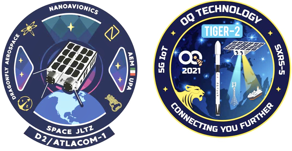
The first of the two smallsats, named “D2 / Atlacom-1,” that were onboard Transporter-2 was a shared 6U satellite mission dedicated to an on-orbit demonstration of new satellite technologies as well as several, novel, satellite applications. They included the world’s first 1U-sized hyperspectral imager to be ever flown, a new 1U tiled ionic liquid electrospray (TILE) propulsion system, a new high-gain X-band antenna and an upgraded X-Band downlink transmitter. The mission comprises “HyperActive,” an international consortium and its partners, and an electric propulsion demonstration by Accion Systems.

The generated data from HyperActive program will be used to develop solutions to improve agriculture yield and livestock, detection of changes in vegetation and pollutants as well as urban environments. For example, a hyperspectral sensor can ‘see’ the spectral signature of an invasive disease threatening an entire harvest, allowing farmers to take preventive steps.

Accion Systems said their TILE-3 propulsion system, sponsored by an ongoing US government propulsion program, is low-cost, compact, low pressure and has less than 50% of the power draw of other propulsion technologies and combines the use of safe, inert liquid propellant with a simple mechanical design and few moving parts.

“The ‘D-2/AtlaCom-1’ satellite contains hyperspectral technology payload and is an interesting case for successful and fast-pace space collaboration across three continents,” said F. Brent Abbott, CEO of NanoAvionics US. “It took us only eight months to build, test and launch the satellite even though hosting many different instruments onboard a shared satellite requires extensive configurations.”

The consortium partners for the mission, brought together through NanoAvionics’ shared satellite service, consisted of Dragonfly Aerospace from South Africa, Space JLTZ from Mexico and NanoAvionics US as a supplier to the consortium. It also included mission contributors Polytechnical University of Atlacomulco (Mexico) and CUBECOM (South Africa).

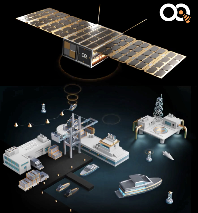
The second satellite is OQ Technology’s Tiger-2. Built by NanoAvionics,this satellite is also the second mission for NanoAvionics with the company. The 6U satellite will grow OQ Technology’s constellation, forming the first global 5G, Internet of Things (IoT) network that combines satellite and terrestrial wireless networks, using regular 5G chips in mobile devices.

OQ Technology’s constellation intends to provide basic commercial IoT and M2M Machine-to-Machine) services, using 5G connectivity, to customers with a focus on Africa, the Middle East, Asia and Latin America.The satellite will expand the 4G and 5G IoT footprint globally, which plays a critical role in enabling mobility in vertical markets such as smart cars, drones, transport, logistics and maritime. It is also very valuable for low latency applications (critical for 5G) as the satellites are in low earth orbit, and provide few milliseconds latency communication, which traditional GEO satellites operators cannot do. Following the launch of Tiger-2, OQ Technology aims to quickly add another two missions to its constellation, followed by a batch of six satellites.

“Both satellites onboard Transporter-2 were some of our quickest from-contract-to-orbit projects to date, and despite the pandemic and a shortfall of components that others have felt, NanoAvionics hasn’t had any supply shortage nor any delays in its lead times and production of satellite buses,” said Vytenis J. Buzas, co-founder and CEO of NanoAvionics. “We build 95 percent of our satellite subsystems in-house, and we have a controlled supply and stock of components and raw materials. That puts us in a good position, for now, to continue building our micro- and nanosatellite buses right on schedule.”

“With more satellite to follow, this mission is essential for OQ Technology to engage with customers and access the market to deliver full 5G services,” said Omar Qaise, CEO OQ Technology. “There will be 24 billion devices around the world to be connected, and we are well positioned for that market. In addition to Tiger-2, we are working with NanoAvionics on multiple other missions.”

Filed Under: News

Fugro’s Satellite Positioning Services Arrives On-Orbit With Loft Orbital’s YAM-2 Smallsat

July 6, 2021 by editorial

Fugro’s SpaceStar™ GNSS Precise Point Positioning (PPP) service is providing essential, high-accuracy positioning in space for the first time — Loft Orbital, which flies and operates customer payloads on their YAM series of smallsats, launched their YAM-2 satellite, the first in space to be equipped with Fugro’s SpaceStar next-generation positioning technology, on June 30 into a 525 km SSO from Cape Canaveral in Florida onboard a SpaceX Falcon 9 rocket.

SpaceStar is using PPP to deliver high-accuracy, sub-decimeter, onboard positioning in real time during YAM-2’s LEO operations. Fugro’s proprietary positioning software is integrated into YAM-2 and employs state-of-the-art technology to receive precise GNSS real-time orbit and clock corrections from geostationary satellites. Highly accurate positioning in LEO is becoming increasingly important for EO applications, safe constellations management as well as space debris collision avoidance.

“We’re especially excited to demonstrate this new functionality,” said Loft Orbital CTO, Pieter van Duijn. “Fugro’s SpaceStar service is something that can really help not only Loft Orbital’s missions but also be of interest to the wider application of space situational awareness and safety.”

Daan Scheer, Fugro’s Satellite Positioning Commercial Manager, said, “We are extremely proud to be providing our real-time PPP service to the YAM-2 small satellite. We’ve been able to bring this innovative product to market thanks to our close cooperation with Loft Orbital and we’re looking forward to completing a successful in-orbit demonstration mission. The accuracy of our SpaceStar position service is not only contributing to our purpose of a safe and livable world but, by facilitating safer navigation in space, even beyond.”

Filed Under: News

Infostellar Is Integrating AWS Ground Station In Their Mission Control Software

July 6, 2021 by editorial

Infostellar Inc. is collaborating with Amazon Web Services, Inc. (AWS) to make AWS Ground Station available within StellarStation. The combination will give satellite operators more opportunities to communicate with their space workloads, downlink geospatial data faster and easier, and decrease the time it takes to get data to decision makers on Earth. Infostellar also plans to leverage AWS for customer integration, testing and other onboarding activities to reduce the time it takes to scale successful operations across a global ground network.

Satellite operators require an increasingly large, global footprint of satellite antennas and expansive ground networks to get decision makers the most recent satellite data and track and manage fast-changing conditions. Larger ground coverage areas also provide satellite operators with more options to downlink their data during each orbit.

The AWS Ground Station network allows customers to cost-effectively control satellite operations, ingest satellite data, integrate the data with applications and other services running in AWS, and scale operations without having to worry about building or managing their own ground infrastructure.

An AWS ground station photographed at night. Image is courtesy of AWS.

StellarStation gives satellite operators a common interface to leverage ground stations from a variety of providers around the globe so they can schedule satellite passes and monitor and exchange data in a standard manner.

Now, with AWS and Infostellar, is required to scale globally in the cloud because operators do not need to send engineers to each site around the world. Instead, they can reuse their integration and test efforts across multiple global sites simultaneously.

The combination of AWS Ground Station and StellarStation helps satellite operators to provide customers with near real-time data through an expanded ground coverage area, including an automated ground network with virtual data and mission management capabilities.

Through the API integration of AWS Ground Station on StellarStation, customers will be able to schedule contacts across both ground networks from a single scheduling interface and specify data endpoints in their AWS Management Console or in their own data reception facility.

Using AWS Ground Station, Infostellar customers can immediately access AWS storage, compute, and analytics services, such as Amazon Simple Storage Services (Amazon S3), to store the downloaded data; Amazon Kinesis Data Streams, for managing data ingestion from satellites; and Amazon SageMaker for building custom machine learning applications that can be applied to a wide variety of data sets.

Customer onboarding, including spectrum licensing, will be coordinated between the two ground operators. Among initial customers of AWS Ground Station on StellarStation mission control software could be Japan-based space start-up ALE Co, Ltd.

“Leveraging AWS Ground Station allows Infostellar to expand our infrastructure very rapidly with the addition of key locations to our global network of ground stations. AWS also shows the benefits of our cloud-based ground service aggregation platform, StellarStation, to the global community of spacecraft operators,” said Naomi Kurahara, Infostellar CEO. “With Infostellar and AWS, satellite customers can migrate their workloads to AWS in order to benefit from its agility, cost savings, elasticity, and global connectivity.”

“We are excited to provide AWS Ground Station services through Infostellar. AWS Ground Station makes it easy for customers to communicate with their satellites and quickly move data around the globe, process and store it in the AWS cloud. StellarStation customers can schedule satellite contacts at AWS Ground Station locations around the world and take advantage of Amazon’s low-latency, high-bandwidth global network to deliver data.” said Jim Caggy, General Manager, AWS Ground Station.

“The combination of AWS Ground Station and InfoStellar’s StellarStation mission control software will provide satellite operators with more frequent communication with their satellites. This collaboration will allow us to better schedule shooting star events for the ALE man-made shooting star experience and provide more flexible options for our customers. This combination is very important to us here at ALE; we look forward to it helping us delight customers all over the world,” said Lena Okajima, CEO, ALE Co, Ltd.

Filed Under: News

  • « Go to Previous Page
  • Page 1
  • Interim pages omitted …
  • Page 27
  • Page 28
  • Page 29
  • Page 30
  • Page 31
  • Interim pages omitted …
  • Page 65
  • Go to Next Page »

Primary Sidebar

WEEKLY NEWSLETTER

Archives

  • August 2026
  • July 2026
  • June 2026
  • May 2026
  • April 2026
  • March 2026
  • February 2026
  • January 2026
  • December 2025
  • November 2025
  • October 2025
  • September 2025
  • August 2025
  • July 2025
  • June 2025
  • May 2025
  • April 2025
  • March 2025
  • February 2025
  • January 2025
  • December 2024
  • November 2024
  • October 2024
  • September 2024
  • August 2024
  • July 2024
  • June 2024
  • May 2024
  • April 2024
  • March 2024
  • February 2024
  • January 2024
  • December 2023
  • November 2023
  • October 2023
  • September 2023
  • August 2023
  • July 2023
  • June 2023
  • May 2023
  • April 2023
  • March 2023
  • February 2023
  • January 2023
  • December 2022
  • November 2022
  • October 2022
  • September 2022
  • August 2022
  • July 2022
  • June 2022
  • May 2022
  • April 2022
  • March 2022
  • February 2022
  • January 2022
  • December 2021
  • November 2021
  • October 2021
  • September 2021
  • August 2021
  • July 2021
  • June 2021
  • May 2021
  • April 2021
  • March 2021
  • February 2021
  • January 2021
  • December 2020
  • November 2020
  • October 2020
  • September 2020
  • August 2020
  • July 2020
  • June 2020
  • May 2020
  • April 2020
  • March 2020
  • February 2020
  • January 2020
  • December 2019
  • November 2019
  • October 2019

© 2019–2026 SatNews

Insert/edit link

Enter the destination URL

Or link to existing content

    No search term specified. Showing recent items. Search or use up and down arrow keys to select an item.
      x
      Sign Up Now!

      Enjoy a free weekly newsletter with recent headlines from the global SmallSat industry.

      Invalid email address
      We promise not to spam you. You can unsubscribe at any time.
      Thanks for subscribing! You will now receive weekly SmallSat News updates.
      We love our advertisers.
      And you will too!

      Please disable Ad Blocker to continue... We promise to keep it unobtrusive.
      We promise not to spam you. You can unsubscribe at any time.
      Invalid email address
      Thanks for subscribing!