• Skip to main content
  • Skip to primary sidebar
  • Home
  • News
  • Featured
  • More News ⌄
    • SatNews
    • SatMagazine
    • MilSatMagazine
  • Events ⌄
    • MilSat Symposium
    • SmallSat Symposium
    • Satellite Innovation
  • Contacts
  • SUBSCRIPTION

SmallSat News

You are here: Home / Archives for News

News

Rocket Lab signs multi-launch contract with iQPS for four Electron missions

February 5, 2025 by editorial

Rocket Lab USA, Inc. (Nasdaq: RKLB) has signed a multi-launch deal with Institute for Q-shu Pioneers of Space, Inc. (iQPS), a Japan-based, Earth imaging company.
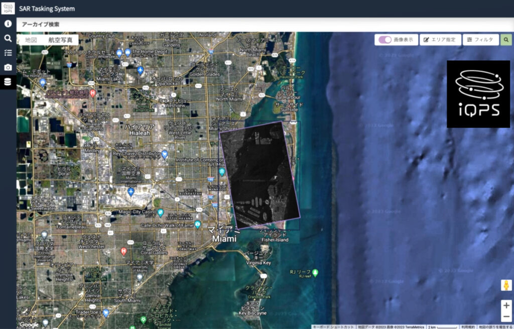
Screen shot of the iQPS SAR tasking system.

The multi-launch contract, signed in July of 2024, includes three dedicated missions for launch in 2025 from Rocket Lab Launch Complex 1 in New Zealand, with a fourth launch scheduled for 2026. Each mission will carry a single satellite to form part of iQPS’ planned constellation of 36 synthetic aperture radar (SAR) satellites that are capable of collecting images through cloud and at night with a high resolution of less than a meter.

This multi-launch contract follows Rocket Lab’s deployment of iQPS’ second commercial SAR satellite to space, QPS-SAR-5, during an Electron launch in December of 2023. The mission was an expedited launch for iQPS that took place within four months of the launch contract’s announcement, after their original launch provider could not meet iQPS’ mission requirements. In addition to launching on Electron, all iQPS satellites will use a Rocket Lab Motorized Lightband as its separation system for deployment to space.

Rocket Lab’s Motorized Lightband separation system

Rocket Lab has emerged as a leading launch provider for Japanese and South Korean space users, having launched Electron missions for EO constellation operators in the region and technology demonstrations. These missions include the previously-launched iQPS mission in December 2023; a mission for the Korea Advanced Institute of Science and Technology (KAIST) in April 2024; a launch for Astroscale-Japan in February 2024 that successfully deployed a technology demonstrator for the first phase of Astroscale-Japan’s orbital debris removal program; and six out of 16 missions on Electron for Japan-based Synspective, for whom Rocket Lab is their sole launch provider to deploy their constellation.

Rocket Lab founder and CEO, Sir Peter Beck, said, “A constellation’s success relies on spacecraft being deployed to precise orbits on tailored timelines to maximize the data collection or service provision the customer needs for their end users. This is the unique and reliable service that dedicated launch on Electron delivers. It’s a privilege to be entrusted with the next batch of iQPS satellites and we look forward to helping them build out the next stage of their constellation.”

iQPS CEO, Dr. Shunsuke Onishi, said, “We are excited to announce our collaboration with Rocket Lab for four upcoming missions. Building on the successful launch of QPS-SAR-5 “TSUKUYOMI-I” in December 2023, this partnership marks another significant milestone in our project. We are deeply grateful to everyone involved in this project – our dedicated team and Rocket Lab – for their commitment and hard work to this contract. As we accelerate the manufacturing and launch of QPS-SAR satellites to build a constellation, we are confident that Rocket Lab is the trusted partner for this purpose and will make our plans even more solid.”

Filed Under: News

Rocket Lab’s Tuesday launch of IOT 4 You and Me is scrubbed with concerns of collision with ISS and others

February 4, 2025 by editorial

This image has an empty alt attribute; its file name is Screen-Shot-2025-01-30-at-2.17.18-PM.png

Rocket Lab’s Tuesday launch is also scrubbed with an explaination indicating that: Rocket Lab has delayed the launch of the IOT 4 You and Me mission in order to ensure the mission does not interfere with “space traffic from other satellites and the ISS,” according to a company statement on X see below. A new launch date has not yet been set.

What is COLA? Collision On Launch Avoidance/Assessment — a process that assesses space traffic from other satellites and the ISS to determine when a rocket can be launched safely. It essentially it tells us when it’s safe to merge onto the space highway. Because the position of spacecraft are always changing relative to each other and the Earth, COLA reports are most accurate a few hours out from launch, which is why sometimes they’ll cause a shift in launch date or time fairly close to the planned T-0.

Rocket Lab ready to launch IoT 4 You and Me Kinéis 16-20 on Tuesday but weather presents challenge

Rocket Lab is scheduled to launch its fourth batch of five satellites for the French Kinéis IoT constellation designed to operate with 25 nanosatellites of 30 kg each at a cost of $6 Million.

The launch will take place at 12:43 pm PST from Rocket Lab’s private orbital launch site, Launch Complex 1, in New Zealand. The mission is the fourth of five dedicated Electron launches booked by Kinéis in a multi-launch contract that will see Rocket Lab deploy an entire constellation of 25 IoT satellites.  The first three missions were successfully launched by Electron in June, September and November 2024.

Weather is a challenge with a forecast that calls for a temperature of 63°F, overcast clouds, 99% cloud cover and a wind speed of 7mph.

Thanks to its constellation of 25 nanosatellites, Kinéis can connect any object from anywhere in the world and transmit useful data from these objects to users in near real time. This data is a decision-making tool that can be used to optimize activities while reducing risks, thanks to three essential functions: tracking, monitoring and alerting.

Kinéis’ space connectivity applications are used in a number of fields that represent major challenges for humankind: natural risk prevention (detection of forest fires, floods, pollution, etc.), monitoring of infrastructure and energy networks (detection of anomalies, predictive maintenance, etc.), transport and logistics monitoring agriculture, traceability of wild and farmed animals, and monitoring of agriculture activities.

The Kinéis constellation also integrates the AIS (Automatic Identification System), a maritime automatic identification system for ships operating on VHF (Very High Frequency) radio frequencies, which enables ship and surveillance systems to know the identity, position, direction and status of ships at sea.

Kinéis’ satellite-based AIS (S-AIS) is a high-performance system (requiring no ground infrastructure) that complements terrestrial AIS, enabling ships to be monitored worldwide, even in international waters not accessible by terrestrial AIS.

Rocket Lab’s launch of IoT 4 You and Me Kinéis 16-20 Monday

This image has an empty alt attribute; its file name is Screen-Shot-2025-02-02-at-7.20.57-PM.png

IOT 4 You and Me Rocket Lab is scheduled to launch Fourth batch of five satellites for the French Kinéis IoT constellation designed to operate with 25 nanosatellites of 30 kg each on Monday, February 3, at 12:43 pm PST.

The launch will take place from Rocket Lab’s private orbital launch site, Launch Complex 1, in New Zealand. The forecast calls for a temperature of 64°F, clear skies, 8% cloud cover and a wind speed of 16mph.

This image has an empty alt attribute; its file name is Screen-Shot-2025-01-30-at-2.17.40-PM.png

The mission is the fourth of five dedicated Electron launches booked by Kinéis in a multi-launch contract that will see Rocket Lab deploy an entire constellation of 25 IoT satellites.  The first three missions were successfully launched by Electron in June, September and November 2024.

“IOT 4 You and Me” is Rocket Lab’s first scheduled launch of 2025, with the company expecting this year to exceed its record-breaking launch cadence of 16 launches across Electron and HASTE achieved in 2024.

Created in 2018, Kinéis is a satellite operator and global connectivity provider. It inherited 40 years of expertise in the Argos system, founded by CNES (French space agency) and historically operated by CLS (Collecte Localisation Satellites). Its mission is to develop reliable technology that provides easy access to useful satellite data.

Thanks to its constellation of 25 nanosatellites, Kinéis can connect any object from anywhere in the world and transmit useful data from these objects to users in near real time. This data is a decision-making tool that can be used to optimize activities while reducing risks, thanks to three essential functions: tracking, monitoring and alerting.

Rocket Lab’s launch of IoT 4 You and Me (Kinéis 16-20) scheduled February 4

This image has an empty alt attribute; its file name is Screen-Shot-2025-01-30-at-2.17.18-PM.png
This image has an empty alt attribute; its file name is Screen-Shot-2025-01-30-at-2.17.40-PM.png

The “IOT 4 You and Me” mission is scheduled to launch during window that opens on February 4th NZDT. Within the multi-day window, there is an instantaneous launch opportunity daily at 09:43 am NZDT (20:43 UTC).

The launch will take place from Rocket Lab’s private orbital launch site, Launch Complex 1, in New Zealand. The mission is the fourth of five dedicated Electron launches booked by Kinéis in a multi-launch contract that will see Rocket Lab deploy an entire constellation of 25 IoT satellites.  The first three missions were successfully launched by Electron in June, September and November 2024.

“IOT 4 You and Me” is Rocket Lab’s first scheduled launch of 2025, with the company expecting this year to exceed its record-breaking launch cadence of 16 launches across Electron and HASTE achieved in 2024.

Created in 2018, Kinéis is a satellite operator and global connectivity provider. It inherited 40 years of expertise in the Argos system, founded by CNES (French space agency) and historically operated by CLS (Collecte Localisation Satellites). Its mission is to develop reliable technology that provides easy access to useful satellite data.

Thanks to its constellation of 25 nanosatellites, Kinéis can connect any object from anywhere in the world and transmit useful data from these objects to users in near real time. This data is a decision-making tool that can be used to optimize activities while reducing risks, thanks to three essential functions: tracking, monitoring and alerting.

Kinéis’ space connectivity applications are used in a number of fields that represent major challenges for mankind, its activities and its environment today: natural risk prevention (detection of forest fires, floods, pollution, etc.), monitoring of infrastructures and energy networks (detection of anomalies, predictive maintenance, etc.), transport and logistics monitoring, agriculture, traceability of wild and farmed animals, and monitoring of commercial and leisure maritime activities.

The Kinéis constellation also integrates the AIS (Automatic Identification System), a maritime automatic identification system for ships operating on VHF (Very High Frequency) radio frequencies, which enables ships and surveillance systems to know the identity, position, direction and status of ships at sea.

Kinéis’ satellite-based AIS (S-AIS) is a high-performance system (requiring no ground infrastructure) that complements terrestrial AIS, enabling ships to be monitored worldwide, even in international waters not accessible by terrestrial AIS.

Filed Under: News

SpaceX Starlink Group 12-3 smallsats launch success including 13 Direct to Cell

February 4, 2025 by editorial

With a launch that was definately fogged in, on Tuesday, February 4 at 5:15 a.m. ET, Falcon 9 launched 21 Starlink satellites, including 13 with Direct to Cell capabilities, to low-Earth orbit from Space Launch Complex 40 (SLC-40) at Cape Canaveral Space Force Station in Florida. All photos by Satnews.

Say goodbye.

SpaceX has now launched 15 Falcon 9 missions so far in 2025. Ten of them have been Starlink flights. This was the 21st flight for the first stage booster supporting this mission, which previously launched OneWeb 1, SES 18+19, Eutelsat HOTBIRD-F1, CRS-24, and now 17 Starlink missions.

Home again.

Last year, SpaceX launched more than 130 Falcon 9 flights, with approximately two-thirds of them designated specifically for the Starlink network that is the largest satellite constellation to date. SpaceX currently operates nearly 7,000 Starlink satellites in LEO, according to astrophysicist and satellite tracker Jonathan McDowell.

SpaceX launch of Starlink Group 12-3 smallsats including 13 Direct to Cell now on Tuesday

Asha Stuart is a filmmaker and a photographer who is used to working on projects around the world, including Zambia, Tanzânia, Namíbia, Ghana, and more recently, Barbados, where her grandfather is from.

SpaceX is targeting Tuesday, February 4 for a Falcon 9 launch of 21 Starlink satellites, including 13 with Direct to Cell capabilities, to low-Earth orbit from Space Launch Complex 40 (SLC-40) at Cape Canaveral Space Force Station in Florida. Liftoff is targeted for 3:37 a.m. ET, with backup opportunities available until 6:24 a.m. ET. If needed, additional launch opportunities are also available Wednesday, February 5 starting at 2:59 a.m. ET.

A live webcast of this mission will begin about five minutes prior to liftoff, which you can watch on X @SpaceX. You can also watch the webcast on the new X TV app.

According to weather officials, there’s a 95% chance of favorable weather conditions at the time of the launch. The forecast calls for a temperature of 68°F, broken clouds, 55% cloud cover and a wind speed of 7mph.

This is the 21st flight for the first stage booster supporting this mission, which previously launched OneWeb 1, SES 18+19, Eutelsat HOTBIRD-F1, CRS-24, and 16 Starlink missions. Following stage separation, the first stage will land on the Just Read the Instructions droneship, which will be stationed in the Atlantic Ocean.

SpaceX to launch Starlink Group 12-3 smallsats including 13 Direct to Cell on Monday

This image has an empty alt attribute; its file name is Screen-Shot-2025-02-02-at-7.07.18-PM.png
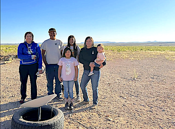
Navajo Nation families in Coconino County, Northern Arizona used to have to drive several miles to get internet.Navajo Nation families in Coconino County, Northern Arizona used to have to drive several miles to get internet.

SpaceX is targeting Monday, February 3 for a Falcon 9 launch of 21 Starlink satellites, including 13 with Direct to Cell capabilities, to low-Earth orbit from Space Launch Complex 40 (SLC-40) at Cape Canaveral Space Force Station in Florida. Liftoff is targeted for 5:54 a.m. ET, with backup opportunities available until 7:42 a.m. ET. If needed, additional launch opportunities are also available Tuesday, February 4 starting at 3:36 a.m. ET.

According to weather officials, there’s a 95% chance of favorable weather conditions at the time of the launch. The forecast calls for a temperature of 65°F, few clouds, 14% cloud cover and a wind speed of 8mph.

A live webcast of this mission will begin about five minutes prior to liftoff, which you can watch here and on X @SpaceX. You can also watch the webcast on the new X TV app.

This is the 21st flight for the first stage booster supporting this mission, which previously launched OneWeb 1, SES 18+19, Eutelsat HOTBIRD-F1, CRS-24, and 16 Starlink missions. Following stage separation, the first stage will land on the Just Read the Instructions droneship, which will be stationed in the Atlantic Ocean.

Filed Under: News

SmallSats: “Sell better, and sell the right thing”

February 4, 2025 by editorial

By Chris Forrester

The 2025 SmallSat Symposium opened on February 4 with a session which looked at the Risks, Realities and Regulations which shape the SmallSat market. Moderated by Janna Lewis (SVP/Policy & General Counsel, Astroscale US) the panel of acknowledged experts examined the challenges and agreed that a core truth was that the industry had to constantly navigate the challenges which inevitably could directly affect a business. She explained that it was generally accepted that the sector was enjoying a 30% CAGR. 

Dr. Abhishek Tripathi, Director of Mission Operations, UC Berkeley, Space Sciences Lab., agreed that growth would continue and that the new Trump administration would be favourable although the risks were that the product market fit – and their product fit – was key. “Are there cheaper large sats coming onto the market, and this is a risk”. 

Robert Cleave, COO, Neo Space Group, agreed with the sector’s prospects. But he cautioned that almost every proposal once suggested ended up by changing the parameters of their intentions.  He said he believed that space was a unifier, and keen to share risk. He said the Kingdom of Saudi Arabia, where he was based, was very much looking at the sharing of risk to ensure a success to its investment plans. 

Drew Svor, partner with Sheppard Mullin, suggested that the risks, whether commercial or technical, or regulatory and geo-political meant that players had to be very flexible, and be aware of those risks and challenges. He said that the new Trump administration would need some time to make their demands known. He warned that SmallSat manufacturers needed to be aware of Cyber security demands. He also hoped that some of the current congestion in some of the frequency bands needed to be addressed although was hopeful that regulators were aware of this congestion and the need to solve the problems. He also forecast the new administration would be open to foreign cash coming in. 

Stewart Marsh, Head of Aerospace, Cambridge Consultants, explained that risks came down to choices and trade-offs. There are manufacturers out there who know their business very well, but SmallSat operators had to be aware that changing the model, for any reason, meant risk and knowing how to mitigate those risks was crucial. Mr Marsh also said that standards-based developments, such as Direct-To-Device services, were extremely important and frequently a partner would be needed to help with the adjacent opportunities. This included AI in networks, and the AI problems were a greater magnitude of challenge in space but AI could definitely help in spectrum, for example. 

Sita Sonty, Partner & MD, Alix Partners, and very interested in the investment opportunities. She argued that the cynic in her saw technical mitigation being less important. “I am not at all sure that the SmallSat market must look closely at commercial conversion. They must sell better – and sell the right thing, and listen more to what the market wants. People also need to talk to the government more, and in particular what it wants in space.”  She also stressed that AI had to be recognised as likely to have a growing importance. 

Dr. Tripathi said he felt that government, based on previous experience, was often fragmented in its procurement. The military and NASA wanted dedicated bespoke satellites, “but in our sector our SmallSat developers cannot put all their efforts into one satellite version. There are solutions, and a commercial company can then supply a more flexible architecture and make some money.”

Filed Under: Featured, News

ATLAS Space Operations enters a strategic partnership with HawkEye 360

February 4, 2025 by editorial

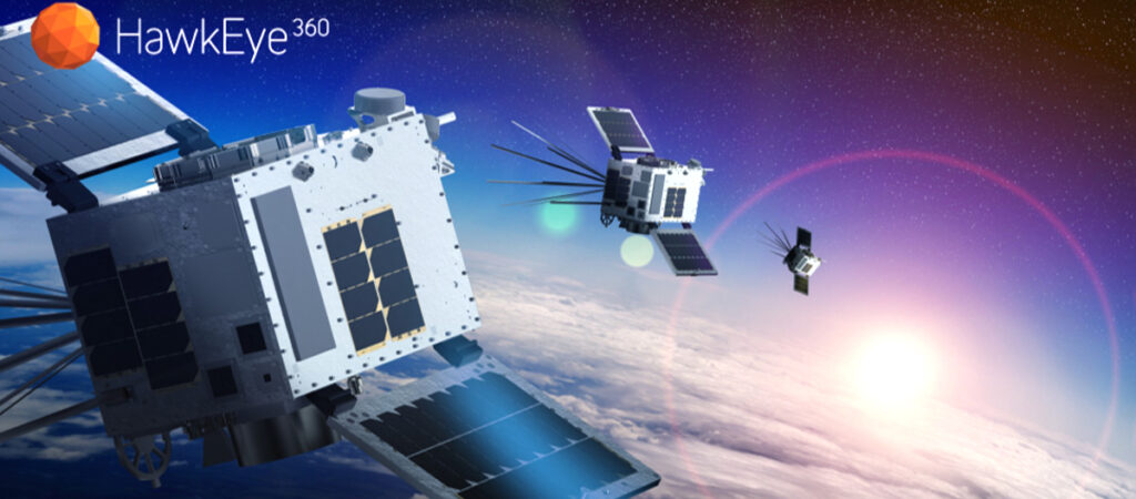
ATLAS Space Operations® has secured a strategic partnership with Hawkeye 360—the collaboration is to enhance HawkEye 360’s RF monitoring capabilities by integrating ATLAS’ Mingenew, Australia, and Awarua, New Zealand, ground stations into its existing ground network coverage.

Selected for their operational readiness and strategic positioning, these locations support efficient communication with HawkEye 360’s mid-latitude satellite clusters. They are part of its broader initiative to reduce data latency and expand its ground station network globally through 2025. This expansion is a key step in increasing the frequency of satellite interactions, which is crucial for providing timely and reliable data to HawkEye 360 customers.

This partnership also allows Hawkeye 360 to leverage ATLAS’ gigabit-per-second X-band modems. Cluster 11 satellites, the latest additions to Hawkeye’s 33 spacecraft constellation, employ transmitters capable of high-speed downlinking that quadruples the delivery speed of actionable insights to end users.

Though ATLAS offers coverage in all latitudes through its Global Federated Network of more than 50 antennas across 34 ground sites, its low-latency coverage for mid-latitude orbits particularly appeals to many constellation operators.

Having completed their single integration effort with ATLAS’ Mingenew and Awarua stations, Hawkeye 360 is now integrated into the entire ATLAS Federated Global Ground Network, thanks to ATLAS’ patented Freedom Software. This means that as demand for Hawkeye 360’s data and analysis continues to grow and their ground segment needs evolve, the ATLAS network stands ready to grow with them.

“Integrating the ATLAS ground stations in Mingenew and Awarua not only optimizes our network for reduced latency but adds capacity and redundancy to our operations in key regions,” said Lorin Metzger, VP of Space at HawkEye 360.

“ATLAS recognizes the vital role space-based solutions play in our daily lives,” said ATLAS Director of Commercial Solutions, Torrey Wigfield. “We are thrilled to provide Hawkeye 360 with this expanded coverage, supporting their RF Spectrum Analysis mission and its positive global impact.”

“Freedom Ground Software as a Service was purpose-built to help companies like Hawkeye 360 seamlessly expand their ground network locations and minimize latency, all while maintaining the high level of security our customers rely on,” said ATLAS CTO and Co-Founder, Brad Bode.

About HawkEye 360
HawkEye 360, headquartered in Herndon, Virginia, leads in defense technology, offering insights into human activity and situational trends from revolutionary radio frequency (RF) geospatial data. Its innovative space-based technology detects, characterizes, and geolocates RF signals, providing an information advantage. These analytics enable analysts to detect irregular behavior, trace suspicious activity, and reveal ships attempting to vanish, offering early warnings to drive tip-and-cue efforts and empowering global leaders with critical insights for confident decision-making.

About ATLAS Space Operations®:
ATLAS Space Operations is the leading provider of Ground Software as a Service™ in the space communications industry. ATLAS’ revolutionary Freedom® software has been recognized by industry-leading publications and organizations such as Via Satellite and CIO Review. Additionally, Aerospace & Defense Review named ATLAS the Space Tech Company of the Year (2024) and acknowledged ATLAS as one of the Top Satellite Solutions Providers (2024, 2023). Lastly, ATLAS was highlighted in the CIO Review: Telecom Edition as Company of the Year (2023), as well as one of the 10 Most Promising Technologies. ATLAS combines the Freedom Software Platform and its federated global antenna network to achieve its mission of securing space access anytime, anywhere.
om.

Filed Under: News

Raccoon in space thanks to SatRev

February 3, 2025 by editorial

Recently, SatRev successfully launched a satellite that is based on the company’s advanced Raccoon platform into orbit.

Telemetry data from the satellite confirms the mission’s full success. This groundbreaking project was successfully executed by SatRev’s experienced engineering team. Leveraging its team’s expertise, SatRev developed the Raccoon satellite platform, which serves as a foundation for advanced space missions. This solution combines flexibility, precision, and efficiency—key attributes for international projects.

Key features of Raccoon include:

  • Precise Control – an advanced ADCS system enables accurate satellite positioning, crucial for Earth observation
  • Energy Optimization – an innovative EPS energy management system ensures efficient operation even in harsh space conditions
  • Versatile Applications – a modular platform design allows for a variety of payloads, making it an ideal solution for both commercial and scientific clients.

The satellite deployment was carried out by SatRev in a two-stage process. In the first phase, the satellite was placed into a transfer orbit as part of the SpaceX Transporter-12 mission. In the second phase, it was precisely positioned into its operational orbit using the advanced Impulse 2 Mira transfer vehicle. The success of both stages required SatRev’s team to meticulously refine every project detail, meet strict technological standards, and synchronize efforts with global industry leaders.

SatRev continues to develop its technologies and expand into international markets, working with global partners on groundbreaking space projects.

“This success is the result of an incredibly talented team of engineers whose experience, determination, and dedication have enabled us to achieve what seemed impossible just a few years ago. Their efforts have turned our vision into reality,” said Grzegorz Zwoliński, founder and CEO of SatRev. “Thanks to our engineers’ passion and determination, we are setting new benchmarks in the space industry, proving that Polish technology has global potential. Every mission is a challenge and proof that a Polish company can play a key role on the international stage. The future of SatRev is built on our extraordinary team.”

About SatRev
SatRev S.A. is a Polish space sector company founded in 2016, specializing in satellite design, manufacturing, and operations, as well as data analytics solutions. SatRev is a national integrator of the full supply chain for nano- and microsatellite production. To date, SatRev has successfully launched 12 satellites into Earth’s orbit.SatRev’s satellites can be used to solve challenges related to resource utilization and optimization across a wide range of applications, including precision agriculture, energy resource assessment, and critical infrastructure monitoring.The development of the company’s innovative satellite systems is based primarily on its proprietary technological capabilities, intellectual property, and its importance to national security and economic growth. SatRev is engaged in advanced discussions with space agencies and governments across its primary target markets, including the USA, Australia, the UK, the European Union, and the Middle East. In November 2024, the company signed a letter of intent with ECL S.A. to initiate negotiations aimed at debuting on the NewConnect market.

Filed Under: News

PASCO to provide data for Japan’s newest radar satellite

January 27, 2025 by editorial

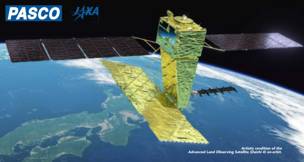
ALOS-4, launched in July of 2024, maintains a 3 meter resolution while expanding its observation swath fourfold to 200 km for high-precision subsidence tracking. (Image courtesy: JAXA)

PASCO has been selected by the Japan Aerospace Exploration Agency (JAXA) to spearhead data services for the Advanced Land Observing Satellite ‘Daichi 4’ (ALOS-4).

As the exclusive provider of satellite imagery for both ALOS-2 and ALOS-4, PASCO will deliver high-end geospatial data via a dedicated platform. This partnership highlights PASCO’s prominent role in advancing satellite-based Earth Observation (EO) and ensuring seamless access to high-resolution imagery for various applications.

Launched in July of 2024, ALOS-4 is a synthetic aperture radar (SAR) satellite that features phased array type L-band radar (PALSAR-3). This advanced radar technology is developed by JAXA and Mitsubishi Electric and offers enhanced observation performance compared to its predecessor. With a spatial resolution of 3 meters and an expanded observation swath of 200 km, ALOS-4 is tailored for precise monitoring of crustal deformation, subsidence, disasters, forests and marine environments.

Unlike optical sensors, PALSAR-3 radar operates independently of sunlight, acquiring images day and night. Its radio waves can penetrate clouds, ensuring consistent observations regardless of weather conditions. These capabilities enable ALOS-4 to monitor disaster-hit areas, sea ice and infrastructure displacement while supporting broader applications like forest conservation.

Additionally, similar to its predecessor ALOS-2, ALOS-4 integrates an automatic identification system (AIS) for ships. Equipped with the advanced SPAISE3 system developed in collaboration with NEC Corporation, the satellite enhances vessel detection in high-traffic marine areas by leveraging multiple antennas and robust ground-based data processing. This innovation ensures improved monitoring of ocean activity, aiding in maritime safety and environmental protection.

PASCO, active in EO since 2005, is committed to addressing societal challenges through the company’s expertise in satellite data processing and geospatial solutions. In partnership with the Remote Sensing Technology Center of Japan (RESTEC) and Tellus, PASCO aims to promote widespread use of ALOS-4 data.

Filed Under: News

Rocket Lab to launch global wildfire detection and monitoring mission for OroraTech

January 23, 2025 by editorial

Rocket Lab USA, Inc. (Nasdaq: RKLB) has signed a contract for a responsive launch on Electron with Orora Technologies (OroraTech), a German company developing a satellite constellation to monitor wildfires and alert first responders to danger. 

Launching from Rocket Lab Launch Complex 1 in New Zealand, the dedicated mission on Electron will deploy eight satellites to a 550 km orbit within just four months from launch contract signing, enabling OroraTech to meet the season-sensitive requirements of its wildfire detection mission. The rapid turnaround is just the latest demonstration of Rocket Lab’s responsive launch capabilities for satellite operators needing urgent access to space.

View of Rocket Lab’s Launch Complex 1

OroraTech is developing a constellation of satellites with thermal infrared cameras that can provide 24/7 monitoring of wildfires globally, supporting better and faster wildfire response to protect forests, people, and infrastructure worldwide. The mission will deploy its latest plane of satellites called OTC-P1 to their current constellation, further expanding OroraTech’s capabilities to first responders, governments, and industry partners. The company will expand their constellation with up to 100 satellites in total by 2028. 

Rocket Lab founder and CEO, Sir Peter Beck, said: “This launch is a showcase of all the benefits of flying dedicated on Electron: control over schedule, agility and ability to meet tight deadlines and mission requirements, and the reliability of launching on the world’s most frequently launched small orbital rocket. Knowing that time is of the essence to get these satellites in space, we’re proud to be rising to the challenge and supporting the OroraTech mission to better monitor for and protect against these devastating natural disasters globally.” 

The mission is the latest launch to be announced in a packed 2025 launch manifest for Rocket Lab that includes the continuation of multi-launch contracts with constellation operators Synspective, Kineis, and BlackSky; a responsive space mission for the U.S. Space Force that will see Rocket Lab build a spacecraft, then launch it on Electron with 24-hours’ notice; and the debut launch of Rocket Lab’s new medium-lift reusable rocket, Neutron.


Filed Under: Featured, News

Pixxel has launched Firefly hyperspectral satellite

January 21, 2025 by editorial

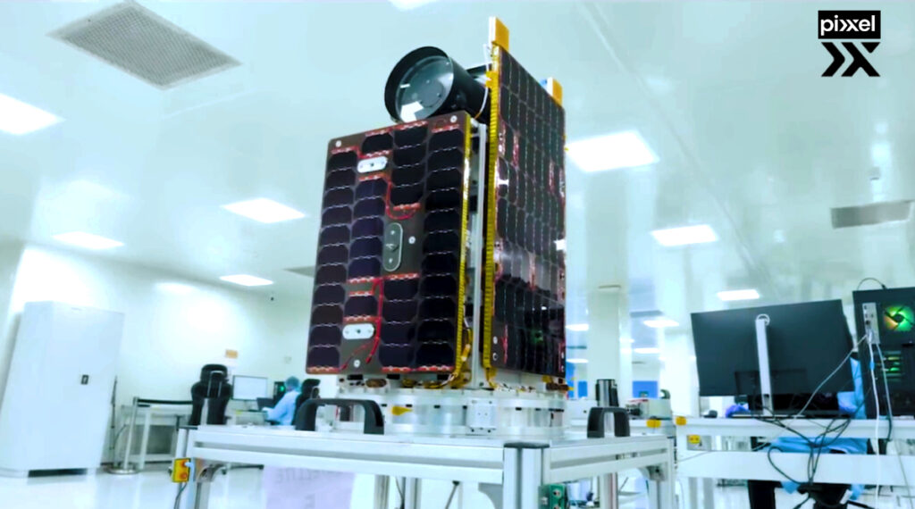
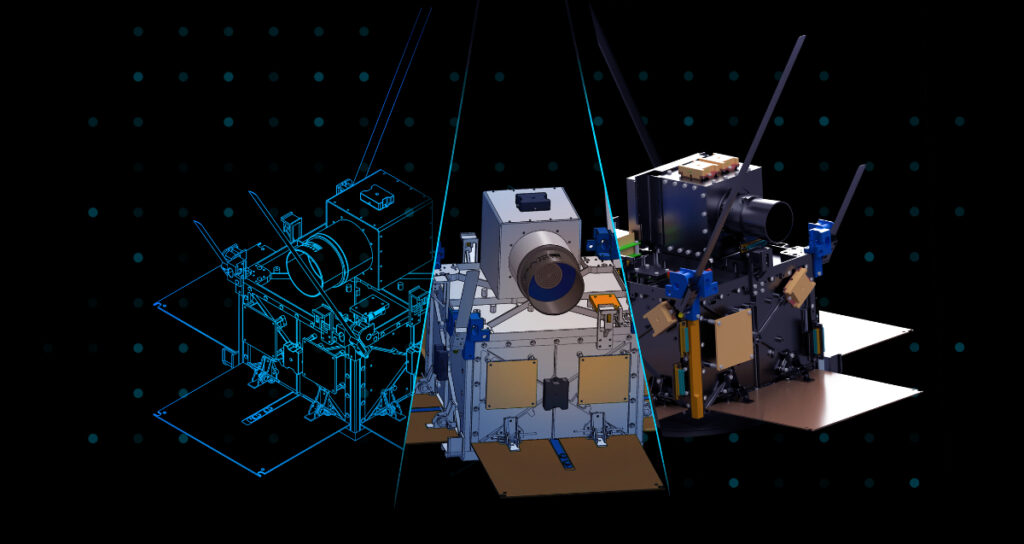
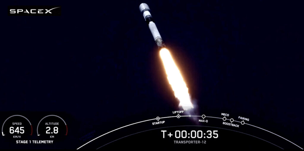
Pixxel has successfully launched the first three satellites of its Firefly constellation. The satellites were integrated via Exolaunch and launched aboard the Transporter-12 rideshare mission via SpaceX from Vandenberg Space Force Base. 

Pixxel’s smallsats, image courtesy of the company.

This marks a significant milestone for Pixxel as it begins commercial operations, delivering critical climate and Earth insights to industries worldwide and solidifying its position as a global leader in Earth Observation. 

SpaceX Transporter-12 launch,
image courtesy of the company.

The Fireflies, currently the world’s highest-resolution commercial-grade hyperspectral satellites, bring unprecedented precision to monitoring the planet and setting a new benchmark for hyperspectral imaging capabilities. With an 5-meter resolution attained for the first time in a hyperspectral spacecraft, Fireflies are six times sharper than the 30-meter standard of most existing hyperspectral satellites, capturing fine details previously invisible to conventional systems. 

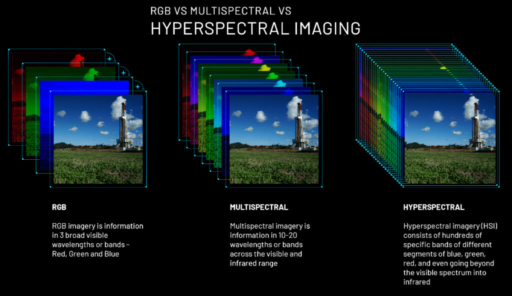
This cutting-edge resolution is paired with the ability to capture data across 150+ spectral bands, enabling Fireflies to detect subtle changes in chemical compositions, vegetation health, water quality, and even atmospheric conditions with unmatched accuracy. Unlike traditional Earth observation satellites that rely on broader spectral bands, Firefly’s narrowband sensors uncover hidden patterns and anomalies critical for applications ranging from agriculture to climate action.

Pixxel’s satellites also feature a 40-kilometer swath width and a daily revisit capability, enabling consistent monitoring of vast areas without compromising on detail and ensuring that no critical event goes unnoticed. This combination of high spatial resolution, spectral richness, and frequent global coverage positions Firefly as the world’s most advanced commercial hyperspectral imaging system.

Orbiting in a sun-synchronous orbit at roughly 550km, the Fireflies will form the cornerstone of Pixxel’s mission to build a health monitor for the planet.

“The future of our planet depends on how deeply we understand it today. The successful deployment of our first commercial satellites is a defining moment for Pixxel and a giant leap toward redefining how we use space technology to address the planet’s challenges,” said Awais Ahmed, Founder and CEO of Pixxel. “By investing in the health of our planet now, Pixxel hopes not just to shape the trajectory of Earth observation but also to help write the next chapter in the story of our shared future.”

“The Fireflies represent years of rigorous research, engineering, and innovation aimed at unlocking critical insights about our planet and are a testament to the ingenuity and dedication of our team and the transformative potential of hyperspectral imaging,” said Kshitij Khandelwal, Founder and CTO of Pixxel. “Their ability to detect subtle changes in Earth’s ecosystems will provide industries and governments with the precise information needed to address critical global challenges confidently.”

This launch marks the first phase of Pixxel’s commercial constellation, with three additional Firefly satellites scheduled to launch in Q2 2025. Together, these satellites will deliver comprehensive, real-time data collection and analysis, equipping industries and governments with insights to address global concerns, manage resources responsibly, and drive climate action.

The Firefly constellation’s advanced hyperspectral imaging capabilities open new possibilities across sectors. From empowering environmental agencies to monitor deforestation and ocean pollution in near real-time to helping industries like mining, oil, and gas enhance resource management and infrastructure safety, the applications are vast and transformative. By detecting subtle changes in soil composition, water quality, or atmospheric conditions, Firefly will change how humanity interacts with and protects our planet’s resources.

As part of its larger mission, Pixxel plans to integrate hyperspectral data with machine learning and artificial intelligence tools, further amplifying the impact of Earth Observation technology. This fusion of advanced satellite imagery and predictive analytics will enable businesses to anticipate disruptions and governments to implement proactive policies, paving the way for a new era of precision decision-making.

Pixxel has already launched three successful demo hyperspectral satellites before this launch and raised $95 million in funding, making it the most well-funded hyperspectral imaging space startup globally. With this commercial launch, Pixxel takes a decisive step toward operationalizing its vision of a hyperspectral-powered future where advanced Earth Observation drives solutions to the world’s most pressing challenges.

Filed Under: News

Sierra Space GPS satellite program reaches key milestone

January 20, 2025 by editorial

Sierra Space has accomplished a key development milestone for the company’s Resilient GPS (R-GPS) program, marked by the successful completion of Systems Requirements Review (SRR). The SRR completion comes after the program’s kickoff in September and is a notable moment for Sierra Space’s national security program, with the ultimate goal of benefiting civilians and military operations through the protection of U.S. satellites.

GPS technology relies on satellite infrastructure and supports everything from ride-share and food delivery apps for civilians to critical navigation for military and defense operations. The increasing sophistication of adversarial threats, however, such as jamming and spoofing, necessitates advancements in GPS resilience.

The U.S. Space Force’s (USSF) R-GPS program plans to address these challenges by integrating proliferated small satellites into the existing GPS architecture. Sierra Space’s expertise in small satellite technology and rapid deployment provides a competitive edge in achieving this goal.

Sierra Space’s strategic engagement in the R-GPS program underscores its commitment to delivering high-impact, innovative satellite solutions for defense applications. By leveraging its expertise in small satellite technology, rapid deployment capabilities, and advanced signal processing, Sierra Space aims to play a pivotal role in strengthening U.S. national security.

Sierra Space’s strategic engagement in the R-GPS program underscores its commitment to delivering high-impact, innovative satellite solutions for defense applications. By leveraging its expertise in small satellite technology, rapid deployment capabilities, and advanced signal processing, Sierra Space aims to play a pivotal role in strengthening U.S. national security.

Sierra Space’s strategic engagement in the R-GPS program underscores its commitment to delivering high-impact, innovative satellite solutions for defense applications. By leveraging its expertise in small satellite technology, rapid deployment capabilities, and advanced signal processing, Sierra Space aims to play a pivotal role in strengthening U.S. national security.

Sierra Space announced in September a “Quick Start” R-GPS contract awarded by the U.S. Space Force Space Systems Command to produce design concepts for smaller, more cost-effective GPS satellites. Sierra Space was selected for this initial award due to the company’s innovative and integrated commercial concepts.

The R-GPS program has been expedited under “Quick Start” authority granted by Congress under Section 229 of the National Defense Authorization Act. This authority allows for rapid response to emerging threats or technologies, enabling the U.S. Space Force to initiate new programs more swiftly.

“The successful Systems Requirements Review of our R-GPS program is a proof point for Sierra Space technology and a notable commercial milestone with our DoD customers,” said Erik Daehler, Vice President of Defense, Satellites & Spacecraft Systems at Sierra Space. “We are focused on efficiency and speed of development to outpace adversaries. The quick turnaround of two months from R-GPS program launch to this next step of development is exactly the speed at which commercial space companies should be moving. We look forward to the next phase of our R-GPS program and getting our satellite technology into orbit.”

“GPS is vital for everything from financial markets to civilian navigation,” said Lt. Col. Justin Deifel, head of the U.S. Space Force’s R-GPS program. “It’s a utility – like water or electricity — and we need to make sure it’s resilient for civilians and warfighters alike, so they have access to GPS when they need it most.”

Filed Under: News

  • « Go to Previous Page
  • Page 1
  • Interim pages omitted …
  • Page 43
  • Page 44
  • Page 45
  • Page 46
  • Page 47
  • Interim pages omitted …
  • Page 339
  • Go to Next Page »

Primary Sidebar

WEEKLY NEWSLETTER

Archives

  • August 2026
  • July 2026
  • June 2026
  • May 2026
  • April 2026
  • March 2026
  • February 2026
  • January 2026
  • December 2025
  • November 2025
  • October 2025
  • September 2025
  • August 2025
  • July 2025
  • June 2025
  • May 2025
  • April 2025
  • March 2025
  • February 2025
  • January 2025
  • December 2024
  • November 2024
  • October 2024
  • September 2024
  • August 2024
  • July 2024
  • June 2024
  • May 2024
  • April 2024
  • March 2024
  • February 2024
  • January 2024
  • December 2023
  • November 2023
  • October 2023
  • September 2023
  • August 2023
  • July 2023
  • June 2023
  • May 2023
  • April 2023
  • March 2023
  • February 2023
  • January 2023
  • December 2022
  • November 2022
  • October 2022
  • September 2022
  • August 2022
  • July 2022
  • June 2022
  • May 2022
  • April 2022
  • March 2022
  • February 2022
  • January 2022
  • December 2021
  • November 2021
  • October 2021
  • September 2021
  • August 2021
  • July 2021
  • June 2021
  • May 2021
  • April 2021
  • March 2021
  • February 2021
  • January 2021
  • December 2020
  • November 2020
  • October 2020
  • September 2020
  • August 2020
  • July 2020
  • June 2020
  • May 2020
  • April 2020
  • March 2020
  • February 2020
  • January 2020
  • December 2019
  • November 2019
  • October 2019

© 2019–2026 SatNews

Insert/edit link

Enter the destination URL

Or link to existing content

    No search term specified. Showing recent items. Search or use up and down arrow keys to select an item.
      x
      Sign Up Now!

      Enjoy a free weekly newsletter with recent headlines from the global SmallSat industry.

      Invalid email address
      We promise not to spam you. You can unsubscribe at any time.
      Thanks for subscribing! You will now receive weekly SmallSat News updates.
      We love our advertisers.
      And you will too!

      Please disable Ad Blocker to continue... We promise to keep it unobtrusive.
      We promise not to spam you. You can unsubscribe at any time.
      Invalid email address
      Thanks for subscribing!